Geodha Mòr an Uillt

Coastal Feature, Headland, Point in Ross-shire

Scotland

Geodha Mòr an Uillt

Coastline, Rubha Chuidhtinis, Eye Peninsula, Isle of Lewis
Coastline, Rubha Chuidhtinis, Eye Peninsula, Isle of Lewis Credit: Claire Pegrum

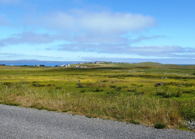
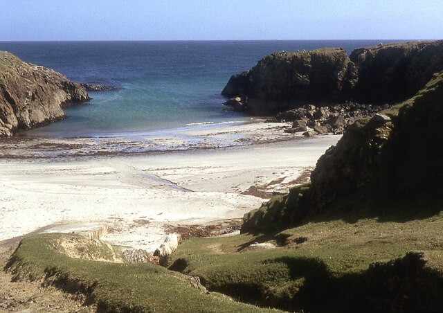
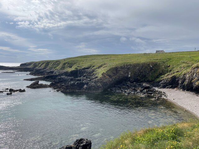
Geodha Mòr an Uillt is a prominent headland located in Ross-shire, Scotland. It is situated along the rugged coastline, offering stunning views of the surrounding landscape and the open sea. The headland is characterized by steep cliffs that rise dramatically from the water, creating a striking and picturesque scene.

At the tip of Geodha Mòr an Uillt, there is a rocky point that juts out into the sea, providing a natural vantage point for visitors to admire the sweeping views of the ocean and the nearby coastline. The headland is also home to a variety of bird species, making it a popular spot for birdwatching enthusiasts.

The rocky terrain of Geodha Mòr an Uillt is a testament to the powerful forces of nature that have shaped the coastline over thousands of years. Visitors to this coastal feature can experience the raw beauty of the Scottish landscape and immerse themselves in the tranquility of the sea. Whether exploring the rugged cliffs or watching the seabirds soar overhead, Geodha Mòr an Uillt offers a unique and unforgettable experience for nature lovers and outdoor enthusiasts alike.

If you have any feedback on the listing, please let us know in the comments section below.

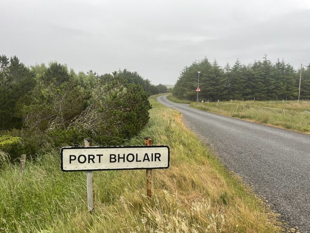
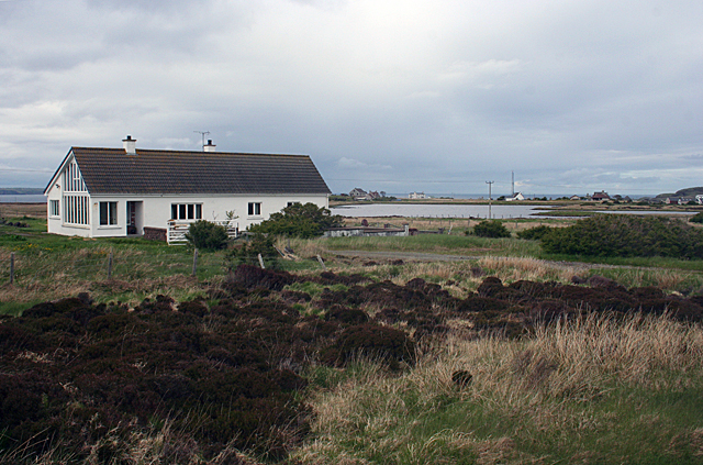
Geodha Mòr an Uillt Images

Images are sourced within 2km of 58.235733/-6.1598752 or Grid Reference NB5534. Thanks to Geograph Open Source API. All images are credited.

Coastline, Rubha Chuidhtinis, Eye Peninsula, Isle of Lewis
Looking across fields towards Cnoc Beag from the A866
Small beach at Sinigeadh, Eye Peninsula
Roads around An Rubha In around 1999, the Ordnance Survey replaced English-language placenames in the Western Isles with Gaelic-language names. Some of the more prominent features (e.g. Isle of Barra; Stornoway; Sound of Harris) do have bilingual labels but, on the whole, villages, lochs, peaks etc. generally have the Gaelic names on the modern-day mapping.

Because the English versions have a tendency not to appear on the maps any more, I have decided to use them in my image titles and, as such, a translation will be readily available from the Gaelic labelling on the map. 

(NB I have not translated some of the more minor loch and river names, where I have not easily found the English version.)
Roads around An Rubha
In around 1999, the Ordnance Survey replaced English-language placenames in the Western Isles with Gaelic-language names. Some of the more prominent features (e.g. Isle of Barra; Stornoway; Sound of Harris) do have bilingual labels but, on the whole, villages, lochs, peaks etc. generally have the Gaelic names on the modern-day mapping. Because the English versions have a tendency not to appear on the maps any more, I have decided to use them in my image titles and, as such, a translation will be readily available from the Gaelic labelling on the map. (NB I have not translated some of the more minor loch and river names, where I have not easily found the English version.)
Roads around An Rubha Geocaching is a type of global treasure hunt of people looking for caches, or hidden stashes of objects. Geocaching may also be described as a series of hide-and-seek games, where hiders provide online clues for seekers. Seekers use global positioning system (GPS) devices to find hidden caches
Roads around An Rubha
Geocaching is a type of global treasure hunt of people looking for caches, or hidden stashes of objects. Geocaching may also be described as a series of hide-and-seek games, where hiders provide online clues for seekers. Seekers use global positioning system (GPS) devices to find hidden caches
Roads around An Rubha
Roads around An Rubha Geocaching is a type of global treasure hunt of people looking for caches, or hidden stashes of objects. Geocaching may also be described as a series of hide-and-seek games, where hiders provide online clues for seekers. Seekers use global positioning system (GPS) devices to find hidden caches
Roads around An Rubha
Geocaching is a type of global treasure hunt of people looking for caches, or hidden stashes of objects. Geocaching may also be described as a series of hide-and-seek games, where hiders provide online clues for seekers. Seekers use global positioning system (GPS) devices to find hidden caches
Slipway at Seisiadar
Coastline of An Rubhan
Fleisirin (Flesherin) A typical Lewis crofting township at the north end of the Eye Peninsula, though quite a lot of the traditional houses have been replaced by more modern buildings.
Fleisirin (Flesherin)
A typical Lewis crofting township at the north end of the Eye Peninsula, though quite a lot of the traditional houses have been replaced by more modern buildings.
Sheep Pens On the fringe of the crofting township of Fleisirin (Flesherin) is a set of pens for managing sheep at dipping, shearing and other times. Beyond the pens is typical Lewis moorland.
Sheep Pens
On the fringe of the crofting township of Fleisirin (Flesherin) is a set of pens for managing sheep at dipping, shearing and other times. Beyond the pens is typical Lewis moorland.
Sheep Pens On the fringe of the crofting township of Fleisirin (Flesherin) is a set of pens for managing sheep at dipping, shearing and other times. Beyond the pens is typical Lewis moorland, and to the right is Loch a Tuath, usually anglicised as Broad Bay though its Gaelic name means 'north loch'.
Sheep Pens
On the fringe of the crofting township of Fleisirin (Flesherin) is a set of pens for managing sheep at dipping, shearing and other times. Beyond the pens is typical Lewis moorland, and to the right is Loch a Tuath, usually anglicised as Broad Bay though its Gaelic name means 'north loch'.
A Rowdy Reception I was extremely glad that this croft at Fleiserin has a stout garden wall and a firmly closed gate here to prevent these two friendly dogs from getting any closer to me. They would be excellent watchdogs, because they sent up a huge amount of noise as soon as I approached, but dogs racing towards me, friendly or otherwise, fill me with fear, especially when they are big enough to knock me over.
A Rowdy Reception
I was extremely glad that this croft at Fleiserin has a stout garden wall and a firmly closed gate here to prevent these two friendly dogs from getting any closer to me. They would be excellent watchdogs, because they sent up a huge amount of noise as soon as I approached, but dogs racing towards me, friendly or otherwise, fill me with fear, especially when they are big enough to knock me over.
Not a Success Someone has planted some broadleaved saplings here, but the experiment has not proved successful. Only one still shows any sign of life, and its leaves have barely managed to creep from the spindly trunk. All the rest are dead, and most have fallen over. I imagine that the combination of wind, salt water and wet acid soil here is not really ideal habitat for young trees.
Not a Success
Someone has planted some broadleaved saplings here, but the experiment has not proved successful. Only one still shows any sign of life, and its leaves have barely managed to creep from the spindly trunk. All the rest are dead, and most have fallen over. I imagine that the combination of wind, salt water and wet acid soil here is not really ideal habitat for young trees.
Aird This is the southern end of the crescent of crofts on Port Mhollair, each strip of land surrounded by very necessary sheep-proof fences.
Aird
This is the southern end of the crescent of crofts on Port Mhollair, each strip of land surrounded by very necessary sheep-proof fences.
Looking South-west from Aird Across the fields from Aird is a relatively recently built group of council houses. It is astonishing how council houses everywhere have a characteristic style that makes them stand out recognisably from whatever the traditional style of building is. I suspect that the crop isn't actually a crop, but just a burgeoning field of rushes.
Looking South-west from Aird
Across the fields from Aird is a relatively recently built group of council houses. It is astonishing how council houses everywhere have a characteristic style that makes them stand out recognisably from whatever the traditional style of building is. I suspect that the crop isn't actually a crop, but just a burgeoning field of rushes.
Loch an Dùin A modern house stands not far from the shore of the loch. The name of the loch refers to the dùn, or ancient fortified place, on a tiny islet off the southern shore. On the far side of the loch is the coastguard communication mast at Upper Aird.
Loch an Dùin
A modern house stands not far from the shore of the loch. The name of the loch refers to the dùn, or ancient fortified place, on a tiny islet off the southern shore. On the far side of the loch is the coastguard communication mast at Upper Aird.
Show me another place!

Geodha Mòr an Uillt is located at Grid Ref: NB5534 (Lat: 58.235733, Lng: -6.1598752)

Unitary Authority: Na h-Eileanan an Iar

Police Authority: Highlands and Islands

What 3 Words

///roughest.headliner.rules. Near North Tolsta, Na h-Eileanan Siar

Related Wikis

Aird, Lewis

Aird (Scottish Gaelic: Àird an Rubha) is a village in the Scottish council area of Eileanan Siar (Western Isles). It is located on the Eye Peninsula on...

Portvoller

Portvoller (Scottish Gaelic: Port Mholair) is a small village on the north tip of the Eye Peninsula (which along with Melbost and Parkend makes up Point...

Broker, Lewis

Broker (Scottish Gaelic: Brocair) is a small hamlet next to the village of Portvoller and Portnaguran on the Eye Peninsula located on the east side of...

Flesherin

Flesherin (Scottish Gaelic: Na Fleisirean) is a small village on the Point peninsula of the Isle of Lewis in the Outer Hebrides. Located near Portnaguran...

Nearby Amenities

Located within 500m of 58.235733,-6.1598752
Rubha Chuidhtinis
Natural: cape
Lat/Long: 58.2334258/-6.1564851
The data included in this document is from www.openstreetmap.org. The data is made available under ODbL.

Have you been to Geodha Mòr an Uillt?

Leave your review of Geodha Mòr an Uillt below (or comments, questions and feedback).