Àird Ghiuthais

Coastal Feature, Headland, Point in Inverness-shire

Scotland

Àird Ghiuthais

Ferry arriving at Clachan, Raasay
Ferry arriving at Clachan, Raasay Credit: Sandy Gerrard

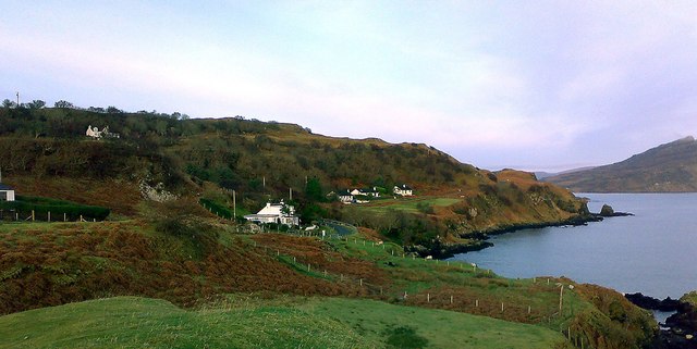
Àird Ghiuthais is a prominent coastal feature located in Inverness-shire, Scotland. This headland, also known as a point, is situated on the western coast of the Scottish Highlands, overlooking the North Atlantic Ocean. Offering breathtaking views and dramatic cliffs, Àird Ghiuthais has become a popular destination for nature enthusiasts and photographers.

The headland is characterized by its rugged landscape, featuring steep cliffs that drop dramatically into the ocean below. These cliffs are composed of ancient rocks, creating a striking contrast against the deep blue waters. The area is known for its abundant wildlife, including various seabirds such as puffins, gannets, and fulmars, which can be spotted nesting on the cliffs.

Visitors to Àird Ghiuthais can enjoy a variety of outdoor activities, such as hiking along the coastal paths that provide stunning panoramic views of the surrounding coastline. The headland offers an ideal vantage point for witnessing breathtaking sunsets over the ocean, creating a truly magical experience.

In addition to its natural beauty, Àird Ghiuthais holds historical significance. The headland is believed to have been inhabited by humans since prehistoric times, with evidence of ancient settlements and burial sites. The area also played a role in the Norse and Viking history of the region, adding to its cultural heritage.

Overall, Àird Ghiuthais stands as a remarkable coastal feature, combining stunning natural scenery, abundant wildlife, and a rich historical background. It continues to captivate visitors from around the world, offering a truly unforgettable experience on the shores of Inverness-shire.

If you have any feedback on the listing, please let us know in the comments section below.

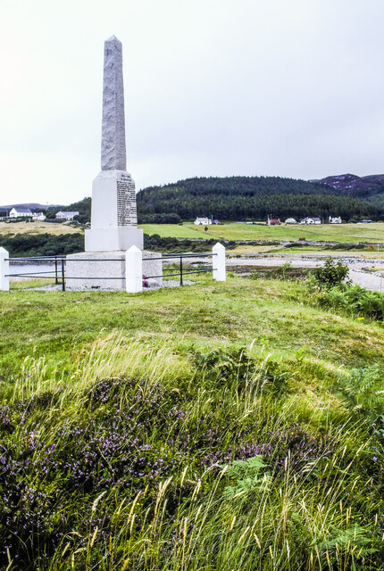
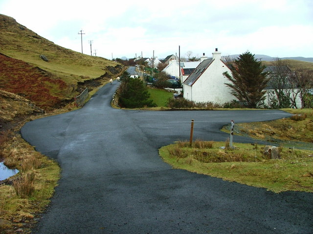
Àird Ghiuthais Images

Images are sourced within 2km of 57.352595/-6.0872854 or Grid Reference NG5436. Thanks to Geograph Open Source API. All images are credited.

Ferry arriving at Clachan, Raasay
Cut Mark, Home Farm, Raasay Not shown on modern OS DB but shown on Six-inch 2nd and later editions, 1892-1960
Cut Mark, Home Farm, Raasay
Not shown on modern OS DB but shown on Six-inch 2nd and later editions, 1892-1960
Corner of Home Farm, Raasay
OS Pivot, Raasay House, Raasay Not shown on modern OS DB but shown on Six-inch 2nd and later editions, 1892-1960.
OS Pivot, Raasay House, Raasay
Not shown on modern OS DB but shown on Six-inch 2nd and later editions, 1892-1960.
Oskaig Point
Oskaig Point
Raasay War memorial at Inverarish Inverarish is the largest settlement on Raasay making it the logical location for the island's war memorial. The village looks out over the Narrows of Raasay to Skye, just a kilometre or two distant.
Raasay War memorial at Inverarish
Inverarish is the largest settlement on Raasay making it the logical location for the island's war memorial. The village looks out over the Narrows of Raasay to Skye, just a kilometre or two distant.
View near Oskaig On the west coast of Raasay with Skye in the distance.
From a print, date uncertain.
View near Oskaig
On the west coast of Raasay with Skye in the distance. From a print, date uncertain.
Road above Oskaig Plantation Looking towards Orchard Wood.
From a print, date approximate.
Road above Oskaig Plantation
Looking towards Orchard Wood. From a print, date approximate.
Piers of former railway viaduct The viaduct carried by these piers carried a rope-worked railway built during the First World War to serve a nearby iron mine.
Piers of former railway viaduct
The viaduct carried by these piers carried a rope-worked railway built during the First World War to serve a nearby iron mine.
Abandoned mine building Derelict building at the site of Raasay Mine 2, a short lived iron mine believed to have seen little production due to geological faulting. It was connected to a processing plant at Suisnish by a rope-worked railway.
Abandoned mine building
Derelict building at the site of Raasay Mine 2, a short lived iron mine believed to have seen little production due to geological faulting. It was connected to a processing plant at Suisnish by a rope-worked railway.
Abandoned mine building Derelict building at Raasay Mine 2, a short lived Iron mine that operated during the First World War.
Abandoned mine building
Derelict building at Raasay Mine 2, a short lived Iron mine that operated during the First World War.
Landscape around Raasay Free Church View Towards Raasay Free Church from Dun Borodale.
Landscape around Raasay Free Church
View Towards Raasay Free Church from Dun Borodale.
The Manse Former Free Church manse.  Now a holiday cottage.
The Manse
Former Free Church manse. Now a holiday cottage.
Railway Viaduct Abutment Abutment of former viaduct across Inverarish Burn on the railway leading to Raasay Mine 2, an iron mine that operated briefly during World War I.
Railway Viaduct Abutment
Abutment of former viaduct across Inverarish Burn on the railway leading to Raasay Mine 2, an iron mine that operated briefly during World War I.
Dun Borodale Remains of an Iron Age broch.  Its appearance is very different from when photographed in 2011 <a href="https://www.geograph.org.uk/photo/2395526">NG5536 : Dùn Borodale</a>. Since then the surrounding woodland has been felled, and much of the moss that covered the stonework has gone.
Dun Borodale
Remains of an Iron Age broch. Its appearance is very different from when photographed in 2011 NG5536 : Dùn Borodale. Since then the surrounding woodland has been felled, and much of the moss that covered the stonework has gone.
Dun Borodale Remaining stonework of the entrance to Dun Borodale broch.
Dun Borodale
Remaining stonework of the entrance to Dun Borodale broch.
Dun Borodale The remains of Dun Borodale broch. The entrance doorway was on the left hand (east) side.
Dun Borodale
The remains of Dun Borodale broch. The entrance doorway was on the left hand (east) side.
Dun Borodale Remains of Dun Borodale broch viewed from the northwest.
Dun Borodale
Remains of Dun Borodale broch viewed from the northwest.
Show me another place!

Àird Ghiuthais is located at Grid Ref: NG5436 (Lat: 57.352595, Lng: -6.0872854)

Unitary Authority: Highland

Police Authority: Highlands and Islands

What 3 Words

///dime.reserves.birdcage. Near Portree, Highland

Related Wikis

Isle of Raasay distillery

Isle of Raasay distillery is a Scotch whisky distillery on the Inner Hebridean Isle of Raasay in Northwest Scotland. The distillery is owned by R&B Distillers...

Inverarish

Inverarish (Scottish Gaelic: Inbhir Àrais) is a village that is the main settlement of the Isle of Raasay, in the civil parish of Portree, in the council...

Peinachorran

Peinchorran (Scottish Gaelic: Peighinn a' Chorrain; Peinachorrain on Ordnance Survey maps) is a remote settlement, lying at the end of the B883 road, on...

Gedintailor

Gedintailor (Scottish Gaelic: Gead an t-Sailleir) is a crofting village, lying on the shores of the Narrows of Raasay on the east coast of the island of...

Nearby Amenities

Located within 500m of 57.352595,-6.0872854
Source: PGS
Lat/Long: 57.3487852/-6.088382
Source: PGS
Lat/Long: 57.3488723/-6.088748
Source: PGS
Lat/Long: 57.3491445/-6.0888296
Source: PGS
Lat/Long: 57.3496219/-6.0884096
Source: PGS
Lat/Long: 57.3500303/-6.0881188
Source: PGS
Lat/Long: 57.3499348/-6.087903
Source: PGS
Lat/Long: 57.3496585/-6.0880665
Source: PGS
Lat/Long: 57.34944/-6.0880316
Source: PGS
Lat/Long: 57.3488774/-6.0879447
Source: PGS
Lat/Long: 57.3509196/-6.0797336
Source: PGS
Lat/Long: 57.3508525/-6.0809062
Source: PGS
Lat/Long: 57.3506466/-6.0811035
Source: PGS
Lat/Long: 57.3504783/-6.0810458
Source: PGS
Lat/Long: 57.3504022/-6.0813048
Source: PGS
Lat/Long: 57.3503848/-6.081753
Source: PGS
Lat/Long: 57.3507823/-6.082432
Source: PGS
Lat/Long: 57.3516476/-6.0822275
Source: PGS
Lat/Long: 57.3516732/-6.0823139
Source: PGS
Lat/Long: 57.3522057/-6.0833183
Source: PGS
Lat/Long: 57.3522353/-6.0837289
Source: PGS
Lat/Long: 57.3520505/-6.0845163
Source: PGS
Lat/Long: 57.3514976/-6.0847192
Source: PGS
Lat/Long: 57.3512828/-6.0848675
Source: PGS
Lat/Long: 57.3507986/-6.0860764
Source: PGS
Lat/Long: 57.3506902/-6.0862917
Source: PGS
Lat/Long: 57.3505901/-6.086477
Source: PGS
Lat/Long: 57.3507966/-6.0881543
Source: PGS
Lat/Long: 57.3509813/-6.0882188
Source: PGS
Lat/Long: 57.3513012/-6.0877197
Source: PGS
Lat/Long: 57.3518018/-6.0880572
Source: PGS
Lat/Long: 57.3523225/-6.0877389
Created By: dmgroom_coastlines
Source: PGS
Lat/Long: 57.3526/-6.0877
Source: PGS
Lat/Long: 57.3529054/-6.0869575
Created By: dmgroom_coastlines
Source: PGS
Lat/Long: 57.35335/-6.08693
Source: PGS
Lat/Long: 57.35362/-6.086787
Source: PGS
Lat/Long: 57.3539874/-6.0861947
Source: PGS
Lat/Long: 57.3541754/-6.0862009
Source: PGS
Lat/Long: 57.354244/-6.0861389
Source: PGS
Lat/Long: 57.3546927/-6.0863371
Source: PGS
Lat/Long: 57.3551805/-6.0855566
Source: PGS
Lat/Long: 57.3548016/-6.0840185
Created By: dmgroom_coastlines
Source: PGS
Lat/Long: 57.35469/-6.08375
Source: PGS
Lat/Long: 57.3547257/-6.0832426
Created By: dmgroom_coastlines
Source: PGS
Lat/Long: 57.3548/-6.08303
Created By: dmgroom_coastlines
Source: PGS
Lat/Long: 57.35505/-6.08253
Created By: dmgroom_coastlines
Source: PGS
Lat/Long: 57.35529/-6.08204
Source: PGS
Lat/Long: 57.3555635/-6.0816664
Ferry Terminal
Lat/Long: 57.3498484/-6.0827728
Ratharsair / Raasay
Board Type: nature
Check Date: 2021-09-15
Information: board
Tourism: information
Lat/Long: 57.3504381/-6.0822119
Toilets
Access: yes
Fee: no
Level: 0
Lat/Long: 57.3506256/-6.0820255
Bicycle Parking
Capacity: 8
Lat/Long: 57.3505983/-6.0821198
Bench
Lat/Long: 57.355259/-6.0814026
Raasay Pictish Stone
Historic: archaeological_site
Lat/Long: 57.3550926/-6.0805636
Artwork Subject: mermaid
Artwork Type: sculpture
Material: stone
Tourism: artwork
Lat/Long: 57.3508557/-6.0817614
Artwork Subject: mermaid
Artwork Type: sculpture
Material: stone
Tourism: artwork
Lat/Long: 57.3509288/-6.0820444
An Àird Ghiuthais
Natural: cape
Lat/Long: 57.3513588/-6.0868762
The data included in this document is from www.openstreetmap.org. The data is made available under ODbL.

Have you been to Àird Ghiuthais?

Leave your review of Àird Ghiuthais below (or comments, questions and feedback).