Sandgeo

Coastal Feature, Headland, Point in Ross-shire

Scotland

Sandgeo

Skaraval at Port Nis View along the coast from Skaraval at Port Nis.
Skaraval at Port Nis Credit: Ajay Tegala

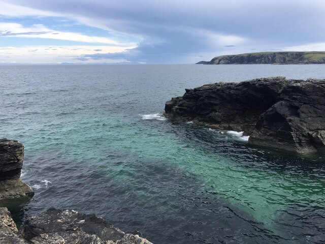
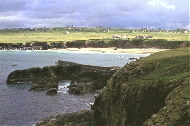
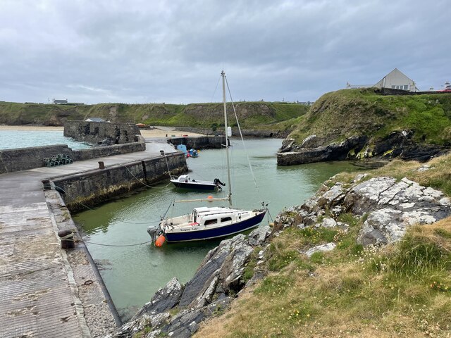
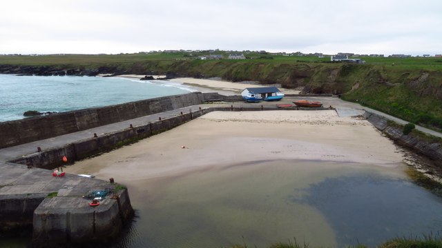
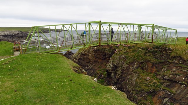
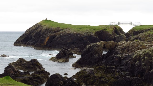
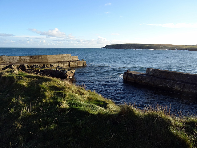
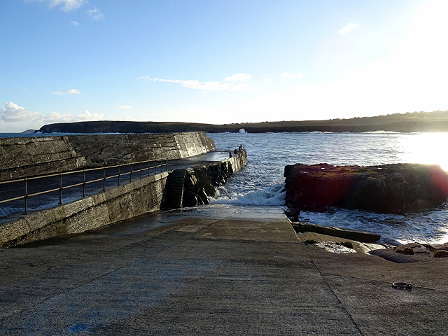
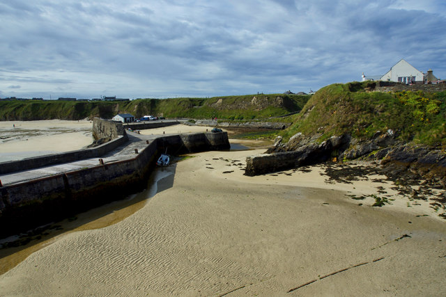
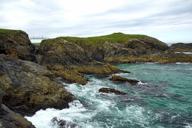
Sandgeo is a coastal feature located in Ross-shire, Scotland. It is a headland that juts out into the North Sea, forming a distinct point along the coastline. The headland is characterized by its rugged cliffs and rocky terrain, providing a striking contrast to the surrounding sandy beaches.

The cliffs of Sandgeo are composed of ancient sedimentary rocks, displaying layers of different colors and textures that have been shaped by natural erosion processes over millions of years. The headland offers breathtaking views of the open sea, with waves crashing against the rocks below, creating a dramatic and picturesque scene.

The area surrounding Sandgeo is home to a diverse range of wildlife, including seabirds, such as gulls and puffins, which nest on the cliffs. The coastal waters are also teeming with marine life, with seals often seen basking on the rocks or swimming in the nearby coves.

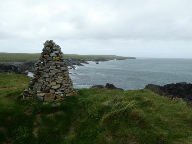
Visitors to Sandgeo can explore the headland by following a network of paths that lead along the cliff tops and down to the beach. The sandy shores provide an opportunity for beachcombing, with shells and other treasures often washed ashore.

The location of Sandgeo makes it a popular spot for outdoor activities, such as hiking, birdwatching, and photography. Its natural beauty and tranquil surroundings make it an ideal destination for those seeking a peaceful escape from the hustle and bustle of everyday life.

In summary, Sandgeo is a captivating coastal feature in Ross-shire, Scotland. Its rugged cliffs, sandy beaches, and abundant wildlife make it a must-visit destination for nature enthusiasts and outdoor adventurers.

If you have any feedback on the listing, please let us know in the comments section below.

Sandgeo Images

Images are sourced within 2km of 58.499301/-6.2245881 or Grid Reference NB5364. Thanks to Geograph Open Source API. All images are credited.

Skaraval at Port Nis View along the coast from Skaraval at Port Nis.
Skaraval at Port Nis
View along the coast from Skaraval at Port Nis.
Dun Eistean cairn with distant view of Butt of Lewis lighthouse
Dun Eistean bridge and houses in Knockaird
Port of Ness
Port of Ness
Port of Ness Post Office
Rocky headland at Port of Ness Houses at Callicvol sit above the beach.
Rocky headland at Port of Ness
Houses at Callicvol sit above the beach.
Port Nis In around 1999, the Ordnance Survey replaced English-language placenames in the Western Isles with Gaelic-language names. Some of the more prominent features (e.g. Isle of Barra; Stornoway; Sound of Harris) do have bilingual labels but, on the whole, villages, lochs, peaks etc. generally have the Gaelic names on the modern-day mapping.

Because the English versions have a tendency not to appear on the maps any more, I have decided to use them in my image titles and, as such, a translation will be readily available from the Gaelic labelling on the map. 

(NB I have not translated some of the more minor loch and river names, where I have not easily found the English version.)
Port Nis
In around 1999, the Ordnance Survey replaced English-language placenames in the Western Isles with Gaelic-language names. Some of the more prominent features (e.g. Isle of Barra; Stornoway; Sound of Harris) do have bilingual labels but, on the whole, villages, lochs, peaks etc. generally have the Gaelic names on the modern-day mapping. Because the English versions have a tendency not to appear on the maps any more, I have decided to use them in my image titles and, as such, a translation will be readily available from the Gaelic labelling on the map. (NB I have not translated some of the more minor loch and river names, where I have not easily found the English version.)
A857 entering Port of Ness
Harbour at Port of Ness
Footbridge linking Lewis with Dun Eistean
Dun Eistean & connecting bridge near Butt of Lewis
Old Rover 2000 (1) The remains of a once-beautiful car crumble away outside a derelict garage.  This series of Rovers was produced at Solihull from 1963 to 1977. <span class="nowrap"><a title="https://en.wikipedia.org/wiki/Rover_P6" rel="nofollow ugc noopener" href="https://en.wikipedia.org/wiki/Rover_P6">Link</a><img style="margin-left:2px;" alt="External link" title="External link - shift click to open in new window" src="https://s1.geograph.org.uk/img/external.png" width="10" height="10"/></span> .  For the front view see <a href="https://www.geograph.org.uk/photo/4705342">NB5363 : Old Rover 2000 (2)</a>.
Old Rover 2000 (1)
The remains of a once-beautiful car crumble away outside a derelict garage. This series of Rovers was produced at Solihull from 1963 to 1977. LinkExternal link . For the front view see NB5363 : Old Rover 2000 (2).
Old Rover 2000 (2) Once a fine car, rusting away outside a derelict garage in Port.  For the rear view see <a href="https://www.geograph.org.uk/photo/4705333">NB5363 : Old Rover 2000 (1)</a>.
Old Rover 2000 (2)
Once a fine car, rusting away outside a derelict garage in Port. For the rear view see NB5363 : Old Rover 2000 (1).
The harbour at Port Nis/Cealagbhal
Port Nis/Cealagbhal slipway
Port Nis
Port Nis
Dùn Èistean The site of a medieval fort on a small island the size of half a football pitch surrounded by steep crags off the coast just east of the Butt of Lewis overlooking the shipping routes of The Minch. The island probably supported a permanent community and is said to be the traditional stronghold of the Clan Morrison. Evidence has been found of houses, storage buildings, a defensive turf wall and, on the highest point, a keep, which could have been up to 4 metres high. On the mainland are the remains of lazy beds and other cultivation. Modern access is by a steel bridge over the steep ravine but the island would have originally been accessed either by climbing down and back up at low tide or by hauling boats up a sloping gorge on the seaward side. A pond on the top provided fresh water. Archaeological finds include coins dating from the reigns of James VI and Elizabeth I, musket balls and pistol shot as well as late medieval pottery.

Probably the first branch of Morrisons in the country.

From my blog <span class="nowrap"><a title="https://fhithich.wordpress.com/2017/08/22/dun-eistean/" rel="nofollow ugc noopener" href="https://fhithich.wordpress.com/2017/08/22/dun-eistean/">Link</a><img style="margin-left:2px;" alt="External link" title="External link - shift click to open in new window" src="https://s1.geograph.org.uk/img/external.png" width="10" height="10"/></span>
Dùn Èistean
The site of a medieval fort on a small island the size of half a football pitch surrounded by steep crags off the coast just east of the Butt of Lewis overlooking the shipping routes of The Minch. The island probably supported a permanent community and is said to be the traditional stronghold of the Clan Morrison. Evidence has been found of houses, storage buildings, a defensive turf wall and, on the highest point, a keep, which could have been up to 4 metres high. On the mainland are the remains of lazy beds and other cultivation. Modern access is by a steel bridge over the steep ravine but the island would have originally been accessed either by climbing down and back up at low tide or by hauling boats up a sloping gorge on the seaward side. A pond on the top provided fresh water. Archaeological finds include coins dating from the reigns of James VI and Elizabeth I, musket balls and pistol shot as well as late medieval pottery. Probably the first branch of Morrisons in the country. From my blog LinkExternal link
Bràighe Mòr
Bràighe Mòr
Show me another place!

Sandgeo is located at Grid Ref: NB5364 (Lat: 58.499301, Lng: -6.2245881)

Unitary Authority: Na h-Eileanan an Iar

Police Authority: Highlands and Islands

What 3 Words

///webcams.cobras.dignity. Near North Tolsta, Na h-Eileanan Siar

Related Wikis

Dùn Èistean

Dùn Èistean is a multi-period archaeological site on an inter-tidal sea stack on the north east coast of the Isle of Lewis, near the village of Knockaird...
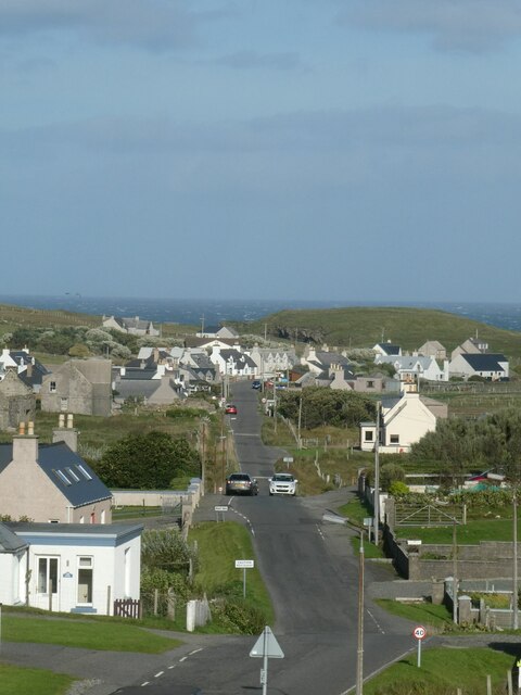
Port of Ness

Port of Ness (Scottish Gaelic: Port Nis) is a village on the Isle of Lewis in the community of Ness, in the Outer Hebrides, Scotland. Port of Ness is within...

Knockaird

Knockaird (Scottish Gaelic: An Cnoc Àrd) is a village on the Isle of Lewis in the parish of Ness, in the Outer Hebrides, Scotland. It is the highest point...

Fivepenny

Fivepenny (Scottish Gaelic: Na Còig Peighinnean) is one of the many villages in the Lewis district of Ness (Nis in Gaelic) and part of the Isle of Lewis...

Nearby Amenities

Located within 500m of 58.499301,-6.2245881
Power: pole
Lat/Long: 58.4972408/-6.2322036
Passing Place
Lat/Long: 58.4980885/-6.2290781
Passing Place
Lat/Long: 58.4969078/-6.2313484
The data included in this document is from www.openstreetmap.org. The data is made available under ODbL.

Have you been to Sandgeo?

Leave your review of Sandgeo below (or comments, questions and feedback).