Poll Eistean

Sea, Estuary, Creek in Ross-shire

Scotland

Poll Eistean

Skaraval at Port Nis View along the coast from Skaraval at Port Nis.
Skaraval at Port Nis Credit: Ajay Tegala

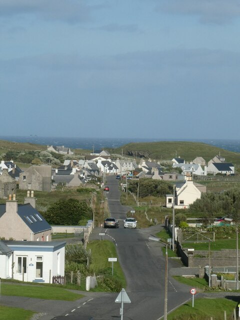
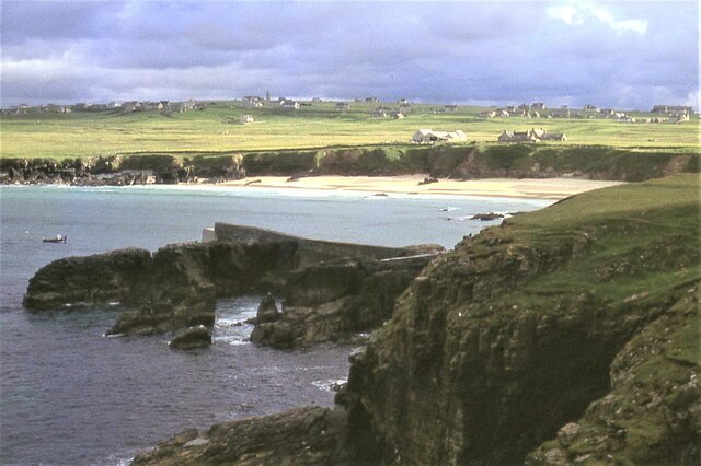
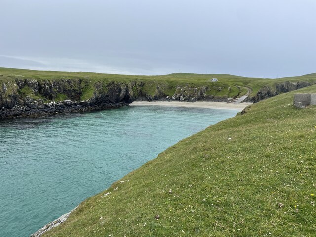
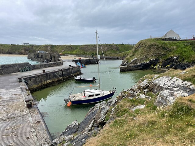
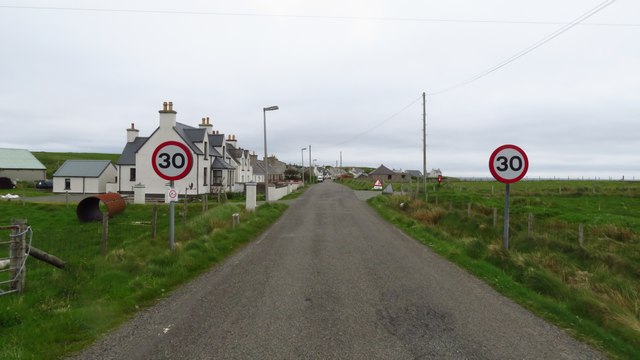
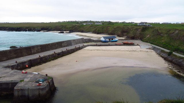
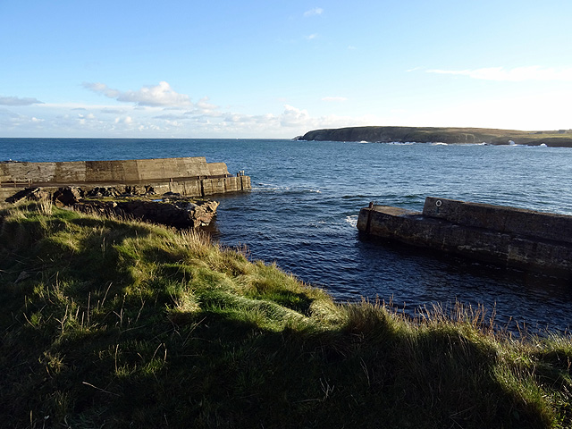
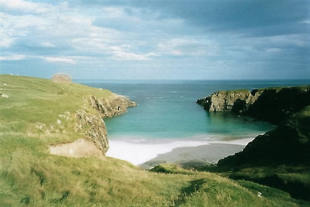
Poll Eistean is a picturesque coastal village located in Ross-shire, Scotland. Situated on the eastern coast of Scotland, it overlooks the North Sea and is nestled between the towns of Ullapool and Gairloch. The village is renowned for its stunning panoramic views, tranquil beaches, and diverse wildlife.

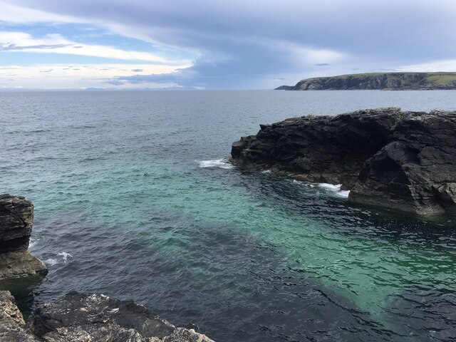
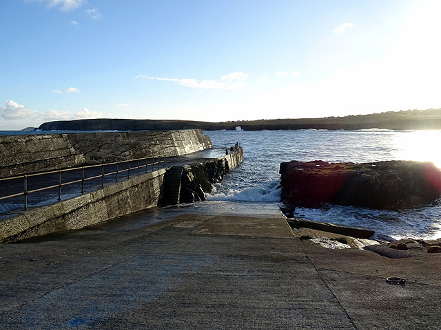
The main attraction of Poll Eistean is its expansive estuary, which is formed by the confluence of several freshwater streams and the sea. This estuary serves as a vital habitat for various species of birds, making it a popular spot for birdwatching enthusiasts. Visitors can observe migratory birds such as curlews, oystercatchers, and herons, as well as resident species like ducks and swans.

The estuary also offers a perfect setting for outdoor activities, including kayaking, canoeing, and fishing. The calm waters provide an ideal environment for beginners and experienced water sports enthusiasts alike. Anglers can enjoy casting their lines in the estuary, hoping to catch sea trout or even a salmon.

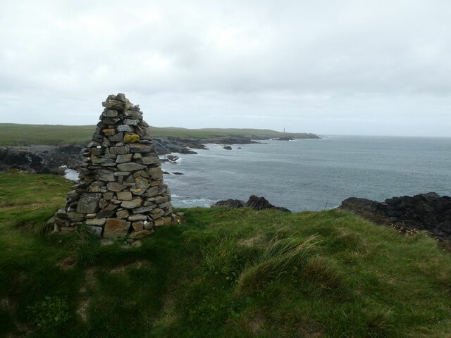
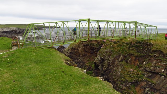
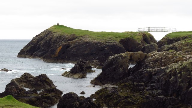
In addition to its natural beauty, Poll Eistean boasts a rich history. Ruins of an ancient Pictish settlement can be found nearby, providing an insight into the village's past. The ruins, along with the surrounding landscape, offer a sense of tranquility and a chance for visitors to immerse themselves in the area's history.

Overall, Poll Eistean is a hidden gem, a serene coastal village that offers a combination of breathtaking views, diverse wildlife, and a glimpse into Scotland's past. Whether you are seeking outdoor adventures or simply looking to unwind amidst nature, Poll Eistean is a destination that should not be missed.

If you have any feedback on the listing, please let us know in the comments section below.

Poll Eistean Images

Images are sourced within 2km of 58.50178/-6.2312255 or Grid Reference NB5364. Thanks to Geograph Open Source API. All images are credited.

Skaraval at Port Nis View along the coast from Skaraval at Port Nis.
Skaraval at Port Nis
View along the coast from Skaraval at Port Nis.
Dun Eistean cairn with distant view of Butt of Lewis lighthouse
Dun Eistean bridge and houses in Knockaird
Port of Ness
Port of Ness
Port of Ness Post Office
Rocky headland at Port of Ness Houses at Callicvol sit above the beach.
Rocky headland at Port of Ness
Houses at Callicvol sit above the beach.
Port Stoth Geocaching is a type of global treasure hunt of people looking for caches, or hidden stashes of objects. Geocaching may also be described as a series of hide-and-seek games, where hiders provide online clues for seekers. Seekers use global positioning system (GPS) devices to find hidden caches
Port Stoth
Geocaching is a type of global treasure hunt of people looking for caches, or hidden stashes of objects. Geocaching may also be described as a series of hide-and-seek games, where hiders provide online clues for seekers. Seekers use global positioning system (GPS) devices to find hidden caches
Port Nis In around 1999, the Ordnance Survey replaced English-language placenames in the Western Isles with Gaelic-language names. Some of the more prominent features (e.g. Isle of Barra; Stornoway; Sound of Harris) do have bilingual labels but, on the whole, villages, lochs, peaks etc. generally have the Gaelic names on the modern-day mapping.

Because the English versions have a tendency not to appear on the maps any more, I have decided to use them in my image titles and, as such, a translation will be readily available from the Gaelic labelling on the map. 

(NB I have not translated some of the more minor loch and river names, where I have not easily found the English version.)
Port Nis
In around 1999, the Ordnance Survey replaced English-language placenames in the Western Isles with Gaelic-language names. Some of the more prominent features (e.g. Isle of Barra; Stornoway; Sound of Harris) do have bilingual labels but, on the whole, villages, lochs, peaks etc. generally have the Gaelic names on the modern-day mapping. Because the English versions have a tendency not to appear on the maps any more, I have decided to use them in my image titles and, as such, a translation will be readily available from the Gaelic labelling on the map. (NB I have not translated some of the more minor loch and river names, where I have not easily found the English version.)
St Molveg's Church, Eoropie
A857 entering Port of Ness
Harbour at Port of Ness
Footbridge linking Lewis with Dun Eistean
Dun Eistean & connecting bridge near Butt of Lewis
Old Rover 2000 (1) The remains of a once-beautiful car crumble away outside a derelict garage.  This series of Rovers was produced at Solihull from 1963 to 1977. <span class="nowrap"><a title="https://en.wikipedia.org/wiki/Rover_P6" rel="nofollow ugc noopener" href="https://en.wikipedia.org/wiki/Rover_P6">Link</a><img style="margin-left:2px;" alt="External link" title="External link - shift click to open in new window" src="https://s1.geograph.org.uk/img/external.png" width="10" height="10"/></span> .  For the front view see <a href="https://www.geograph.org.uk/photo/4705342">NB5363 : Old Rover 2000 (2)</a>.
Old Rover 2000 (1)
The remains of a once-beautiful car crumble away outside a derelict garage. This series of Rovers was produced at Solihull from 1963 to 1977. LinkExternal link . For the front view see NB5363 : Old Rover 2000 (2).
Old Rover 2000 (2) Once a fine car, rusting away outside a derelict garage in Port.  For the rear view see <a href="https://www.geograph.org.uk/photo/4705333">NB5363 : Old Rover 2000 (1)</a>.
Old Rover 2000 (2)
Once a fine car, rusting away outside a derelict garage in Port. For the rear view see NB5363 : Old Rover 2000 (1).
The harbour at Port Nis/Cealagbhal
Port Nis/Cealagbhal slipway
Port Stoth Port Stoth is the most northerly beach on the Western Isles. All the materials for the construction of the Butt of Lewis lighthouse were landed here between 1851 and 1862. As it was a sheltered spot the beach continued to be used to bring supplies to the lighthouse until the 1960s. 
On 22nd January 1901 a wooden lugsail (Lugger) in ballast was stranded at Port Stoth. Surprisingly, no name is recorded of the unregistered vessel but its date of building was known to be 1893 and the master was a Captain Gunn.
Port Stoth
Port Stoth is the most northerly beach on the Western Isles. All the materials for the construction of the Butt of Lewis lighthouse were landed here between 1851 and 1862. As it was a sheltered spot the beach continued to be used to bring supplies to the lighthouse until the 1960s. On 22nd January 1901 a wooden lugsail (Lugger) in ballast was stranded at Port Stoth. Surprisingly, no name is recorded of the unregistered vessel but its date of building was known to be 1893 and the master was a Captain Gunn.
Show me another place!

Poll Eistean is located at Grid Ref: NB5364 (Lat: 58.50178, Lng: -6.2312255)

Unitary Authority: Na h-Eileanan an Iar

Police Authority: Highlands and Islands

What 3 Words

///sharpness.holidays.backhand. Near North Tolsta, Na h-Eileanan Siar

Related Wikis

Dùn Èistean

Dùn Èistean is a multi-period archaeological site on an inter-tidal sea stack on the north east coast of the Isle of Lewis, near the village of Knockaird...

Knockaird

Knockaird (Scottish Gaelic: An Cnoc Àrd) is a village on the Isle of Lewis in the parish of Ness, in the Outer Hebrides, Scotland. It is the highest point...

Fivepenny

Fivepenny (Scottish Gaelic: Na Còig Peighinnean) is one of the many villages in the Lewis district of Ness (Nis in Gaelic) and part of the Isle of Lewis...

Port of Ness

Port of Ness (Scottish Gaelic: Port Nis) is a village on the Isle of Lewis in the community of Ness, in the Outer Hebrides, Scotland. Port of Ness is within...

Nearby Amenities

Located within 500m of 58.50178,-6.2312255
Generator Method: wind_turbine
Generator Source: wind
Power: generator
Lat/Long: 58.4991166/-6.2332311
Power: pole
Lat/Long: 58.498917/-6.2375371
Power: pole
Lat/Long: 58.4986685/-6.2367206
Power: pole
Lat/Long: 58.4984469/-6.2359737
Power: pole
Lat/Long: 58.4981631/-6.2350568
Power: pole
Lat/Long: 58.497928/-6.2342825
Power: pole
Lat/Long: 58.4976724/-6.2334639
Passing Place
Lat/Long: 58.4980885/-6.2290781
The data included in this document is from www.openstreetmap.org. The data is made available under ODbL.

Have you been to Poll Eistean?

Leave your review of Poll Eistean below (or comments, questions and feedback).