Rubha na h-Easgainne

Coastal Feature, Headland, Point in Inverness-shire

Scotland

Rubha na h-Easgainne

Camp on the moor above Elgol
Camp on the moor above Elgol Credit: Alan Reid

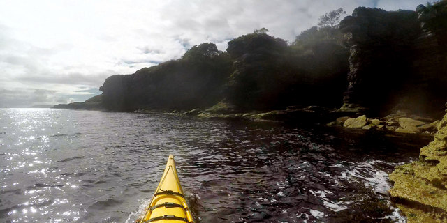
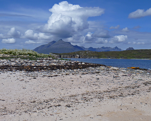
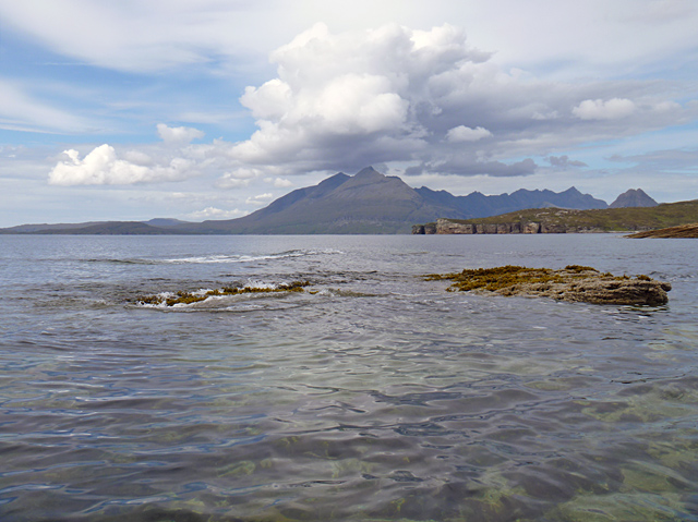
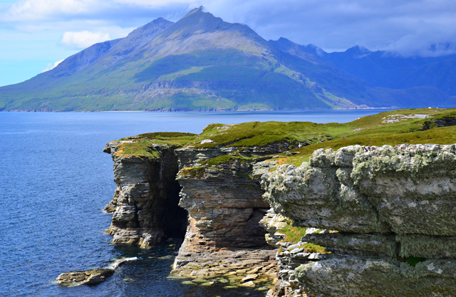
Rubha na h-Easgainne is a stunning coastal feature located in Inverness-shire, Scotland. Situated on the west coast, it is a prominent headland that juts out into the sea, forming a point that offers breathtaking views of the surrounding landscape.

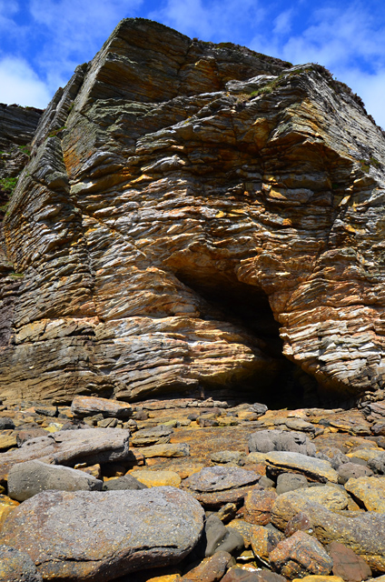
The name Rubha na h-Easgainne translates to "Headland of the Little Waterfall" in Scottish Gaelic, which is a fitting description given the presence of a small waterfall that cascades down the cliffs into the ocean below. This waterfall adds to the beauty and charm of the area, creating a picturesque scene that attracts visitors from far and wide.

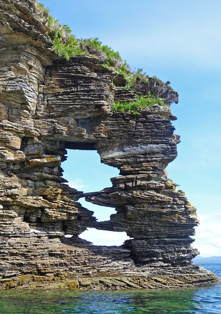
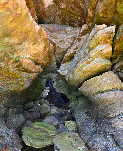
The headland itself is characterized by its rugged and dramatic cliffs, which are made up of ancient rocks that have been shaped over centuries by the relentless power of the sea. The cliffs rise high above the water, providing a vantage point for visitors to admire the expansive views of the coastline and the nearby islands.

Rubha na h-Easgainne is also a haven for wildlife enthusiasts. The surrounding waters are home to a diverse range of marine life, including seals, dolphins, and various species of seabirds. Birdwatchers can spot colonies of nesting seabirds on the cliffs, such as puffins, guillemots, and razorbills.

Access to Rubha na h-Easgainne is relatively easy, with a well-maintained footpath that leads visitors to the headland. There are also designated viewing points and benches along the way, allowing for moments of rest and contemplation while taking in the breathtaking scenery.

Overall, Rubha na h-Easgainne is a captivating coastal feature that showcases the natural beauty and diversity of the Inverness-shire coastline. It offers a unique opportunity to immerse oneself in Scotland's rugged and untamed coastal landscape, making it a must-visit destination for nature lovers and outdoor enthusiasts.

If you have any feedback on the listing, please let us know in the comments section below.

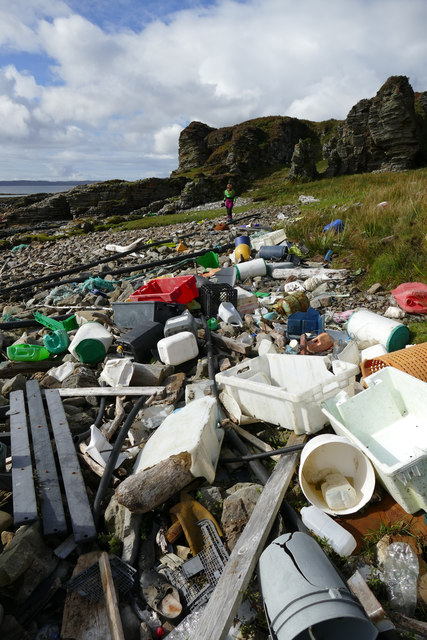
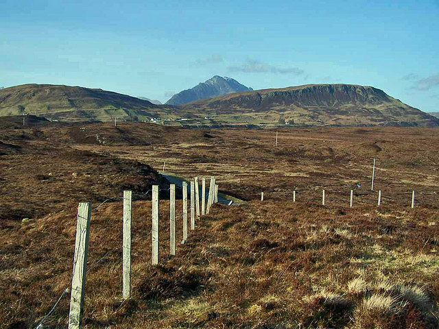
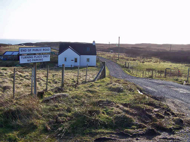
Rubha na h-Easgainne Images

Images are sourced within 2km of 57.126609/-6.0836601 or Grid Reference NG5211. Thanks to Geograph Open Source API. All images are credited.

Camp on the moor above Elgol
Plastic washed up west of Rubha na h-Easgainne This seems a fairly typical scene on weather-facing beaches in Skye - a few bits of wood (with nails) which might be useful for a campfire, but mostly plastic which one really shouldn't burn on an open fire, but how to get rid of it ? Behind the storm beach, plastic rubbish is incorporated in the soil and will be almost impossible to remove, though perhaps less likely to end up as micro-plastic continuing to degrade and pollute. There seems to be less rope and fishing net than there used to be, but more pipe and other fish-farm hardware, along with lubricant containers and fish boxes.
Plastic washed up west of Rubha na h-Easgainne
This seems a fairly typical scene on weather-facing beaches in Skye - a few bits of wood (with nails) which might be useful for a campfire, but mostly plastic which one really shouldn't burn on an open fire, but how to get rid of it ? Behind the storm beach, plastic rubbish is incorporated in the soil and will be almost impossible to remove, though perhaps less likely to end up as micro-plastic continuing to degrade and pollute. There seems to be less rope and fishing net than there used to be, but more pipe and other fish-farm hardware, along with lubricant containers and fish boxes.
The geo leading to Spar Cave The geo, and the cave beyond, have joint and dyke-controlled walls (intrusive basalt of Palaeogene age) in the Druim an Fhuarain Sandstone Member of the Bearreraig Sandstone Formation of Aalenian to Bajocian stages (oldest Middle Jurassic). Although this is called a sandstone, the geological map key describes it as sandstone, cross-bedded and sandy limestone, massive or thinly bedded with fragments of crinoid ossicles, bivalve, bryozoans, belemnite and brachiopod fragments. The member is up to 485m thick, and quite variable. The particular strata lying above the cave are clearly quite rich in lime, as percolation water passing through them has created a large volume of calcite deposits inside the cave (which is still impressive despite the depredations of Victorian collectors). Apparently the cave can be reached on foot at low tide, but our visit was by sea kayak, so the state of the tide was of little consequence - the geo rises above the high tide mark, so boats could be left in safety whilst the cave was explored.
The geo leading to Spar Cave
The geo, and the cave beyond, have joint and dyke-controlled walls (intrusive basalt of Palaeogene age) in the Druim an Fhuarain Sandstone Member of the Bearreraig Sandstone Formation of Aalenian to Bajocian stages (oldest Middle Jurassic). Although this is called a sandstone, the geological map key describes it as sandstone, cross-bedded and sandy limestone, massive or thinly bedded with fragments of crinoid ossicles, bivalve, bryozoans, belemnite and brachiopod fragments. The member is up to 485m thick, and quite variable. The particular strata lying above the cave are clearly quite rich in lime, as percolation water passing through them has created a large volume of calcite deposits inside the cave (which is still impressive despite the depredations of Victorian collectors). Apparently the cave can be reached on foot at low tide, but our visit was by sea kayak, so the state of the tide was of little consequence - the geo rises above the high tide mark, so boats could be left in safety whilst the cave was explored.
Paddling along the Strathaird coast The whole of the eastern side of the Strathaird peninsula is bounded by low cliffs of the Druim an Fhuarain Sandstone Member of the Bearreraig Sandstone Formation of Aalenian to Bajocian stages (oldest Middle Jurassic). Although this is called a sandstone, the geological map key describes it as sandstone, cross-bedded and sandy limestone, massive or thinly bedded with fragments of crinoid ossicles, bivalve, bryozoans, belemnite and brachiopod fragments. The member is up to 485m thick, and quite variable. The soluble nature of the cement between sand grains means that the rock is easily eroded by solution, but being on the sheltered side of this bit of land, has not been washed away by wave action. The cross-bedding is thus shown up by deep etching of the surface of the cliff. Much more recently than the deposition of the sandstone, during the split that opened up the Atlantic Ocean, much igneous activity took place in parts of Western Scotland, and that is reflected here by the intrusion of basalt of Palaeogene age, most noticeably as NW-SE trending dykes (at right angles to the coast) which give rise to numerous geos, beloved of sea kayakers for poking into.
Paddling along the Strathaird coast
The whole of the eastern side of the Strathaird peninsula is bounded by low cliffs of the Druim an Fhuarain Sandstone Member of the Bearreraig Sandstone Formation of Aalenian to Bajocian stages (oldest Middle Jurassic). Although this is called a sandstone, the geological map key describes it as sandstone, cross-bedded and sandy limestone, massive or thinly bedded with fragments of crinoid ossicles, bivalve, bryozoans, belemnite and brachiopod fragments. The member is up to 485m thick, and quite variable. The soluble nature of the cement between sand grains means that the rock is easily eroded by solution, but being on the sheltered side of this bit of land, has not been washed away by wave action. The cross-bedding is thus shown up by deep etching of the surface of the cliff. Much more recently than the deposition of the sandstone, during the split that opened up the Atlantic Ocean, much igneous activity took place in parts of Western Scotland, and that is reflected here by the intrusion of basalt of Palaeogene age, most noticeably as NW-SE trending dykes (at right angles to the coast) which give rise to numerous geos, beloved of sea kayakers for poking into.
Paddling along the Strathaird coast The journey from Kilmarie to Elgol around the coast of the Strathaird peninsula is a short paddle allowing plenty of time to explore the geos, caves and other gunk-holes formed in the almost continuous line of sandstone cliffs. The scenery gets gradually more exciting as the headland of Rubha na h-Easgainne and the island of Eilean na h-Àirde are approached. The only disadvantage of doing the trip in this direction is that the sun is in one's eyes most of the way down the southeastern coast of the peninsula.
Paddling along the Strathaird coast
The journey from Kilmarie to Elgol around the coast of the Strathaird peninsula is a short paddle allowing plenty of time to explore the geos, caves and other gunk-holes formed in the almost continuous line of sandstone cliffs. The scenery gets gradually more exciting as the headland of Rubha na h-Easgainne and the island of Eilean na h-Àirde are approached. The only disadvantage of doing the trip in this direction is that the sun is in one's eyes most of the way down the southeastern coast of the peninsula.
Road to Glasnakille The brown moorland heather and grass will soon be turning green with fresh growth. The road connects the remote Glasnakille community with that of the slightly less remote Elgol.
Road to Glasnakille
The brown moorland heather and grass will soon be turning green with fresh growth. The road connects the remote Glasnakille community with that of the slightly less remote Elgol.
Communications mast above Elgol A necessary evil these days, no matter how remote the location.
Communications mast above Elgol
A necessary evil these days, no matter how remote the location.
Fence above Glasnakille The broken down fence contains an area of moorland surrounding a communications mast. The view is north, with craggy Ben Meabost on the right.
Fence above Glasnakille
The broken down fence contains an area of moorland surrounding a communications mast. The view is north, with craggy Ben Meabost on the right.
Ruin in Glasnakille This remote community faces east over the sea towards the Sleat peninsula of Skye.
Ruin in Glasnakille
This remote community faces east over the sea towards the Sleat peninsula of Skye.
End of the road The public road south from Glasnakille ends here, though there are at least two further dwellings down the track.
End of the road
The public road south from Glasnakille ends here, though there are at least two further dwellings down the track.
Perforated headland below Glasnakille A remarkable feature on a remarkable section of coastline. Just south of Spar Cave, right below Dun Grugaig, is this beautifully eroded headland of Jurassic sandstone.
Perforated headland below Glasnakille
A remarkable feature on a remarkable section of coastline. Just south of Spar Cave, right below Dun Grugaig, is this beautifully eroded headland of Jurassic sandstone.
The beach on Eilean na h-Àirde The north end of the sandy beach on Eilean na h-Àirde, with a view towards Suidhe Biorach and the Cuillin.
The beach on Eilean na h-Àirde
The north end of the sandy beach on Eilean na h-Àirde, with a view towards Suidhe Biorach and the Cuillin.
Reef south of Eilean na h-Àirde One of several small skerries in the shallow water south of Eilean na h-Àirde. In the centre of the background view is Gars-bheinn at the south end of the Cuillin Ridge.
Reef south of Eilean na h-Àirde
One of several small skerries in the shallow water south of Eilean na h-Àirde. In the centre of the background view is Gars-bheinn at the south end of the Cuillin Ridge.
Jurassic sandstone cliffs below Glasnakille
The entrance to the Spar Cave Looking out of the canyon-like entrance to the Spar Cave, to the sea beyond. The cave itself lies behind the photographer.
The entrance to the Spar Cave
Looking out of the canyon-like entrance to the Spar Cave, to the sea beyond. The cave itself lies behind the photographer.
Cave east of Suidhe Biorach A through cave with a narrow exit at the far end. See <a href="https://www.geograph.org.uk/photo/3004729">NG5112 : Inside the through cave</a>
It is said by some guides to be Prince Charles's Cave - but that is a little further west.
Cave east of Suidhe Biorach
A through cave with a narrow exit at the far end. See NG5112 : Inside the through cave It is said by some guides to be Prince Charles's Cave - but that is a little further west.
Inside the through cave Looking towards the rear exit of the cave seen in <a href="https://www.geograph.org.uk/photo/3004725">NG5112 : Cave east of Suidhe Biorach</a>
Inside the through cave
Looking towards the rear exit of the cave seen in NG5112 : Cave east of Suidhe Biorach
Sea cliffs north of Suidhe Biorach Soft sedimentary rocks riddled with caves and geodhs. The view is from Suidhe Biorach looking towards Gars-bheinn at the southern end of the Cuillin.
Sea cliffs north of Suidhe Biorach
Soft sedimentary rocks riddled with caves and geodhs. The view is from Suidhe Biorach looking towards Gars-bheinn at the southern end of the Cuillin.
Show me another place!

Rubha na h-Easgainne is located at Grid Ref: NG5211 (Lat: 57.126609, Lng: -6.0836601)

Unitary Authority: Highland

Police Authority: Highlands and Islands

What 3 Words

///acid.stadium.puncture. Near Elgol, Highland

Related Wikis

Strathaird

Strathaird is a peninsula on the island of Skye, Scotland, situated between Loch Slapin and Loch Scavaig on the south coast.W. H. Murray said that "Skye...

Elgol

Elgol (Scottish Gaelic: Ealaghol) is a village on the shores of Loch Scavaig towards the end of the Strathaird peninsula in the Isle of Skye, in the Scottish...

Tarskavaig

Tarskavaig (Tarsgabhaig in Scottish Gaelic) is a crofting village on the west coast of Sleat on the Isle of Skye in Scotland. It sits in a glen which meets...

Kilmarie

Kilmarie or Kilmaree (Scottish Gaelic: Cill Ma Ruibhe), (Gaelic: cill =' church or cell'; marie from St. Maolrubha) is a village in the Isle of Skye, Scotland...

Nearby Amenities

Located within 500m of 57.126609,-6.0836601
Created By: dmgroom_coastlines
Source: PGS
Lat/Long: 57.12782/-6.08207
Created By: dmgroom_coastlines
Source: PGS
Lat/Long: 57.12833/-6.08203
Created By: dmgroom_coastlines
Source: PGS
Lat/Long: 57.12846/-6.08178
Created By: dmgroom_coastlines
Source: PGS
Lat/Long: 57.12856/-6.08084
Created By: dmgroom_coastlines
Source: PGS
Lat/Long: 57.12985/-6.08097
Created By: dmgroom_coastlines
Source: PGS
Lat/Long: 57.1301/-6.08095
Created By: dmgroom_coastlines
Source: PGS
Lat/Long: 57.13061/-6.08091
Source: PGS
Lat/Long: 57.1285218/-6.0909836
Source: PGS
Lat/Long: 57.1282656/-6.0888807
Source: PGS
Lat/Long: 57.1281841/-6.0881083
Created By: dmgroom_coastlines
Source: PGS
Lat/Long: 57.12821/-6.08769
Created By: dmgroom_coastlines
Source: PGS
Lat/Long: 57.12743/-6.08728
Source: PGS
Lat/Long: 57.126903/-6.0872714
Source: PGS
Lat/Long: 57.126076/-6.087207
Source: PGS
Lat/Long: 57.1263323/-6.0858981
Source: PGS
Lat/Long: 57.1263323/-6.0852544
Source: PGS
Lat/Long: 57.1262507/-6.0841815
Source: PGS
Lat/Long: 57.1269961/-6.0825722
Source: PGS
Lat/Long: 57.1271825/-6.0820572
Created By: dmgroom_coastlines
Source: PGS
Lat/Long: 57.12756/-6.08209
Rubha na h-Easgainne
Alt Name: Rubha an Easgair
Natural: cape
Lat/Long: 57.1268074/-6.0843665
The data included in this document is from www.openstreetmap.org. The data is made available under ODbL.

Have you been to Rubha na h-Easgainne?

Leave your review of Rubha na h-Easgainne below (or comments, questions and feedback).