Rubha Aird na Cruaich

Coastal Feature, Headland, Point in Argyllshire

Scotland

Rubha Aird na Cruaich

Moorland Above the cliffs of Fascadale Bay and the sea off N. Ardnamurchan
Moorland Credit: Peter Aikman

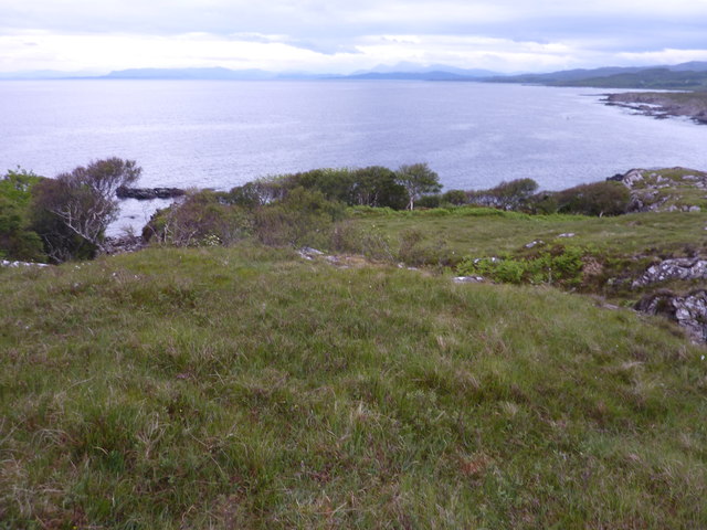
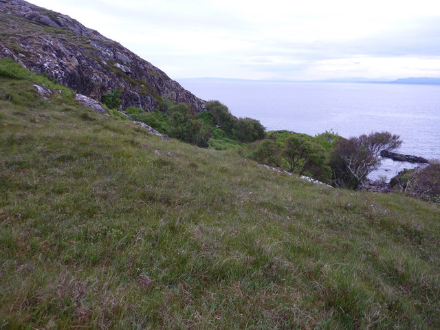
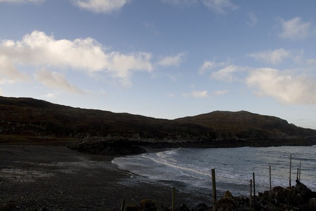
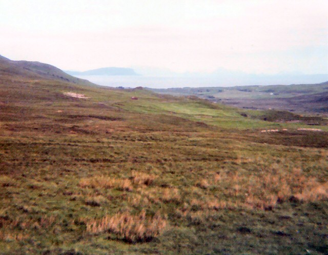
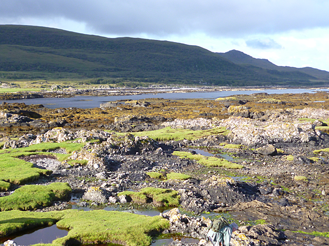
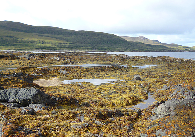
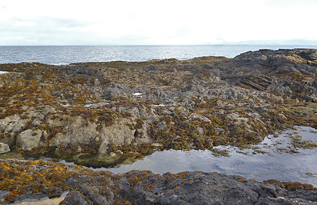
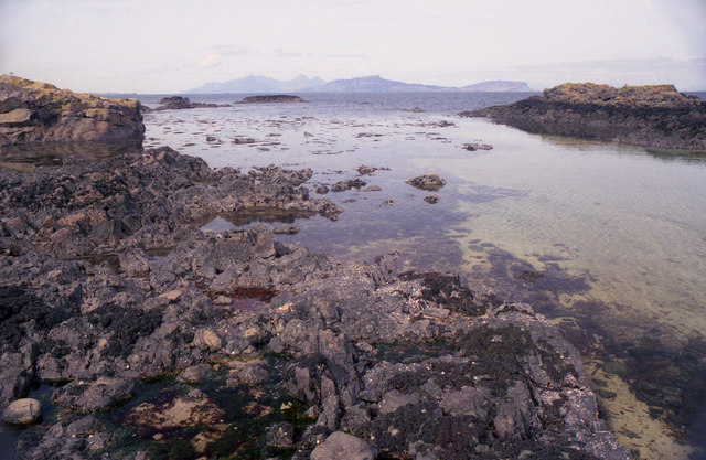
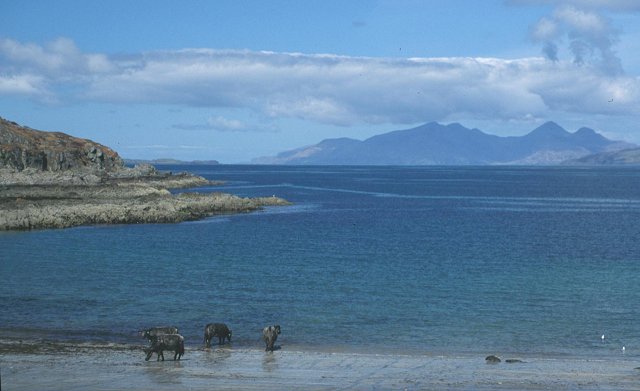
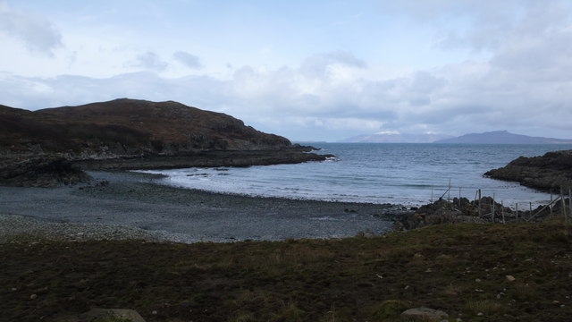
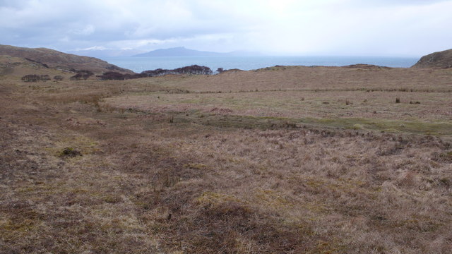
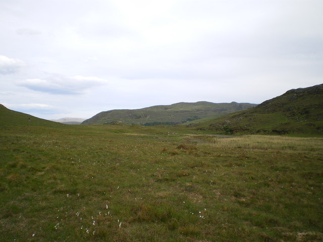
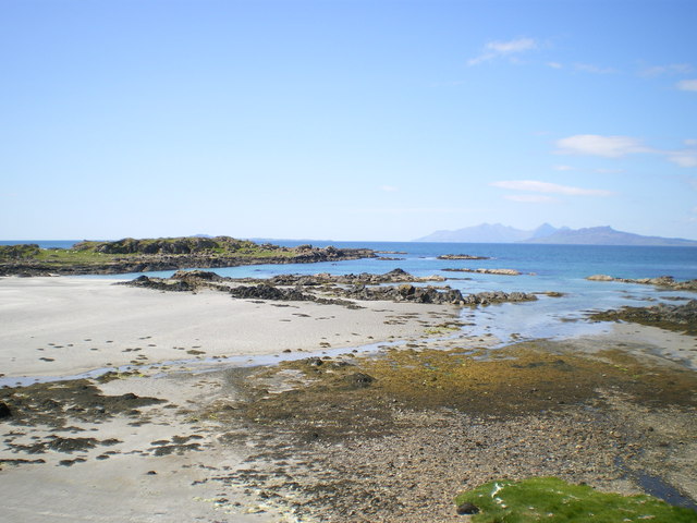
Rubha Aird na Cruaich is a rugged headland located in Argyllshire, Scotland. Situated on the west coast of the Kintyre Peninsula, this coastal feature offers stunning views of the surrounding landscape and the Atlantic Ocean. The headland is characterized by steep cliffs and rocky outcrops, making it a popular destination for hikers and nature enthusiasts.

At the tip of Rubha Aird na Cruaich, visitors can enjoy panoramic views of the sea and the nearby islands of Islay and Jura. The area is known for its diverse wildlife, including seabirds such as gannets, puffins, and guillemots. On a clear day, visitors may also spot seals and dolphins in the waters below.

The headland is accessible by a coastal path that winds its way along the cliffs, offering opportunities for exploration and photography. The rugged beauty of Rubha Aird na Cruaich makes it a must-visit destination for those seeking a taste of Scotland's wild and untamed coastline.

If you have any feedback on the listing, please let us know in the comments section below.

Rubha Aird na Cruaich Images

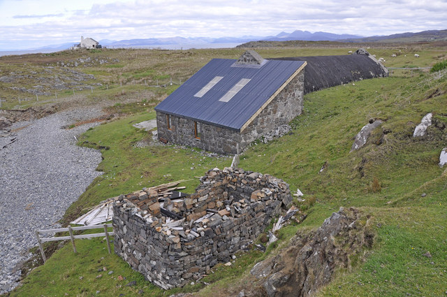
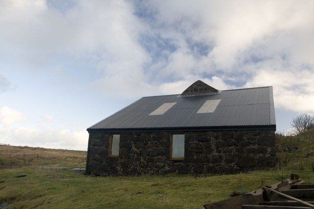
Images are sourced within 2km of 56.76296/-6.0890967 or Grid Reference NM5070. Thanks to Geograph Open Source API. All images are credited.

Moorland Above the cliffs of Fascadale Bay and the sea off N. Ardnamurchan
Moorland
Above the cliffs of Fascadale Bay and the sea off N. Ardnamurchan
Cliffs west of Fascadale
Fascadale Beach
Fascadale Beach
On the road to Fascadale View from the road to Fascally on the Ardnmurchan Estate. In the distance the island of Eigg is visible off shore
On the road to Fascadale
View from the road to Fascally on the Ardnmurchan Estate. In the distance the island of Eigg is visible off shore
Former icehouse at Fascadale Fascadale was a salmon fishing station and ice was collected during the winter and stored in the icehouse.   During the salmon netting season, February to August, the salmon were packed with ice for the journey to southern markets.   The icehouse has the characteristic rounded roof which would have been covered with growing turf.
Former icehouse at Fascadale
Fascadale was a salmon fishing station and ice was collected during the winter and stored in the icehouse. During the salmon netting season, February to August, the salmon were packed with ice for the journey to southern markets. The icehouse has the characteristic rounded roof which would have been covered with growing turf.
Building at Fascadale We didn't look inside, so I don't know what this building was used for. I'm guessing storage of fishing/boating equipment.
Building at Fascadale
We didn't look inside, so I don't know what this building was used for. I'm guessing storage of fishing/boating equipment.
Saltmarsh near Achateny Cushions of saltmarsh, bright green in low sunshine, at the shoreline. One of the cottages at Achateny is just visible in the distance, and the hills behind it, in the shadow of the clouds, are part of the 'great eucrite'.
Saltmarsh near Achateny
Cushions of saltmarsh, bright green in low sunshine, at the shoreline. One of the cottages at Achateny is just visible in the distance, and the hills behind it, in the shadow of the clouds, are part of the 'great eucrite'.
Megablock from the east A megablock is a very large chunk of rock which has been displaced by a high energy debris flows from a higher level, and dumped with vast amounts of other rock to produce a jumbled mass of distorted and displaced rock fragments. This block measures about 25 metres by 35 metres, and is made up of beds of calcareous sandstone tipped up on end so that the beds are vertical instead of horizontal. Just imagine the forces involved in moving something this size from its original location! The shadows are those of admiring geologists, but it won't be long before there will need to be a work party to strip off the seaweed so that the corduroy-like texture of the block can continue to be admired. For the reciprocal view see <a href="https://www.geograph.org.uk/photo/3658374">NM5270 : Megablock from the west</a>
Megablock from the east
A megablock is a very large chunk of rock which has been displaced by a high energy debris flows from a higher level, and dumped with vast amounts of other rock to produce a jumbled mass of distorted and displaced rock fragments. This block measures about 25 metres by 35 metres, and is made up of beds of calcareous sandstone tipped up on end so that the beds are vertical instead of horizontal. Just imagine the forces involved in moving something this size from its original location! The shadows are those of admiring geologists, but it won't be long before there will need to be a work party to strip off the seaweed so that the corduroy-like texture of the block can continue to be admired. For the reciprocal view see NM5270 : Megablock from the west
Shore near Achateny Saltmarsh above high tide mark, and rocks colonised by channel wrack just below high tide mark. The hills are part of the exterior of the 'great eucrite'.
Shore near Achateny
Saltmarsh above high tide mark, and rocks colonised by channel wrack just below high tide mark. The hills are part of the exterior of the 'great eucrite'.
Megablock from the west A megablock is a very large chunk of rock which has been displaced by a high energy debris flows from a higher level, and dumped with vast amounts of other rock to produce a jumbled mass of distorted and displaced rock fragments. This block measures about 25 metres by 35 metres, and is made up of beds of calcareous sandstone tipped up on end so that the beds are vertical instead of horizontal. Just imagine the forces involved in moving something this size from its original location! The sunlight glinting through the seaweed makes it easier to see the vertical beds than in <a href="https://www.geograph.org.uk/photo/3658346">NM5270 : Megablock from the east</a>.
Megablock from the west
A megablock is a very large chunk of rock which has been displaced by a high energy debris flows from a higher level, and dumped with vast amounts of other rock to produce a jumbled mass of distorted and displaced rock fragments. This block measures about 25 metres by 35 metres, and is made up of beds of calcareous sandstone tipped up on end so that the beds are vertical instead of horizontal. Just imagine the forces involved in moving something this size from its original location! The sunlight glinting through the seaweed makes it easier to see the vertical beds than in NM5270 : Megablock from the east.
Rocky Foreshore at Port Bàn Port Bàn means 'white port' or 'pale port' and presumably takes its name from pale sand. It is protected from the north-east by this wave-cut platform of rocks of the Achateny Breccia. In the background are hills which are part of the outer 'great eucrite'.
Rocky Foreshore at Port Bàn
Port Bàn means 'white port' or 'pale port' and presumably takes its name from pale sand. It is protected from the north-east by this wave-cut platform of rocks of the Achateny Breccia. In the background are hills which are part of the outer 'great eucrite'.
Rocky Foreshore The only land in this square is a few tens of square metres of mostly intertidal rocks. They are part of the interesting-looking Achateny Breccia, but no matter how interesting, a rising tide is not the time to examine them!
Rocky Foreshore
The only land in this square is a few tens of square metres of mostly intertidal rocks. They are part of the interesting-looking Achateny Breccia, but no matter how interesting, a rising tide is not the time to examine them!
Intertidal Rocks This corner of the square contains just a small area of rocks which are mostly below water at high tide. They belong to the Achateny Breccia, and a quick glance suggested that there might be interesting things to see. The tide, however, was rising, so a hasty retreat was called for as soon as this photograph was in the bag.
Intertidal Rocks
This corner of the square contains just a small area of rocks which are mostly below water at high tide. They belong to the Achateny Breccia, and a quick glance suggested that there might be interesting things to see. The tide, however, was rising, so a hasty retreat was called for as soon as this photograph was in the bag.
Port Ban Coastline Eigg and Rum can be seen in the distance.
Port Ban Coastline
Eigg and Rum can be seen in the distance.
Cattle, Fascadale. Cattle on the beach at Fascadale on the north shore of Ardnamurchan. View of Rum between Muck and Eigg.
Cattle, Fascadale.
Cattle on the beach at Fascadale on the north shore of Ardnamurchan. View of Rum between Muck and Eigg.
Fascadale Bay There were cattle grazing on the beach.  All the houses at Fascadale are now holiday homes owned by Ardnamurchan Estates and all were occupied this Easter weekend.  Eigg in the distance.
Fascadale Bay
There were cattle grazing on the beach. All the houses at Fascadale are now holiday homes owned by Ardnamurchan Estates and all were occupied this Easter weekend. Eigg in the distance.
Previously worked ground, Fascadale There is evidence of lazy beds here.  This hill gives easy walking on mainly short grass.
Previously worked ground, Fascadale
There is evidence of lazy beds here. This hill gives easy walking on mainly short grass.
The eastern view of Lochan Dubh Frankly, the lochan was a bit of a disappointment. After a prolonged dry spell, it was little more than a boggy marsh; no doubt it's a bit more like a proper lochan in normal West Highland weather.
The eastern view of Lochan Dubh
Frankly, the lochan was a bit of a disappointment. After a prolonged dry spell, it was little more than a boggy marsh; no doubt it's a bit more like a proper lochan in normal West Highland weather.
Show me another place!

Rubha Aird na Cruaich is located at Grid Ref: NM5070 (Lat: 56.76296, Lng: -6.0890967)

Unitary Authority: Highland

Police Authority: Highlands and Islands

What 3 Words

///princely.inhales.thinker. Near Kilchoan, Highland

Related Wikis

Achateny

Achateny (Scottish Gaelic: Ach/Achadh an Teine) is a hamlet in Argyll on Ardnamurchan in the Scottish Highlands. It is in the Scottish council area of...

Kilmory, Ardnamurchan

Kilmory (Cill Mhoire in Gaelic meaning "Mary's Cell" or "Church of Mary") is a small crofting (township) hamlet on the north coast of Ardnamurchan, western...

Port an Eilean Mhòir boat burial

The Port an Eilean Mhòir boat burial is a Viking boat burial site in Ardnamurchan, Scotland, the most westerly point on the island of Great Britain. Dated...

Achnaha

Achnaha (Scottish Gaelic: Achadh na h-Àtha) is a remote village in Ardnamurchan, Lochaber, in the Scottish council area of Highland. One of the local...

Nearby Amenities

Located within 500m of 56.76296,-6.0890967
Created By: dmgroom_coastlines
Source: PGS
Lat/Long: 56.76289/-6.08644
Created By: dmgroom_coastlines
Source: PGS
Lat/Long: 56.76176/-6.09282
Created By: dmgroom_coastlines
Source: PGS
Lat/Long: 56.76074/-6.09313
Created By: dmgroom_coastlines
Source: PGS
Lat/Long: 56.7609/-6.09451
Fascadale
Name Gd: Fascadal
Place: hamlet
Lat/Long: 56.7609636/-6.0909508
The data included in this document is from www.openstreetmap.org. The data is made available under ODbL.

Have you been to Rubha Aird na Cruaich?

Leave your review of Rubha Aird na Cruaich below (or comments, questions and feedback).