Roininis a Deas

Coastal Feature, Headland, Point in Ross-shire

Scotland

Roininis a Deas

Coastline, Roisinis an Ear, Isle of Lewis The only land within the grid square is the tip of the grass bank from which the photo was taken and the rock platform below.
Coastline, Roisinis an Ear, Isle of Lewis Credit: Claire Pegrum

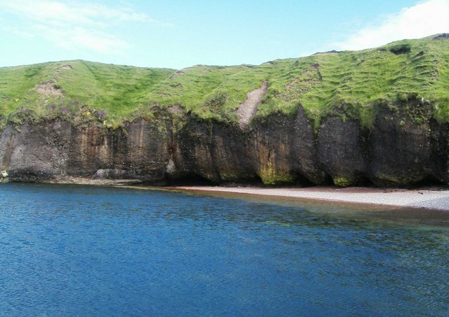
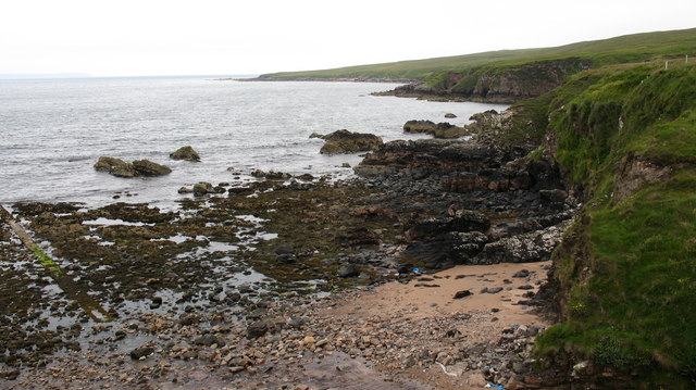
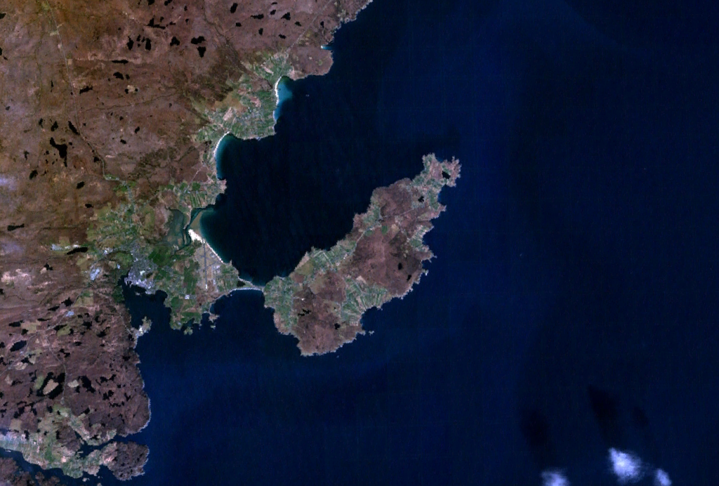
Roininis a Deas is a picturesque coastal feature located in Ross-shire, Scotland. It is a prominent headland that extends into the North Atlantic Ocean, forming a distinctive point along the coastline. The headland is characterized by rugged cliffs, stunning rock formations, and breathtaking panoramic views of the surrounding landscape.

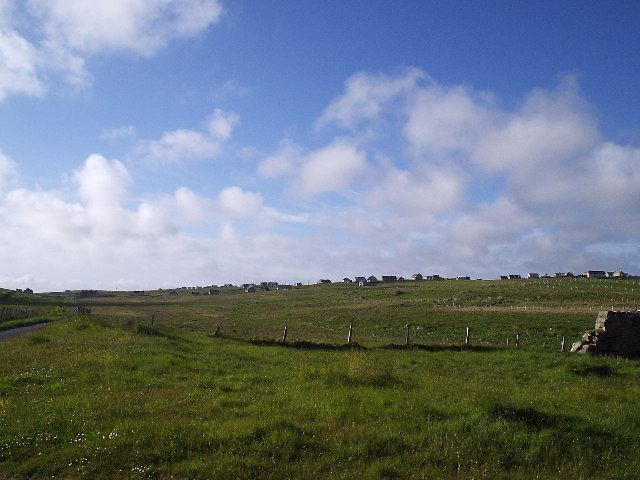
Situated in an area of outstanding natural beauty, Roininis a Deas is a popular destination for outdoor enthusiasts and nature lovers. The headland offers a plethora of recreational activities such as hiking, birdwatching, and photography. Visitors can explore the network of trails that meander through the headland, providing access to various viewpoints and hidden coves.

The coastal area surrounding Roininis a Deas is home to a diverse range of wildlife, including seabirds, seals, and occasionally dolphins and whales. Birdwatchers can spot species such as puffins, guillemots, and fulmars nesting on the cliffs. The headland is also a designated Site of Special Scientific Interest, as it supports a unique ecosystem with various rare plants and marine life.

Historically, Roininis a Deas has played a significant role in the maritime heritage of the region. The headland has witnessed countless shipwrecks and maritime events over the centuries, adding to its allure and intrigue. Today, remnants of ancient structures and fishing platforms can still be found, serving as a reminder of the area's rich cultural history.

Overall, Roininis a Deas is a captivating coastal feature that offers visitors a chance to immerse themselves in the beauty of Scotland's rugged coastline. Whether it's exploring the trails, observing wildlife, or simply enjoying the breathtaking views, this headland is a must-visit destination for nature enthusiasts and those seeking tranquility by the sea.

If you have any feedback on the listing, please let us know in the comments section below.

Roininis a Deas Images

Images are sourced within 2km of 58.219851/-6.255581 or Grid Reference NB5033. Thanks to Geograph Open Source API. All images are credited.
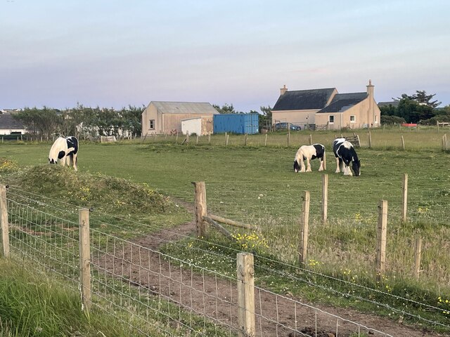
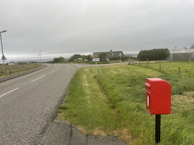
Coastline, Roisinis an Ear, Isle of Lewis The only land within the grid square is the tip of the grass bank from which the photo was taken and the rock platform below.
Coastline, Roisinis an Ear, Isle of Lewis
The only land within the grid square is the tip of the grass bank from which the photo was taken and the rock platform below.
Roads around An Rubha Geocaching is a type of global treasure hunt of people looking for caches, or hidden stashes of objects. Geocaching may also be described as a series of hide-and-seek games, where hiders provide online clues for seekers. Seekers use global positioning system (GPS) devices to find hidden caches
Roads around An Rubha
Geocaching is a type of global treasure hunt of people looking for caches, or hidden stashes of objects. Geocaching may also be described as a series of hide-and-seek games, where hiders provide online clues for seekers. Seekers use global positioning system (GPS) devices to find hidden caches
Horses at Aiginis Geocaching is a type of global treasure hunt of people looking for caches, or hidden stashes of objects. Geocaching may also be described as a series of hide-and-seek games, where hiders provide online clues for seekers. Seekers use global positioning system (GPS) devices to find hidden caches
Horses at Aiginis
Geocaching is a type of global treasure hunt of people looking for caches, or hidden stashes of objects. Geocaching may also be described as a series of hide-and-seek games, where hiders provide online clues for seekers. Seekers use global positioning system (GPS) devices to find hidden caches
Roads around An Rubha Geocaching is a type of global treasure hunt of people looking for caches, or hidden stashes of objects. Geocaching may also be described as a series of hide-and-seek games, where hiders provide online clues for seekers. Seekers use global positioning system (GPS) devices to find hidden caches
Roads around An Rubha
Geocaching is a type of global treasure hunt of people looking for caches, or hidden stashes of objects. Geocaching may also be described as a series of hide-and-seek games, where hiders provide online clues for seekers. Seekers use global positioning system (GPS) devices to find hidden caches
Road of  An Rubha
Road of An Rubha
Roads of An Rubha
Roads of An Rubha
Cliff Undercutting at Roisinis This picture, taken from a rocky outcrop, shows extensive undercutting of the cliffs.  Cliff erosion is a major problem in the local area but this photograph depicting the erosion along with the blue sea and grass creeping down the cliff shows the damage as attractive rather than destructive.
Cliff Undercutting at Roisinis
This picture, taken from a rocky outcrop, shows extensive undercutting of the cliffs. Cliff erosion is a major problem in the local area but this photograph depicting the erosion along with the blue sea and grass creeping down the cliff shows the damage as attractive rather than destructive.
Dibidale Burn The tiny Dibidale Burn flows into Broad Bay west of Garrabost.  The elevated pipeline appears to be some kind of water supply.
Dibidale Burn
The tiny Dibidale Burn flows into Broad Bay west of Garrabost. The elevated pipeline appears to be some kind of water supply.
Track across the moor This track, probably a peat road, takes off to the south from the road leading to Lower Bayble (Pabail Iarach).  The gridsquare, almost entirely featureless moorland, looked a poor possibility for a photo until this puddle obligingly offered a reflection of the sky.
Track across the moor
This track, probably a peat road, takes off to the south from the road leading to Lower Bayble (Pabail Iarach). The gridsquare, almost entirely featureless moorland, looked a poor possibility for a photo until this puddle obligingly offered a reflection of the sky.
Free Church of Scotland, Point A large modern building near the village of Garrabost.  Services are held in both English and Gaelic, as is common throughout Lewis.
Free Church of Scotland, Point
A large modern building near the village of Garrabost. Services are held in both English and Gaelic, as is common throughout Lewis.
Grazing land near Garrabost These sheep are grazing on land adjacent to the Free Church of Scotland <a href="https://www.geograph.org.uk/photo/494702">NB5132 : Free Church of Scotland, Point</a>.  This view looks towards the south west, to the village of Lower Bayble (Pabail Iarach).
Grazing land near Garrabost
These sheep are grazing on land adjacent to the Free Church of Scotland NB5132 : Free Church of Scotland, Point. This view looks towards the south west, to the village of Lower Bayble (Pabail Iarach).
Crofting land at Garrabost A maze of fences mark out the crofts on the north coast of the Eye Peninsula.
Crofting land at Garrabost
A maze of fences mark out the crofts on the north coast of the Eye Peninsula.
Rock and Sand, Eye peninsula. Looking along the coast from the end of a narrow lane that leads down to the shore from the A866 near Garrabost.
Rock and Sand, Eye peninsula.
Looking along the coast from the end of a narrow lane that leads down to the shore from the A866 near Garrabost.
Property [and car] with scope for improvement. Any offers for this fine property?  I would guess that the car is an optional extra.
Property [and car] with scope for improvement.
Any offers for this fine property? I would guess that the car is an optional extra.
Point FC ground. Local football club ground. Note the all seater main stand. The previous evening there had been the pre season friendly against an under 19 Rangers side.
Point FC ground.
Local football club ground. Note the all seater main stand. The previous evening there had been the pre season friendly against an under 19 Rangers side.
Garrabost Shoreline This photo was taken from the slipway at the end of the road. The amount of caves and outcrops of rock were just spectacular, and in the background is the village of Upper Garrabost.
Garrabost Shoreline
This photo was taken from the slipway at the end of the road. The amount of caves and outcrops of rock were just spectacular, and in the background is the village of Upper Garrabost.
Eroded landing point This photo of the Garrabost coastline shows what I think must have been a pier that has subsided, but the water is so clear and fresh looking
Eroded landing point
This photo of the Garrabost coastline shows what I think must have been a pier that has subsided, but the water is so clear and fresh looking
Stac Mor Gharraboist One of the most easily recognisable features of erosion found on this coastline is the stack at Aignish.
Stac Mor Gharraboist
One of the most easily recognisable features of erosion found on this coastline is the stack at Aignish.
Show me another place!

Roininis a Deas is located at Grid Ref: NB5033 (Lat: 58.219851, Lng: -6.255581)

Unitary Authority: Na h-Eileanan an Iar

Police Authority: Highlands and Islands

What 3 Words

///brilliant.overt.cropping. Near Stornoway, Na h-Eileanan Siar

Related Wikis

Aignish

Aignish (Scottish Gaelic: Aiginis) is located northwest of Knock and east of Stornoway on the east coast of the Isle of Lewis, in the Outer Hebrides, Scotland...

Knock, Isle of Lewis

Knock, from the Gaelic, An Cnoc (a small hill), is a village in Point peninsula on the Isle of Lewis in the Outer Hebrides of Scotland. Point (an Rubha...

Garrabost

Garrabost (Scottish Gaelic: Garrabost) is a village in the Point (An Rubha) peninsula isthmus on the east coast of the Isle of Lewis, in the Outer Hebrides...

Bayble

Bayble (Scottish Gaelic: Pabail) is a large village in Point (An Rubha), on the Isle of Lewis, 6 miles (10 kilometres) east of Stornoway. Bayble is also...

Point, Lewis

Point (Scottish Gaelic: An Rubha), also known as the Eye Peninsula, is a peninsula some 11 km long in the Outer Hebrides (or Western Isles), Scotland....

Broad Bay, Lewis

Broad Bay (Scottish Gaelic: Loch a Tuath, meaning "north loch") is a bay which is situated on the coast of Isle of Lewis, and separates Back and Point...

Branahuie

Branahuie (Scottish Gaelic: Bràigh na h-Aoidhe) is a village on the Isle of Lewis in the Outer Hebrides, Scotland. Branahuie is within the parish of Stornoway...

Shulishader

Shulishader (Scottish Gaelic: Siadar an Rubha) is a small village with a population of around 120 people in Point, Outer Hebrides on the Isle of Lewis...

Nearby Amenities

Located within 500m of 58.219851,-6.255581
Bus Stop
Garrabost
Naptan AtcoCode: 6010731655
Naptan Bearing: S
Naptan CommonName: Garrabost
Naptan Indicator: Upper Garrabost
Naptan Landmark: Upper Garrabost
Naptan NaptanCode: 94723853
Naptan Street: Upper Garrabost
Naptan Verified: no
Source: naptan_import
Lat/Long: 58.2207141/-6.2488195
Turning Circle
Lat/Long: 58.2207207/-6.2487001
Garrabost Uarach
Name En: Upper Garrabost
Name Gd: Garrabost Uarach
Place: hamlet
Lat/Long: 58.2196638/-6.2473261
Barrier: cattle_grid
Lat/Long: 58.2209585/-6.2488925
Street Lamp
Lamp Type: electric
Lat/Long: 58.2208026/-6.2488702
Street Lamp
Lamp Type: electric
Lat/Long: 58.2201726/-6.2478396
Street Lamp
Lamp Type: electric
Lat/Long: 58.2204661/-6.248311
Street Lamp
Lamp Type: electric
Lat/Long: 58.219828/-6.2473528
Passing Place
Lat/Long: 58.2194021/-6.2472348
Roisinis an Lar
Natural: cape
Lat/Long: 58.2217022/-6.2531136
Roisinis a´Deas
Natural: cape
Lat/Long: 58.2198744/-6.2555652
The data included in this document is from www.openstreetmap.org. The data is made available under ODbL.

Have you been to Roininis a Deas?

Leave your review of Roininis a Deas below (or comments, questions and feedback).