Sròn na h-Iolaire
Coastal Feature, Headland, Point in Argyllshire
Scotland
Sròn na h-Iolaire

Sròn na h-Iolaire is a prominent coastal feature located in Argyllshire, Scotland. It is a headland or point that stretches out into the sea, offering breathtaking views and natural beauty. The name "Sròn na h-Iolaire" translates to "Eagle's Nose" in English, which is a fitting description due to its distinctive shape.
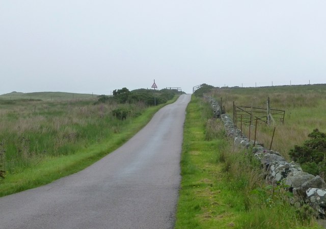
The headland is situated on the western coast of Scotland, overlooking the Atlantic Ocean. Its rugged cliffs and rocky terrain make it a visually striking landmark. The cliffs rise steeply from the shoreline, creating a dramatic contrast between land and sea.
The area surrounding Sròn na h-Iolaire is rich in biodiversity, with a variety of plant and animal species thriving in the diverse ecosystems. The headland is home to numerous seabird colonies, including puffins, gannets, and razorbills, making it a popular spot for birdwatchers.
In addition to its natural beauty, Sròn na h-Iolaire also holds historical significance. It is believed that ancient settlers inhabited the area, as evidenced by the presence of prehistoric settlements and burial sites nearby. The headland also played a role in maritime navigation, serving as a landmark for sailors and fishermen.
Visitors to Sròn na h-Iolaire can enjoy the stunning coastal scenery through various activities such as hiking, nature walks, and photography. The headland is easily accessible and provides an ideal vantage point to observe the surrounding landscape and wildlife.
Overall, Sròn na h-Iolaire is a captivating coastal feature in Argyllshire, offering a combination of natural beauty, historical significance, and recreational opportunities.
If you have any feedback on the listing, please let us know in the comments section below.
Sròn na h-Iolaire Images
Images are sourced within 2km of 55.796125/-6.0259412 or Grid Reference NR4763. Thanks to Geograph Open Source API. All images are credited.


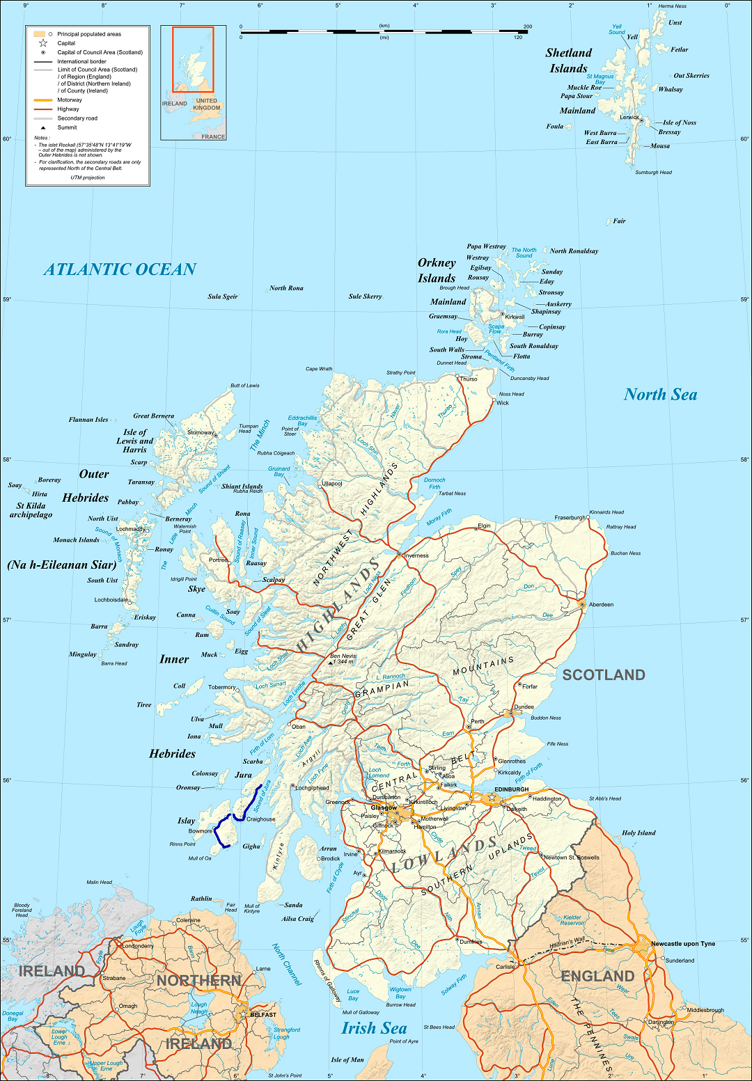
Sròn na h-Iolaire is located at Grid Ref: NR4763 (Lat: 55.796125, Lng: -6.0259412)
Unitary Authority: Argyll and Bute
Police Authority: Argyll and West Dunbartonshire
What 3 Words
///vehicle.padlock.screen. Near Craighouse, Argyll & Bute
Related Wikis

Claig Castle
Claig Castle was a stronghold of the Clan Donald or MacDonald in the south of Scotland. == History == The castle was once a massive fort described as a...

Ardfin
Ardfin is a country estate on the island of Jura, Inner Hebrides, Scotland. It is situated at the southern tip of the island, between Feolin and Craighouse...
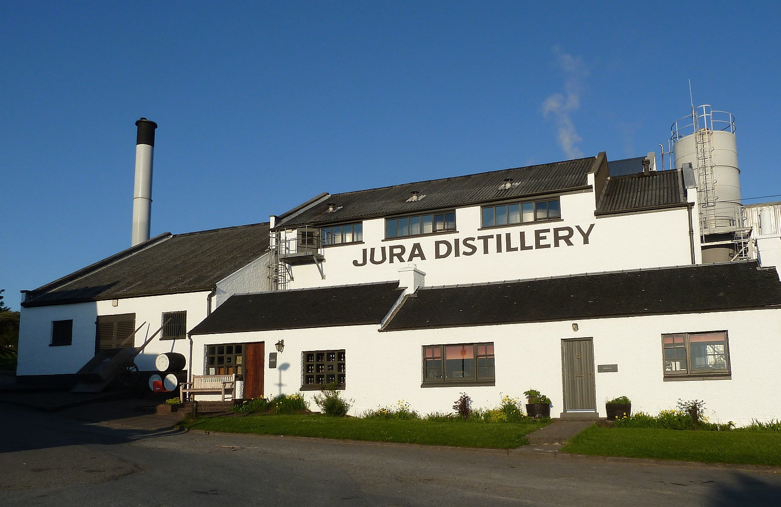
Jura distillery
Jura distillery is a Scotch whisky distillery on the island of Jura in the Inner Hebrides off the West Coast of Scotland. The distillery is operated by...

Craighouse
Craighouse (Scottish Gaelic: Taigh na Creige) is the main settlement and capital of the Scottish Inner Hebridean island of Jura, in Argyll and Bute. In...
A846 road
The A846 road is one of the two principal roads of Islay in the Inner Hebrides off the west coast of mainland Scotland and the only 'A' road on the neighbouring...

Keils
Keils formerly Kilearnadill is a hamlet 0.25 miles (0.40 km) from Craighouse on the island of Jura, in the council area of Argyll and Bute, Scotland. Keils...

Feolin
Feolin (also known as Feolin Ferry) is a slipway on the west coast of Jura. MV Eilean Dhiura provides a vehicle and passenger ferry service from Port Askaig...

Dunlossit House
Dunlossit House is a Category C listed country house near Port Askaig, Islay in the county of Argyll, in western Scotland.. == History and architecture... ==
Nearby Amenities
Located within 500m of 55.796125,-6.0259412Have you been to Sròn na h-Iolaire?
Leave your review of Sròn na h-Iolaire below (or comments, questions and feedback).