Am Far-eilean

Coastal Feature, Headland, Point in Argyllshire

Scotland

Am Far-eilean

Ardfin Boathouse A recent shot of the Ardfin Boathouse, scene of the K Foundation's notorious burning of a million pounds in 1994.  The building is now being restored and adapted to be a refreshment stop on a new 18-hole golf course which is under construction on the Ardfin Estate.  The course is due to open in 2017.
Ardfin Boathouse Credit: David Hoult

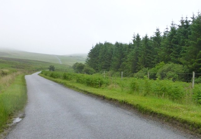
Am Far-eilean is a prominent coastal feature located in Argyllshire, Scotland. This headland, also referred to as a point, is renowned for its stunning natural beauty and rich history. Situated on the western coast of Scotland, it juts out into the Atlantic Ocean, offering breathtaking views of the surrounding landscape.

The rugged terrain of Am Far-eilean is characterized by dramatic cliffs, rocky outcrops, and pristine sandy beaches. The headland is covered in lush vegetation, including heather, gorse, and various species of wildflowers. This creates a vibrant and picturesque setting that attracts both locals and tourists alike.

In addition to its natural beauty, Am Far-eilean holds historical significance. The headland is home to ancient ruins, including stone circles and burial sites, which provide insight into the region's early inhabitants. These archaeological sites have been studied extensively and offer a glimpse into the lives of the people who once called this area home.

Am Far-eilean is a popular destination for outdoor enthusiasts due to its diverse range of activities. Visitors can enjoy hiking along the headland, exploring the numerous trails that wind through the rugged landscape. The coastal waters surrounding the point are also perfect for water sports such as kayaking and sailing.

Overall, Am Far-eilean in Argyllshire is a captivating coastal feature that combines natural beauty, historical importance, and recreational opportunities. Whether one is seeking adventure or simply looking to immerse themselves in the stunning surroundings, this headland offers a truly unforgettable experience.

If you have any feedback on the listing, please let us know in the comments section below.

Am Far-eilean Images

Images are sourced within 2km of 55.796113/-6.037003 or Grid Reference NR4763. Thanks to Geograph Open Source API. All images are credited.

Ardfin Boathouse A recent shot of the Ardfin Boathouse, scene of the K Foundation's notorious burning of a million pounds in 1994.  The building is now being restored and adapted to be a refreshment stop on a new 18-hole golf course which is under construction on the Ardfin Estate.  The course is due to open in 2017.
Ardfin Boathouse
A recent shot of the Ardfin Boathouse, scene of the K Foundation's notorious burning of a million pounds in 1994. The building is now being restored and adapted to be a refreshment stop on a new 18-hole golf course which is under construction on the Ardfin Estate. The course is due to open in 2017.
Tide race, Sound of Islay White water and a tilted buoy in the Sound of Islay.   The currents here are fierce and I have once been on a ferry that was unable to land at Port Askaig due to wind and tide (they tried!).
Tide race, Sound of Islay
White water and a tilted buoy in the Sound of Islay. The currents here are fierce and I have once been on a ferry that was unable to land at Port Askaig due to wind and tide (they tried!).
Am Fraoch Eileann An island in the Sound of Islay. Jura beyond.
Am Fraoch Eileann
An island in the Sound of Islay. Jura beyond.
Am Fraoch Eilean Off the south coast of Jura.
Am Fraoch Eilean
Off the south coast of Jura.
Standing Stone  On the moor above Camas an Staca.
Standing Stone
On the moor above Camas an Staca.
Jura in the rain On the main road to Craighouse.
Jura in the rain
On the main road to Craighouse.
Milestone on the road to Feolin But how far?
Milestone on the road to Feolin
But how far?
Newly planted trees Above Jura House.
Newly planted trees
Above Jura House.
Cattle grid Approaching Ardfin Farm.
Cattle grid
Approaching Ardfin Farm.
Red deer at Cabrach One of three young stags browsing in roadside woodland.
Red deer at Cabrach
One of three young stags browsing in roadside woodland.
Ardfin Farm on the Isle of Jura Big building developments, reported to be a hotel resort and golf course.
Ardfin Farm on the Isle of Jura
Big building developments, reported to be a hotel resort and golf course.
Black Rocks, Sound of Islay A skerry between the course of the ferry and Jura. Taken through rain.
Black Rocks, Sound of Islay
A skerry between the course of the ferry and Jura. Taken through rain.
Black Rocks skerry In the Sound of Islay, with Jura and the bay at A' Chrois just visible through rain.
Black Rocks skerry
In the Sound of Islay, with Jura and the bay at A' Chrois just visible through rain.
Am Fraoch Eilean Seen through rain from the ferry to Port Askaig.
Am Fraoch Eilean
Seen through rain from the ferry to Port Askaig.
Am Fraoch Eilean Looking through the rain from the ferry to Port Askaig. A cloud covered Jura is beyond.
Am Fraoch Eilean
Looking through the rain from the ferry to Port Askaig. A cloud covered Jura is beyond.
Am Fraoch Eilean Looking northeast from the ferry to Port Askaig. The 'bump' on Jura beyond the island is Brat Bheinn.
Am Fraoch Eilean
Looking northeast from the ferry to Port Askaig. The 'bump' on Jura beyond the island is Brat Bheinn.
A sodden Stonechat A heavy period of rain resulting in a ruffled Stonechat beside the A846 on Jura.
A sodden Stonechat
A heavy period of rain resulting in a ruffled Stonechat beside the A846 on Jura.
Old Milestone by the A846, Drochaid Glac Eanruigein, Jura Parish By the A846, in parish of Jura (Jura District), by widened road near track to Camas an Staca, rocky banking behind.

Inscription reads:-
: Craig- / house / 4 : : Feolin / 4 :

Surveyed

Milestone Society National ID: AB_JURA04
Old Milestone by the A846, Drochaid Glac Eanruigein, Jura Parish
By the A846, in parish of Jura (Jura District), by widened road near track to Camas an Staca, rocky banking behind. Inscription reads:- : Craig- / house / 4 : : Feolin / 4 : Surveyed Milestone Society National ID: AB_JURA04
Show me another place!

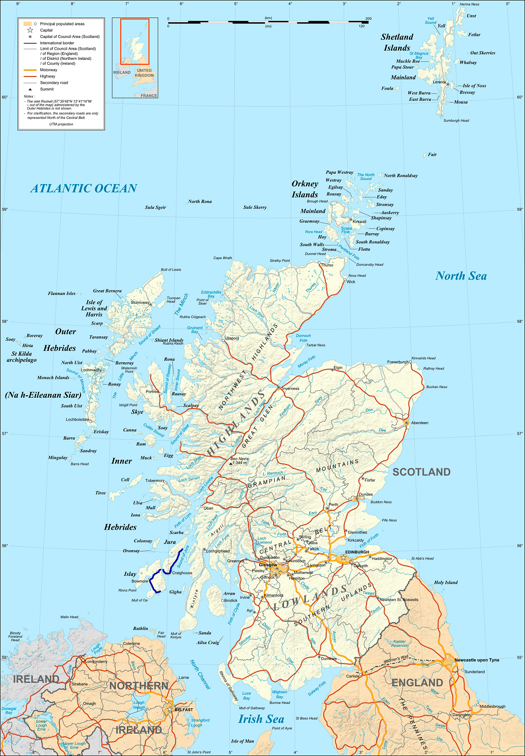
Am Far-eilean is located at Grid Ref: NR4763 (Lat: 55.796113, Lng: -6.037003)

Unitary Authority: Argyll and Bute

Police Authority: Argyll and West Dunbartonshire

What 3 Words

///pushed.relished.lectures. Near Craighouse, Argyll & Bute

Related Wikis

Claig Castle

Claig Castle was a stronghold of the Clan Donald or MacDonald in the south of Scotland. == History == The castle was once a massive fort described as a...

Ardfin

Ardfin is a country estate on the island of Jura, Inner Hebrides, Scotland. It is situated at the southern tip of the island, between Feolin and Craighouse...

A846 road

The A846 road is one of the two principal roads of Islay in the Inner Hebrides off the west coast of mainland Scotland and the only 'A' road on the neighbouring...
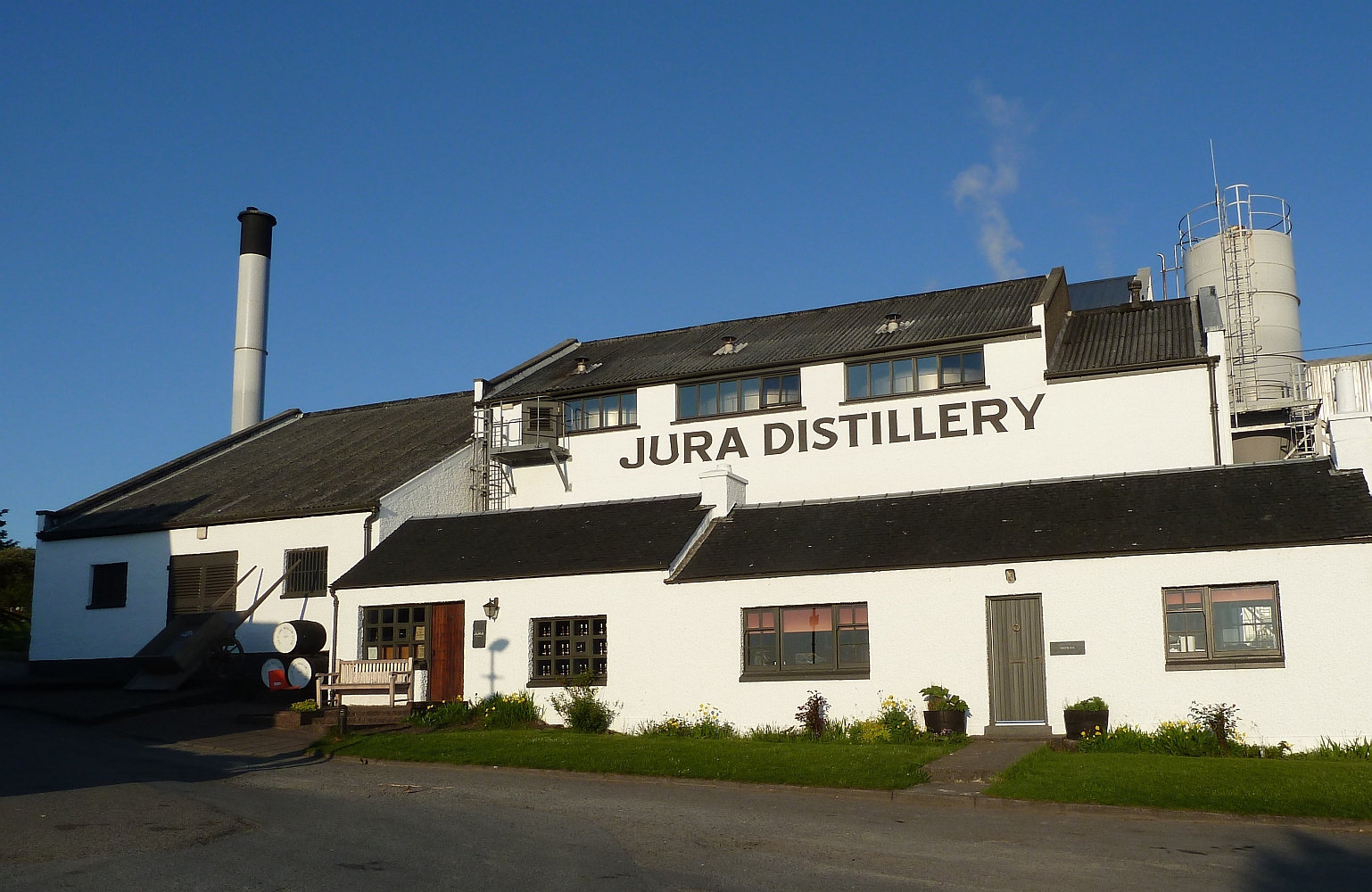
Jura distillery

Jura distillery is a Scotch whisky distillery on the island of Jura in the Inner Hebrides off the West Coast of Scotland. The distillery is operated by...

Feolin

Feolin (also known as Feolin Ferry) is a slipway on the west coast of Jura. MV Eilean Dhiura provides a vehicle and passenger ferry service from Port Askaig...

Craighouse

Craighouse (Scottish Gaelic: Taigh na Creige) is the main settlement and capital of the Scottish Inner Hebridean island of Jura, in Argyll and Bute. In...

Dunlossit House

Dunlossit House is a Category C listed country house near Port Askaig, Islay in the county of Argyll, in western Scotland.. == History and architecture... ==

Sound of Islay

The Sound of Islay (Scottish Gaelic: Caol Ìle) is a narrow strait between the islands of Islay and Jura off the west coast of Scotland. It is about 30...

Nearby Amenities

Located within 500m of 55.796113,-6.037003
Source: PGS
Lat/Long: 55.7955623/-6.0358627
Source: PGS
Lat/Long: 55.7955647/-6.0356914
Source: PGS
Lat/Long: 55.7956978/-6.0355914
Caolas a' Phlotha
Natural: water
Lat/Long: 55.7949667/-6.033567
K Foundation Burn a Million Quid
Tourism: attraction
Wikidata: Q12125318
Wikipedia: en:K Foundation Burn a Million Quid
Lat/Long: 55.7957254/-6.0358414
Golf: pin
Lat/Long: 55.7980969/-6.0348845
Golf: pin
Lat/Long: 55.7978049/-6.035056
Golf: pin
Lat/Long: 55.7961931/-6.0347104
The data included in this document is from www.openstreetmap.org. The data is made available under ODbL.

Have you been to Am Far-eilean?

Leave your review of Am Far-eilean below (or comments, questions and feedback).