Carraig Camas an Staca

Coastal Feature, Headland, Point in Argyllshire

Scotland

Carraig Camas an Staca

Old Milestone by the A486, Beinn na Doire Leithe, Jura parish Stone post by the A846, in parish of Jura (Jura District), South of Beinn na Doire Leithe, opposite first forestry on south, on banking on inland side.

Inscription reads:-
: Craig- / house / 5 : : Feolin / 3 :

Surveyed

Milestone Society National ID: AB_JURA03
Old Milestone by the A486, Beinn na Doire Leithe, Jura parish Credit: thejackrustles

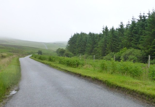
Carraig Camas an Staca, also known as Stac Point, is a prominent coastal feature located in Argyllshire, Scotland. Situated on the western coast of the country, Carraig Camas an Staca is a picturesque headland that extends out into the Atlantic Ocean.

This stunning point is characterized by its rugged cliffs, which rise dramatically from the sea, offering breathtaking views of the surrounding landscape. The cliffs are composed of various types of rock, including sandstone and basalt, which have been shaped by centuries of erosion from the crashing waves.

Carraig Camas an Staca is known for its rich biodiversity, attracting many nature enthusiasts and birdwatchers. The area is home to a variety of bird species, including puffins, guillemots, and razorbills, which nest in the cliffs during the breeding season. Seals can also be spotted in the water, adding to the charm of this coastal spot.

Visitors to Carraig Camas an Staca can enjoy a scenic walk along the coastal path, which offers stunning panoramic views of the surrounding sea and cliffs. The headland is also a popular spot for fishing, with anglers often trying their luck from the rocks.

The location of Carraig Camas an Staca makes it an ideal place for outdoor activities such as hiking, picnicking, and photography. Its natural beauty and rugged charm make it a must-visit destination for those exploring the Argyllshire coastline.

If you have any feedback on the listing, please let us know in the comments section below.

Carraig Camas an Staca Images

Images are sourced within 2km of 55.802211/-6.0468 or Grid Reference NR4663. Thanks to Geograph Open Source API. All images are credited.

Old Milestone by the A486, Beinn na Doire Leithe, Jura parish Stone post by the A846, in parish of Jura (Jura District), South of Beinn na Doire Leithe, opposite first forestry on south, on banking on inland side.

Inscription reads:-
: Craig- / house / 5 : : Feolin / 3 :

Surveyed

Milestone Society National ID: AB_JURA03
Old Milestone by the A486, Beinn na Doire Leithe, Jura parish
Stone post by the A846, in parish of Jura (Jura District), South of Beinn na Doire Leithe, opposite first forestry on south, on banking on inland side. Inscription reads:- : Craig- / house / 5 : : Feolin / 3 : Surveyed Milestone Society National ID: AB_JURA03
OS Rivet: Jura, Mucraidh <span class="nowrap"><a title="https://www.bench-marks.org.uk/bm166733" rel="nofollow ugc noopener" href="https://www.bench-marks.org.uk/bm166733">Link</a><img style="margin-left:2px;" alt="External link" title="External link - shift click to open in new window" src="https://s1.geograph.org.uk/img/external.png" width="10" height="10"/></span>
OS Rivet: Jura, Mucraidh
Ardfin Boathouse A recent shot of the Ardfin Boathouse, scene of the K Foundation's notorious burning of a million pounds in 1994.  The building is now being restored and adapted to be a refreshment stop on a new 18-hole golf course which is under construction on the Ardfin Estate.  The course is due to open in 2017.
Ardfin Boathouse
A recent shot of the Ardfin Boathouse, scene of the K Foundation's notorious burning of a million pounds in 1994. The building is now being restored and adapted to be a refreshment stop on a new 18-hole golf course which is under construction on the Ardfin Estate. The course is due to open in 2017.
Glas Eilean by Jura A low isle by Jura consisting of Permian lava largely olivine-basalt.
Glas Eilean by Jura
A low isle by Jura consisting of Permian lava largely olivine-basalt.
Tide race, Sound of Islay White water and a tilted buoy in the Sound of Islay.   The currents here are fierce and I have once been on a ferry that was unable to land at Port Askaig due to wind and tide (they tried!).
Tide race, Sound of Islay
White water and a tilted buoy in the Sound of Islay. The currents here are fierce and I have once been on a ferry that was unable to land at Port Askaig due to wind and tide (they tried!).
Am Fraoch Eileann An island in the Sound of Islay. Jura beyond.
Am Fraoch Eileann
An island in the Sound of Islay. Jura beyond.
Black Rocks buoy Marking channel in Sound of Islay.
(Mod - Where can I find the exact location of the buoy?)
Black Rocks buoy
Marking channel in Sound of Islay. (Mod - Where can I find the exact location of the buoy?)
Am Fraoch Eilean Off the south coast of Jura.
Am Fraoch Eilean
Off the south coast of Jura.
Glas Eilean Off the south west coast of Jura.
Glas Eilean
Off the south west coast of Jura.
Misty moors Across the Sound of Islay the lighthouse on McArthur's Head is just visible.
Misty moors
Across the Sound of Islay the lighthouse on McArthur's Head is just visible.
Standing Stone  On the moor above Camas an Staca.
Standing Stone
On the moor above Camas an Staca.
Jura in the rain On the main road to Craighouse.
Jura in the rain
On the main road to Craighouse.
Milestone on the road to Feolin But how far?
Milestone on the road to Feolin
But how far?
Newly planted trees Above Jura House.
Newly planted trees
Above Jura House.
Cattle grid Approaching Ardfin Farm.
Cattle grid
Approaching Ardfin Farm.
Ardfin Farm on the Isle of Jura Big building developments, reported to be a hotel resort and golf course.
Ardfin Farm on the Isle of Jura
Big building developments, reported to be a hotel resort and golf course.
Black Rocks, Sound of Islay A skerry between the course of the ferry and Jura. Taken through rain.
Black Rocks, Sound of Islay
A skerry between the course of the ferry and Jura. Taken through rain.
Black Rocks skerry In the Sound of Islay, with Jura and the bay at A' Chrois just visible through rain.
Black Rocks skerry
In the Sound of Islay, with Jura and the bay at A' Chrois just visible through rain.
Show me another place!

Carraig Camas an Staca is located at Grid Ref: NR4663 (Lat: 55.802211, Lng: -6.0468)

Unitary Authority: Argyll and Bute

Police Authority: Argyll and West Dunbartonshire

What 3 Words

///scrubbing.bracing.fluid. Near Port Askaig, Argyll & Bute

Related Wikis

Claig Castle

Claig Castle was a stronghold of the Clan Donald or MacDonald in the south of Scotland. == History == The castle was once a massive fort described as a...

Ardfin

Ardfin is a country estate on the island of Jura, Inner Hebrides, Scotland. It is situated at the southern tip of the island, between Feolin and Craighouse...

A846 road

The A846 road is one of the two principal roads of Islay in the Inner Hebrides off the west coast of mainland Scotland and the only 'A' road on the neighbouring...

Feolin

Feolin (also known as Feolin Ferry) is a slipway on the west coast of Jura. MV Eilean Dhiura provides a vehicle and passenger ferry service from Port Askaig...

Nearby Amenities

Located within 500m of 55.802211,-6.0468
Source: PGS
Lat/Long: 55.8012749/-6.0414634
Camas an Staca
Created By: Potlatch 0.10b
Is In: Argyll and Bute, Scotland
Name En: Camas an Staca
Name Gd: Camas an Staca
Place: hamlet
Lat/Long: 55.8029016/-6.0487327
Power: pole
Lat/Long: 55.805649/-6.0515934
Power: pole
Lat/Long: 55.8049329/-6.0498981
Power: pole
Lat/Long: 55.8048256/-6.047821
Power: pole
Lat/Long: 55.8047656/-6.0462211
Power: pole
Lat/Long: 55.8046868/-6.044217
Power: pole
Lat/Long: 55.8046174/-6.0422129
Power: pole
Lat/Long: 55.8045132/-6.0404333
Golf: pin
Lat/Long: 55.8029794/-6.040929
Golf: pin
Lat/Long: 55.8028086/-6.0464376
Golf: pin
Lat/Long: 55.8014628/-6.040705
The data included in this document is from www.openstreetmap.org. The data is made available under ODbL.

Have you been to Carraig Camas an Staca?

Leave your review of Carraig Camas an Staca below (or comments, questions and feedback).