Sornach a' Ghearrain
Coastal Feature, Headland, Point in Argyllshire
Scotland
Sornach a' Ghearrain

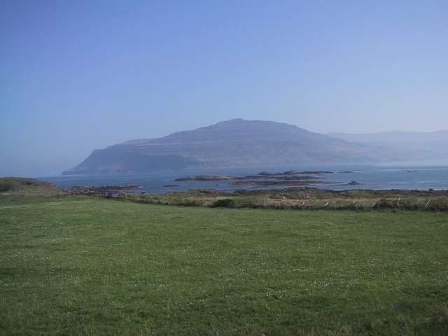
Sornach a' Ghearrain, also known as Sornach Point, is a prominent coastal feature located in Argyllshire, Scotland. Situated on the west coast of the country, it is a headland that juts out into the North Atlantic Ocean, offering breathtaking views and a rugged, picturesque landscape.
The point is characterized by its rocky cliffs that rise dramatically from the sea, creating a stunning backdrop against the crashing waves. The headland is predominantly composed of rugged granite, giving it a distinct and imposing appearance. The surrounding area is rich in marine life, with seals often spotted lounging on the rocks and a variety of seabirds soaring above.
Sornach a' Ghearrain offers a range of outdoor activities for nature enthusiasts. Hiking trails wind along the coastline, offering panoramic views of the ocean and the surrounding countryside. The point is also a popular spot for fishing, with anglers attracted by the abundance of fish in the waters.
The headland's location also makes it an excellent vantage point for wildlife watching. Visitors may catch glimpses of dolphins or porpoises swimming offshore, and with luck, even spot whales migrating through the area. The diverse flora and fauna found in the surrounding coastal habitat also make it an attractive destination for birdwatching.
Sornach a' Ghearrain is not only a place of natural beauty but also holds historical significance. Ruins of ancient settlements can be found in the vicinity, providing insight into the area's past and adding an air of mystery to the landscape.
Overall, Sornach a' Ghearrain is a captivating coastal feature that showcases the raw beauty of Argyllshire's rugged coastline and offers visitors a unique opportunity to connect with nature and explore Scotland's rich history.
If you have any feedback on the listing, please let us know in the comments section below.
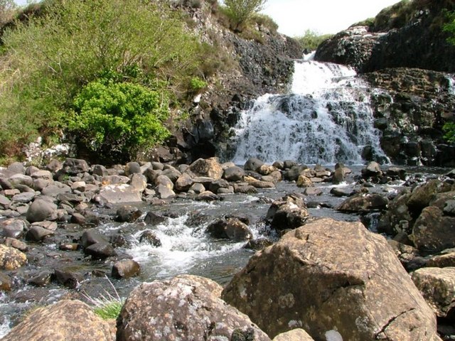
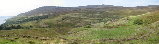
Sornach a' Ghearrain Images
Images are sourced within 2km of 56.366363/-6.1195389 or Grid Reference NM4526. Thanks to Geograph Open Source API. All images are credited.


Sornach a' Ghearrain is located at Grid Ref: NM4526 (Lat: 56.366363, Lng: -6.1195389)
Unitary Authority: Argyll and Bute
Police Authority: Argyll and West Dunbartonshire
What 3 Words
///husbands.simple.hack. Near Fionnphort, Argyll & Bute
Nearby Locations
Related Wikis
Loch Scridain
Loch Scridain is a 15-kilometre-long (9-mile) sea loch, with a west-south west aspect, on the western, or Atlantic coastline of the Isle of Mull, in the...

Tiroran
Tiroran is hamlet on the Isle of Mull in Argyll and Bute, Scotland. == History == In the late 18th century Tiroran House was associated with the McKinnon...

Ardmeanach
Ardmeanach in modern times refers to a peninsula on the Isle of Mull. It is the middle one out of three westward-facing peninsulas on the island, and the...

Pennyghael
Pennyghael (Scottish Gaelic: Peighinn nan Gàidheal) is a small village in the Ross of Mull, Argyll and Bute, Scotland. It is located along the A849 road...

Knockan
Knockan (Scottish Gaelic: An Cnocan) is a township of six crofts in the community of Ardtun, in the south of the Isle of Mull off the west coast of Scotland...
Aird of Kinloch
Aird of Kinloch (Gaelic:An Àird) is a rocky outcrop between Loch Scridain and Loch Beg on the Isle of Mull, Argyll and Bute, Scotland. == References ==

Ardtun
Ardtun (Scottish Gaelic: Àird Tunna) is a settlement on the Isle of Mull, in Argyll and Bute, Scotland. Ardtun is within the parish of Kilfinichen and...

Shiaba
Shiaba (Scottish Gaelic: Siaba) is a ruined township located on the southwestern peninsula of the Isle of Mull, Scotland. It lies about 8 km to the east...
Nearby Amenities
Located within 500m of 56.366363,-6.1195389Have you been to Sornach a' Ghearrain?
Leave your review of Sornach a' Ghearrain below (or comments, questions and feedback).