An Càrnan
Coastal Feature, Headland, Point in Argyllshire
Scotland
An Càrnan

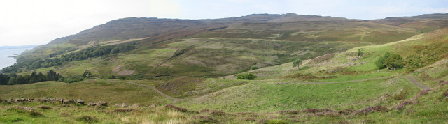
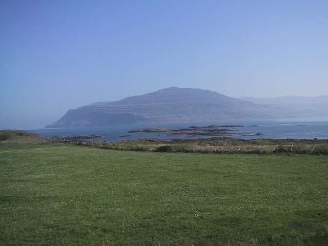
An Càrnan is a prominent coastal feature located in Argyllshire, Scotland. It is a headland that juts out into the Atlantic Ocean, forming a distinctive point along the rugged coastline. Situated near the village of Craobh Haven, An Càrnan offers breathtaking panoramic views of the surrounding area.
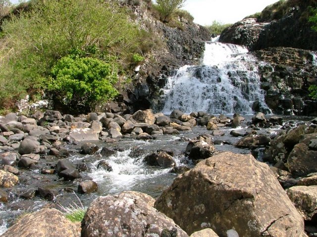
The headland is characterized by its rocky cliffs, which rise steeply from the sea, creating an impressive sight. The cliffs are composed of ancient rock formations, displaying a variety of colors and textures. The jagged coastline is also home to numerous caves and crevices, adding to the allure of the landscape.
An Càrnan is a popular destination for outdoor enthusiasts and nature lovers. It provides opportunities for hiking, bird watching, and photography. The headland offers several walking trails that allow visitors to explore its diverse flora and fauna, including wildflowers, seabirds, and occasional sightings of seals and dolphins.
In addition to its natural beauty, An Càrnan also boasts a rich historical and cultural heritage. The headland is believed to have been occupied by ancient settlements, evidenced by the presence of archaeological remains such as stone circles and burial cairns. These remnants offer a glimpse into the lives of the people who once called this area home.
Overall, An Càrnan is a captivating coastal feature that showcases the stunning beauty of Argyllshire. Its dramatic cliffs, diverse wildlife, and historical significance make it a must-visit destination for anyone exploring the Scottish coastline.
If you have any feedback on the listing, please let us know in the comments section below.
An Càrnan Images
Images are sourced within 2km of 56.365941/-6.1297822 or Grid Reference NM4526. Thanks to Geograph Open Source API. All images are credited.


An Càrnan is located at Grid Ref: NM4526 (Lat: 56.365941, Lng: -6.1297822)
Unitary Authority: Argyll and Bute
Police Authority: Argyll and West Dunbartonshire
What 3 Words
///crumples.migrants.animate. Near Fionnphort, Argyll & Bute
Nearby Locations
Related Wikis

Ardmeanach
Ardmeanach in modern times refers to a peninsula on the Isle of Mull. It is the middle one out of three westward-facing peninsulas on the island, and the...
Loch Scridain
Loch Scridain is a 15-kilometre-long (9-mile) sea loch, with a west-south west aspect, on the western, or Atlantic coastline of the Isle of Mull, in the...

Tiroran
Tiroran is hamlet on the Isle of Mull in Argyll and Bute, Scotland. == History == In the late 18th century Tiroran House was associated with the McKinnon...

Knockan
Knockan (Scottish Gaelic: An Cnocan) is a township of six crofts in the community of Ardtun, in the south of the Isle of Mull off the west coast of Scotland...

Ardtun
Ardtun (Scottish Gaelic: Àird Tunna) is a settlement on the Isle of Mull, in Argyll and Bute, Scotland. Ardtun is within the parish of Kilfinichen and...

Pennyghael
Pennyghael (Scottish Gaelic: Peighinn nan Gàidheal) is a small village in the Ross of Mull, Argyll and Bute, Scotland. It is located along the A849 road...
Aird of Kinloch
Aird of Kinloch (Gaelic:An Àird) is a rocky outcrop between Loch Scridain and Loch Beg on the Isle of Mull, Argyll and Bute, Scotland. == References ==

Shiaba
Shiaba (Scottish Gaelic: Siaba) is a ruined township located on the southwestern peninsula of the Isle of Mull, Scotland. It lies about 8 km to the east...
Nearby Amenities
Located within 500m of 56.365941,-6.1297822Have you been to An Càrnan?
Leave your review of An Càrnan below (or comments, questions and feedback).