Poll Duchaill

Coastal Feature, Headland, Point in Inverness-shire

Scotland

Poll Duchaill

Laig, farm and bay
Laig, farm and bay Credit: Alan Reid

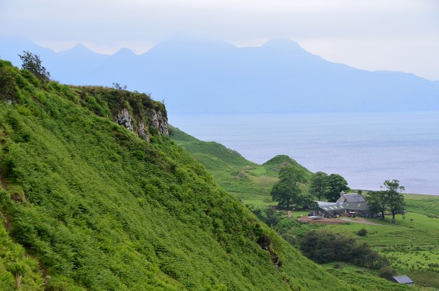
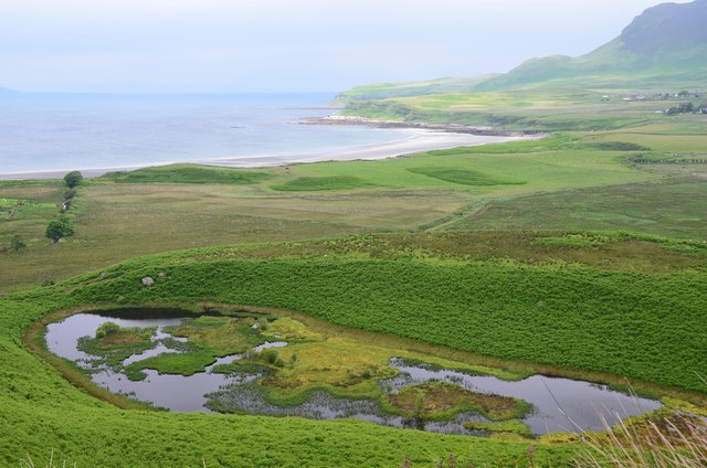
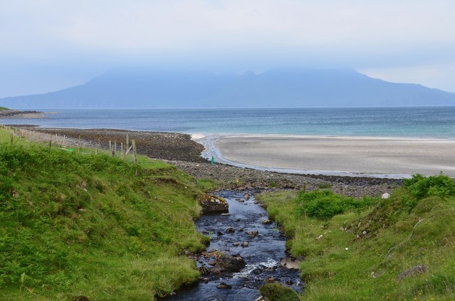
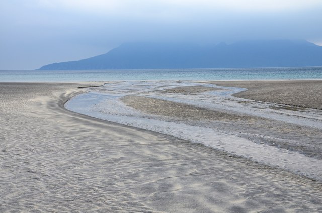
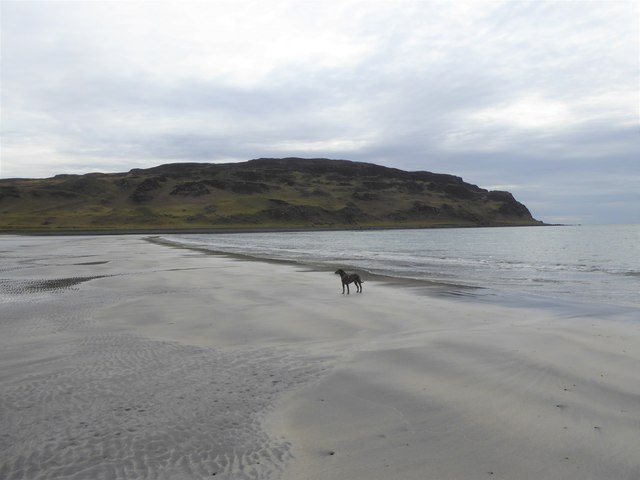
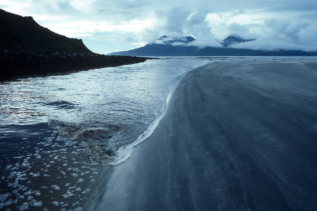
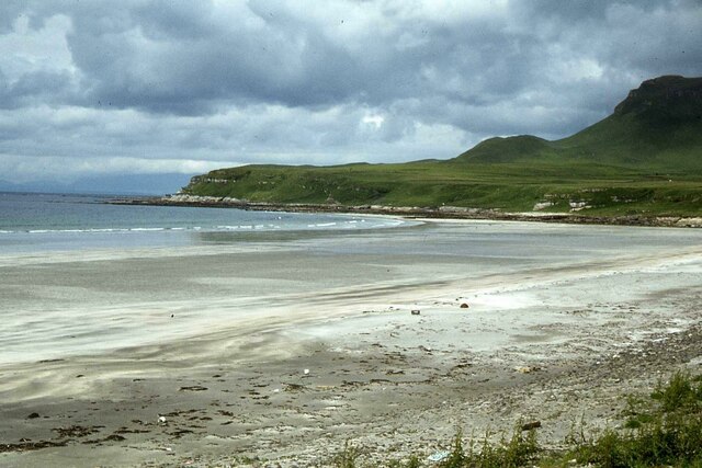
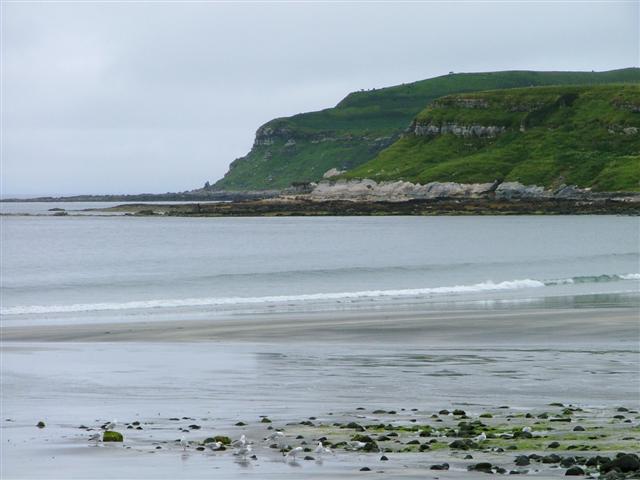
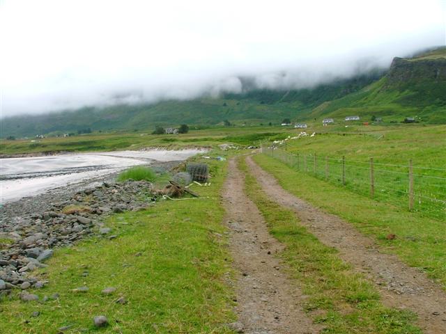
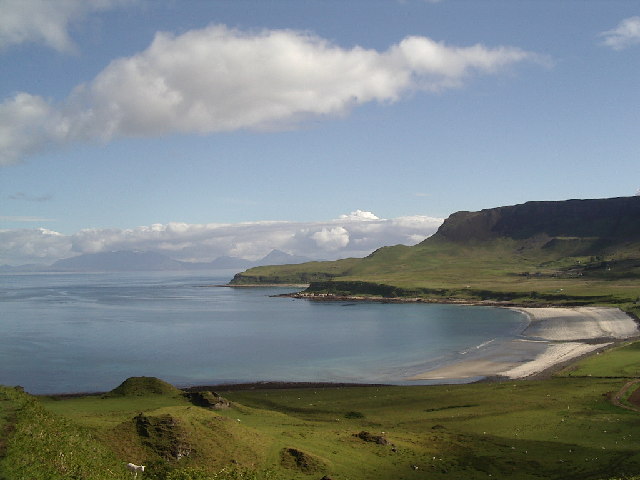
Poll Duchaill is a prominent coastal feature located in Inverness-shire, Scotland. This rugged headland juts out into the North Sea, offering stunning views of the surrounding coastline and sea. The name "Poll Duchaill" is derived from Gaelic and translates to "black pool," which likely refers to the dark, rocky cliffs that line the shoreline.

The headland is known for its dramatic cliffs, which rise steeply from the sea below. These cliffs are home to a variety of seabirds, including puffins, guillemots, and razorbills, making it a popular spot for birdwatching. The area is also rich in marine life, with seals often seen basking on the rocks below.

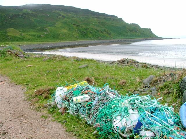
Visitors to Poll Duchaill can enjoy scenic walks along the cliff tops, taking in the breathtaking views of the sea and surrounding landscape. The headland is also a popular spot for fishing, with anglers often trying their luck from the rocky shores.

Overall, Poll Duchaill is a stunning coastal feature that offers visitors a chance to experience the natural beauty and wildlife of the Scottish coast.

If you have any feedback on the listing, please let us know in the comments section below.

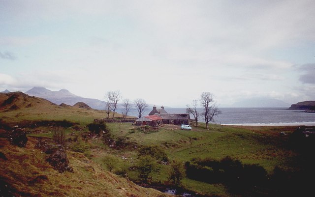
Poll Duchaill Images

Images are sourced within 2km of 56.914943/-6.1883919 or Grid Reference NM4588. Thanks to Geograph Open Source API. All images are credited.

Laig, farm and bay
Laig, farm and bay
Laig from the south The scattered houses of Cleadale lie under the distant cliffs.
Laig from the south
The scattered houses of Cleadale lie under the distant cliffs.
Bay of Laig on the Isle of Eigg Note where the burn has brought down debris to create a small 'promontory' where the cattle are grazing.
Bay of Laig on the Isle of Eigg
Note where the burn has brought down debris to create a small 'promontory' where the cattle are grazing.
Gateway to Laig The path to Laig descends through this gap in the line of outcrops to the farm and the bay.
Gateway to Laig
The path to Laig descends through this gap in the line of outcrops to the farm and the bay.
Hillside near Laig On the path down to Laig farm with Rum in the background.
Hillside near Laig
On the path down to Laig farm with Rum in the background.
Lochan near Laig A partly silted up lochan on the shelf of land above Laig. The coast continues around Laig Bay and round the next headland to the Singing Sands.
Lochan near Laig
A partly silted up lochan on the shelf of land above Laig. The coast continues around Laig Bay and round the next headland to the Singing Sands.
Footbridge and hydro powerhouse, Laig The hydroelectric installation is rated at 100kW, the largest of Eigg Electric's sources - see <span class="nowrap"><a title="http://www.isleofeigg.org/eigg-electric/" rel="nofollow ugc noopener" href="http://www.isleofeigg.org/eigg-electric/">Link</a><img style="margin-left:2px;" alt="External link" title="External link - shift click to open in new window" src="https://s1.geograph.org.uk/img/external.png" width="10" height="10"/></span> for more details.
Footbridge and hydro powerhouse, Laig
The hydroelectric installation is rated at 100kW, the largest of Eigg Electric's sources - see LinkExternal link for more details.
Ruins at Laig The remains of a substantial stone farmhouse at Laig.
Ruins at Laig
The remains of a substantial stone farmhouse at Laig.
Burn reaches the beach, Laig The Abhainn Gleann Charadail drains the central moorland area northwards to reach the sea here at Laig Bay. In the background, cloud base on the Rum hills is falling - not a good weather sign.
Burn reaches the beach, Laig
The Abhainn Gleann Charadail drains the central moorland area northwards to reach the sea here at Laig Bay. In the background, cloud base on the Rum hills is falling - not a good weather sign.
White sand beach, Bay of Laig An expanse of deserted beach on the west coast of Eigg with clouds obscuring the peaks of Rum across the sound.
White sand beach, Bay of Laig
An expanse of deserted beach on the west coast of Eigg with clouds obscuring the peaks of Rum across the sound.
Tràigh Chlithe, Isle of Eigg
Beach and coast at Bay of Laig, Eigg The coast by Bay of Laig points straight to Rum.  The incoming tide has preferentially made its way up the edge of the beach.
Beach and coast at Bay of Laig, Eigg
The coast by Bay of Laig points straight to Rum. The incoming tide has preferentially made its way up the edge of the beach.
Bay of Laig, Eigg
Bay of Laig, Eigg
South shore of Laig Bay Collected flotsam
South shore of Laig Bay
Collected flotsam
Track to Laig
Track to Laig
Headland at Cleadale Taken looking north from Laig beach (NM470881)
Headland at Cleadale
Taken looking north from Laig beach (NM470881)
View of the Track to Laig looking Towards a cloudy Cleadale
Laig Beach from above Laig farm
Show me another place!

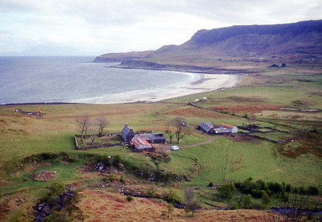
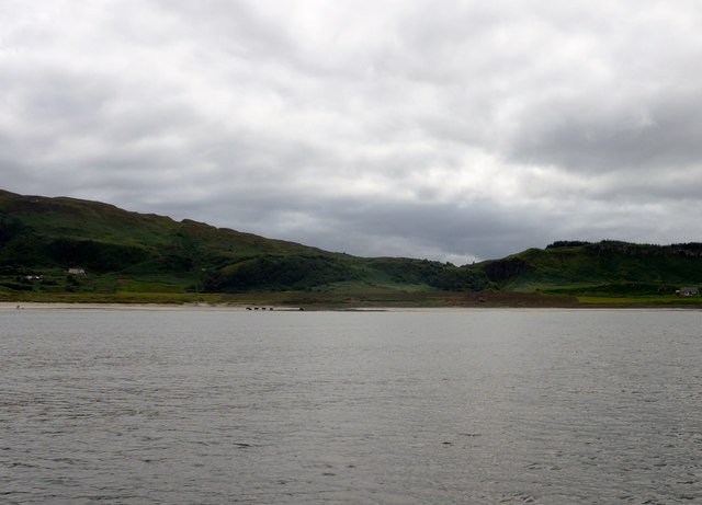
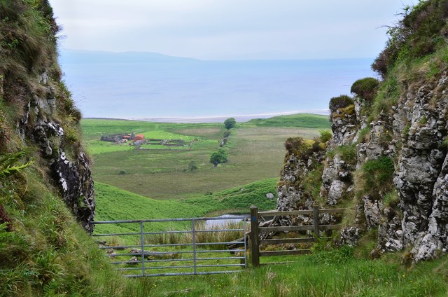
Poll Duchaill is located at Grid Ref: NM4588 (Lat: 56.914943, Lng: -6.1883919)

Unitary Authority: Highland

Police Authority: Highlands and Islands

What 3 Words

///deprives.smashes.checked. Near Arisaig, Highland

Related Wikis

Eigg

Eigg ( eg; Scottish Gaelic: Eige; Scots: Eigg) is one of the Small Isles in the Scottish Inner Hebrides. It lies to the south of the Isle of Skye and to...

Cleadale

Cleadale (Scottish Gaelic: Clèadail) is a settlement on the north west side of the island of Eigg, in the Small Isles of Scotland and is in the council...

An Sgùrr (Eigg)

An Sgùrr is the highest hill on the Inner Hebridean island of Eigg, Lochaber, Highland, Scotland. It was formed 58.72 ± 0.07 million years ago; the result...

Galmisdale

Galmisdale is the main port of the island of Eigg, one of the Small Isles of the Inner Hebrides. It is in the Scottish council area of Highland. ��2�...

Nearby Amenities

Located within 500m of 56.914943,-6.1883919
Source: PGS
Lat/Long: 56.9120012/-6.1939914
Source: PGS
Lat/Long: 56.9122243/-6.1934779
Source: PGS
Lat/Long: 56.9123546/-6.1930176
Source: PGS
Lat/Long: 56.912903/-6.1923717
Source: PGS
Lat/Long: 56.9130604/-6.1924989
Source: PGS
Lat/Long: 56.9141063/-6.191694
Source: PGS
Lat/Long: 56.9141393/-6.1915483
Source: PGS
Lat/Long: 56.9140996/-6.1911801
Source: PGS
Lat/Long: 56.9143356/-6.1887551
Source: PGS
Lat/Long: 56.9145831/-6.1873093
Source: PGS
Lat/Long: 56.9146095/-6.1871549
Source: PGS
Lat/Long: 56.9148145/-6.1865375
Source: PGS
Lat/Long: 56.9153458/-6.1857503
Source: PGS
Lat/Long: 56.9154052/-6.1856208
Source: PGS
Lat/Long: 56.9154388/-6.1854697
Source: PGS
Lat/Long: 56.9155463/-6.1844752
Source: PGS
Lat/Long: 56.9156575/-6.1837961
Source: PGS
Lat/Long: 56.9158286/-6.1817315
The data included in this document is from www.openstreetmap.org. The data is made available under ODbL.

Have you been to Poll Duchaill?

Leave your review of Poll Duchaill below (or comments, questions and feedback).