Eilean na Còinnich

Coastal Feature, Headland, Point in Argyllshire

Scotland

Eilean na Còinnich

Igneous escarpment above Balmeanach Tertiary lava flows dominate the view but there are surviving sedimentary rocks, including chalk, here from before the volcanoes, this has led to good farmland along the coast and on Inch Kenneth.
Igneous escarpment above Balmeanach Credit: Richard Webb

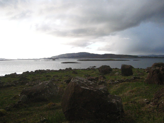
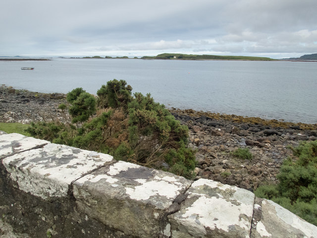
Eilean na Còinnich is a prominent coastal feature located in Argyllshire, Scotland. It is a headland or point that juts out into the sea, offering breathtaking views and a unique natural environment.

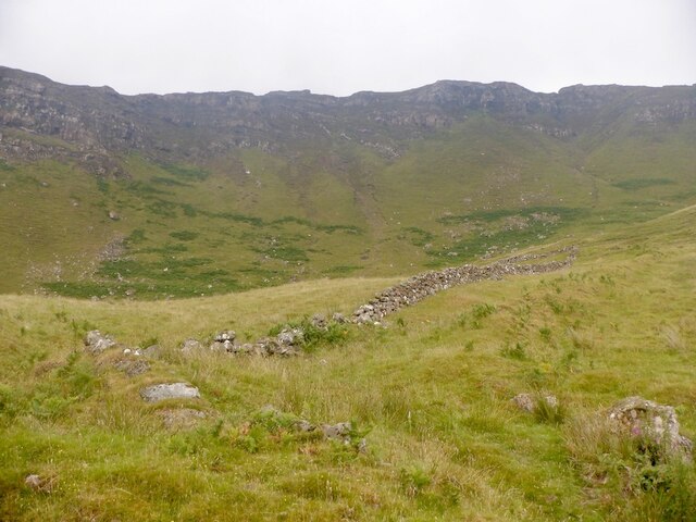
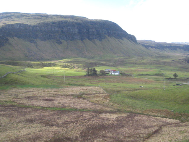
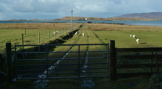
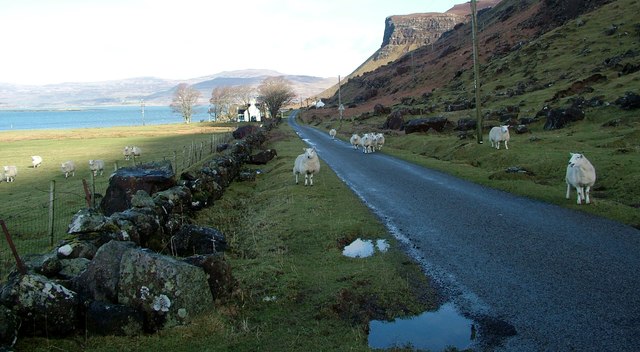
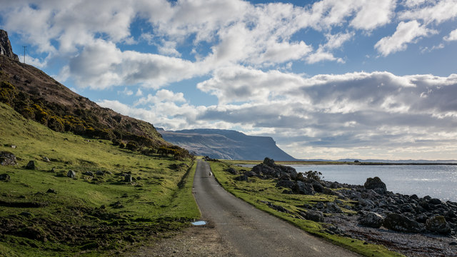
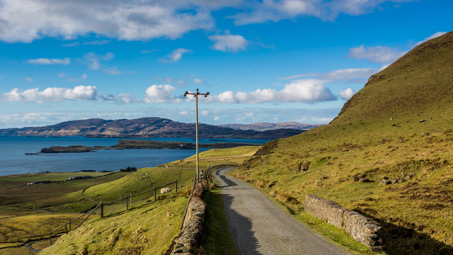
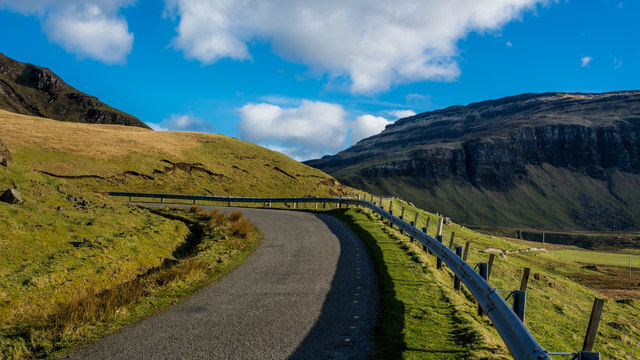
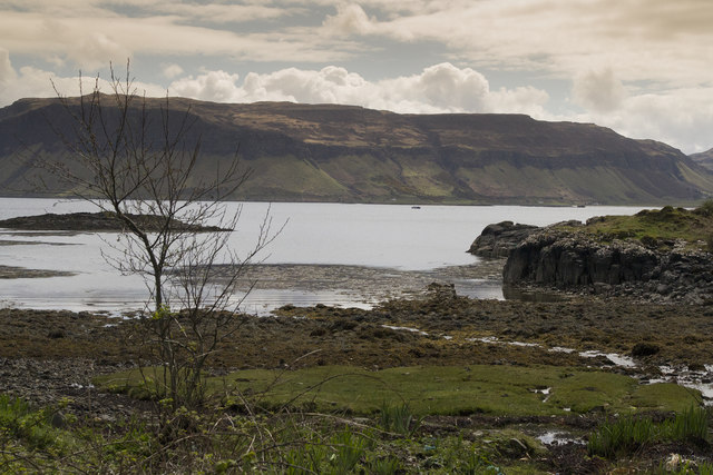
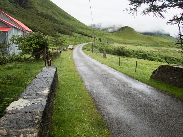
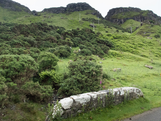
Situated on the western coast of Scotland, Eilean na Còinnich is known for its rugged cliffs and rocky terrain. The headland is characterized by steep slopes and jagged cliffs that provide a dramatic backdrop to the surrounding waters. The area is rich in diverse wildlife, including seabirds, seals, and occasionally dolphins and whales.

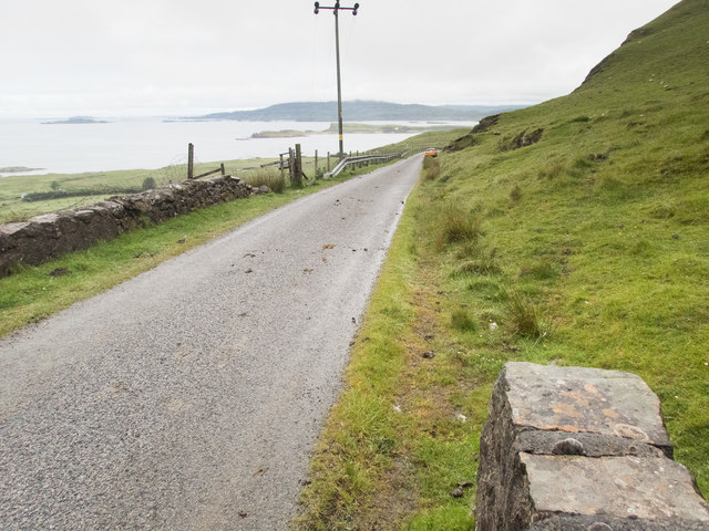
The headland is accessible by a narrow path that winds its way along the coastline, offering visitors a chance to explore the stunning natural scenery. The path is relatively challenging, with some steep sections and uneven terrain, but the reward is well worth the effort. From the top of Eilean na Còinnich, visitors are treated to panoramic views of the surrounding sea, nearby islands, and the distant mountain ranges of the mainland.

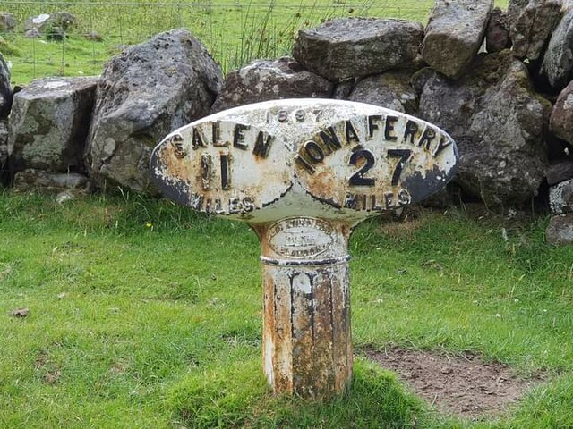
Eilean na Còinnich also holds historical significance, with remnants of ancient settlements and ruins scattered throughout the area. These archaeological sites provide a glimpse into the past and the lives of the people who once called this headland home.

Overall, Eilean na Còinnich is a captivating coastal feature that showcases the raw beauty of Scotland's western coast. Its majestic cliffs, diverse wildlife, and historical significance make it a must-visit destination for nature lovers, hikers, and history enthusiasts alike.

If you have any feedback on the listing, please let us know in the comments section below.

Eilean na Còinnich Images

Images are sourced within 2km of 56.432132/-6.1421449 or Grid Reference NM4434. Thanks to Geograph Open Source API. All images are credited.

Igneous escarpment above Balmeanach Tertiary lava flows dominate the view but there are surviving sedimentary rocks, including chalk, here from before the volcanoes, this has led to good farmland along the coast and on Inch Kenneth.
Igneous escarpment above Balmeanach
Tertiary lava flows dominate the view but there are surviving sedimentary rocks, including chalk, here from before the volcanoes, this has led to good farmland along the coast and on Inch Kenneth.
Old milepost One of the remaining mileposts on the B8035 road from Salen southwards to join the A849 for the 38 miles from Salen to Fionnphort and the Iona Ferry jetty.   These posts on Mull made by Smith, Patterson of Blaydon are the only ones known to have been cast at that foundry that have a date, 1897.   This post is on the west side of the road north of Balnahard.
Old milepost
One of the remaining mileposts on the B8035 road from Salen southwards to join the A849 for the 38 miles from Salen to Fionnphort and the Iona Ferry jetty. These posts on Mull made by Smith, Patterson of Blaydon are the only ones known to have been cast at that foundry that have a date, 1897. This post is on the west side of the road north of Balnahard.
Marshy ground below the B8035 near An Sithean Looking towards a farmstead at Balmeanach in square <a href="https://www.geograph.org.uk/gridref/NM4433">NM4433</a>.
Marshy ground below the B8035 near An Sithean
Looking towards a farmstead at Balmeanach in square NM4433.
Rocks on the shore of Loch na Keal at Rubha a'Ghearrain The low-lying island in the centre of the photo is Samalan Island.
Rocks on the shore of Loch na Keal at Rubha a'Ghearrain
The low-lying island in the centre of the photo is Samalan Island.
Inch Kenneth from Gribun Field gate and track leading from the B8035 at Gribun, Mull, down to the Loch opposite Inch Kenneth island
Inch Kenneth from Gribun
Field gate and track leading from the B8035 at Gribun, Mull, down to the Loch opposite Inch Kenneth island
Gribun sheep Very inquisitive and/or hungry sheep along the B8035 at Gribun, Mull - February 2016
Gribun sheep
Very inquisitive and/or hungry sheep along the B8035 at Gribun, Mull - February 2016
Gribun cattle Cattle around a ring-feeder on ground below the B8035 at Gribun, Mull. Inch Kenneth island is across the water and Little Colonsay further off to the left.
Gribun cattle
Cattle around a ring-feeder on ground below the B8035 at Gribun, Mull. Inch Kenneth island is across the water and Little Colonsay further off to the left.
Road near Clachandhu
Start of the downhill section of the B8073 to Loch na Keal
In the hairpins on the B8035
Cliffs on Mull The road passes directly below these cliffs. It is very narrow with passing places so you hope not to meet something large coming the other way.
Cliffs on Mull
The road passes directly below these cliffs. It is very narrow with passing places so you hope not to meet something large coming the other way.
Coastal road on Mull There are a number of images taken along the Allt na Teangaidh, eg <a href="https://www.geograph.org.uk/photo/4388391">NM4532 : Allt na Teangaidh</a>. This bridge, with a rivet benchmark <a href="https://www.geograph.org.uk/photo/5461761">NM4532 : Benchmark on a bridge parapet</a> at the end of the parapet, is over an unnamed tributary flowing from the cliffs of A Mhaol. The view is along the A8035 (which runs out of the square in about 150m) to the small island of Inch Kenneth and the larger island of Ulva beyond.
Coastal road on Mull
There are a number of images taken along the Allt na Teangaidh, eg NM4532 : Allt na Teangaidh. This bridge, with a rivet benchmark NM4532 : Benchmark on a bridge parapet at the end of the parapet, is over an unnamed tributary flowing from the cliffs of A Mhaol. The view is along the A8035 (which runs out of the square in about 150m) to the small island of Inch Kenneth and the larger island of Ulva beyond.
Benchmark on a bridge parapet The OS description is NBM RIVET NE PARA BR NW END. The bridge parapet and the view from it are shown in <a href="https://www.geograph.org.uk/photo/5461757">NM4532 : Coastal road on Mull</a>.
Benchmark on a bridge parapet
The OS description is NBM RIVET NE PARA BR NW END. The bridge parapet and the view from it are shown in NM4532 : Coastal road on Mull.
On the bridge over the Alltan na Caillich This is looking SE to the fantastic scenery (partly obscured by mist) that overlooks the A8035 and the coast of this part of Mull. The red-roofed house features in <a href="https://www.geograph.org.uk/photo/2944007">NM4534 : Corrugated House by the B8035</a> and  <a href="https://www.geograph.org.uk/photo/3377713">NM4534 : Corrugated iron house at Balnahard</a>. There is a rivet benchmark <a href="https://www.geograph.org.uk/photo/5461779">NM4534 : A well indicated benchmark</a> on the right hand edge of the stone with the large patch of whitish lichen on its left hand edge.
On the bridge over the Alltan na Caillich
This is looking SE to the fantastic scenery (partly obscured by mist) that overlooks the A8035 and the coast of this part of Mull. The red-roofed house features in NM4534 : Corrugated House by the B8035 and NM4534 : Corrugated iron house at Balnahard. There is a rivet benchmark NM4534 : A well indicated benchmark on the right hand edge of the stone with the large patch of whitish lichen on its left hand edge.
A well indicated benchmark The arrow of this rivet benchmark is really obvious, unlike many. The OS description is: RIVET E PARA BR OVER ALLTAN NA CAILLICH 1.3M N END. The bridge is shown in <a href="https://www.geograph.org.uk/photo/5461774">NM4534 : On the bridge over the Alltan na Caillich</a>.
A well indicated benchmark
The arrow of this rivet benchmark is really obvious, unlike many. The OS description is: RIVET E PARA BR OVER ALLTAN NA CAILLICH 1.3M N END. The bridge is shown in NM4534 : On the bridge over the Alltan na Caillich.
Marvellous scenery on the Mull coast The scenery here is wonderful. This bridge <a href="https://www.geograph.org.uk/photo/3045622">NM4535 : Road towards the Bungalow, Loch na Keal</a> over an unnamed stream has a rivet benchmark <a href="https://www.geograph.org.uk/photo/5461796">NM4535 : Benchmark and lichen</a> on it.
Marvellous scenery on the Mull coast
The scenery here is wonderful. This bridge NM4535 : Road towards the Bungalow, Loch na Keal over an unnamed stream has a rivet benchmark NM4535 : Benchmark and lichen on it.
Benchmark and lichen The lichen is doing a good job of very slowly obscuring the accompanying arrow of this rivet benchmark (OS description: RIVET E PARA BR 1.3M N END). The bridge parapet is shown in <a href="https://www.geograph.org.uk/photo/5461790">NM4535 : Marvellous scenery on the Mull coast</a>.
Benchmark and lichen
The lichen is doing a good job of very slowly obscuring the accompanying arrow of this rivet benchmark (OS description: RIVET E PARA BR 1.3M N END). The bridge parapet is shown in NM4535 : Marvellous scenery on the Mull coast.
View to Inch Kenneth Beyond the parapet of this bridge over an unnamed stream is a narrow strip of coast and a view to Inch Kenneth two squares to the west. There is a rivet benchmark <a href="https://www.geograph.org.uk/photo/5461820">NM4535 : Benchmark on bridge parapet</a> on the central stone of the parapet.
View to Inch Kenneth
Beyond the parapet of this bridge over an unnamed stream is a narrow strip of coast and a view to Inch Kenneth two squares to the west. There is a rivet benchmark NM4535 : Benchmark on bridge parapet on the central stone of the parapet.
Show me another place!

Eilean na Còinnich is located at Grid Ref: NM4434 (Lat: 56.432132, Lng: -6.1421449)

Unitary Authority: Argyll and Bute

Police Authority: Argyll and West Dunbartonshire

What 3 Words

///permanent.retaliate.trifling. Near Salen, Argyll & Bute

Related Wikis

St Kenneth's Chapel

St. Kenneth's Chapel is a ruined chapel on Inch Kenneth Island, Parish of Kilfinichen and Kilvickeon, Isle of Mull, Argyll and Bute, Scotland. It dates...

Inch Kenneth

Inch Kenneth (Scottish Gaelic: Innis Choinnich) is a small grassy island off the west coast of the Isle of Mull, in Scotland. It is at the entrance of...

Samalan Island

Samalan Island is a small island, just off the Isle of Mull at the mouth of Loch na Keal in the Inner Hebrides, Scotland. To its south west is the island...

Ardmeanach

Ardmeanach in modern times refers to a peninsula on the Isle of Mull. It is the middle one out of three westward-facing peninsulas on the island, and the...

Nearby Amenities

Located within 500m of 56.432132,-6.1421449
Post Box
Post Box Type: lamp
Ref: PA68 147
Royal Cypher: scottish_crown
Lat/Long: 56.4333574/-6.134341
Telephone
Defibrillator
Booth: K6
Covered: booth
Defibrillator Location: inside old red phone box in Balnahard
Emergency: defibrillator
Man Made: telephone_box
Lat/Long: 56.4335176/-6.134526
Balnahard
Place: locality
Lat/Long: 56.4341019/-6.1360173
Power: pole
Lat/Long: 56.4310454/-6.1342576
Power: pole
Lat/Long: 56.4317262/-6.1346224
Power: pole
Lat/Long: 56.4322808/-6.1349469
Power: pole
Lat/Long: 56.433233/-6.1354512
Power: pole
Lat/Long: 56.433927/-6.1352581
The data included in this document is from www.openstreetmap.org. The data is made available under ODbL.

Have you been to Eilean na Còinnich?

Leave your review of Eilean na Còinnich below (or comments, questions and feedback).