Bodhachan Ruadha

Coastal Feature, Headland, Point in Argyllshire

Scotland

Bodhachan Ruadha

Igneous escarpment above Balmeanach Tertiary lava flows dominate the view but there are surviving sedimentary rocks, including chalk, here from before the volcanoes, this has led to good farmland along the coast and on Inch Kenneth.
Igneous escarpment above Balmeanach Credit: Richard Webb

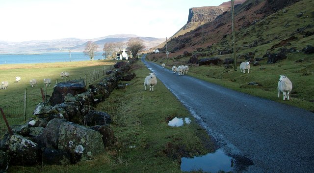
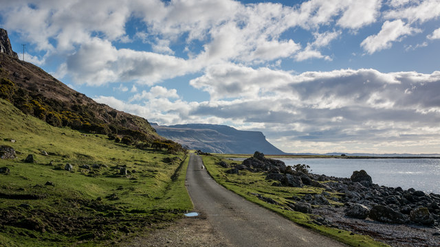
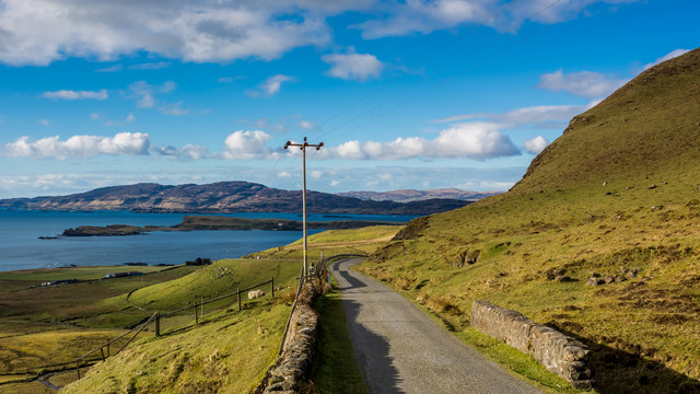
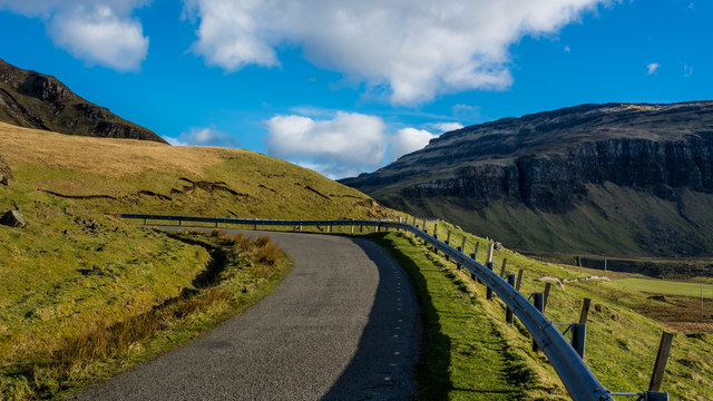
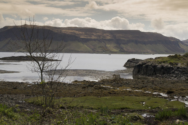
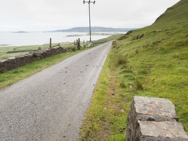
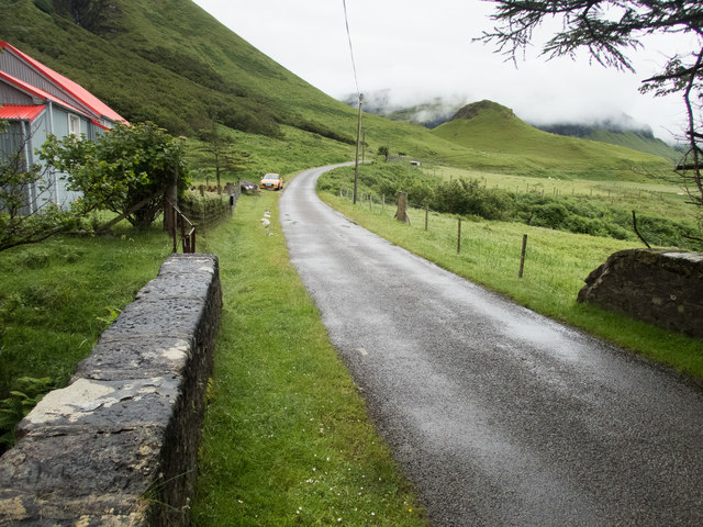
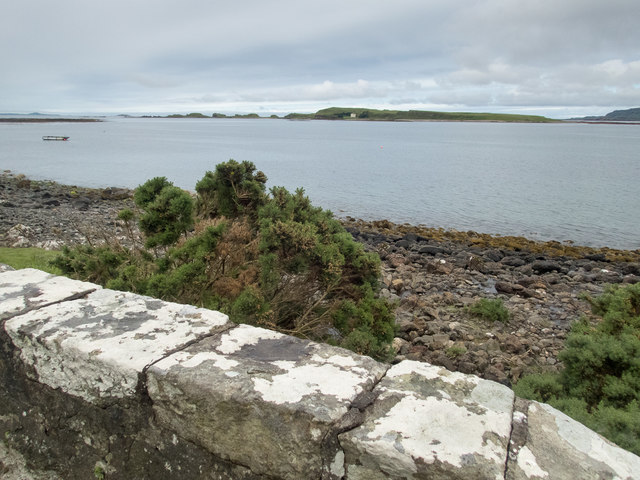
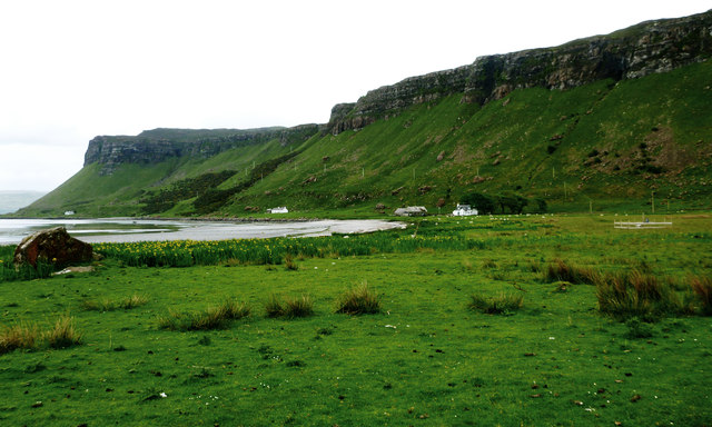
Bodhachan Ruadha is a prominent coastal feature located in Argyllshire, Scotland. Situated on the west coast of the country, it is known for its picturesque views and rugged natural beauty. Bodhachan Ruadha is specifically classified as a headland, jutting out into the sea and forming a distinctive point along the coastline.

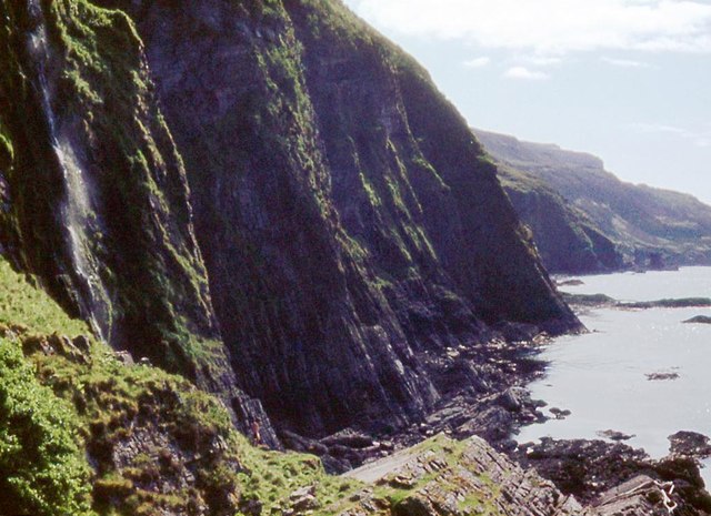
The headland is characterized by its steep cliffs, which rise dramatically from the surrounding sea. These cliffs are composed of various types of rock, including granite and sandstone, creating a diverse geological landscape. Visitors to Bodhachan Ruadha can witness the erosion caused by the powerful waves crashing against the cliffs, resulting in unique formations and rock formations.

The headland offers stunning panoramic views of the surrounding area, including the vast expanse of the ocean and the nearby islands of the Inner Hebrides. On clear days, it is even possible to see as far as the Isle of Mull and the Isle of Skye. These breathtaking vistas make Bodhachan Ruadha a popular destination for nature lovers, photographers, and outdoor enthusiasts.

The headland is also home to a rich array of wildlife. Seabirds, such as puffins, gannets, and guillemots, can be spotted nesting on the cliffs, while seals and dolphins can often be seen swimming in the waters below. The diverse flora and fauna of Bodhachan Ruadha contribute to its ecological importance, making it a protected area under Scottish conservation laws.

Overall, Bodhachan Ruadha is a captivating coastal feature, offering visitors a glimpse into the raw beauty of Scotland's west coast. Its stunning cliffs, panoramic views, and vibrant wildlife make it a must-visit destination for anyone seeking an authentic Scottish coastal experience.

If you have any feedback on the listing, please let us know in the comments section below.

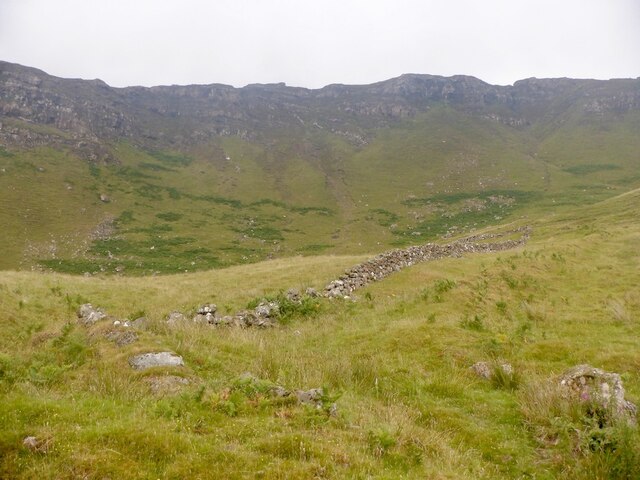
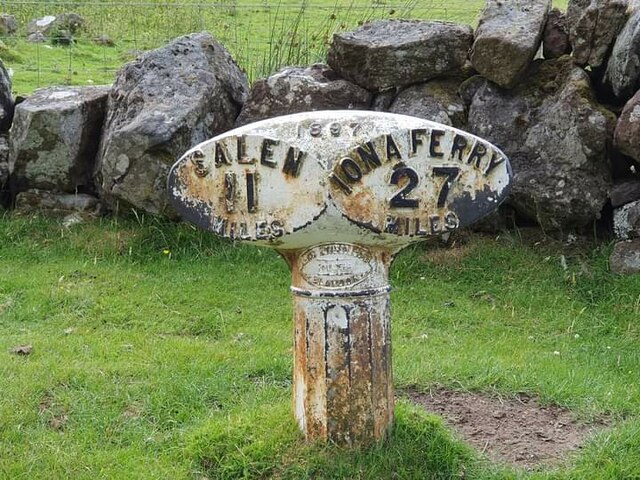
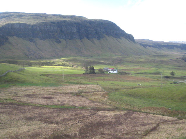
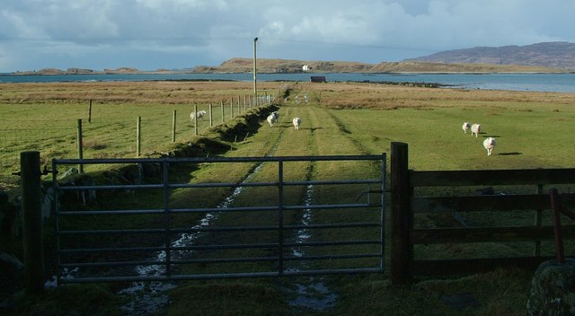
Bodhachan Ruadha Images

Images are sourced within 2km of 56.429083/-6.1493923 or Grid Reference NM4434. Thanks to Geograph Open Source API. All images are credited.

Igneous escarpment above Balmeanach Tertiary lava flows dominate the view but there are surviving sedimentary rocks, including chalk, here from before the volcanoes, this has led to good farmland along the coast and on Inch Kenneth.
Igneous escarpment above Balmeanach
Tertiary lava flows dominate the view but there are surviving sedimentary rocks, including chalk, here from before the volcanoes, this has led to good farmland along the coast and on Inch Kenneth.
Old milepost One of the remaining mileposts on the B8035 road from Salen southwards to join the A849 for the 38 miles from Salen to Fionnphort and the Iona Ferry jetty.   These posts on Mull made by Smith, Patterson of Blaydon are the only ones known to have been cast at that foundry that have a date, 1897.   This post is on the west side of the road north of Balnahard.
Old milepost
One of the remaining mileposts on the B8035 road from Salen southwards to join the A849 for the 38 miles from Salen to Fionnphort and the Iona Ferry jetty. These posts on Mull made by Smith, Patterson of Blaydon are the only ones known to have been cast at that foundry that have a date, 1897. This post is on the west side of the road north of Balnahard.
Marshy ground below the B8035 near An Sithean Looking towards a farmstead at Balmeanach in square <a href="https://www.geograph.org.uk/gridref/NM4433">NM4433</a>.
Marshy ground below the B8035 near An Sithean
Looking towards a farmstead at Balmeanach in square NM4433.
Inch Kenneth from Gribun Field gate and track leading from the B8035 at Gribun, Mull, down to the Loch opposite Inch Kenneth island
Inch Kenneth from Gribun
Field gate and track leading from the B8035 at Gribun, Mull, down to the Loch opposite Inch Kenneth island
Gribun sheep Very inquisitive and/or hungry sheep along the B8035 at Gribun, Mull - February 2016
Gribun sheep
Very inquisitive and/or hungry sheep along the B8035 at Gribun, Mull - February 2016
Gribun cattle Cattle around a ring-feeder on ground below the B8035 at Gribun, Mull. Inch Kenneth island is across the water and Little Colonsay further off to the left.
Gribun cattle
Cattle around a ring-feeder on ground below the B8035 at Gribun, Mull. Inch Kenneth island is across the water and Little Colonsay further off to the left.
Sea cliffs at Mackinnon's Cave
Road near Clachandhu
Start of the downhill section of the B8073 to Loch na Keal
In the hairpins on the B8035
Cliffs on Mull The road passes directly below these cliffs. It is very narrow with passing places so you hope not to meet something large coming the other way.
Cliffs on Mull
The road passes directly below these cliffs. It is very narrow with passing places so you hope not to meet something large coming the other way.
Coastal road on Mull There are a number of images taken along the Allt na Teangaidh, eg <a href="https://www.geograph.org.uk/photo/4388391">NM4532 : Allt na Teangaidh</a>. This bridge, with a rivet benchmark <a href="https://www.geograph.org.uk/photo/5461761">NM4532 : Benchmark on a bridge parapet</a> at the end of the parapet, is over an unnamed tributary flowing from the cliffs of A Mhaol. The view is along the A8035 (which runs out of the square in about 150m) to the small island of Inch Kenneth and the larger island of Ulva beyond.
Coastal road on Mull
There are a number of images taken along the Allt na Teangaidh, eg NM4532 : Allt na Teangaidh. This bridge, with a rivet benchmark NM4532 : Benchmark on a bridge parapet at the end of the parapet, is over an unnamed tributary flowing from the cliffs of A Mhaol. The view is along the A8035 (which runs out of the square in about 150m) to the small island of Inch Kenneth and the larger island of Ulva beyond.
Benchmark on a bridge parapet The OS description is NBM RIVET NE PARA BR NW END. The bridge parapet and the view from it are shown in <a href="https://www.geograph.org.uk/photo/5461757">NM4532 : Coastal road on Mull</a>.
Benchmark on a bridge parapet
The OS description is NBM RIVET NE PARA BR NW END. The bridge parapet and the view from it are shown in NM4532 : Coastal road on Mull.
On the bridge over the Alltan na Caillich This is looking SE to the fantastic scenery (partly obscured by mist) that overlooks the A8035 and the coast of this part of Mull. The red-roofed house features in <a href="https://www.geograph.org.uk/photo/2944007">NM4534 : Corrugated House by the B8035</a> and  <a href="https://www.geograph.org.uk/photo/3377713">NM4534 : Corrugated iron house at Balnahard</a>. There is a rivet benchmark <a href="https://www.geograph.org.uk/photo/5461779">NM4534 : A well indicated benchmark</a> on the right hand edge of the stone with the large patch of whitish lichen on its left hand edge.
On the bridge over the Alltan na Caillich
This is looking SE to the fantastic scenery (partly obscured by mist) that overlooks the A8035 and the coast of this part of Mull. The red-roofed house features in NM4534 : Corrugated House by the B8035 and NM4534 : Corrugated iron house at Balnahard. There is a rivet benchmark NM4534 : A well indicated benchmark on the right hand edge of the stone with the large patch of whitish lichen on its left hand edge.
A well indicated benchmark The arrow of this rivet benchmark is really obvious, unlike many. The OS description is: RIVET E PARA BR OVER ALLTAN NA CAILLICH 1.3M N END. The bridge is shown in <a href="https://www.geograph.org.uk/photo/5461774">NM4534 : On the bridge over the Alltan na Caillich</a>.
A well indicated benchmark
The arrow of this rivet benchmark is really obvious, unlike many. The OS description is: RIVET E PARA BR OVER ALLTAN NA CAILLICH 1.3M N END. The bridge is shown in NM4534 : On the bridge over the Alltan na Caillich.
View to Inch Kenneth Beyond the parapet of this bridge over an unnamed stream is a narrow strip of coast and a view to Inch Kenneth two squares to the west. There is a rivet benchmark <a href="https://www.geograph.org.uk/photo/5461820">NM4535 : Benchmark on bridge parapet</a> on the central stone of the parapet.
View to Inch Kenneth
Beyond the parapet of this bridge over an unnamed stream is a narrow strip of coast and a view to Inch Kenneth two squares to the west. There is a rivet benchmark NM4535 : Benchmark on bridge parapet on the central stone of the parapet.
Benchmark on bridge parapet The OS description is: RIVET NW PARA BR 1.6M N END. The bridge is shown in <a href="https://www.geograph.org.uk/photo/5461816">NM4535 : View to Inch Kenneth</a>.
Benchmark on bridge parapet
The OS description is: RIVET NW PARA BR 1.6M N END. The bridge is shown in NM4535 : View to Inch Kenneth.
Clachandhu from Rubha Baile na h-Airde This is the point where the "Wilderness coast" of Mull becomes a little more subdued and is accessible to road building - the B8035 cuts across the Ardmeanach peninsula from Loch Scridain, and here drops down to a wide enough coastal plain on the shore of Loch na Keal. The flat area is at its most extensive just at this point, where a reef extends out into Loch na Keal towards Inch Kenneth and has provided enough shelter from the sea for a wide grassy area to form and provide some grazing, hence the habitation.
Clachandhu from Rubha Baile na h-Airde
This is the point where the "Wilderness coast" of Mull becomes a little more subdued and is accessible to road building - the B8035 cuts across the Ardmeanach peninsula from Loch Scridain, and here drops down to a wide enough coastal plain on the shore of Loch na Keal. The flat area is at its most extensive just at this point, where a reef extends out into Loch na Keal towards Inch Kenneth and has provided enough shelter from the sea for a wide grassy area to form and provide some grazing, hence the habitation.
Show me another place!

Bodhachan Ruadha is located at Grid Ref: NM4434 (Lat: 56.429083, Lng: -6.1493923)

Unitary Authority: Argyll and Bute

Police Authority: Argyll and West Dunbartonshire

What 3 Words

///relies.treatment.averages. Near Salen, Argyll & Bute

Related Wikis

St Kenneth's Chapel

St. Kenneth's Chapel is a ruined chapel on Inch Kenneth Island, Parish of Kilfinichen and Kilvickeon, Isle of Mull, Argyll and Bute, Scotland. It dates...

Inch Kenneth

Inch Kenneth (Scottish Gaelic: Innis Choinnich) is a small grassy island off the west coast of the Isle of Mull, in Scotland. It is at the entrance of...

Samalan Island

Samalan Island is a small island, just off the Isle of Mull at the mouth of Loch na Keal in the Inner Hebrides, Scotland. To its south west is the island...

Ardmeanach

Ardmeanach in modern times refers to a peninsula on the Isle of Mull. It is the middle one out of three westward-facing peninsulas on the island, and the...

Have you been to Bodhachan Ruadha?

Leave your review of Bodhachan Ruadha below (or comments, questions and feedback).