An Leac

Coastal Feature, Headland, Point in Inverness-shire

Scotland

An Leac

Boilerplate rock on the slopes of Sgurr nan Eag A heavily glaciated outcrop near the Allt na h-Airigh Leithe.
Boilerplate rock on the slopes of Sgurr nan Eag Credit: John Allan

An Leac is a prominent coastal feature located in Inverness-shire, Scotland. It is classified as a headland or point due to its distinct geographical formation and position on the coastline. An Leac is situated on the western edge of the Scottish Highlands, overlooking the North Atlantic Ocean.

Rising approximately 200 feet above sea level, An Leac boasts breathtaking panoramic views of the surrounding landscape and sea. The headland is characterized by its rugged and rocky terrain, with steep cliffs jutting out into the ocean. These cliffs are composed of various types of rock, including granite and sandstone, which have been shaped by the forces of erosion over millions of years.

An Leac serves as a prominent landmark along the coastline, attracting both locals and tourists alike. Its strategic location offers a picturesque spot for outdoor activities such as hiking, birdwatching, and photography. The headland is also a popular destination for wildlife enthusiasts, as it provides a habitat for a variety of seabirds, including puffins, gannets, and fulmars.

Due to its exposure to the Atlantic Ocean, An Leac experiences strong winds and powerful waves, making it a challenging location for maritime activities such as boating and fishing. However, the headland's natural beauty and unique geological features make it a captivating sight for visitors seeking to immerse themselves in Scotland's stunning coastal scenery.

Overall, An Leac in Inverness-shire is a remarkable coastal feature that showcases the rugged beauty of Scotland's west coast. With its towering cliffs, breathtaking views, and diverse wildlife, this headland provides an unforgettable experience for nature lovers and adventure seekers.

If you have any feedback on the listing, please let us know in the comments section below.
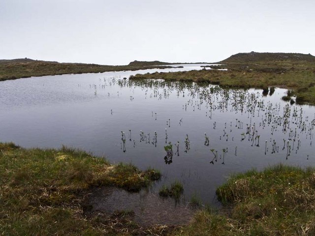
An Leac Images

Images are sourced within 2km of 57.171408/-6.2364608 or Grid Reference NG4416. Thanks to Geograph Open Source API. All images are credited.

Boilerplate rock on the slopes of Sgurr nan Eag A heavily glaciated outcrop near the Allt na h-Airigh Leithe.
Boilerplate rock on the slopes of Sgurr nan Eag
A heavily glaciated outcrop near the Allt na h-Airigh Leithe.
Boilerplate rock below Coir' a' Ghrunnda Heavily glaciated bedrock on the moorland below the coire. The east face of Sgurr Sgumain towers beyond the entrance to the coire.
Boilerplate rock below Coir' a' Ghrunnda
Heavily glaciated bedrock on the moorland below the coire. The east face of Sgurr Sgumain towers beyond the entrance to the coire.
Shoreline of Soay Taken from a boat moored at the entrance of Soay Harbour, the view along part of the western shoreline of Soay. In the distance can be seen, Rubha an Dunain, the headland that projects from Glen Brittle on Skye.
Shoreline of Soay
Taken from a boat moored at the entrance of Soay Harbour, the view along part of the western shoreline of Soay. In the distance can be seen, Rubha an Dunain, the headland that projects from Glen Brittle on Skye.
Soay Sheep Second island of the day on a RIB from Elgol on day of Marhofn 2011 annual meeting in Portree organised by Alan Holmes. Just landed on Soay and managed to snap a picture of sheep on Soay.
Soay Sheep
Second island of the day on a RIB from Elgol on day of Marhofn 2011 annual meeting in Portree organised by Alan Holmes. Just landed on Soay and managed to snap a picture of sheep on Soay.
RIB Trip To Soay Second island of the day on a RIB from Elgol on day of Marhofn 2011 annual meeting in Portree organised by Alan Holmes. Just landed on Soay with photo of RIB off shore
RIB Trip To Soay
Second island of the day on a RIB from Elgol on day of Marhofn 2011 annual meeting in Portree organised by Alan Holmes. Just landed on Soay with photo of RIB off shore
The entrance to Soay Harbour The narrow and shallow entrance makes Soay Harbour a very sheltered spot. This is the west side of the entrance at high tide, just where the underwater bar runs across under the photographer's position.
The entrance to Soay Harbour
The narrow and shallow entrance makes Soay Harbour a very sheltered spot. This is the west side of the entrance at high tide, just where the underwater bar runs across under the photographer's position.
Soay Harbour The narrow and shallow entrance makes Soay Harbour a very sheltered spot. This is the east side of the entrance at high tide, just where the underwater bar runs across under the photographer's position.
Note the old wall on top of the shoreline rocks.
Soay Harbour
The narrow and shallow entrance makes Soay Harbour a very sheltered spot. This is the east side of the entrance at high tide, just where the underwater bar runs across under the photographer's position. Note the old wall on top of the shoreline rocks.
Soay Sound coastline Looking from the Sound to the basalt lava layers of the Skye coastline. The Cuillin can be seen beyond.
Soay Sound coastline
Looking from the Sound to the basalt lava layers of the Skye coastline. The Cuillin can be seen beyond.
Mouth of the Allt na Meacnaish Where the Allt na Meacnaish, which is the outlet from Loch Meachdannach, flows into Soay Sound.
Mouth of the Allt na Meacnaish
Where the Allt na Meacnaish, which is the outlet from Loch Meachdannach, flows into Soay Sound.
North coast of Soay Sound The shore and cliffs in this view account for all the land area of the square. The rest, behind the photographer, is the water of Soay Sound.
North coast of Soay Sound
The shore and cliffs in this view account for all the land area of the square. The rest, behind the photographer, is the water of Soay Sound.
Coastline below Cnoc Leathan The north shore of Soay Sound.
Coastline below Cnoc Leathan
The north shore of Soay Sound.
Sea caves on Soay Sound There are many small caves on this stretch of the Skye coast where there is a narrow exposure of Toridonian Sandstone at sea level, below the plateau basalt lava.
Sea caves on Soay Sound
There are many small caves on this stretch of the Skye coast where there is a narrow exposure of Toridonian Sandstone at sea level, below the plateau basalt lava.
Natural Sculpture Natural weathering of the wonderful red Torridonian Sandstone has produced this splendid sculpture.
Natural Sculpture
Natural weathering of the wonderful red Torridonian Sandstone has produced this splendid sculpture.
Slopes above Soay Sound Skye is visible across the Sound on the left (back right is eastern Soay, across the harbour).
Slopes above Soay Sound
Skye is visible across the Sound on the left (back right is eastern Soay, across the harbour).
Coastal pinnacle This rock is briefly, at high tide, a separate island.
Coastal pinnacle
This rock is briefly, at high tide, a separate island.
Lochan near Ceann na Beinne
Loch Meachdannach
Loch Meachdannach
Boulder
Boulder
Show me another place!

An Leac is located at Grid Ref: NG4416 (Lat: 57.171408, Lng: -6.2364608)

Unitary Authority: Highland

Police Authority: Highlands and Islands

What 3 Words

///exits.sharpness.tungsten. Near Elgol, Highland

Nearby Locations

An Leac

Related Wikis

Soay, Inner Hebrides

Soay (Scottish Gaelic: Sòdhaigh, pronounced [ˈs̪ɔː.aj]) is an island just off the coast of Skye, in the Inner Hebrides of Scotland. == Geography == Soay...
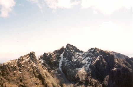
Sgùrr nan Eag

Sgùrr nan Eag is a mountain 924 metres (3,031 ft) high in the Cuillin range on the Isle of Skye, Scotland. It is the southernmost Munro of the Cuillins...

Cuillin

The Cuillin (Scottish Gaelic: An Cuiltheann) is a range of mostly jagged rocky mountains on the Isle of Skye in Scotland. The main Cuillin ridge is also...

Sgùrr Alasdair

Sgùrr Alasdair is the highest peak of the Black Cuillin, and the highest peak on the Isle of Skye and in the Inner Hebrides, and indeed in all the Scottish...

Nearby Amenities

Located within 500m of 57.171408,-6.2364608
Source: PGS
Lat/Long: 57.1700621/-6.2440089
Created By: dmgroom_coastlines
Source: PGS
Lat/Long: 57.17065/-6.24256
Source: PGS
Lat/Long: 57.1709666/-6.2418148
Source: PGS
Lat/Long: 57.1717492/-6.2389854
Created By: dmgroom_coastlines
Source: PGS
Lat/Long: 57.17152/-6.23589
Source: PGS
Lat/Long: 57.1717169/-6.2362358
Source: PGS
Lat/Long: 57.1723102/-6.2336931
Source: PGS
Lat/Long: 57.1727173/-6.2314508
Source: PGS
Lat/Long: 57.1715017/-6.2377915
Source: PGS
Lat/Long: 57.1715657/-6.2384996
Source: PGS
Lat/Long: 57.1721019/-6.2401354
Source: PGS
Lat/Long: 57.17126/-6.24157
Source: PGS
Lat/Long: 57.1715192/-6.2380919
Source: PGS
Lat/Long: 57.1715017/-6.2398837
Source: PGS
Lat/Long: 57.1715017/-6.2398837
Source: PGS
Lat/Long: 57.17131/-6.23779
An Leac
Natural: cape
Lat/Long: 57.171332/-6.2370062
The data included in this document is from www.openstreetmap.org. The data is made available under ODbL.

Have you been to An Leac?

Leave your review of An Leac below (or comments, questions and feedback).