Slochd a' Mhadaidh

Coastal Feature, Headland, Point in Inverness-shire

Scotland

Slochd a' Mhadaidh

Port Gobhlaig
Port Gobhlaig Credit: Matthew Chadwick

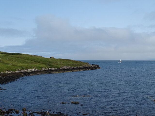
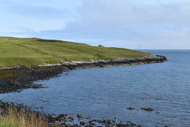
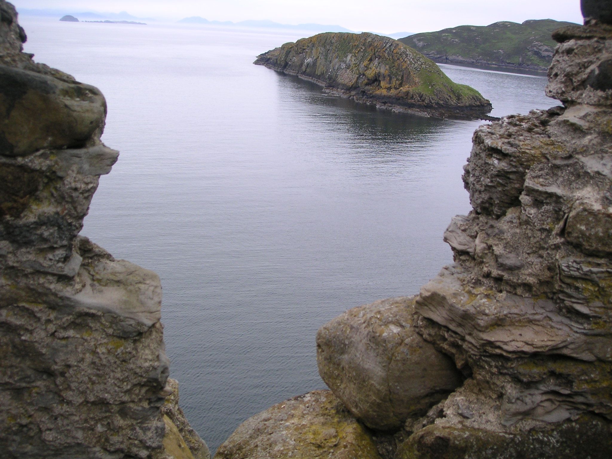
Slochd a' Mhadaidh is a prominent coastal feature located in Inverness-shire, Scotland. It is a headland that juts out into the North Sea, forming a distinctive point along the rugged coastline. The name "Slochd a' Mhadaidh" translates to "the fox's hollow" in English, likely derived from the area's historical association with foxes.

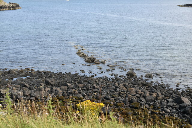
This headland is characterized by its steep cliffs that rise dramatically from the sea, providing breathtaking panoramic views of the surrounding landscape. The cliffs are composed of rugged, weathered rock formations, adding to the area's natural beauty and allure.

Slochd a' Mhadaidh is an important landmark for maritime navigation due to its prominent position along the coastline. It is often used as a reference point by sailors and fishermen navigating the treacherous waters of the North Sea.

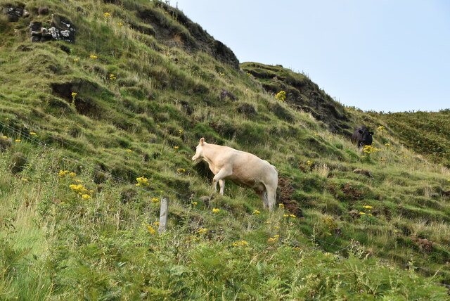
The headland is also home to a diverse range of flora and fauna, including seabirds, such as gulls and cormorants, which nest along the cliffs. The coastal waters surrounding Slochd a' Mhadaidh are known to support a variety of marine life, including seals and dolphins, making it a popular spot for wildlife enthusiasts and nature lovers.

Visitors to Slochd a' Mhadaidh can enjoy scenic walks along the cliff-top paths, taking in the stunning views and observing the abundance of wildlife. The area also offers opportunities for outdoor activities such as birdwatching, photography, and rock climbing.

Overall, Slochd a' Mhadaidh is a captivating coastal feature in Inverness-shire, offering both natural beauty and a rich diversity of wildlife, making it a must-visit destination for nature enthusiasts and outdoor adventurers.

If you have any feedback on the listing, please let us know in the comments section below.

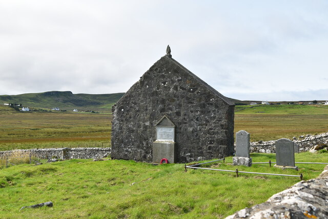
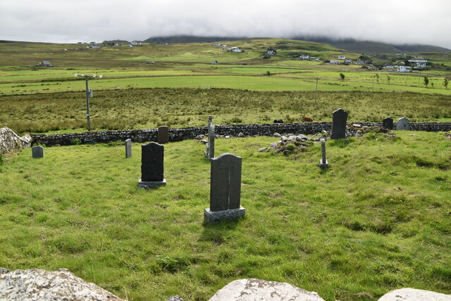
Slochd a' Mhadaidh Images

Images are sourced within 2km of 57.695276/-6.2979284 or Grid Reference NG4375. Thanks to Geograph Open Source API. All images are credited.

Port Gobhlaig
Port Gobhlaig
St Moluag's Church
St Moluag's Church
A855, Shulista The A855 is approximately 33 miles long, encircling the Trotternish Peninsula at the north end of Skye. It is single-track for much of its length, undergoing fairly frequent repair as it is mostly built on top of a peat moor. Despite nominally being a coast road, the route is more often than not inland, with only glimpses of the sea available, particularly on the east coast of Trotternish. Despite this, however, it is a spectacular drive, and reveals some of Skye's finer features <span class="nowrap"><a title="https://www.sabre-roads.org.uk/wiki/index.php?title=A855" rel="nofollow ugc noopener" href="https://www.sabre-roads.org.uk/wiki/index.php?title=A855">Link</a><img style="margin-left:2px;" alt="External link" title="External link - shift click to open in new window" src="https://s1.geograph.org.uk/img/external.png" width="10" height="10"/></span> (SABRE).
A855, Shulista
The A855 is approximately 33 miles long, encircling the Trotternish Peninsula at the north end of Skye. It is single-track for much of its length, undergoing fairly frequent repair as it is mostly built on top of a peat moor. Despite nominally being a coast road, the route is more often than not inland, with only glimpses of the sea available, particularly on the east coast of Trotternish. Despite this, however, it is a spectacular drive, and reveals some of Skye's finer features LinkExternal link (SABRE).
Kilmaluag, Innlands
Kilmaluag, Innlands
Huts beside River Kilmaluag
Greenhill Cottage, Kendram
Kendram, Balmacqueen Road
A855 The A855 runs 33 miles around North Skye from Portree <a href="https://www.geograph.org.uk/photo/7431346">NG4743 : A87, A855 junction, Portree</a> to Uig <a href="https://www.geograph.org.uk/photo/7386522">NG3964 : A855 / A87 junction</a>, via Staffin.
<span class="nowrap"><a title="https://www.sabre-roads.org.uk/wiki/index.php?title=A855" rel="nofollow ugc noopener" href="https://www.sabre-roads.org.uk/wiki/index.php?title=A855">Link</a><img style="margin-left:2px;" alt="External link" title="External link - shift click to open in new window" src="https://s1.geograph.org.uk/img/external.png" width="10" height="10"/></span>
A855
The A855 runs 33 miles around North Skye from Portree NG4743 : A87, A855 junction, Portree to Uig NG3964 : A855 / A87 junction, via Staffin. LinkExternal link
Entering Kilmaluag, A855 The A855 runs 33 miles around North Skye from Portree <a href="https://www.geograph.org.uk/photo/7431346">NG4743 : A87, A855 junction, Portree</a> to Uig <a href="https://www.geograph.org.uk/photo/7386522">NG3964 : A855 / A87 junction</a>, via Staffin.
<span class="nowrap"><a title="https://www.sabre-roads.org.uk/wiki/index.php?title=A855" rel="nofollow ugc noopener" href="https://www.sabre-roads.org.uk/wiki/index.php?title=A855">Link</a><img style="margin-left:2px;" alt="External link" title="External link - shift click to open in new window" src="https://s1.geograph.org.uk/img/external.png" width="10" height="10"/></span>
Entering Kilmaluag, A855
The A855 runs 33 miles around North Skye from Portree NG4743 : A87, A855 junction, Portree to Uig NG3964 : A855 / A87 junction, via Staffin. LinkExternal link
Road to Balmaqueen
Road to Balmaqueen
Lower Aird
Lower Aird
Port Gobhlaig
Port Gobhlaig
Rocky beach, Port Gobhlaig
Lone cow
Lone cow
The Byre
The Byre
St Moluag's Church In the United Kingdom, a scheduled monument is a 'nationally important' archaeological site or historic building, given protection against unauthorised change.
There are about 20,000 scheduled monuments in England representing about 37,000 heritage assets. Of the tens of thousands of scheduled monuments in the UK, most are inconspicuous archaeological sites, but some are large ruins.
Wikipedia: <span class="nowrap"><a title="https://en.wikipedia.org/wiki/Scheduled_monument" rel="nofollow ugc noopener" href="https://en.wikipedia.org/wiki/Scheduled_monument">Link</a><img style="margin-left:2px;" alt="External link" title="External link - shift click to open in new window" src="https://s1.geograph.org.uk/img/external.png" width="10" height="10"/></span>
St Moluag's Church
In the United Kingdom, a scheduled monument is a 'nationally important' archaeological site or historic building, given protection against unauthorised change. There are about 20,000 scheduled monuments in England representing about 37,000 heritage assets. Of the tens of thousands of scheduled monuments in the UK, most are inconspicuous archaeological sites, but some are large ruins. Wikipedia: LinkExternal link
Kilmaluag Cemetery
Kilmaluag Cemetery
Show me another place!

Slochd a' Mhadaidh is located at Grid Ref: NG4375 (Lat: 57.695276, Lng: -6.2979284)

Unitary Authority: Highland

Police Authority: Highlands and Islands

What 3 Words

///comfort.unheated.edge. Near Uig, Highland

Related Wikis

Kilmaluag

Kilmaluag (Scottish Gaelic: Cill Moluaig, meaning St. Moluag's Cell, Church or Chapel) is a township made up of several small settlements on the most northerly...

Duntulm

Duntulm (Scottish Gaelic: Dùn Thuilm) is a township on the most northerly point of the Trotternish peninsula of the Isle of Skye made up of Shulista (north...

Eilean Trodday

Eilean Trodday is an island in The Minch just off the north coast of the Trotternish peninsula of Skye in Scotland. Eilean Trodday is about 38 hectares...
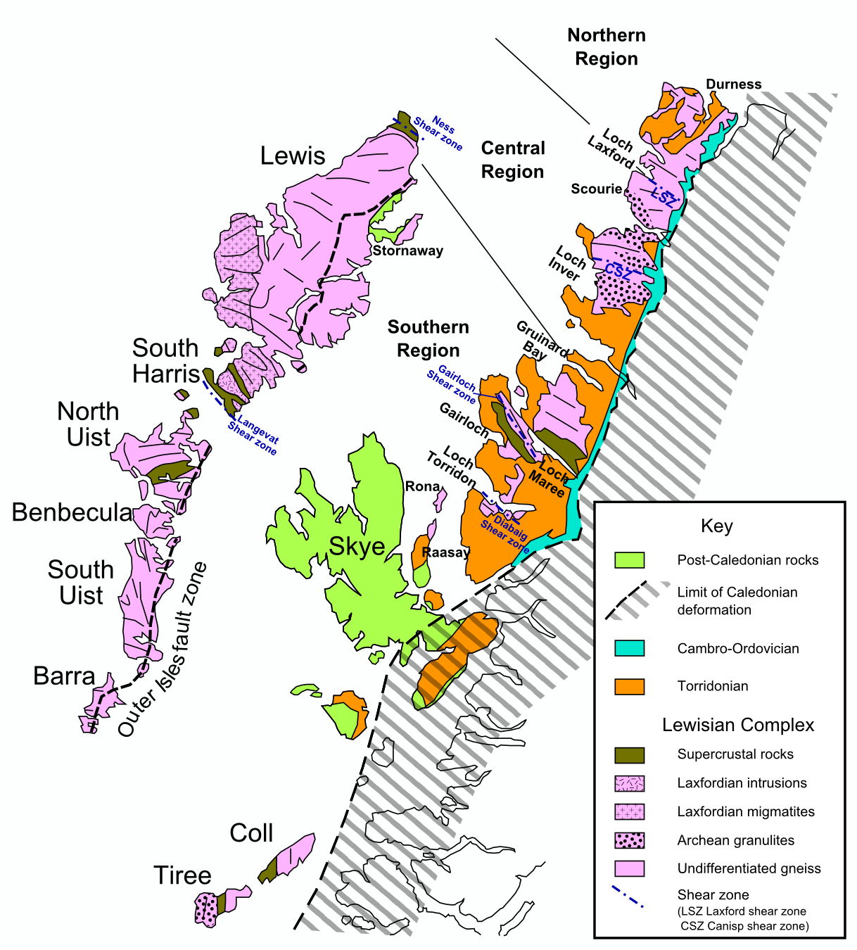
Hebridean Terrane

The Hebridean Terrane is one of the terranes that form part of the Caledonian orogenic belt in northwest Scotland. Its boundary with the neighbouring Northern...

Nearby Amenities

Located within 500m of 57.695276,-6.2979284
Turning Circle
Source: survey
Lat/Long: 57.6942893/-6.3044255
Ford: yes
Note: estimated; please move to correct position and change to correct type (bridge, culvert, ford?)
Lat/Long: 57.6909087/-6.2967736
Turning Circle
Lat/Long: 57.6952036/-6.3018637
Port Gobhlaig
Place: locality
Lat/Long: 57.6924793/-6.3034838
Ford: yes
Note: estimated; please move to correct position and change to correct type (bridge, culvert, ford?)
Lat/Long: 57.6913665/-6.2951135
Clifeag
Place: locality
Lat/Long: 57.6933961/-6.3041675
An Laman
Natural: cape
Lat/Long: 57.6944139/-6.2971535
Lower Aird
Place: isolated_dwelling
Lat/Long: 57.6944698/-6.3023034
Aird House
Place: isolated_dwelling
Lat/Long: 57.6954101/-6.30413
Barrier: kissing_gate
Foot: yes
Lat/Long: 57.6914192/-6.2948385
The data included in this document is from www.openstreetmap.org. The data is made available under ODbL.

Have you been to Slochd a' Mhadaidh?

Leave your review of Slochd a' Mhadaidh below (or comments, questions and feedback).