Rubha na Tràighe Bàine

Coastal Feature, Headland, Point in Argyllshire

Scotland

Rubha na Tràighe Bàine

Coastline of Islay With Am Meall in the background.
Coastline of Islay Credit: Andrew Abbott

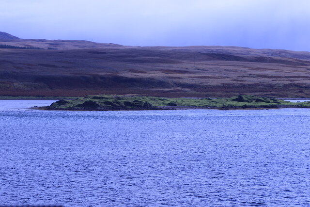
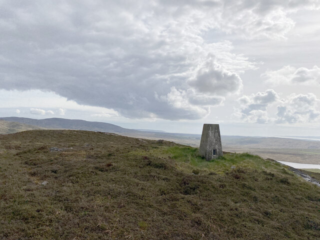
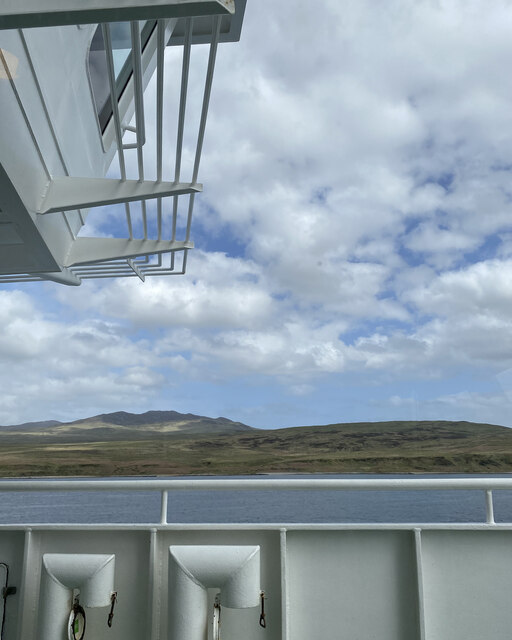
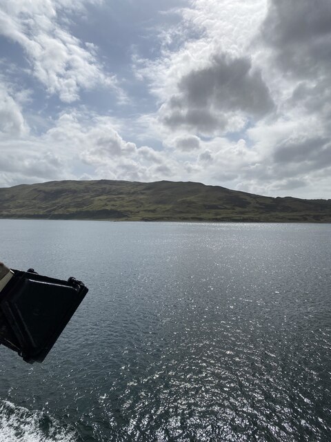
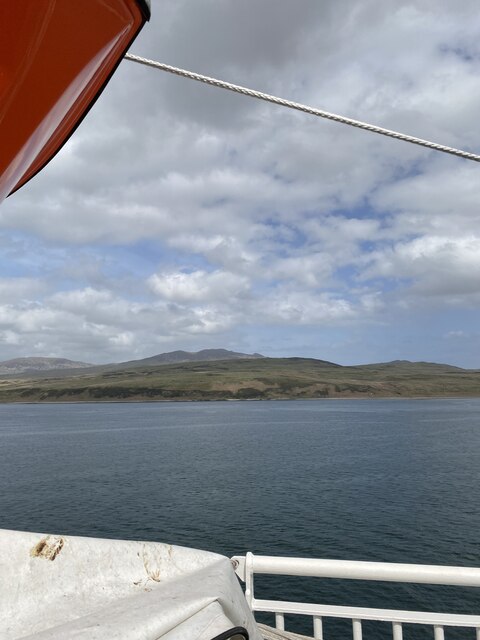
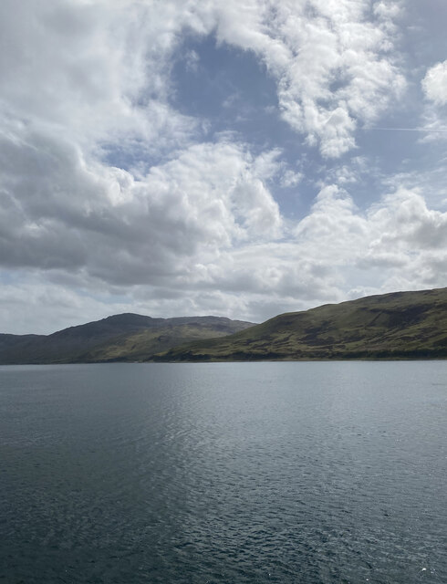
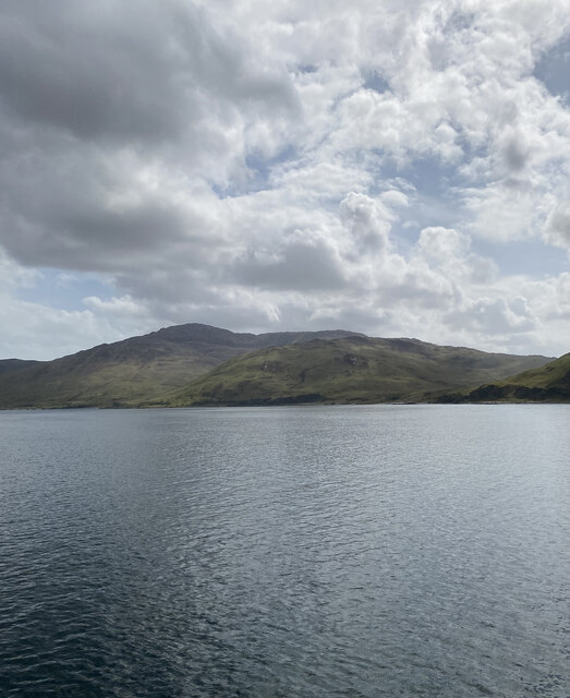
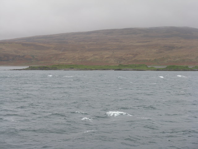
Rubha na Tràighe Bàine is a prominent coastal feature located in Argyllshire, Scotland. This headland, also known as the Point of the White Strand, juts out into the Atlantic Ocean, offering breathtaking views of the surrounding landscape.

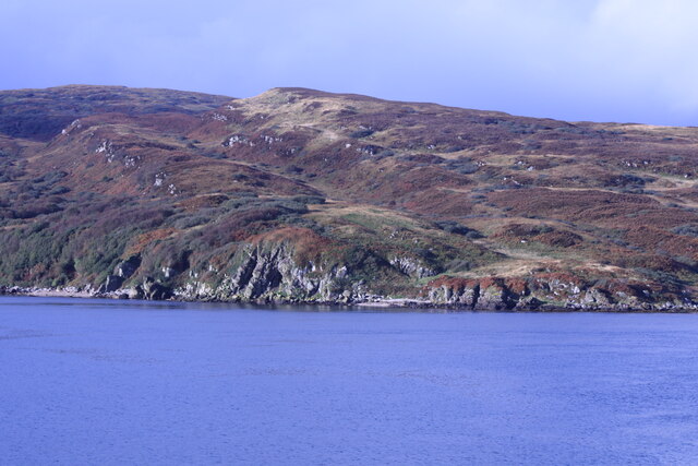
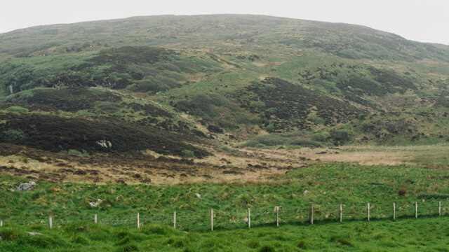
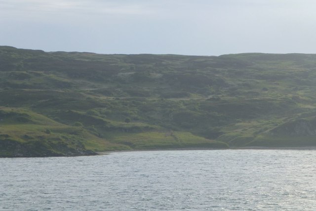
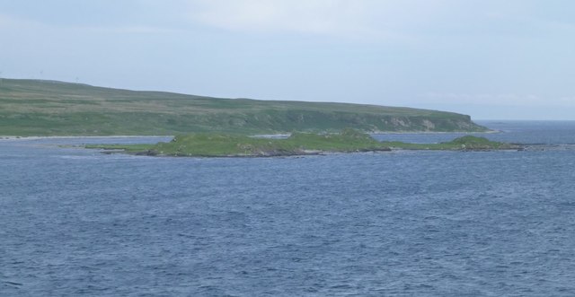
The headland is characterized by its rugged and rocky terrain, with steep cliffs that descend into the sea below. These cliffs provide nesting sites for various seabirds, including gannets and puffins, making it a popular spot for birdwatchers and nature enthusiasts. The area is also home to a diverse range of plant species, such as heather and sea thrift, adding a splash of vibrant color to the coastal landscape.

Rubha na Tràighe Bàine offers visitors a chance to immerse themselves in the natural beauty of the Scottish coastline. The crashing waves and the sound of seagulls create a serene and tranquil atmosphere, perfect for those seeking a peaceful retreat or a leisurely stroll along the shoreline. Fishing is also a common activity in the area, with locals and tourists alike trying their luck in the abundant waters.

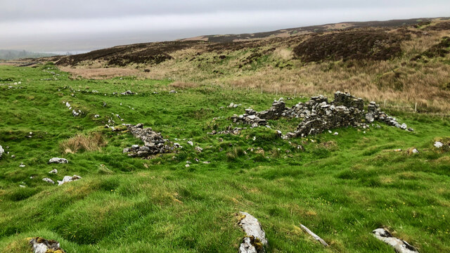
In addition to its natural beauty, the headland holds historical significance. Ruins of an ancient fort can be found on the headland, serving as a reminder of the area's rich past. The fort is believed to have been built by the Picts, an ancient Celtic people, and offers a glimpse into the region's ancient history.

Overall, Rubha na Tràighe Bàine is a captivating coastal feature that combines stunning natural scenery with a rich cultural heritage, making it a must-visit destination for anyone exploring the Argyllshire region of Scotland.

If you have any feedback on the listing, please let us know in the comments section below.

Rubha na Tràighe Bàine Images

Images are sourced within 2km of 55.814061/-6.1037893 or Grid Reference NR4365. Thanks to Geograph Open Source API. All images are credited.

Coastline of Islay With Am Meall in the background.
Coastline of Islay
With Am Meall in the background.
Glas Eilean From the MV Finlaggan.
Glas Eilean
From the MV Finlaggan.
Kilslevan deserted village The remains of deserted houses and settlements are common throughout the whole of Scotland, Islay is no exception.

Kilslevan seems to have once been a township of at least eight longhouses, and several other buildings, enclosures and two corn-drying kilns although these are hard to discern under the grass and moss. There are the ruins of a rudimentary chapel nearby. Close by too, is an old lead mine, although it is not clear if this was related to the village.

Its Gaelic name is Cill Sléibleainn meaning St. Slevan’s Church.

The village was abandoned in the later half of 19th century. One local source refers to a claim that it was “a plague village”. Perhaps not ‘the’ plague but an epidemic of some sort may well have reduced the population for it to become unsustainable

We are fortunate that the 1836 Islay Tenants Rental List has been transcribed and made available online Under Kilslevan, seven tenants are listed :—

Ronald McDougall
Alexander Campbell
Archibald Currie (Black)
Archibald Currie (fair)
Archibald McDougall
Alexander Currie
Hugh Currie
Another source gives the population as 67 in the 1841 census, and 55 in the 1851. There must have been big multi-generational families in those days. Abandonment must have taken place sometime in the following decades.

For references see my blog <span class="nowrap"><a title="http://www.fhithich.uk/?p=28118" rel="nofollow ugc noopener" href="http://www.fhithich.uk/?p=28118">Link</a><img style="margin-left:2px;" alt="External link" title="External link - shift click to open in new window" src="https://s1.geograph.org.uk/img/external.png" width="10" height="10"/></span>
Kilslevan deserted village
The remains of deserted houses and settlements are common throughout the whole of Scotland, Islay is no exception. Kilslevan seems to have once been a township of at least eight longhouses, and several other buildings, enclosures and two corn-drying kilns although these are hard to discern under the grass and moss. There are the ruins of a rudimentary chapel nearby. Close by too, is an old lead mine, although it is not clear if this was related to the village. Its Gaelic name is Cill Sléibleainn meaning St. Slevan’s Church. The village was abandoned in the later half of 19th century. One local source refers to a claim that it was “a plague village”. Perhaps not ‘the’ plague but an epidemic of some sort may well have reduced the population for it to become unsustainable We are fortunate that the 1836 Islay Tenants Rental List has been transcribed and made available online Under Kilslevan, seven tenants are listed :— Ronald McDougall Alexander Campbell Archibald Currie (Black) Archibald Currie (fair) Archibald McDougall Alexander Currie Hugh Currie Another source gives the population as 67 in the 1841 census, and 55 in the 1851. There must have been big multi-generational families in those days. Abandonment must have taken place sometime in the following decades. For references see my blog LinkExternal link
Dùn Bhoraraic
Dùn Bhoraraic
Jura from Beinn Dubh
Beinn Dubh Trig Point Flush Bracket S9002
Views to Jura from ferry
Views to Islay from ferry
Islay from sound of Islay
Glas Eilean by Jura A low isle by Jura consisting of Permian lava largely olivine-basalt.
Glas Eilean by Jura
A low isle by Jura consisting of Permian lava largely olivine-basalt.
Fionn-phort From the ferry from Kennacraig to Port Askaig.
Fionn-phort
From the ferry from Kennacraig to Port Askaig.
Glas Eilean Off the south west coast of Jura.
Glas Eilean
Off the south west coast of Jura.
Glas Eilean in Sound of Islay Viewed from the Kennacraig ferry heading to Port Askaig.
Glas Eilean in Sound of Islay
Viewed from the Kennacraig ferry heading to Port Askaig.
Glas Eilean A rocky island just off the Isle of Jura, seen from the ferry to Port Askaig.
Glas Eilean
A rocky island just off the Isle of Jura, seen from the ferry to Port Askaig.
Glas Eilean The northern, grassier, end of this rocky islet just off the coast of Jura.
Glas Eilean
The northern, grassier, end of this rocky islet just off the coast of Jura.
Coast of Islay around Fionn-phort
Show me another place!

Rubha na Tràighe Bàine is located at Grid Ref: NR4365 (Lat: 55.814061, Lng: -6.1037893)

Unitary Authority: Argyll and Bute

Police Authority: Argyll and West Dunbartonshire

What 3 Words

///cable.narrowest.sandals. Near Ballygrant, Argyll & Bute

Related Wikis

A846 road

The A846 road is one of the two principal roads of Islay in the Inner Hebrides off the west coast of mainland Scotland and the only 'A' road on the neighbouring...

Dunlossit House

Dunlossit House is a Category C listed country house near Port Askaig, Islay in the county of Argyll, in western Scotland.. == History and architecture... ==

Ballygrant

Ballygrant (Scottish Gaelic: Baile a' Ghràna) is a small village on the Inner Hebrides island of Islay of the western coast of Scotland. The village is...

Port Askaig

Port Askaig (Scottish Gaelic: Port Asgaig) is a port village on the east coast of the island of Islay, in Scotland. The village lies on the Sound of Islay...

Sound of Islay

The Sound of Islay (Scottish Gaelic: Caol Ìle) is a narrow strait between the islands of Islay and Jura off the west coast of Scotland. It is about 30...

Feolin

Feolin (also known as Feolin Ferry) is a slipway on the west coast of Jura. MV Eilean Dhiura provides a vehicle and passenger ferry service from Port Askaig...

Dun Guaidhre

Dun Guaidhre, also known as Dùn Ghùaidhre, is an Iron Age fort southwest of Kilmeny, Islay, Scotland. It is protected as a scheduled monument.Local tradition...

Caol Ila distillery

Caol Ila distillery (; Scottish Gaelic: Taigh-staile Chaol Ìle [t̪ʰəˈs̪t̪alə xɯːlˈiːlə], "Sound of Islay Distillery") is a Scotch whisky distillery near...

Nearby Amenities

Located within 500m of 55.814061,-6.1037893
Note: door
Lat/Long: 55.8126331/-6.1060901
Power: pole
Lat/Long: 55.8108134/-6.1076732
Power: pole
Lat/Long: 55.8121425/-6.1056044
Location Transition: yes
Power: pole
Lat/Long: 55.8127061/-6.1047495
The data included in this document is from www.openstreetmap.org. The data is made available under ODbL.

Have you been to Rubha na Tràighe Bàine?

Leave your review of Rubha na Tràighe Bàine below (or comments, questions and feedback).