Carraig Fhada

Coastal Feature, Headland, Point in Argyllshire

Scotland

Carraig Fhada

Port na Seilich From the MV Finlaggan.
Port na Seilich Credit: Andrew Abbott

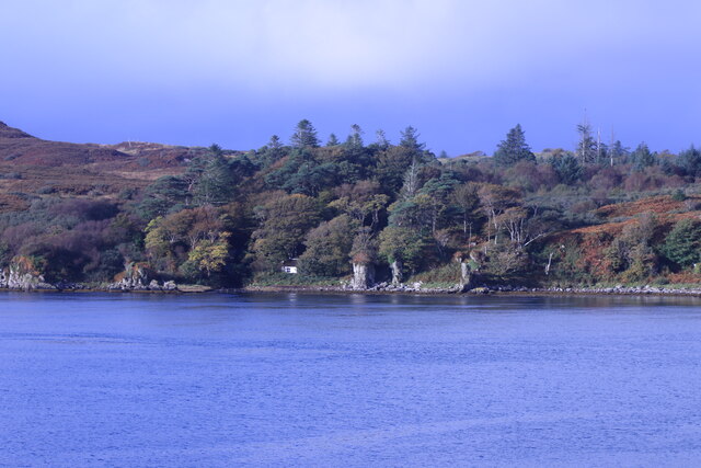
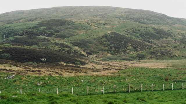
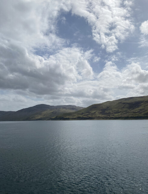
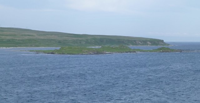
Carraig Fhada is a prominent coastal feature located in Argyllshire, Scotland. It is a captivating headland that juts out into the Atlantic Ocean, forming a distinctive point along the rugged coastline. The name "Carraig Fhada" translates to "long rock" in Gaelic, which aptly describes the elongated shape of the headland.

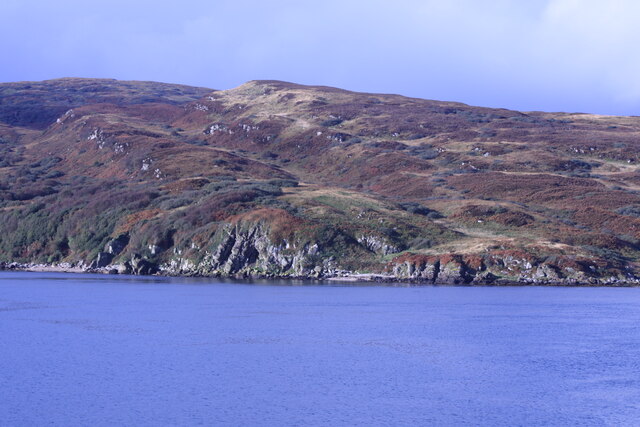
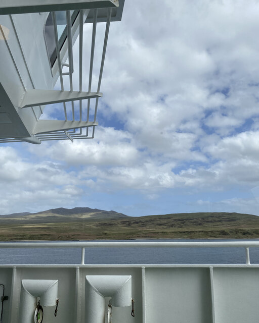
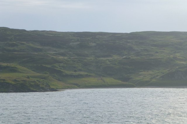
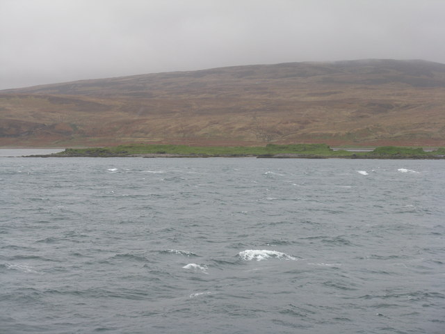
Situated in a remote and unspoiled area, Carraig Fhada offers breathtaking views of the surrounding landscape. The headland is characterized by towering cliffs that drop dramatically into the sea, creating a stunning backdrop against the crashing waves. These cliffs provide nesting sites for a variety of seabirds, including puffins, guillemots, and razorbills, making it a popular spot for birdwatchers.

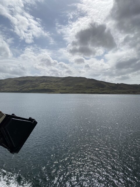
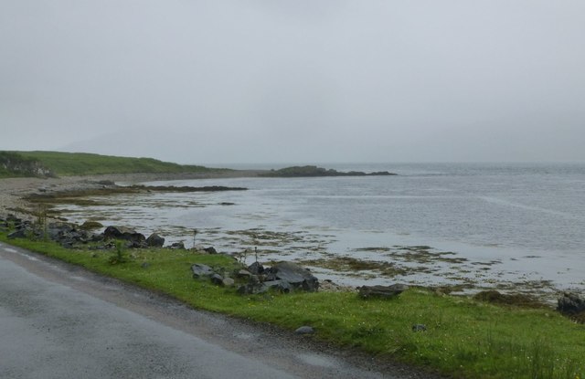
Carraig Fhada is also home to a diverse range of marine life. The surrounding waters are teeming with fish, and seals can often be spotted basking on the rocks or swimming close to the shore. The headland's rocky beaches are a treasure trove for beachcombers, as they are scattered with interesting shells, pebbles, and other marine artifacts.

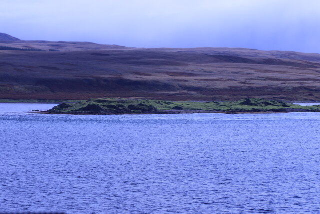
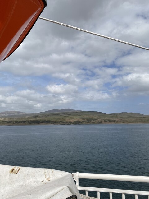
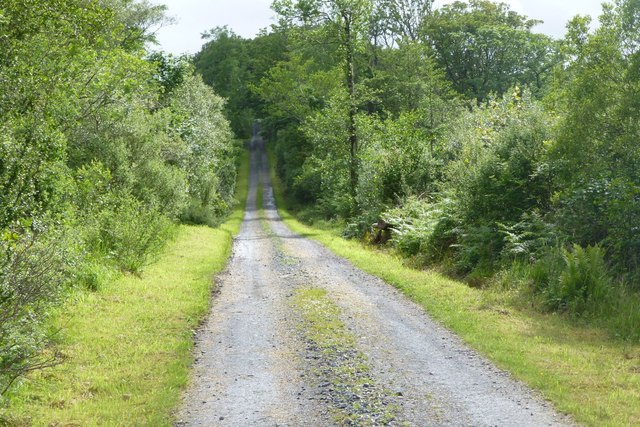
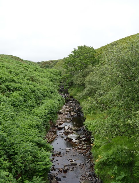
Access to Carraig Fhada is relatively easy, with a well-maintained footpath leading from the nearby village. The headland is a favored spot for hikers and nature enthusiasts, who can explore the area and enjoy the stunning views along the coastal trail.

Overall, Carraig Fhada is a remarkable coastal feature that showcases the raw beauty of Scotland's coastline. Its majestic cliffs, diverse wildlife, and picturesque surroundings make it a must-visit destination for anyone seeking a true Scottish coastal experience.

If you have any feedback on the listing, please let us know in the comments section below.

Carraig Fhada Images

Images are sourced within 2km of 55.817977/-6.1044896 or Grid Reference NR4265. Thanks to Geograph Open Source API. All images are credited.
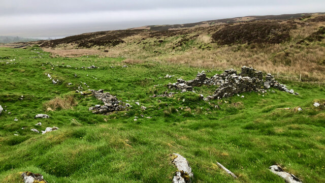
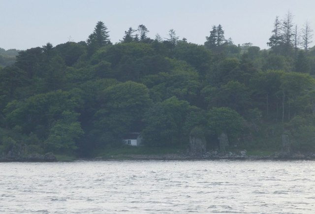
Port na Seilich From the MV Finlaggan.
Port na Seilich
From the MV Finlaggan.
Coastline of Islay With Am Meall in the background.
Coastline of Islay
With Am Meall in the background.
Glas Eilean From the MV Finlaggan.
Glas Eilean
From the MV Finlaggan.
Building (Period Unassigned) Not sure is recorded for this pair of ruins. For further info. see Canmore.org.uk. Islay, Kilslevan | Canmore. Available online at: <span class="nowrap"><a title="https://canmore.org.uk/site/155645/islay-kilslevan" rel="nofollow ugc noopener" href="https://canmore.org.uk/site/155645/islay-kilslevan">Link</a><img style="margin-left:2px;" alt="External link" title="External link - shift click to open in new window" src="https://s1.geograph.org.uk/img/external.png" width="10" height="10"/></span> [Accessed 29 May 2022].
Building (Period Unassigned)
Not sure is recorded for this pair of ruins. For further info. see Canmore.org.uk. Islay, Kilslevan | Canmore. Available online at: LinkExternal link [Accessed 29 May 2022].
Kilslevan deserted village The remains of deserted houses and settlements are common throughout the whole of Scotland, Islay is no exception.

Kilslevan seems to have once been a township of at least eight longhouses, and several other buildings, enclosures and two corn-drying kilns although these are hard to discern under the grass and moss. There are the ruins of a rudimentary chapel nearby. Close by too, is an old lead mine, although it is not clear if this was related to the village.

Its Gaelic name is Cill Sléibleainn meaning St. Slevan’s Church.

The village was abandoned in the later half of 19th century. One local source refers to a claim that it was “a plague village”. Perhaps not ‘the’ plague but an epidemic of some sort may well have reduced the population for it to become unsustainable

We are fortunate that the 1836 Islay Tenants Rental List has been transcribed and made available online Under Kilslevan, seven tenants are listed :—

Ronald McDougall
Alexander Campbell
Archibald Currie (Black)
Archibald Currie (fair)
Archibald McDougall
Alexander Currie
Hugh Currie
Another source gives the population as 67 in the 1841 census, and 55 in the 1851. There must have been big multi-generational families in those days. Abandonment must have taken place sometime in the following decades.

For references see my blog <span class="nowrap"><a title="http://www.fhithich.uk/?p=28118" rel="nofollow ugc noopener" href="http://www.fhithich.uk/?p=28118">Link</a><img style="margin-left:2px;" alt="External link" title="External link - shift click to open in new window" src="https://s1.geograph.org.uk/img/external.png" width="10" height="10"/></span>
Kilslevan deserted village
The remains of deserted houses and settlements are common throughout the whole of Scotland, Islay is no exception. Kilslevan seems to have once been a township of at least eight longhouses, and several other buildings, enclosures and two corn-drying kilns although these are hard to discern under the grass and moss. There are the ruins of a rudimentary chapel nearby. Close by too, is an old lead mine, although it is not clear if this was related to the village. Its Gaelic name is Cill Sléibleainn meaning St. Slevan’s Church. The village was abandoned in the later half of 19th century. One local source refers to a claim that it was “a plague village”. Perhaps not ‘the’ plague but an epidemic of some sort may well have reduced the population for it to become unsustainable We are fortunate that the 1836 Islay Tenants Rental List has been transcribed and made available online Under Kilslevan, seven tenants are listed :— Ronald McDougall Alexander Campbell Archibald Currie (Black) Archibald Currie (fair) Archibald McDougall Alexander Currie Hugh Currie Another source gives the population as 67 in the 1841 census, and 55 in the 1851. There must have been big multi-generational families in those days. Abandonment must have taken place sometime in the following decades. For references see my blog LinkExternal link
Dùn Bhoraraic
Dùn Bhoraraic
Views to Jura from ferry
Views to Islay from ferry
Track through the woods  West of Loch Allan.
Track through the woods
West of Loch Allan.
Fionn-phort From the ferry from Kennacraig to Port Askaig.
Fionn-phort
From the ferry from Kennacraig to Port Askaig.
Rubha Port an t-Seilich Where the waters from Loch Allan enter the Sound of Islay.
For a view in better light see <a title="https://www.geograph.org.uk/photo/15478" href="https://www.geograph.org.uk/photo/15478">Link</a>
Rubha Port an t-Seilich
Where the waters from Loch Allan enter the Sound of Islay. For a view in better light see Link
Glas Eilean in Sound of Islay Viewed from the Kennacraig ferry heading to Port Askaig.
Glas Eilean in Sound of Islay
Viewed from the Kennacraig ferry heading to Port Askaig.
Bay leading up to Carragh an t-Sruith On a wet day on Jura!
Bay leading up to Carragh an t-Sruith
On a wet day on Jura!
Glas Eilean The northern, grassier, end of this rocky islet just off the coast of Jura.
Glas Eilean
The northern, grassier, end of this rocky islet just off the coast of Jura.
Abhainn an Daimh-sgeir A small burn and gorge about to enter the Sound of Islay (behind photographer).
Abhainn an Daimh-sgeir
A small burn and gorge about to enter the Sound of Islay (behind photographer).
Show me another place!

Carraig Fhada is located at Grid Ref: NR4265 (Lat: 55.817977, Lng: -6.1044896)

Unitary Authority: Argyll and Bute

Police Authority: Argyll and West Dunbartonshire

What 3 Words

///pillow.fortnight.pound. Near Ballygrant, Argyll & Bute

Related Wikis

A846 road

The A846 road is one of the two principal roads of Islay in the Inner Hebrides off the west coast of mainland Scotland and the only 'A' road on the neighbouring...

Dunlossit House

Dunlossit House is a Category C listed country house near Port Askaig, Islay in the county of Argyll, in western Scotland.. == History and architecture... ==

Port Askaig

Port Askaig (Scottish Gaelic: Port Asgaig) is a port village on the east coast of the island of Islay, in Scotland. The village lies on the Sound of Islay...

Ballygrant

Ballygrant (Scottish Gaelic: Baile a' Ghràna) is a small village on the Inner Hebrides island of Islay of the western coast of Scotland. The village is...

Sound of Islay

The Sound of Islay (Scottish Gaelic: Caol Ìle) is a narrow strait between the islands of Islay and Jura off the west coast of Scotland. It is about 30...

Feolin

Feolin (also known as Feolin Ferry) is a slipway on the west coast of Jura. MV Eilean Dhiura provides a vehicle and passenger ferry service from Port Askaig...

Caol Ila distillery

Caol Ila distillery (; Scottish Gaelic: Taigh-staile Chaol Ìle [t̪ʰəˈs̪t̪alə xɯːlˈiːlə], "Sound of Islay Distillery") is a Scotch whisky distillery near...

Dun Guaidhre

Dun Guaidhre, also known as Dùn Ghùaidhre, is an Iron Age fort southwest of Kilmeny, Islay, Scotland. It is protected as a scheduled monument.Local tradition...

Have you been to Carraig Fhada?

Leave your review of Carraig Fhada below (or comments, questions and feedback).