Sròn Lionta

Coastal Feature, Headland, Point in Ross-shire

Scotland

Sròn Lionta

Eilean an Taighe “The island with the house” in the Shiant Islands
Eilean an Taighe Credit: Tim Ball

Sròn Lionta is a prominent coastal feature located in Ross-shire, Scotland. This headland, also known as a point, is situated on the eastern coast of the Scottish Highlands, overlooking the North Sea. It is situated approximately 10 miles northeast of the town of Tain.

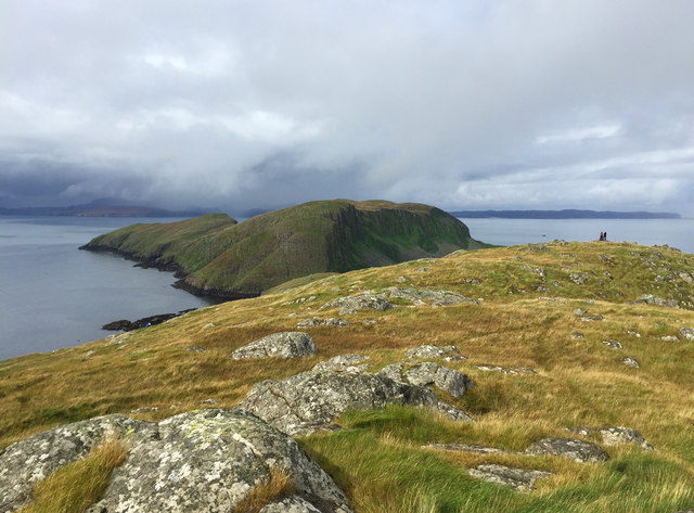
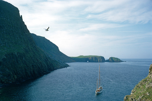
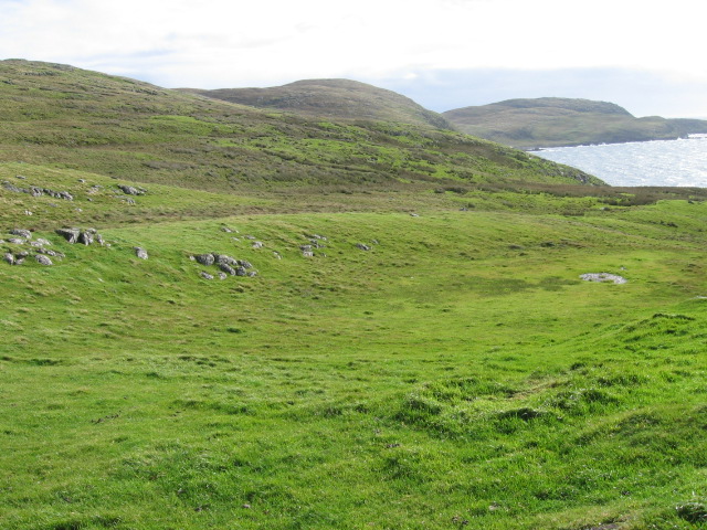
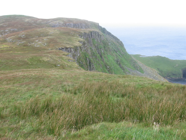
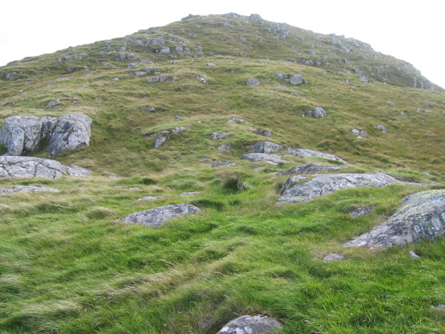
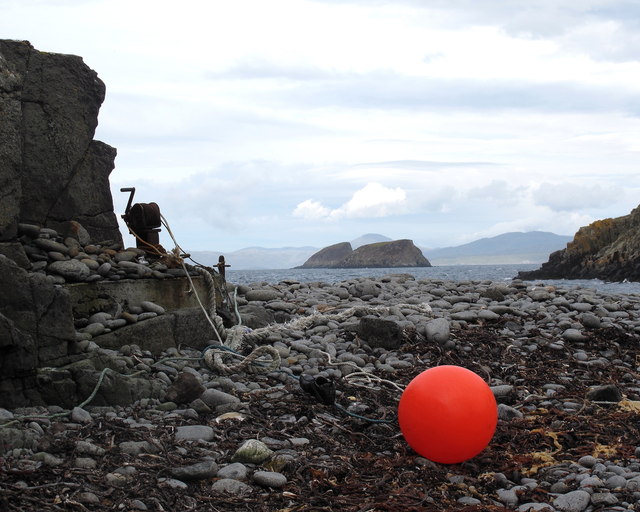
With its rugged cliffs and stunning coastal views, Sròn Lionta is a popular destination for nature enthusiasts and hikers. The headland is characterized by its steep slopes, rocky terrain, and grassy meadows. The cliffs, which rise up to 100 feet in some areas, provide a dramatic backdrop to the crashing waves below.

The headland is home to a diverse range of flora and fauna. Common species found here include seabirds such as kittiwakes, fulmars, and guillemots. The surrounding waters are known to support a variety of marine life, including seals and dolphins, which can often be spotted from the cliffs.

Access to Sròn Lionta is relatively easy, with a well-maintained footpath leading from the nearby village of Hilton. The path offers breathtaking views of the surrounding countryside and leads visitors to the headland's most prominent feature, a natural stone arch known as the Lion's Nose.

Overall, Sròn Lionta is a captivating coastal feature that showcases the rugged beauty of the Scottish Highlands. Its stunning cliffs, diverse wildlife, and picturesque views make it a must-visit destination for nature lovers and those seeking to explore the scenic Scottish coastline.

If you have any feedback on the listing, please let us know in the comments section below.

Sròn Lionta Images

Images are sourced within 2km of 57.895567/-6.3583141 or Grid Reference NG4197. Thanks to Geograph Open Source API. All images are credited.

Eilean an Taighe “The island with the house” in the Shiant Islands
Eilean an Taighe
“The island with the house” in the Shiant Islands
Shiant Islands - Garbh Eilean from Eilean an Taighe The spit of land connecting the two (the usual landing place) is known as Mol Mor. Even in these fairly benign conditions the direction of the weather is clear.

Garbh Eilean is a Marilyn (summit Mullach Buidhe, 162m), though the actual summit is concealed by the nearby ground.
Shiant Islands - Garbh Eilean from Eilean an Taighe
The spit of land connecting the two (the usual landing place) is known as Mol Mor. Even in these fairly benign conditions the direction of the weather is clear. Garbh Eilean is a Marilyn (summit Mullach Buidhe, 162m), though the actual summit is concealed by the nearby ground.
Bidean a' Roimh A point of land jutting eastwards from Garbh Eilean in the Shiants.
Bidean a' Roimh
A point of land jutting eastwards from Garbh Eilean in the Shiants.
Shiant Islands A view from close to the highest point of Eilean an Taighe, looking to Garbh Eilean to the north. The two islands are connected by a shingle bar.
Shiant Islands
A view from close to the highest point of Eilean an Taighe, looking to Garbh Eilean to the north. The two islands are connected by a shingle bar.
South end of Eilean an Taighe Looking from just south of the summit of the island to the southernmost tip of the Shiant Islands.
South end of Eilean an Taighe
Looking from just south of the summit of the island to the southernmost tip of the Shiant Islands.
The isthmus between Eilean an Taighe and Eilean Garbh A shingle bar that connects two of the three main islands of the Shiants. It also provides the easiest landing point on the group.
The isthmus between Eilean an Taighe and Eilean Garbh
A shingle bar that connects two of the three main islands of the Shiants. It also provides the easiest landing point on the group.
Coast of the Shiant Islands The yacht that brought me here and which I helped crew for ten days is anchored in the bay. The yacht is the 14-m Ismana built in 1951.  See <span class="nowrap"><a title="http://www.sandemanyachtcompany.co.uk/yacht/272/laurent-giles-47-ft-yawl-1951" rel="nofollow ugc noopener" href="http://www.sandemanyachtcompany.co.uk/yacht/272/laurent-giles-47-ft-yawl-1951">Link</a><img style="margin-left:2px;" alt="External link" title="External link - shift click to open in new window" src="https://s1.geograph.org.uk/img/external.png" width="10" height="10"/></span>  The natural arch is marked on the OS map.
Coast of the Shiant Islands
The yacht that brought me here and which I helped crew for ten days is anchored in the bay. The yacht is the 14-m Ismana built in 1951. See LinkExternal link The natural arch is marked on the OS map.
Eilean an Taighe, Shiant Islands In the middle distance is a cairn, seen in close up here <a href="https://www.geograph.org.uk/photo/3101336">NG4197 : Cairn overlooking the Sound of Shiant</a>.
Eilean an Taighe, Shiant Islands
In the middle distance is a cairn, seen in close up here NG4197 : Cairn overlooking the Sound of Shiant.
Narrow beach connecting to Eilean an Taighe
Eilean an Taighe coastline
Near Rubha Stocanis
Near Rubha Stocanis
Towards Carnach Mhòr
Old field wall at Glaic na Crotha
Towards highest point on Eilean an Taighe
Ship passing the Shiant Islands (Na h-Eileanan Mora) Taken from the ferry from Uig to Tarbert.
Ship passing the Shiant Islands (Na h-Eileanan Mora)
Taken from the ferry from Uig to Tarbert.
The Shiants from Scalpay Bridge Taken early one August morning looking out to the Shiant Isles as the sun rises over eastern Harris. Two fishing boats make their way out to sea.
I have taken an arbitrary square on Garbh Eilean (one of the Shiants) as the subject position for this shot.
The Shiants from Scalpay Bridge
Taken early one August morning looking out to the Shiant Isles as the sun rises over eastern Harris. Two fishing boats make their way out to sea. I have taken an arbitrary square on Garbh Eilean (one of the Shiants) as the subject position for this shot.
Pebble isthmus betwixt House Isle and Garbh Eilean This very narrow pebble beach is the Shiant's best landing point.
Garbh Eilean = Rough isle in Gaelic
Pebble isthmus betwixt House Isle and Garbh Eilean
This very narrow pebble beach is the Shiant's best landing point. Garbh Eilean = Rough isle in Gaelic
Old winding gear & beached float The pebbled isthmus the landing point on the Shiant main Isles.
Overlooking the Sound of Shiant
Old winding gear & beached float
The pebbled isthmus the landing point on the Shiant main Isles. Overlooking the Sound of Shiant
Show me another place!

Sròn Lionta is located at Grid Ref: NG4197 (Lat: 57.895567, Lng: -6.3583141)

Unitary Authority: Na h-Eileanan an Iar

Police Authority: Highlands and Islands

What 3 Words

///lame.rules.anguished. Near Tarbert, Na h-Eileanan Siar

Related Wikis

Shiant Islands

The Shiant Islands (; Scottish Gaelic: Na h-Eileanan Mòra [nə ˈhelanən ˈmoːɾə] or Na h-Eileanan Seunta [nə ˈhelanən ˈʃiant̪ə] ) or Shiant Isles are a privately...

Eilean an Taighe

"Eilean an Taighe", or "Eilean Taigh" is a fairly common island nameEilean an T(a)ighe, meaning "House Island" (lit. "Island of the House"), is one of...

Garbh Eilean, Shiant Islands

Garbh Eilean (Scottish Gaelic Rough Isle) is one of the Shiant Islands at the south end of the Minch on the west coast of Scotland. == Geology == In geological...

Eilean Mhuire

Eilean Mhuire (meaning "Virgin Mary's island") is the most easterly of the Shiant Islands in the Outer Hebrides. Once populated, Eilean Mhuire is now used...

Nearby Amenities

Located within 500m of 57.895567,-6.3583141
Entrance: yes
Lat/Long: 57.8931098/-6.3579056
The data included in this document is from www.openstreetmap.org. The data is made available under ODbL.

Have you been to Sròn Lionta?

Leave your review of Sròn Lionta below (or comments, questions and feedback).