Laimhrig

Coastal Feature, Headland, Point in Ross-shire

Scotland

Laimhrig

Shore at  Cuidhir Rocky shoreline backed by equally rocky hills at the Cuidhir road end.
Shore at Cuidhir Credit: Colin Smith

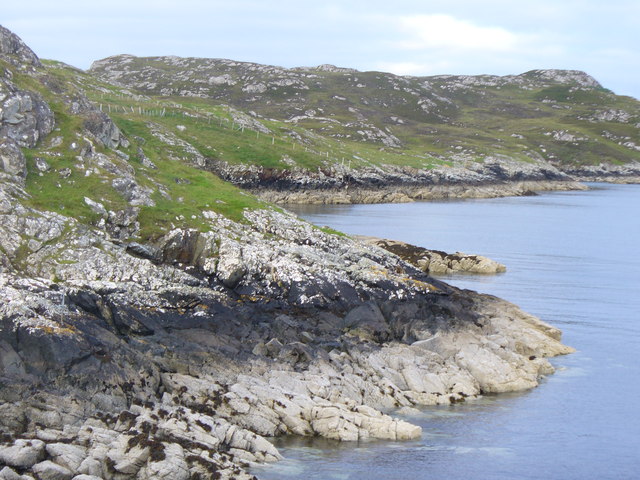
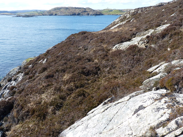
Laimhrig is a prominent coastal feature located in Ross-shire, Scotland. It is a headland that juts out into the North Sea, forming a distinctive point along the coastline. Laimhrig is known for its dramatic cliffs, which rise steeply from the sea, providing breathtaking views of the surrounding landscape.

The headland is composed of rugged rock formations, primarily consisting of ancient sandstone and shale. These geological features have been shaped by centuries of erosion from the crashing waves, resulting in striking cliffs and sea stacks. The exposed rocks also reveal layers of sediment, offering valuable insights into the region's geological history.

Laimhrig is a haven for wildlife, with numerous seabirds nesting on its cliffs, including puffins, guillemots, and razorbills. It is also a popular spot for birdwatching, as migratory species often pass through the area. Seal colonies can often be spotted lounging on nearby rocks or swimming in the surrounding waters.

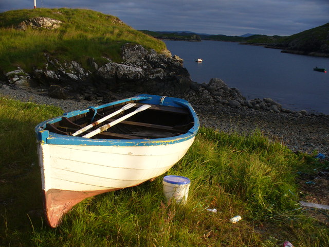
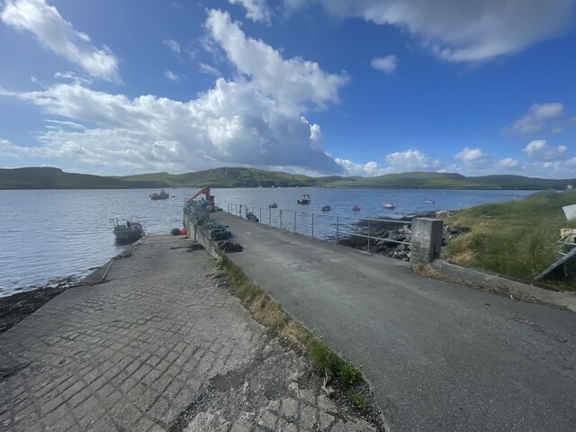
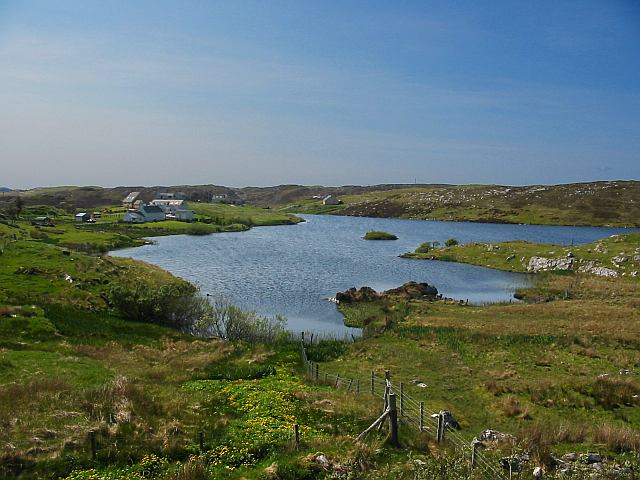
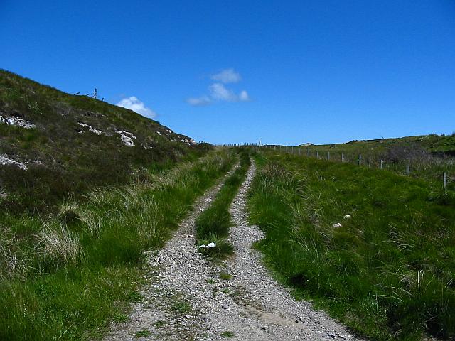
The headland is easily accessible by foot, with several walking trails leading to its summit. From there, visitors can enjoy panoramic views of the North Sea, the nearby coastline, and the surrounding countryside. The area surrounding Laimhrig is rich in natural beauty, with rolling hills, heather-covered moorland, and picturesque coastal villages.

Laimhrig is a popular destination for outdoor enthusiasts, offering opportunities for hiking, photography, and exploration. Its scenic beauty and diverse wildlife make it an ideal location for nature lovers and those seeking a tranquil escape by the sea.

If you have any feedback on the listing, please let us know in the comments section below.
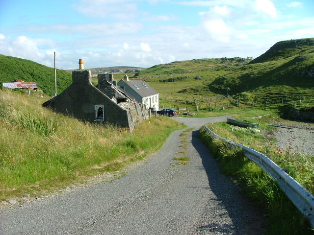
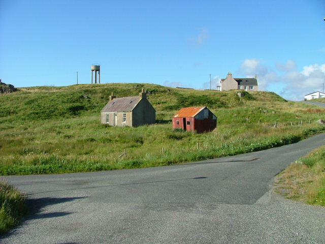
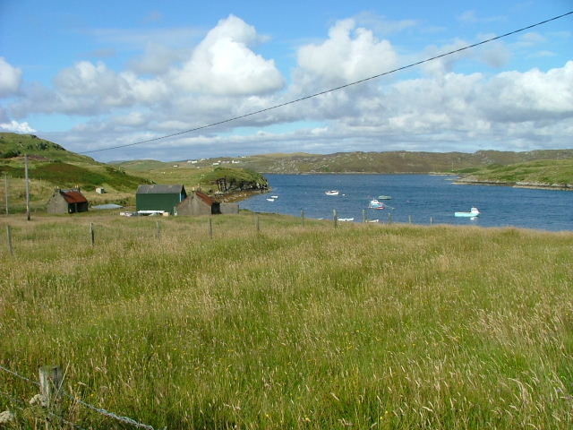
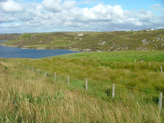
Laimhrig Images

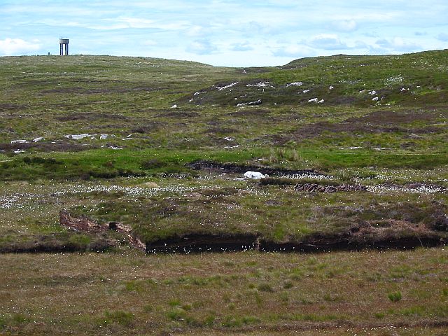
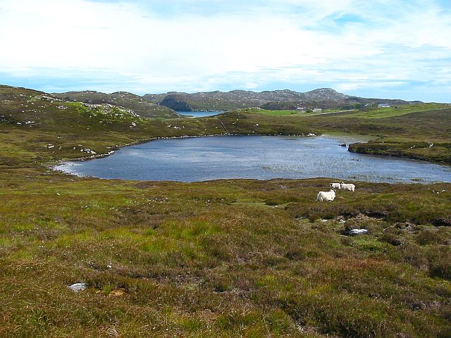
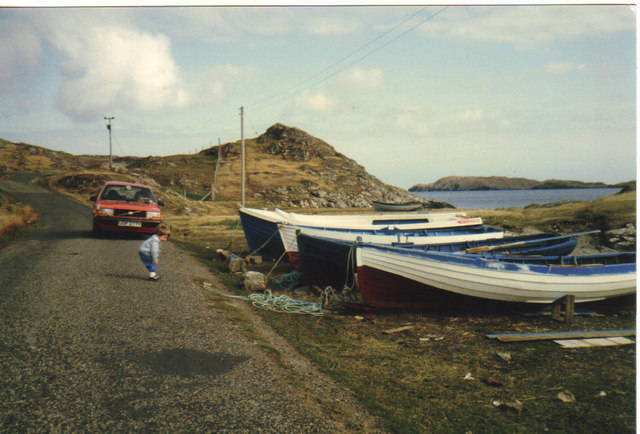
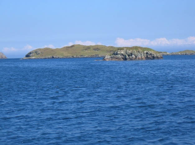
Images are sourced within 2km of 58.137556/-6.4144221 or Grid Reference NB4025. Thanks to Geograph Open Source API. All images are credited.

Shore at  Cuidhir Rocky shoreline backed by equally rocky hills at the Cuidhir road end.
Shore at Cuidhir
Rocky shoreline backed by equally rocky hills at the Cuidhir road end.
Evening at Cuidhir Rowing boat, in the evening sunshine, pulled up onto the grass above the small, rocky cove at Cuidhir.
Evening at Cuidhir
Rowing boat, in the evening sunshine, pulled up onto the grass above the small, rocky cove at Cuidhir.
Grimshader Salmon Farm Marine Harvest - Arachas Bhratan Griomshadair. Sea loch industry on the shores of Loch Griomsiadair.
Grimshader Salmon Farm
Marine Harvest - Arachas Bhratan Griomshadair. Sea loch industry on the shores of Loch Griomsiadair.
Loch Griomsiadair Yacht and lobster boat moored in the sheltered sea loch at Grimshader which is also used for salmon farming.
Loch Griomsiadair
Yacht and lobster boat moored in the sheltered sea loch at Grimshader which is also used for salmon farming.
Coastline
Coastline
Crosbost Jetty Geocaching is a type of global treasure hunt of people looking for caches, or hidden stashes of objects. Geocaching may also be described as a series of hide-and-seek games, where hiders provide online clues for seekers. Seekers use global positioning system (GPS) devices to find hidden caches
Crosbost Jetty
Geocaching is a type of global treasure hunt of people looking for caches, or hidden stashes of objects. Geocaching may also be described as a series of hide-and-seek games, where hiders provide online clues for seekers. Seekers use global positioning system (GPS) devices to find hidden caches
Loch Grimshader Ordnance survey maps show two Loch Grimshaders! One is the sea loch as shown on  <a href="https://www.geograph.org.uk/gridref/NB3925">NB3925</a>; the second is this small freshwater loch in the village of Grimshader. It seems likely that the ordnance survey got it wrong many years ago when it first named the sea loch as Loch Grimshader. Its name was originally Loch Hurnavay.

This freshwater loch has a small island in it. Although I have found no archaeological reference to it, I suspect that the island is possibly a crannog, as it has a sunken overgrown interior within a ring of large stones and boulders. The loch is good for brown trout and eels.

The village, Grimshader, takes its name from the Norse, and means Grim's summer pasture.
Loch Grimshader
Ordnance survey maps show two Loch Grimshaders! One is the sea loch as shown on NB3925; the second is this small freshwater loch in the village of Grimshader. It seems likely that the ordnance survey got it wrong many years ago when it first named the sea loch as Loch Grimshader. Its name was originally Loch Hurnavay. This freshwater loch has a small island in it. Although I have found no archaeological reference to it, I suspect that the island is possibly a crannog, as it has a sunken overgrown interior within a ring of large stones and boulders. The loch is good for brown trout and eels. The village, Grimshader, takes its name from the Norse, and means Grim's summer pasture.
Grimshader's 'Peat Road' This track is used by local crofters to reach their flocks grazing on the open moorland, and by some villagers who cut peat for fuel.
Grimshader's 'Peat Road'
This track is used by local crofters to reach their flocks grazing on the open moorland, and by some villagers who cut peat for fuel.
Peat Cuttings, Bog Cotton and Water Tower The peat cuttings just right of centre in this photograph were, until recently, worked by Torcuil MacRath (Torquil MacRae), a Gaelic poet and author of some distinction who died late in 2006. A wonderful character and a good neighbour, it was our privilege and pleasure to count him as a friend during the few years my family and I have lived here. I now work these peat cuttings myself.

While much of the UK has suffered a wet spring and summer in 2007, the weather on the Isle of Lewis has been relatively dry. Perhaps this accounts for the fine crop of bog cotton seen on the moorland this year.

On the horizon is a water tower, no longer used.
Peat Cuttings, Bog Cotton and Water Tower
The peat cuttings just right of centre in this photograph were, until recently, worked by Torcuil MacRath (Torquil MacRae), a Gaelic poet and author of some distinction who died late in 2006. A wonderful character and a good neighbour, it was our privilege and pleasure to count him as a friend during the few years my family and I have lived here. I now work these peat cuttings myself. While much of the UK has suffered a wet spring and summer in 2007, the weather on the Isle of Lewis has been relatively dry. Perhaps this accounts for the fine crop of bog cotton seen on the moorland this year. On the horizon is a water tower, no longer used.
Loch nan Capull Loch nan Capull (the loch of the colt). A reasonably good trout loch.
Loch nan Capull
Loch nan Capull (the loch of the colt). A reasonably good trout loch.
Boats at Cuidhir Loch Leurbost The Islands of Tabhaidh Bheag and Tabhaidh are clearly seen in distance.
Boats at Cuidhir Loch Leurbost
The Islands of Tabhaidh Bheag and Tabhaidh are clearly seen in distance.
Eilean Bhatarsaidh Unnamed Islet in foreground and Stac at Loch Erisort Entrance in distance (left of frame). Collectively these Islands are referred to as Na h-Eileanan Bairclin or Barkin Isles.
Eilean Bhatarsaidh
Unnamed Islet in foreground and Stac at Loch Erisort Entrance in distance (left of frame). Collectively these Islands are referred to as Na h-Eileanan Bairclin or Barkin Isles.
Road end at Crosbost
Old croft buildings at Ranais
Grazing land at Ranais Overlooking Loch Griomsiadar.
Grazing land at Ranais
Overlooking Loch Griomsiadar.
Loch Sgeireach On Aird Raerinis.
Loch Sgeireach
On Aird Raerinis.
Loch Liurboist at Crosbost Small boats at moorings in the sea loch while an ancient boat lies rotting on the grassy shore. View looking south-east to Tannaraidh and The Minch.
Loch Liurboist at Crosbost
Small boats at moorings in the sea loch while an ancient boat lies rotting on the grassy shore. View looking south-east to Tannaraidh and The Minch.
Fish Farming at Crosbost Salmon cages in the sea loch, Loch Liurboist.
Fish Farming at Crosbost
Salmon cages in the sea loch, Loch Liurboist.
Show me another place!

Laimhrig is located at Grid Ref: NB4025 (Lat: 58.137556, Lng: -6.4144221)

Unitary Authority: Na h-Eileanan an Iar

Police Authority: Highlands and Islands

What 3 Words

///dame.zips.thrashed. Near Leurbost, Na h-Eileanan Siar

Related Wikis

Crossbost

Crossbost is a village on the Isle of Lewis in the parish of North Lochs, in the Outer Hebrides, Scotland. It is located approximately ten miles away...

North Lochs

North Lochs, (Scottish Gaelic: Ceann a Tuath nan Loch), an area in eastern Lewis, Outer Hebrides, Scotland, is named for the many lochans (small lochs...

Rainish Eilean Mòr

Rainish Eilean Mòr is an uninhabited island in Loch Orasaigh, north of the village of Leurbost in the area of South Lochs on the Isle of Lewis, Lewis and...

Leurbost

Leurbost (Scottish Gaelic: Liùrbost) is a village on the east coast of the Isle of Lewis in the Outer Hebrides of Scotland. It is approximately 6 miles...

Nearby Amenities

Located within 500m of 58.137556,-6.4144221
Bus Stop
Ranish
Bus: yes
Naptan AtcoCode: 6010731785
Naptan Bearing: SE
Naptan CommonName: Ranish
Naptan Indicator: Bus Shelter
Naptan Landmark: Bus Shelter
Naptan NaptanCode: 94723749
Naptan Street: Bus Shelter
Naptan Verified: no
Public Transport: platform
Source: naptan_import
Lat/Long: 58.1371684/-6.4075687
Ranais
Place: village
Lat/Long: 58.1365862/-6.4081522
Barrier: cattle_grid
Lat/Long: 58.1353699/-6.4094318
Turning Circle
Lat/Long: 58.1356006/-6.4069047
Power: pole
Lat/Long: 58.1356485/-6.4070448
Power: pole
Lat/Long: 58.1359094/-6.4075487
Power: pole
Lat/Long: 58.1361027/-6.4081804
Power: pole
Lat/Long: 58.1363337/-6.4089425
Power: pole
Lat/Long: 58.1365699/-6.4097807
Power: pole
Lat/Long: 58.1369683/-6.4104493
Power: pole
Lat/Long: 58.1371733/-6.4120447
Power: pole
Lat/Long: 58.13734/-6.408811
Power: pole
Lat/Long: 58.1376852/-6.4072943
Power: pole
Lat/Long: 58.1375509/-6.4067203
Power: pole
Lat/Long: 58.1363285/-6.4110958
Power: pole
Lat/Long: 58.1358886/-6.4106288
Power: pole
Lat/Long: 58.1357874/-6.4096529
Power: pole
Lat/Long: 58.1353838/-6.4094759
Power: pole
Lat/Long: 58.1358406/-6.4119808
Power: pole
Lat/Long: 58.1357575/-6.4129149
Power: pole
Lat/Long: 58.1356965/-6.4135344
Power: pole
Lat/Long: 58.1357095/-6.4143038
Power: pole
Lat/Long: 58.1356952/-6.415056
Power: pole
Lat/Long: 58.1356654/-6.4157172
Power: pole
Lat/Long: 58.1356836/-6.4174773
Power: pole
Lat/Long: 58.1356745/-6.418318
Power: pole
Lat/Long: 58.1367918/-6.4225755
Power: pole
Lat/Long: 58.1363337/-6.4210097
Power: pole
Lat/Long: 58.1363441/-6.4192988
Power: pole
Lat/Long: 58.1363415/-6.4174551
Power: pole
Lat/Long: 58.136349/-6.4155618
Power: pole
Lat/Long: 58.1367671/-6.4137556
Power: pole
Lat/Long: 58.1374808/-6.4106706
Power: pole
Lat/Long: 58.1353948/-6.4218582
Power: pole
Lat/Long: 58.1351911/-6.4211011
Power: pole
Lat/Long: 58.1350055/-6.420398
Power: pole
Lat/Long: 58.1352092/-6.4196384
Power: pole
Lat/Long: 58.1354311/-6.4188543
Power: pole
Lat/Long: 58.1357919/-6.4184929
Power: pole
Lat/Long: 58.136041/-6.4188641
Power: pole
Lat/Long: 58.1355811/-6.421533
Power: pole
Lat/Long: 58.1355474/-6.4207513
Loch Griomsiadair
Natural: bay
Lat/Long: 58.1406217/-6.4135266
Power: pole
Lat/Long: 58.1360385/-6.4093456
Power: pole
Lat/Long: 58.1346557/-6.4204893
The data included in this document is from www.openstreetmap.org. The data is made available under ODbL.

Have you been to Laimhrig?

Leave your review of Laimhrig below (or comments, questions and feedback).