Aird Iosal

Coastal Feature, Headland, Point in Ross-shire

Scotland

Aird Iosal

Srianach Head The distant mountains are on mainland Scotland - specifically, Assynt and Coigach.
Srianach Head Credit: Toby Speight

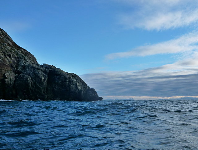
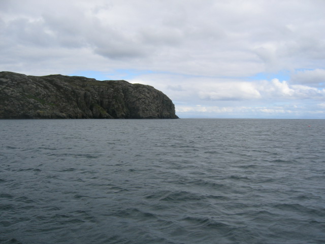
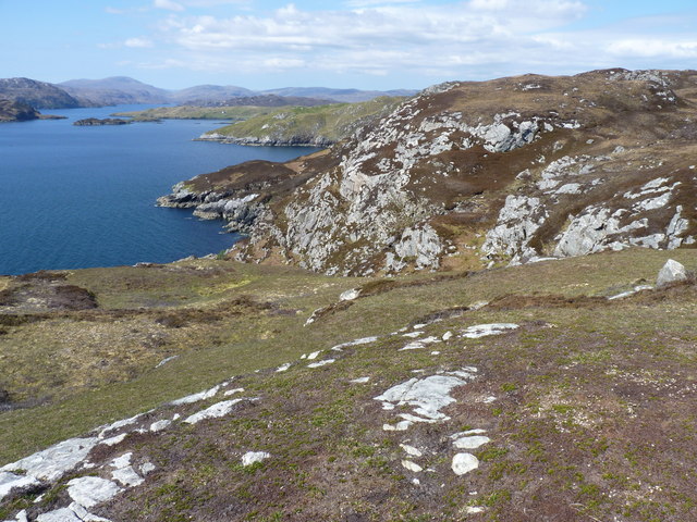
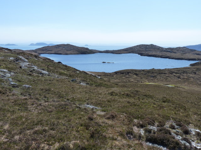
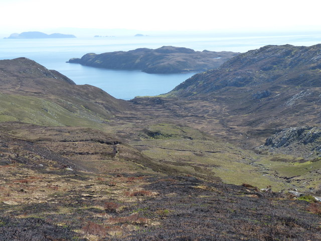
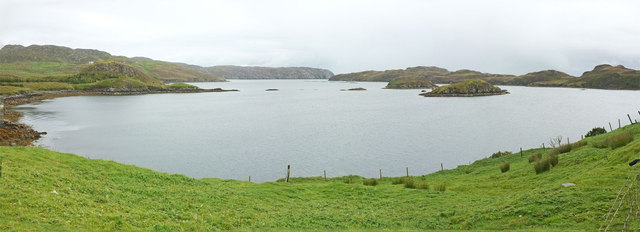
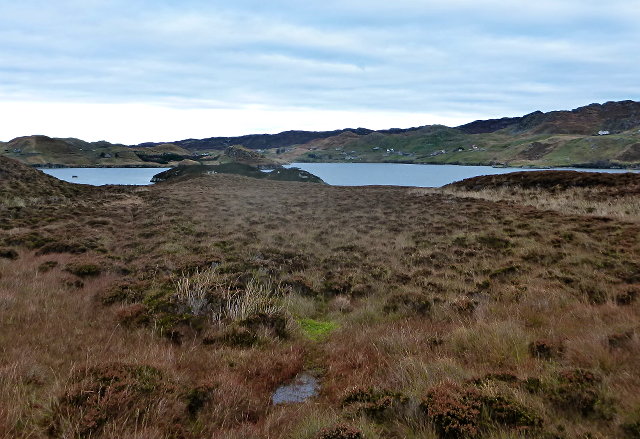
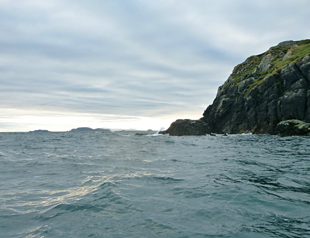
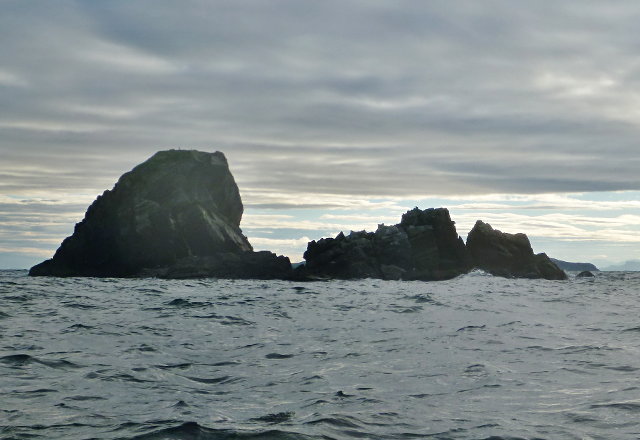
Aird Iosal is a prominent headland located in Ross-shire, Scotland. Situated on the northern coast, it is a notable coastal feature that offers breathtaking views of the surrounding landscape. The headland juts out into the North Sea, providing a dramatic and picturesque backdrop for visitors.

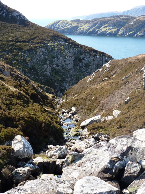
Aird Iosal is characterized by its rugged cliffs, which reach heights of up to 100 meters in some areas. These cliffs are composed of sedimentary rock formations, showcasing layers of different geological eras and providing a unique insight into the region's history. The headland is also home to a variety of flora and fauna, including seabirds such as gannets and puffins, which nest in the cliffs during breeding season.

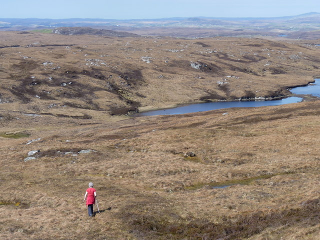
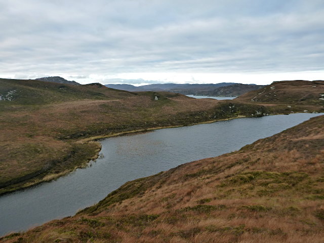
The headland is accessible via a well-maintained coastal path, which allows visitors to explore the area and take in the stunning views. On a clear day, one can see across the North Sea to the Orkney Islands, adding to the allure of this coastal feature. The path also leads to a small, secluded beach nestled within a sheltered cove, providing a tranquil spot for relaxation and picnics.

Aird Iosal is a popular destination for nature enthusiasts, hikers, and birdwatchers. Its remote location and unspoiled natural beauty make it an ideal spot for those seeking solitude and a connection with the outdoors. Whether exploring the cliffs, observing the wildlife, or simply enjoying the panoramic views, Aird Iosal offers a captivating experience for visitors of all ages.

If you have any feedback on the listing, please let us know in the comments section below.

Aird Iosal Images

Images are sourced within 2km of 58.010479/-6.4143905 or Grid Reference NB3910. Thanks to Geograph Open Source API. All images are credited.

Srianach Head The distant mountains are on mainland Scotland - specifically, Assynt and Coigach.
Srianach Head
The distant mountains are on mainland Scotland - specifically, Assynt and Coigach.
Srianach Head Very prominent Headland marking northern side of Loch Shell on the east side of Lewis.
Srianach Head
Very prominent Headland marking northern side of Loch Shell on the east side of Lewis.
Srianach Headland at the mouth of Loch Sealg, Pairc. Seen from Uisinis.
Srianach
Headland at the mouth of Loch Sealg, Pairc. Seen from Uisinis.
Looking North West across Lochan
Moorland with Loch Cartach and the Shiant Islands in the distance
Moorland below Beinn Bhreac
Beinn Bhreac, Lewis With Jim Bloomer and Mat Webster from NW on a sunny late afternoon.

Name: Beinn Bhreac
Hill number: 1584
Height: 191m / 627ft
Area: 24A: Lewis and Nearby Islands
Class: Ma
Grid ref: NB 40680 12104
Summit feature: small cairn
Drop: 160m
Col: 31m  NB334138
Beinn Bhreac, Lewis
With Jim Bloomer and Mat Webster from NW on a sunny late afternoon. Name: Beinn Bhreac Hill number: 1584 Height: 191m / 627ft Area: 24A: Lewis and Nearby Islands Class: Ma Grid ref: NB 40680 12104 Summit feature: small cairn Drop: 160m Col: 31m NB334138
The shoreline looking west into Loch Sealg
Looking down a gully towards Eilean Liubhaird
Moorland with Lochan Tobhta Ruairidh Dhuibh
Looking down Gleann Ceann Eastail with Eilean Liubhaird beyond
Caolas a Tuath A panoramic view down the length of the channel.
Caolas a Tuath
A panoramic view down the length of the channel.
Eilean Liubhaird Eilean Liubhaird is a small island south of Lemreway - the village in the background of this view.
Eilean Liubhaird
Eilean Liubhaird is a small island south of Lemreway - the village in the background of this view.
Leac Reidh This is the eastern extremity of Eilean Liubhaird.
Leac Reidh
This is the eastern extremity of Eilean Liubhaird.
Loch na Buaile This is the largest body of fresh water on Eilean Liubhaird.
Loch na Buaile
This is the largest body of fresh water on Eilean Liubhaird.
Stac a' Bhàigh A small rocky islet just off Eilean Liubhaird.
Stac a' Bhàigh
A small rocky islet just off Eilean Liubhaird.
Stac a' Chomhraig, Isle of Lewis Described in the OS Name Book of 1848-1852 as a small, nearly round conical island which is about 120 feet high and connected to the shore at low water.
Stac a' Chomhraig, Isle of Lewis
Described in the OS Name Book of 1848-1852 as a small, nearly round conical island which is about 120 feet high and connected to the shore at low water.
Summit, Beinn Bhreac Beinn Bhreac, 191m, 160m prominence, is the highest point of a large area of peat covered moorland south of Loch Odhairn in Pairc.
Summit, Beinn Bhreac
Beinn Bhreac, 191m, 160m prominence, is the highest point of a large area of peat covered moorland south of Loch Odhairn in Pairc.
Show me another place!

Aird Iosal is located at Grid Ref: NB3910 (Lat: 58.010479, Lng: -6.4143905)

Unitary Authority: Na h-Eileanan an Iar

Police Authority: Highlands and Islands

What 3 Words

///explored.attic.migrate. Near Leurbost, Na h-Eileanan Siar

Related Wikis

Eilean Liubhaird

Eilean Liubhaird or Eilean Iubhard is an island in the Outer Hebrides, to the east of Lewis. == Geography and geology == The rock is "gneiss bedrock with...

Orinsay

Orinsay (Scottish Gaelic: Orasaigh) is a crofting village on the Isle of Lewis in the district of Pairc, in the Outer Hebrides, Scotland. The settlement...

Stiomrabhaig

Stiomrabhaig is an abandoned crofter's village on the Isle of Lewis in the Outer Hebrides. == History == The United Kingdom Census 1851 shows that the...

Gravir

Gravir (Scottish Gaelic: Grabhair), is a village on the shore of Loch Odhairn (a sea loch) in the Park district of the Isle of Lewis. Gravir is within...

Calbost

Calbost (Scottish Gaelic: Calabost) is a village on the Isle of Lewis in the Outer Hebrides, Scotland. Calbost is within the parish of Lochs, and within...

Park, Lewis

Park (Scottish Gaelic: A' Phàirc), also known as South Lochs, is a huge area of land connected to the rest of Lewis only by a narrow neck between Loch...

Cabharstadh

Cabharstadh or Caversta (Scottish Gaelic: Cabharstaigh) is a village on the Isle of Lewis in the Outer Hebrides, Scotland. Caversta is situated in the...

Nearby Amenities

Located within 500m of 58.010479,-6.4143905
Created By: dmgroom_coastlines
Lat/Long: 58.00859/-6.40732
The data included in this document is from www.openstreetmap.org. The data is made available under ODbL.

Have you been to Aird Iosal?

Leave your review of Aird Iosal below (or comments, questions and feedback).