Aird Buidhe a' Chùil

Coastal Feature, Headland, Point in Argyllshire

Scotland

Aird Buidhe a' Chùil

Eilean Chormaic, Port Uisken
Eilean Chormaic, Port Uisken Credit: Steven Brown

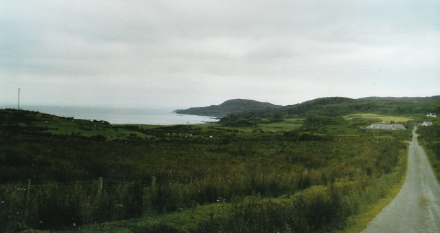
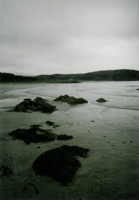
Aird Buidhe a' Chùil is a prominent coastal feature located in Argyllshire, Scotland. Situated on the western coast of the country, this headland or point juts out into the sea, offering stunning views of the surrounding landscape.

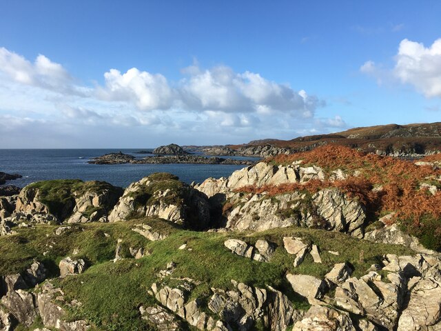
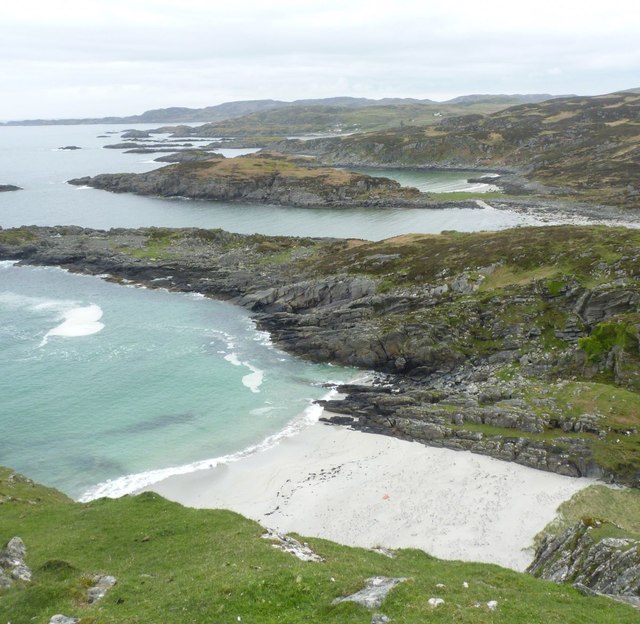
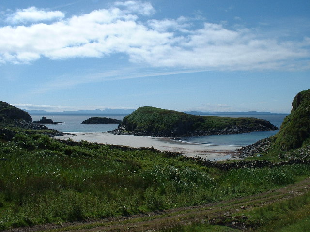
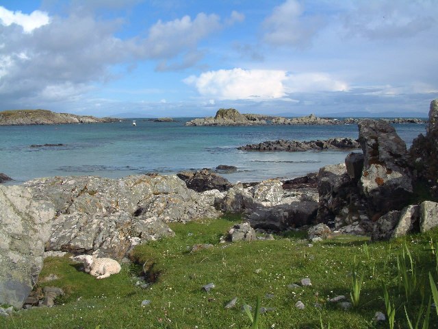
The name "Aird Buidhe a' Chùil" translates to "yellow headland at the back," which accurately describes the appearance of this distinct geological formation. The headland is characterized by its yellowish hue, which contrasts beautifully with the deep blue waters of the sea. The point extends out into the water, creating a natural barrier between the land and the ocean.

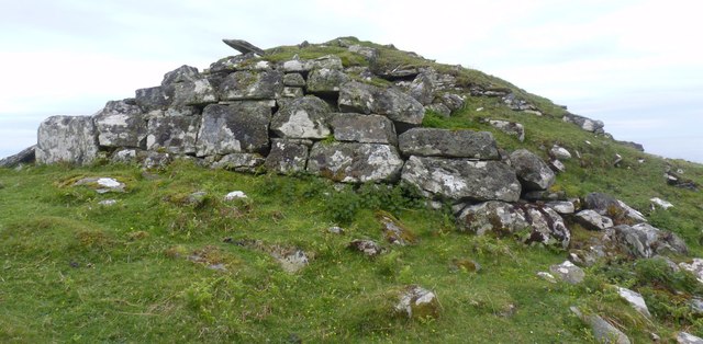
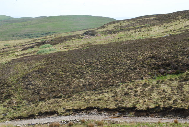
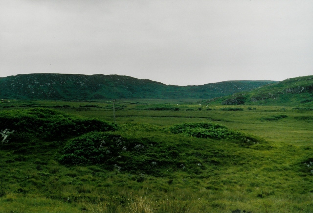
Aird Buidhe a' Chùil is known for its rugged and dramatic cliffs that line the coastline. These cliffs are a result of millions of years of erosion and weathering, creating a striking and picturesque sight. The headland also features small coves and caves, carved out by the relentless waves over time.

The area surrounding Aird Buidhe a' Chùil is rich in biodiversity. The headland is home to various species of seabirds, such as gannets, puffins, and fulmars, which nest on the cliffs. The coastal waters are teeming with marine life, including seals and dolphins, making it a popular spot for wildlife enthusiasts and photographers.

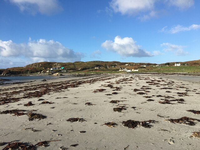
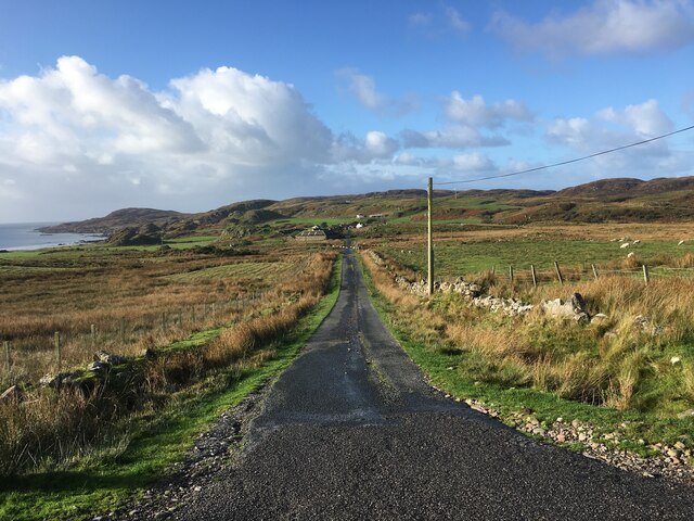
Visitors to Aird Buidhe a' Chùil can enjoy breathtaking coastal walks, taking in the stunning vistas and immersing themselves in the natural beauty of the area. The headland is easily accessible, with well-maintained footpaths that guide visitors along the coastline. Whether it's the geological wonders, the abundant wildlife, or the tranquility of the surroundings, Aird Buidhe a' Chùil offers a truly unforgettable coastal experience in Argyllshire, Scotland.

If you have any feedback on the listing, please let us know in the comments section below.

Aird Buidhe a' Chùil Images

Images are sourced within 2km of 56.287647/-6.2202999 or Grid Reference NM3818. Thanks to Geograph Open Source API. All images are credited.

Eilean Chormaic, Port Uisken
Beach at Uisken
Beach at Uisken
Near the road end at Uisken
Phone box and postbox near Uisken
Road to Ardachy
Road to Ardachy
Dun a' Gheird, Mull The name is probably a corruption of Dun nan Geard (Fort of the Guard). It is a well-preserved galleried dun with spectacular views west across the south coast of the Ross of Mull and south to Colonsay, Islay and Jura. At the time of our visit, however, we could only imagine such views!

For more information, visit <span class="nowrap"><a title="http://www.scotlandsplaces.gov.uk/record/rcahms/21974/dun-gheird-mull/rcahms" rel="nofollow ugc noopener" href="http://www.scotlandsplaces.gov.uk/record/rcahms/21974/dun-gheird-mull/rcahms">Link</a><img style="margin-left:2px;" alt="External link" title="External link - shift click to open in new window" src="https://s1.geograph.org.uk/img/external.png" width="10" height="10"/></span>
Dun a' Gheird, Mull
The name is probably a corruption of Dun nan Geard (Fort of the Guard). It is a well-preserved galleried dun with spectacular views west across the south coast of the Ross of Mull and south to Colonsay, Islay and Jura. At the time of our visit, however, we could only imagine such views! For more information, visit LinkExternal link
View south-west from Dun a' Gheird, Mull The south coast of the Ross of Mull is dotted with rocky islets and many attractive beaches, like this one.
View south-west from Dun a' Gheird, Mull
The south coast of the Ross of Mull is dotted with rocky islets and many attractive beaches, like this one.
Garbh Eilean and  Kilvickeon Beach, Mull Garbh Eilean is a tidal island on a beautiful beach. The grid line runs right down the middle of Garbh Eilean, so the left-hand side as seen here is actually in <a href="https://www.geograph.org.uk/gridref/NM4118">NM4118</a>. The islands of Jura and Islay are visible on the horizon.
Garbh Eilean and Kilvickeon Beach, Mull
Garbh Eilean is a tidal island on a beautiful beach. The grid line runs right down the middle of Garbh Eilean, so the left-hand side as seen here is actually in NM4118. The islands of Jura and Islay are visible on the horizon.
Cnoc Mòr, L.Assapol, Mull Heather moorland in the foreground, but bracken and grass on Cnoc Mòr in the distance.
Cnoc Mòr, L.Assapol, Mull
Heather moorland in the foreground, but bracken and grass on Cnoc Mòr in the distance.
Garbh Eilean, Isle of Mull On Garbh Eilean, looking towards mainland Mull (the island is an island only when the tide is in, as it is in this photo).  Fishermen have wedged their fishing rods in cracks in the rocks.
Garbh Eilean, Isle of Mull
On Garbh Eilean, looking towards mainland Mull (the island is an island only when the tide is in, as it is in this photo). Fishermen have wedged their fishing rods in cracks in the rocks.
Port Uisken, Mull Coastline at Uisken on the south side of the Ross of Mull
Port Uisken, Mull
Coastline at Uisken on the south side of the Ross of Mull
Road to Ardalanish A dull day for going to one of the finest beaches in Mull...  The houses down the road are the small village of Ardalanish, the beach is in the cove on the left, the headland beyond is Rubh' Ardalanish.
Road to Ardalanish
A dull day for going to one of the finest beaches in Mull... The houses down the road are the small village of Ardalanish, the beach is in the cove on the left, the headland beyond is Rubh' Ardalanish.
Grazing land near Uisken Poor quality grazing is standard on Mull - no different here on the south coast. Looking northeast (inland) from the road to Uisken.
Grazing land near Uisken
Poor quality grazing is standard on Mull - no different here on the south coast. Looking northeast (inland) from the road to Uisken.
Ardalanish Bay A beautiful beach, even on a grey day!  Looking east towards Aird Dubh
Ardalanish Bay
A beautiful beach, even on a grey day! Looking east towards Aird Dubh
Hebridean woolcraft Isle of Mull weavers are based on a farm at Ardalanish. Well worth a visit (though our Hebridean teddy - made from local brown Hebridean wool - still smells a bit of machine oil !)
Hebridean woolcraft
Isle of Mull weavers are based on a farm at Ardalanish. Well worth a visit (though our Hebridean teddy - made from local brown Hebridean wool - still smells a bit of machine oil !)
Ardachy Farm with damp grazing.
Ardachy
Farm with damp grazing.
Ardachy Cattle grazing on wetland near Ardachy.
Ardachy
Cattle grazing on wetland near Ardachy.
Phone box, Uisken
Phone box, Uisken
Show me another place!

Aird Buidhe a' Chùil is located at Grid Ref: NM3818 (Lat: 56.287647, Lng: -6.2202999)

Unitary Authority: Argyll and Bute

Police Authority: Argyll and West Dunbartonshire

What 3 Words

///expansion.croutons.downsize. Near Fionnphort, Argyll & Bute

Related Wikis

Uisken

Uisken (Scottish Gaelic: Uisgean, meaning "water-bay") is a settlement on a sandy bay on the Ross of Mull in the south of the Isle of Mull, on the west...
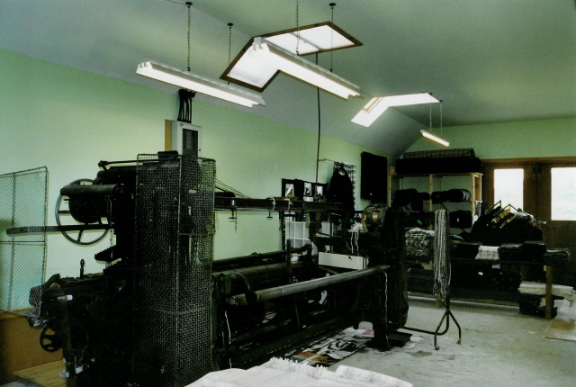
Ardalanish

Ardalanish (Scottish Gaelic: Àird Dealanais) is a village on the Isle of Mull in Argyll and Bute, Scotland. It is now an organic farm and weaving mill...

Knocknafenaig

Knocknafenaig (Scottish Gaelic: Cnoc na Fennaig) is a ruined township on the Isle of Mull, Scotland. Located in the south-western portion of the island...

Bunessan

Bunessan (Scottish Gaelic: Bun Easain) is a small village on the Ross of Mull in the south-west of the Isle of Mull, off the west coast of Scotland. The...

Nearby Amenities

Located within 500m of 56.287647,-6.2202999
Source: PGS
Lat/Long: 56.2860224/-6.212758
Source: PGS
Lat/Long: 56.286272/-6.2128742
Source: PGS
Lat/Long: 56.2866646/-6.2129216
Source: PGS
Lat/Long: 56.2867159/-6.2131548
Source: PGS
Lat/Long: 56.2868727/-6.2132851
Source: PGS
Lat/Long: 56.2870576/-6.2131725
Source: PGS
Lat/Long: 56.2872296/-6.2128272
Source: PGS
Lat/Long: 56.2874188/-6.2127679
Source: PGS
Lat/Long: 56.2874012/-6.2123383
Source: PGS
Lat/Long: 56.2879176/-6.2127403
Source: PGS
Lat/Long: 56.2886965/-6.2125684
Source: PGS
Lat/Long: 56.2887864/-6.2126278
Source: PGS
Lat/Long: 56.2889238/-6.2126257
Source: PGS
Lat/Long: 56.289867/-6.2134518
Source: PGS
Lat/Long: 56.2898744/-6.2149425
Source: PGS
Lat/Long: 56.2897794/-6.2157742
Source: PGS
Lat/Long: 56.2897304/-6.215948
Source: PGS
Lat/Long: 56.2893772/-6.2171044
Source: PGS
Lat/Long: 56.2891586/-6.2171636
Source: PGS
Lat/Long: 56.2888502/-6.2173941
Source: PGS
Lat/Long: 56.2880839/-6.2183324
Source: PGS
Lat/Long: 56.2878677/-6.2180157
Source: PGS
Lat/Long: 56.28759/-6.2177301
Source: PGS
Lat/Long: 56.2875825/-6.2179559
Source: PGS
Lat/Long: 56.2863224/-6.2187756
Created By: dmgroom_coastlines
Source: PGS
Lat/Long: 56.28611/-6.21886
Created By: dmgroom_coastlines
Source: PGS
Lat/Long: 56.2856/-6.2189
Created By: dmgroom_coastlines
Source: PGS
Lat/Long: 56.28548/-6.21914
Created By: dmgroom_coastlines
Source: PGS
Lat/Long: 56.28549/-6.21959
Created By: dmgroom_coastlines
Source: PGS
Lat/Long: 56.28562/-6.21982
Created By: dmgroom_coastlines
Source: PGS
Lat/Long: 56.28575/-6.22004
Created By: dmgroom_coastlines
Source: PGS
Lat/Long: 56.28576/-6.2205
Created By: dmgroom_coastlines
Source: PGS
Lat/Long: 56.28564/-6.22074
Created By: dmgroom_coastlines
Source: PGS
Lat/Long: 56.28514/-6.221
Source: PGS
Lat/Long: 56.2851063/-6.2215694
Source: PGS
Lat/Long: 56.2857709/-6.2212887
Source: PGS
Lat/Long: 56.2859631/-6.2212119
Source: PGS
Lat/Long: 56.2862173/-6.220936
Source: PGS
Lat/Long: 56.2863239/-6.2208838
Source: PGS
Lat/Long: 56.2864253/-6.2209847
Source: PGS
Lat/Long: 56.2864325/-6.221027
Source: PGS
Lat/Long: 56.2865848/-6.2218154
Source: PGS
Lat/Long: 56.2860472/-6.2221756
Created By: dmgroom_coastlines
Source: PGS
Lat/Long: 56.28583/-6.22326
Created By: dmgroom_coastlines
Source: PGS
Lat/Long: 56.2857/-6.2235
Created By: dmgroom_coastlines
Source: PGS
Lat/Long: 56.28443/-6.22381
Source: PGS
Lat/Long: 56.2842844/-6.2244018
Source: PGS
Lat/Long: 56.2840939/-6.2244286
Source: PGS
Lat/Long: 56.2838259/-6.2244501
Source: PGS
Lat/Long: 56.2857626/-6.2262388
Source: PGS
Lat/Long: 56.2858907/-6.2268129
Uisken
Name Gd: Uisgean
Place: hamlet
Population: 6
Wikidata: Q7878129
Wikipedia: en:Uisken
Lat/Long: 56.2896613/-6.2192384
Basic Site
Tourism: camp_site
Lat/Long: 56.2904671/-6.2168954
Parking
Access: yes
Capacity: 6
Fee: no
Parking: surface
Lat/Long: 56.2894293/-6.2190155
Source: PGS
Lat/Long: 56.29023/-6.21418
Place: farm
Lat/Long: 56.2915658/-6.220259
Place: farm
Lat/Long: 56.2893026/-6.2201149
Power: pole
Lat/Long: 56.2916292/-6.2215309
Power: pole
Lat/Long: 56.2908781/-6.2207396
Power: pole
Lat/Long: 56.2903635/-6.2202253
Power: pole
Lat/Long: 56.2898622/-6.2202067
Power: pole
Lat/Long: 56.2891464/-6.2201907
Power: pole
Lat/Long: 56.2918629/-6.2199376
Power: pole
Lat/Long: 56.2917416/-6.2207369
Power: pole
Lat/Long: 56.2909535/-6.2228312
Power: pole
Lat/Long: 56.2908367/-6.2234654
Power: pole
Lat/Long: 56.2905513/-6.2191302
Power: pole
Lat/Long: 56.2906799/-6.218243
The data included in this document is from www.openstreetmap.org. The data is made available under ODbL.

Have you been to Aird Buidhe a' Chùil?

Leave your review of Aird Buidhe a' Chùil below (or comments, questions and feedback).