Slochd nam Bà

Sea, Estuary, Creek in Argyllshire

Scotland

Slochd nam Bà

Eilean Chormaic, Port Uisken
Eilean Chormaic, Port Uisken Credit: Steven Brown

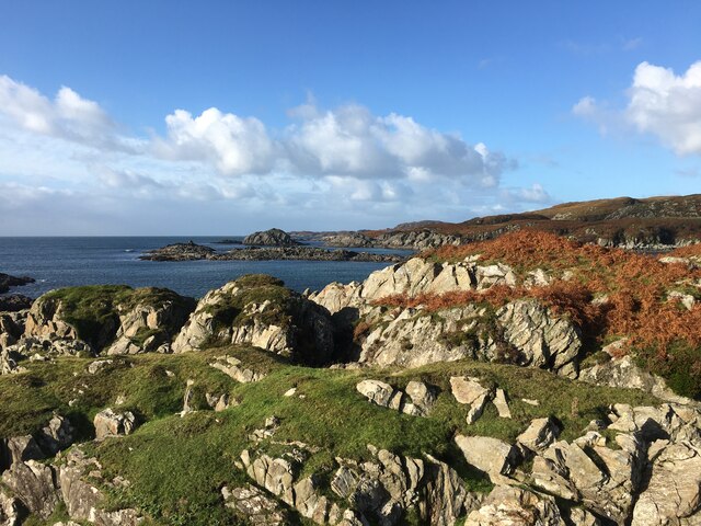
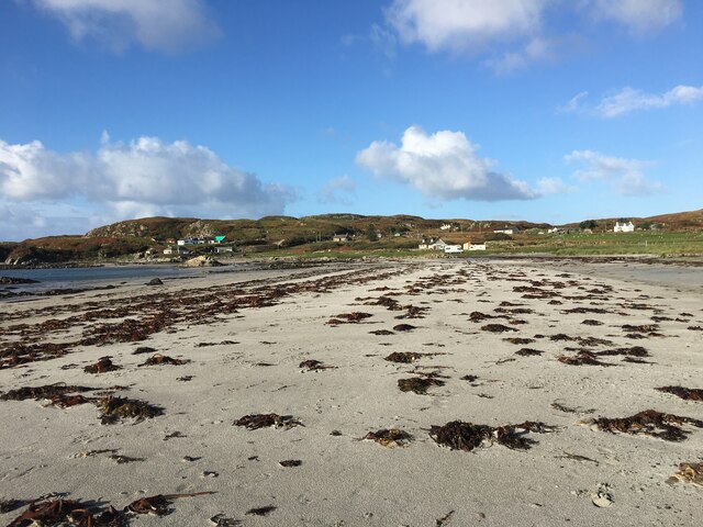
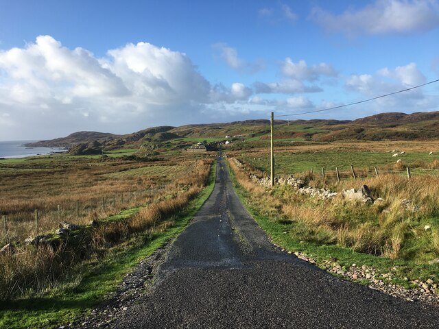
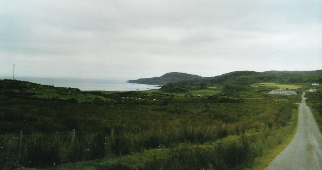
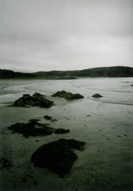
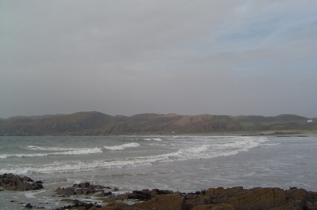
Slochd nam Bà is a picturesque sea inlet located in Argyllshire, Scotland. Nestled along the western coast of the country, this natural wonder offers breathtaking views and a tranquil atmosphere. The name "Slochd nam Bà" translates to "Hollow of the Cattle" in Gaelic, reflecting the area's historical connection to livestock farming.

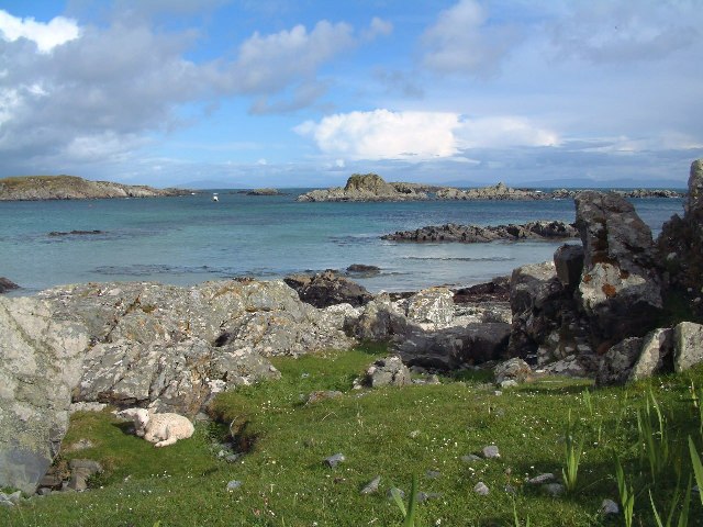
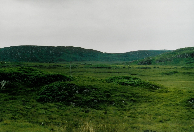
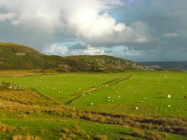
Situated between rolling hills and lush greenery, Slochd nam Bà is a haven for wildlife and nature enthusiasts. The crystal-clear waters of the estuary provide a habitat for a diverse array of marine life, including seals, otters, and various species of fish. Birdwatchers will be delighted by the presence of seabirds such as gulls, herons, and even the occasional osprey.

The creek within Slochd nam Bà is tidal, resulting in a dynamic ecosystem that changes with the ebb and flow of the tides. During low tide, visitors can explore the exposed mudflats and discover a rich variety of plants and small creatures that call this unique environment home.

For those seeking adventure, Slochd nam Bà offers opportunities for kayaking, paddleboarding, and even sailing. The calm waters and stunning surroundings make it an ideal spot for leisurely water-based activities.

Overall, Slochd nam Bà is a hidden gem in Argyllshire, showcasing the natural beauty and biodiversity of Scotland's coastal areas. Whether you are a nature lover, a wildlife enthusiast, or simply someone looking to unwind in a serene setting, Slochd nam Bà is a destination that is sure to leave a lasting impression.

If you have any feedback on the listing, please let us know in the comments section below.

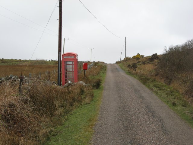
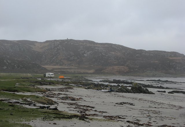
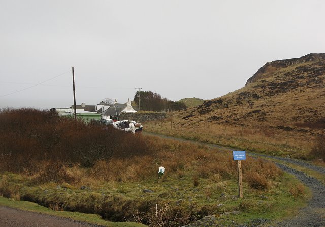
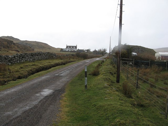
Slochd nam Bà Images

Images are sourced within 2km of 56.284729/-6.2277716 or Grid Reference NM3818. Thanks to Geograph Open Source API. All images are credited.

Eilean Chormaic, Port Uisken
Beach at Uisken
Beach at Uisken
Near the road end at Uisken
Phone box and postbox near Uisken
Road to Ardachy
Road to Ardachy
Port Uisken, Mull Coastline at Uisken on the south side of the Ross of Mull
Port Uisken, Mull
Coastline at Uisken on the south side of the Ross of Mull
Road to Ardalanish A dull day for going to one of the finest beaches in Mull...  The houses down the road are the small village of Ardalanish, the beach is in the cove on the left, the headland beyond is Rubh' Ardalanish.
Road to Ardalanish
A dull day for going to one of the finest beaches in Mull... The houses down the road are the small village of Ardalanish, the beach is in the cove on the left, the headland beyond is Rubh' Ardalanish.
Grazing land near Uisken Poor quality grazing is standard on Mull - no different here on the south coast. Looking northeast (inland) from the road to Uisken.
Grazing land near Uisken
Poor quality grazing is standard on Mull - no different here on the south coast. Looking northeast (inland) from the road to Uisken.
Ardalanish Bay A beautiful beach, even on a grey day!  Looking east towards Aird Dubh
Ardalanish Bay
A beautiful beach, even on a grey day! Looking east towards Aird Dubh
Hebridean woolcraft Isle of Mull weavers are based on a farm at Ardalanish. Well worth a visit (though our Hebridean teddy - made from local brown Hebridean wool - still smells a bit of machine oil !)
Hebridean woolcraft
Isle of Mull weavers are based on a farm at Ardalanish. Well worth a visit (though our Hebridean teddy - made from local brown Hebridean wool - still smells a bit of machine oil !)
Ardachy Farm with damp grazing.
Ardachy
Farm with damp grazing.
Ardachy Cattle grazing on wetland near Ardachy.
Ardachy
Cattle grazing on wetland near Ardachy.
Phone box, Uisken
Phone box, Uisken
Uisken Simple campsite on the beach.
Uisken
Simple campsite on the beach.
Ardchiavaig Coastal property amongst the usual wet grassland.
Ardchiavaig
Coastal property amongst the usual wet grassland.
A dreich day in Uisken Fine drizzle during an otherwise warm April.
A dreich day in Uisken
Fine drizzle during an otherwise warm April.
Ardalanish Bay
Ardalanish Bay
View south from near Ardachy, Isle of Mull
Show me another place!

Slochd nam Bà is located at Grid Ref: NM3818 (Lat: 56.284729, Lng: -6.2277716)

Unitary Authority: Argyll and Bute

Police Authority: Argyll and West Dunbartonshire

What 3 Words

///mural.solid.outsiders. Near Fionnphort, Argyll & Bute

Related Wikis

Uisken

Uisken (Scottish Gaelic: Uisgean, meaning "water-bay") is a settlement on a sandy bay on the Ross of Mull in the south of the Isle of Mull, on the west...

Ardalanish

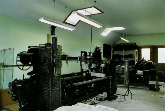
Ardalanish (Scottish Gaelic: Àird Dealanais) is a village on the Isle of Mull in Argyll and Bute, Scotland. It is now an organic farm and weaving mill...

Knocknafenaig

Knocknafenaig (Scottish Gaelic: Cnoc na Fennaig) is a ruined township on the Isle of Mull, Scotland. Located in the south-western portion of the island...

Bunessan

Bunessan (Scottish Gaelic: Bun Easain) is a small village on the Ross of Mull in the south-west of the Isle of Mull, off the west coast of Scotland. The...

Suidhe

Suidhe (Scottish Gaelic: Suidhe) is a ruined township located on the southwestern peninsula of the Isle of Mull, Scotland. It lies just over 1 km to the...

Ross of Mull

The Ross of Mull (Scottish Gaelic: An Ros Mhuileach) is the largest peninsula of the Isle of Mull, about 28 kilometres (17 mi) long, and makes up the south...

Ardtun

Ardtun (Scottish Gaelic: Àird Tunna) is a settlement on the Isle of Mull, in Argyll and Bute, Scotland. Ardtun is within the parish of Kilfinichen and...

Shiaba

Shiaba (Scottish Gaelic: Siaba) is a ruined township located on the southwestern peninsula of the Isle of Mull, Scotland. It lies about 8 km to the east...

Nearby Amenities

Located within 500m of 56.284729,-6.2277716
Created By: dmgroom_coastlines
Source: PGS
Lat/Long: 56.28575/-6.22004
Created By: dmgroom_coastlines
Source: PGS
Lat/Long: 56.28576/-6.2205
Created By: dmgroom_coastlines
Source: PGS
Lat/Long: 56.28564/-6.22074
Created By: dmgroom_coastlines
Source: PGS
Lat/Long: 56.28514/-6.221
Source: PGS
Lat/Long: 56.2851063/-6.2215694
Source: PGS
Lat/Long: 56.2857709/-6.2212887
Source: PGS
Lat/Long: 56.2859631/-6.2212119
Source: PGS
Lat/Long: 56.2862173/-6.220936
Source: PGS
Lat/Long: 56.2863239/-6.2208838
Source: PGS
Lat/Long: 56.2864253/-6.2209847
Source: PGS
Lat/Long: 56.2864325/-6.221027
Source: PGS
Lat/Long: 56.2865848/-6.2218154
Source: PGS
Lat/Long: 56.2860472/-6.2221756
Created By: dmgroom_coastlines
Source: PGS
Lat/Long: 56.28583/-6.22326
Created By: dmgroom_coastlines
Source: PGS
Lat/Long: 56.2857/-6.2235
Created By: dmgroom_coastlines
Source: PGS
Lat/Long: 56.28443/-6.22381
Source: PGS
Lat/Long: 56.2842844/-6.2244018
Source: PGS
Lat/Long: 56.2840939/-6.2244286
Source: PGS
Lat/Long: 56.2838259/-6.2244501
Source: PGS
Lat/Long: 56.2835996/-6.2245949
Source: PGS
Lat/Long: 56.28343/-6.22504
Source: PGS
Lat/Long: 56.28306/-6.22576
Created By: dmgroom_coastlines
Source: PGS
Lat/Long: 56.28295/-6.22623
Source: PGS
Lat/Long: 56.2832601/-6.2264886
Created By: dmgroom_coastlines
Source: PGS
Lat/Long: 56.28363/-6.22756
Created By: dmgroom_coastlines
Source: PGS
Lat/Long: 56.28375/-6.22778
Created By: dmgroom_coastlines
Source: PGS
Lat/Long: 56.28388/-6.228
Created By: dmgroom_coastlines
Source: PGS
Lat/Long: 56.28402/-6.22822
Created By: dmgroom_coastlines
Source: PGS
Lat/Long: 56.28427/-6.22821
Source: PGS
Lat/Long: 56.2857626/-6.2262388
Source: PGS
Lat/Long: 56.2858907/-6.2268129
Source: PGS
Lat/Long: 56.2850045/-6.2279374
Created By: dmgroom_coastlines
Source: PGS
Lat/Long: 56.28456/-6.22957
Created By: dmgroom_coastlines
Source: PGS
Lat/Long: 56.28444/-6.22981
Created By: dmgroom_coastlines
Source: PGS
Lat/Long: 56.28445/-6.23027
Created By: dmgroom_coastlines
Source: PGS
Lat/Long: 56.28473/-6.23163
Created By: dmgroom_coastlines
Source: PGS
Lat/Long: 56.28474/-6.23209
Source: PGS
Lat/Long: 56.2850192/-6.2329014
Source: PGS
Lat/Long: 56.2857497/-6.2339847
Source: PGS
Lat/Long: 56.2862761/-6.2334052
Source: PGS
Lat/Long: 56.2864532/-6.2336174
Source: PGS
Lat/Long: 56.2859712/-6.2331792
The data included in this document is from www.openstreetmap.org. The data is made available under ODbL.

Have you been to Slochd nam Bà?

Leave your review of Slochd nam Bà below (or comments, questions and feedback).