A' Bhualaidh

Coastal Feature, Headland, Point in Argyllshire

Scotland

A' Bhualaidh

Phone box and postbox near Uisken
Phone box and postbox near Uisken Credit: Steven Brown

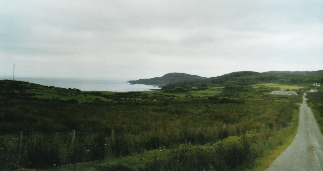
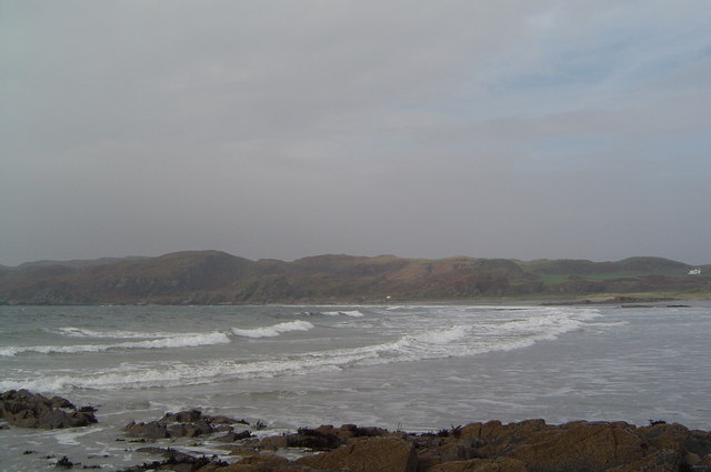
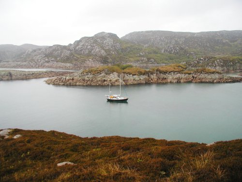
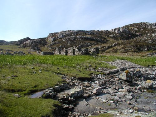
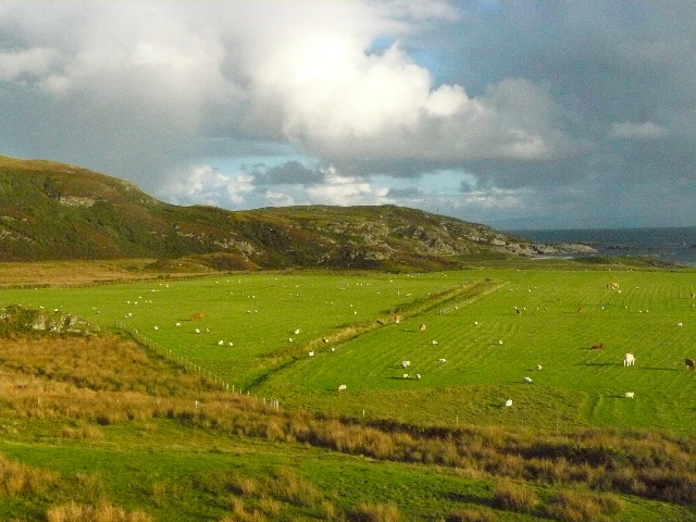
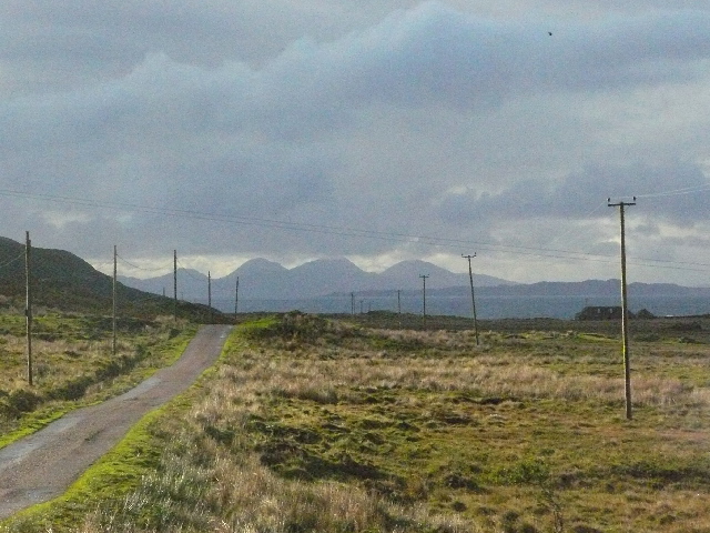
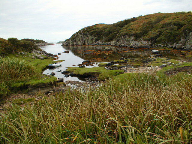
A' Bhualaidh is a prominent coastal feature located in Argyllshire, Scotland. It is a headland that juts out into the sea, forming a distinctive point along the coastline. The headland is characterized by its rugged cliffs, which rise steeply from the water, offering breathtaking views of the surrounding landscape.

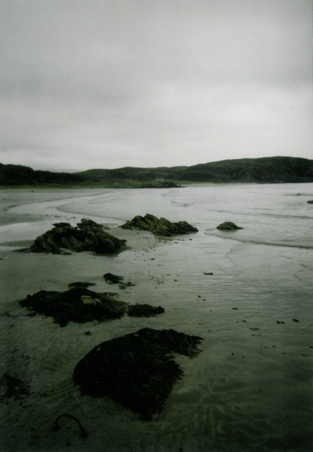
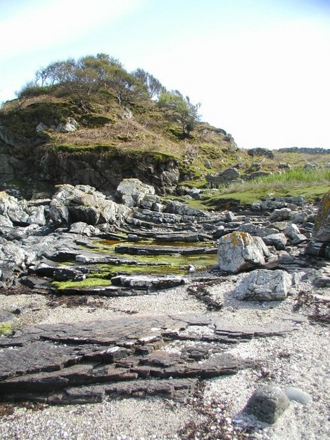
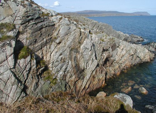
The cliffs of A' Bhualaidh are composed of various types of rock, including sandstone and limestone, which have been shaped by the relentless force of the ocean over millions of years. This erosion has created unique geological formations, such as sea caves and arches, that are a popular attraction for nature enthusiasts and photographers.

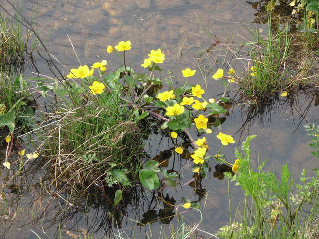
The headland is also home to a diverse range of flora and fauna. The rugged terrain provides a suitable habitat for various seabirds, including gulls, puffins, and razorbills, which nest in the cliffs. Visitors may also spot seals basking on the rocks or dolphins playing in the waters surrounding the headland.

A' Bhualaidh offers numerous recreational opportunities for outdoor enthusiasts. The cliffs provide challenging routes for rock climbers, while the surrounding waters are popular for kayaking and fishing. Hiking trails lead visitors along the headland, offering stunning panoramic views of the coastline and the adjacent islands.

Overall, A' Bhualaidh is a remarkable coastal feature that showcases the raw beauty of Argyllshire's natural environment. Its towering cliffs, diverse wildlife, and recreational opportunities make it a captivating destination for both locals and tourists alike.

If you have any feedback on the listing, please let us know in the comments section below.
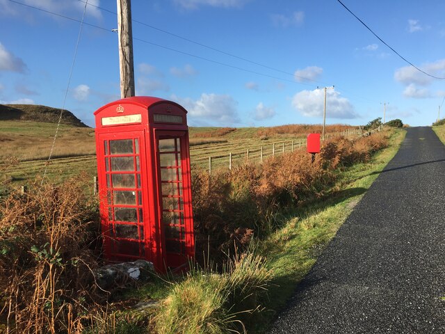
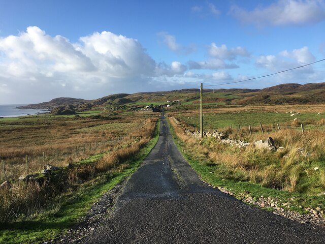
A' Bhualaidh Images

Images are sourced within 2km of 56.281965/-6.254095 or Grid Reference NM3618. Thanks to Geograph Open Source API. All images are credited.

Phone box and postbox near Uisken
Road to Ardachy
Road to Ardachy
Road to Ardalanish A dull day for going to one of the finest beaches in Mull...  The houses down the road are the small village of Ardalanish, the beach is in the cove on the left, the headland beyond is Rubh' Ardalanish.
Road to Ardalanish
A dull day for going to one of the finest beaches in Mull... The houses down the road are the small village of Ardalanish, the beach is in the cove on the left, the headland beyond is Rubh' Ardalanish.
Ardalanish Bay A beautiful beach, even on a grey day!  Looking east towards Aird Dubh
Ardalanish Bay
A beautiful beach, even on a grey day! Looking east towards Aird Dubh
Hebridean woolcraft Isle of Mull weavers are based on a farm at Ardalanish. Well worth a visit (though our Hebridean teddy - made from local brown Hebridean wool - still smells a bit of machine oil !)
Hebridean woolcraft
Isle of Mull weavers are based on a farm at Ardalanish. Well worth a visit (though our Hebridean teddy - made from local brown Hebridean wool - still smells a bit of machine oil !)
Ardachy Farm with damp grazing.
Ardachy
Farm with damp grazing.
Ardachy Cattle grazing on wetland near Ardachy.
Ardachy
Cattle grazing on wetland near Ardachy.
Phone box, Uisken
Phone box, Uisken
Ardalanish Bay
Ardalanish Bay
The anchorage at  Rubh  Ardalanish A wild, remote spot on the Ross of Mull. The rock here is all granite but nearby there is metamorphic rock where garnets can be found on the beach. A lonely place now but there is much of evidence of former habitation around the bay.
The anchorage at Rubh Ardalanish
A wild, remote spot on the Ross of Mull. The rock here is all granite but nearby there is metamorphic rock where garnets can be found on the beach. A lonely place now but there is much of evidence of former habitation around the bay.
Rubh' Ardalanish Some interesting geology here - this part of the Headland of Rubh' Ardalanish is in the contact zone between the Ross of Mull granite to the west and an area of schist to the east. The landscape is rugged and spectacular. Remote now, there is much evidence of former habitation.
Rubh' Ardalanish
Some interesting geology here - this part of the Headland of Rubh' Ardalanish is in the contact zone between the Ross of Mull granite to the west and an area of schist to the east. The landscape is rugged and spectacular. Remote now, there is much evidence of former habitation.
Xenoliths The patches of darker rock set into the pinkish Ross of Mull granite are 'Xenoliths' - lumps of the surrounding rock which broke off and fell into the molten granite while it was deep underground. It has since solidified and been exposed on the surface by erosion.
Xenoliths
The patches of darker rock set into the pinkish Ross of Mull granite are 'Xenoliths' - lumps of the surrounding rock which broke off and fell into the molten granite while it was deep underground. It has since solidified and been exposed on the surface by erosion.
Ruined Cottage A sad reminder that people once lived and worked in this beautiful place. There are piles of stones cleared from the ground to show that the land was cultivated and several other cottages in the vicinity saying that it was a good place to make a living.
Ruined Cottage
A sad reminder that people once lived and worked in this beautiful place. There are piles of stones cleared from the ground to show that the land was cultivated and several other cottages in the vicinity saying that it was a good place to make a living.
View south from near Ardachy, Isle of Mull
The Paps of Jura from the Uisken Road, Isle of Mull
Collapsing stream bank Bank collapsing caused by erosion from storm waters
Collapsing stream bank
Bank collapsing caused by erosion from storm waters
Marsh Marigolds in stream bed A moment of calm 50 yds from the shore
Marsh Marigolds in stream bed
A moment of calm 50 yds from the shore
Creek north of Rubh Ardalanish Coastal land between Torr na Sealga and Beinn a Chaol-airigh to the north of the anchorage on Rubh Ardalanish
Creek north of Rubh Ardalanish
Coastal land between Torr na Sealga and Beinn a Chaol-airigh to the north of the anchorage on Rubh Ardalanish
Show me another place!

A' Bhualaidh is located at Grid Ref: NM3618 (Lat: 56.281965, Lng: -6.254095)

Unitary Authority: Argyll and Bute

Police Authority: Argyll and West Dunbartonshire

What 3 Words

///assess.butlers.observe. Near Fionnphort, Argyll & Bute

Related Wikis

Ardalanish

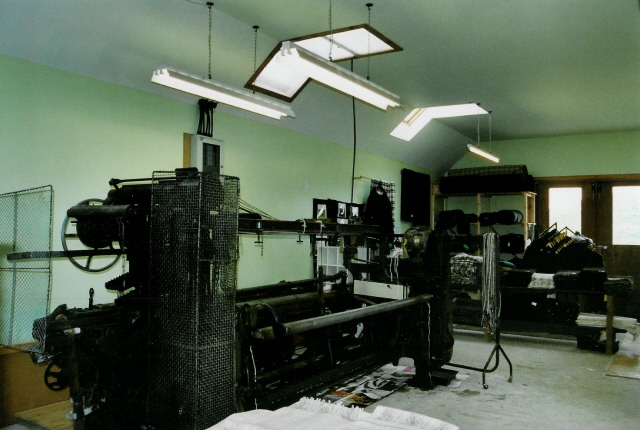
Ardalanish (Scottish Gaelic: Àird Dealanais) is a village on the Isle of Mull in Argyll and Bute, Scotland. It is now an organic farm and weaving mill...

Knocknafenaig

Knocknafenaig (Scottish Gaelic: Cnoc na Fennaig) is a ruined township on the Isle of Mull, Scotland. Located in the south-western portion of the island...

Uisken

Uisken (Scottish Gaelic: Uisgean, meaning "water-bay") is a settlement on a sandy bay on the Ross of Mull in the south of the Isle of Mull, on the west...

Ross of Mull

The Ross of Mull (Scottish Gaelic: An Ros Mhuileach) is the largest peninsula of the Isle of Mull, about 28 kilometres (17 mi) long, and makes up the south...

Suidhe

Suidhe (Scottish Gaelic: Suidhe) is a ruined township located on the southwestern peninsula of the Isle of Mull, Scotland. It lies just over 1 km to the...

Bunessan

Bunessan (Scottish Gaelic: Bun Easain) is a small village on the Ross of Mull in the south-west of the Isle of Mull, off the west coast of Scotland. The...

Ardtun

Ardtun (Scottish Gaelic: Àird Tunna) is a settlement on the Isle of Mull, in Argyll and Bute, Scotland. Ardtun is within the parish of Kilfinichen and...

Knockan

Knockan (Scottish Gaelic: An Cnocan) is a township of six crofts in the community of Ardtun, in the south of the Isle of Mull off the west coast of Scotland...

Nearby Amenities

Located within 500m of 56.281965,-6.254095
Source: PGS
Lat/Long: 56.2858964/-6.252033
Source: PGS
Lat/Long: 56.2856643/-6.2522167
Created By: dmgroom_coastlines
Source: PGS
Lat/Long: 56.28505/-6.25164
Created By: dmgroom_coastlines
Source: PGS
Lat/Long: 56.28454/-6.25168
Created By: dmgroom_coastlines
Source: PGS
Lat/Long: 56.28301/-6.25179
Source: PGS
Lat/Long: 56.2828914/-6.2515703
Source: PGS
Lat/Long: 56.2825793/-6.252817
Source: PGS
Lat/Long: 56.283651/-6.2533711
Source: PGS
Lat/Long: 56.2835843/-6.2536919
Created By: dmgroom_coastlines
Source: PGS
Lat/Long: 56.28203/-6.2537
Created By: dmgroom_coastlines
Source: PGS
Lat/Long: 56.2819/-6.25394
Created By: dmgroom_coastlines
Source: PGS
Lat/Long: 56.28178/-6.25418
Created By: dmgroom_coastlines
Source: PGS
Lat/Long: 56.28165/-6.25441
Created By: dmgroom_coastlines
Source: PGS
Lat/Long: 56.28153/-6.25465
Source: PGS
Lat/Long: 56.2811729/-6.2550298
Source: PGS
Lat/Long: 56.2806586/-6.254106
Created By: dmgroom_coastlines
Source: PGS
Lat/Long: 56.27972/-6.25363
Created By: dmgroom_coastlines
Source: PGS
Lat/Long: 56.27974/-6.25455
Source: PGS
Lat/Long: 56.279334/-6.2549488
Created By: dmgroom_coastlines
Source: PGS
Lat/Long: 56.27897/-6.25484
Created By: dmgroom_coastlines
Source: PGS
Lat/Long: 56.27871/-6.25439
Source: PGS
Lat/Long: 56.2784665/-6.2538389
Lower Ardalanish
Place: hamlet
Lat/Long: 56.278848/-6.2597096
The data included in this document is from www.openstreetmap.org. The data is made available under ODbL.

Have you been to A' Bhualaidh?

Leave your review of A' Bhualaidh below (or comments, questions and feedback).