Carn Praunter

Coastal Feature, Headland, Point in Cornwall

England

Carn Praunter

Windswept, St Just Clearly the owners of this shop have an eye for detail and design.
Windswept, St Just Credit: Jonathan Billinger

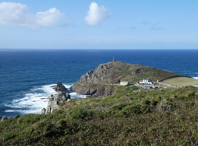
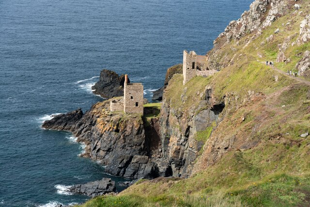
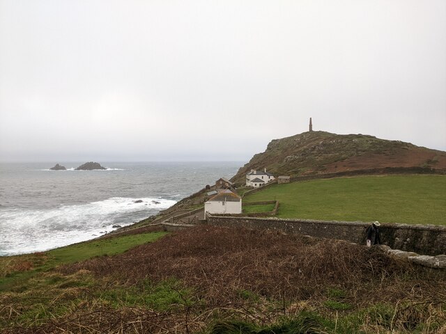
Carn Praunter is a prominent headland located on the coast of Cornwall, England. It is situated near the town of Penzance and overlooks the Celtic Sea. The headland is known for its rugged cliffs, stunning views, and diverse wildlife.

Carn Praunter is a popular destination for hikers and nature enthusiasts due to its picturesque landscapes and abundance of flora and fauna. The headland is home to a variety of seabirds, including puffins, gannets, and razorbills, making it a prime spot for birdwatching.

The rocky cliffs of Carn Praunter are also a favorite among rock climbers, offering challenging routes and breathtaking vistas of the surrounding coastline. Additionally, the headland is a designated Area of Outstanding Natural Beauty, further highlighting its significance as a natural landmark.

Visitors to Carn Praunter can enjoy leisurely walks along the coastal paths, explore the numerous coves and inlets, or simply relax and take in the stunning panoramic views of the sea. Overall, Carn Praunter is a must-visit destination for those seeking to experience the beauty and tranquility of Cornwall's rugged coastline.

If you have any feedback on the listing, please let us know in the comments section below.

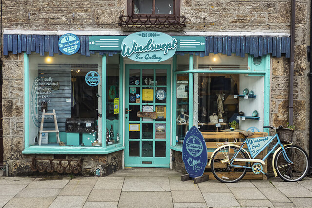
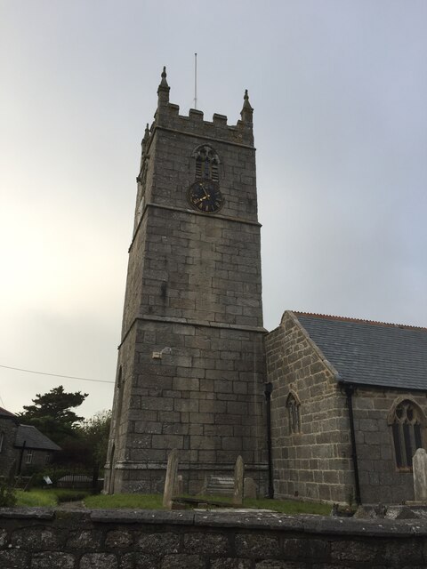
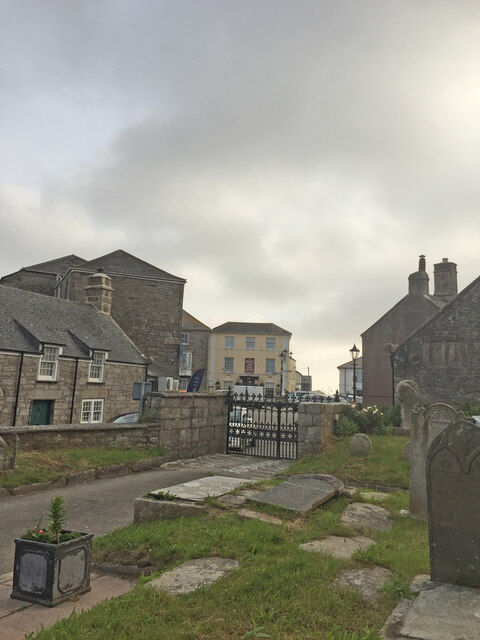
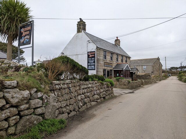
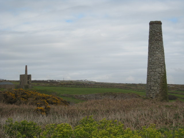
Carn Praunter Images

Images are sourced within 2km of 50.133348/-5.6931842 or Grid Reference SW3632. Thanks to Geograph Open Source API. All images are credited.

Windswept, St Just Clearly the owners of this shop have an eye for detail and design.
Windswept, St Just
Clearly the owners of this shop have an eye for detail and design.
St Just Church Tower
St Just from the churchyard of St Just church
OS Cut Mark - St Just, St Just's Church <span class="nowrap"><a title="https://www.bench-marks.org.uk/bm43294" rel="nofollow ugc noopener" href="https://www.bench-marks.org.uk/bm43294">Link</a><img style="margin-left:2px;" alt="External link" title="External link - shift click to open in new window" src="https://s1.geograph.org.uk/img/external.png" width="10" height="10"/></span>
OS Cut Mark - St Just, St Just's Church
Location of OS Cut Mark - St Just, St Just's Church <span class="nowrap"><a title="https://www.bench-marks.org.uk/bm43294" rel="nofollow ugc noopener" href="https://www.bench-marks.org.uk/bm43294">Link</a><img style="margin-left:2px;" alt="External link" title="External link - shift click to open in new window" src="https://s1.geograph.org.uk/img/external.png" width="10" height="10"/></span>
Location of OS Cut Mark - St Just, St Just's Church
Carn Gloose Trig Point Flush Bracket S8141
Botallack Mine
Botallack Mine
Coastal views near Botallack
Section of coastal path
Botallack Head Trig Point Flush Bracket S8138
Botallack - Crowns Mines Looking down on the two ruined engine houses of Crowns Mines at Botallack, This is a UNESCO World Heritage Site.
<>More information to follow.
Botallack - Crowns Mines
Looking down on the two ruined engine houses of Crowns Mines at Botallack, This is a UNESCO World Heritage Site. <>More information to follow.
Ballowall Barrow This Bronze Age barrow was excavated (and radically altered) in 1878 by Cornish antiquarian William Borlase. The internal walls were rebuilt by him which has unfortunately affected the way it is perceived. It is however an evocative site in a stunning location.
See &lt;span class=&quot;nowrap&quot;&gt;&lt;a title=&quot;https://www.english-heritage.org.uk/visit/places/ballowall-barrow&quot; rel=&quot;nofollow ugc noopener&quot; href=&quot;https://www.english-heritage.org.uk/visit/places/ballowall-barrow&quot;&gt;Link&lt;/a&gt;&lt;img style=&quot;margin-left:2px;&quot; alt=&quot;External link&quot; title=&quot;External link - shift click to open in new window&quot; src=&quot;https://s1.geograph.org.uk/img/external.png&quot; width=&quot;10&quot; height=&quot;10&quot;/&gt;&lt;/span&gt;
Ballowall Barrow
This Bronze Age barrow was excavated (and radically altered) in 1878 by Cornish antiquarian William Borlase. The internal walls were rebuilt by him which has unfortunately affected the way it is perceived. It is however an evocative site in a stunning location. See LinkExternal link
Cape Cornwall from Ballowall Barrow Looking over to England&amp;#039;s only cape - Cape Cornwall as seen from beside &lt;a href=&quot;https://www.geograph.org.uk/photo/6982138&quot;&gt;SW3531 : Ballowall Barrow&lt;/a&gt;
Cape Cornwall from Ballowall Barrow
Looking over to England's only cape - Cape Cornwall as seen from beside SW3531 : Ballowall Barrow
 Crowns Engine Houses at Botallack
Crowns Engine Houses at Botallack
The centre of St Just
Cape Cornwall seen from the National Trust car park
National Trust car park and hut at Cape Cornwall
The Queen's Arms, Botallock
Show me another place!

Carn Praunter is located at Grid Ref: SW3632 (Lat: 50.133348, Lng: -5.6931842)

Unitary Authority: Cornwall

Police Authority: Devon and Cornwall

What 3 Words

///lifeguard.bagels.learning. Near St Just, Cornwall

Related Wikis

Boscean

Boscean is a hamlet on the Penwith peninsula in west Cornwall, England, United Kingdom, approximately half-a-mile northwest of St Just. == References ==
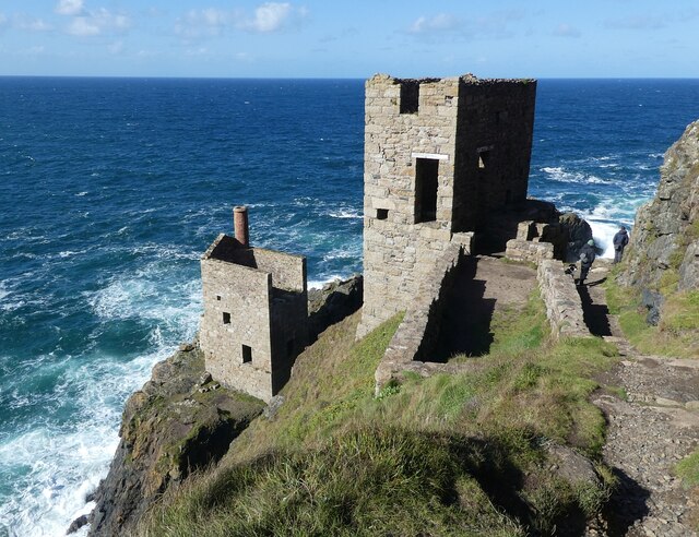
Wheal Owles

Wheal Owles was a tin mine in the parish of St Just in Cornwall, UK and the site of a disaster in 1893 when twenty miners lost their lives. Since 2006...

Botallack

Botallack (Cornish: Bostalek, meaning "Talek's dwelling") is a village in west Cornwall, England, United Kingdom. It lies along the B3306 road which connects...

Botallack Mine

The Botallack Mine (Cornish: Bostalek) is a former mine in Botallack in the west of Cornwall, UK. Since 2006 it has been part of the UNESCO World Heritage...

Nearby Amenities

Located within 500m of 50.133348,-5.6931842
Boscean
Name Kw: Bosseghan
Place: hamlet
Wikidata: Q4947143
Lat/Long: 50.1312833/-5.6909247
Kenidjack
Name Kw: Keunysek
Place: hamlet
Lat/Long: 50.1332097/-5.6889958
Chimney
Historic: ruins
Lat/Long: 50.1373041/-5.6919895
Kenidjack Valley
Place: locality
Wikidata: Q6389279
Wikipedia: en:Kenidjack Valley
Lat/Long: 50.1329885/-5.6937979
Chimney
Historic: ruins
Lat/Long: 50.1325179/-5.695041
Barrier: stile
Lat/Long: 50.13502/-5.695424
Barrier: stile
Lat/Long: 50.1297608/-5.6919801
Barrier: stile
Lat/Long: 50.1292183/-5.692082
Source: Bing
Lat/Long: 50.1377348/-5.6945336
Source: Bing
Lat/Long: 50.1377039/-5.6944907
Source: Bing
Lat/Long: 50.1376764/-5.694378
Source: Bing
Lat/Long: 50.1376867/-5.6943244
Source: Bing
Lat/Long: 50.1377623/-5.6941956
Source: Bing
Lat/Long: 50.1377314/-5.6941688
Source: Bing
Lat/Long: 50.1376626/-5.694142
Source: Bing
Lat/Long: 50.1375973/-5.6942171
Source: Bing
Lat/Long: 50.1375801/-5.6941956
Source: Bing
Lat/Long: 50.1375457/-5.6942171
Source: Bing
Lat/Long: 50.1375354/-5.6941634
Source: Bing
Lat/Long: 50.1374941/-5.6941634
Source: Bing
Lat/Long: 50.1373876/-5.6942171
Source: Bing
Lat/Long: 50.13736/-5.69426
Source: Bing
Lat/Long: 50.1372913/-5.6944263
Source: Bing
Lat/Long: 50.1372363/-5.6944263
Source: Bing
Lat/Long: 50.1372122/-5.6944692
Source: Bing
Lat/Long: 50.1372397/-5.6946355
Source: Bing
Lat/Long: 50.1372741/-5.6947321
Source: Bing
Lat/Long: 50.1373085/-5.6947535
Source: Bing
Lat/Long: 50.13736/-5.6948286
Source: Bing
Lat/Long: 50.1373738/-5.6948769
Source: Bing
Lat/Long: 50.1373532/-5.6949359
Source: Bing
Lat/Long: 50.1373188/-5.6949145
Source: Bing
Lat/Long: 50.1373119/-5.6949735
Source: Bing
Lat/Long: 50.137281/-5.695011
Source: Bing
Lat/Long: 50.1372431/-5.6950164
Source: Bing
Lat/Long: 50.1372672/-5.6950539
Source: Bing
Lat/Long: 50.1372672/-5.6951451
Source: Bing
Lat/Long: 50.1372328/-5.6951666
Source: Bing
Lat/Long: 50.1371606/-5.6951237
Source: Bing
Lat/Long: 50.1371228/-5.695129
Source: Bing
Lat/Long: 50.1370884/-5.6951505
Source: Bing
Lat/Long: 50.1370712/-5.6951934
Source: Bing
Lat/Long: 50.1370643/-5.6952471
Source: Bing
Lat/Long: 50.1369578/-5.6953114
Source: Bing
Lat/Long: 50.1369406/-5.6954187
Source: Bing
Lat/Long: 50.1368787/-5.6954724
Source: Bing
Lat/Long: 50.1368374/-5.6954724
Source: Bing
Lat/Long: 50.1368065/-5.6954992
Source: Bing
Lat/Long: 50.1367893/-5.6955475
Source: Bing
Lat/Long: 50.1368065/-5.6957084
Source: Bing
Lat/Long: 50.1367755/-5.6957299
Source: Bing
Lat/Long: 50.1367308/-5.6958157
Source: Bing
Lat/Long: 50.136693/-5.6958103
Source: Bing
Lat/Long: 50.1366655/-5.6958425
Source: Bing
Lat/Long: 50.1366208/-5.6959391
Source: Bing
Lat/Long: 50.1366311/-5.6960464
Source: Bing
Lat/Long: 50.1367205/-5.696218
Source: Bing
Lat/Long: 50.1367274/-5.6962717
Source: Bing
Lat/Long: 50.1367171/-5.6963199
Source: Bing
Lat/Long: 50.1366861/-5.6964111
Source: Bing
Lat/Long: 50.1366621/-5.6964487
Source: Bing
Lat/Long: 50.1366242/-5.6964541
Source: Bing
Lat/Long: 50.1365555/-5.6965023
Source: Bing
Lat/Long: 50.1365108/-5.6965828
Source: Bing
Lat/Long: 50.1365314/-5.6966311
Source: Bing
Lat/Long: 50.1365589/-5.6966579
Source: Bing
Lat/Long: 50.1365589/-5.6968242
Source: Bing
Lat/Long: 50.1365417/-5.6969315
Source: Bing
Lat/Long: 50.1365073/-5.6969476
Source: Bing
Lat/Long: 50.1364833/-5.6969905
Source: Bing
Lat/Long: 50.1364729/-5.6972426
Source: Bing
Lat/Long: 50.1364317/-5.6973982
Source: Bing
Lat/Long: 50.1364283/-5.6975859
Source: Bing
Lat/Long: 50.1365486/-5.6975967
Source: Bing
Lat/Long: 50.1366449/-5.6976718
Source: Bing
Lat/Long: 50.1366793/-5.6976718
Source: Bing
Lat/Long: 50.1366964/-5.6977201
Source: Bing
Lat/Long: 50.136693/-5.6977844
Source: Bing
Lat/Long: 50.1366724/-5.6978273
Source: Bing
Lat/Long: 50.1366105/-5.6978864
Source: Bing
Lat/Long: 50.1366002/-5.6979454
Noexit: yes
Lat/Long: 50.1316873/-5.6879367
Noexit: yes
Lat/Long: 50.1316985/-5.6880212
The data included in this document is from www.openstreetmap.org. The data is made available under ODbL.

Have you been to Carn Praunter?

Leave your review of Carn Praunter below (or comments, questions and feedback).