Botallack Moor

Downs, Moorland in Cornwall

England

Botallack Moor

Windswept, St Just Clearly the owners of this shop have an eye for detail and design.
Windswept, St Just Credit: Jonathan Billinger

Botallack Moor, located in Cornwall, England, is a picturesque area known for its stunning downs and moorland landscapes. Spanning across a vast expanse, this natural wonder is a haven for nature enthusiasts and offers visitors a glimpse into the region's diverse ecosystem.

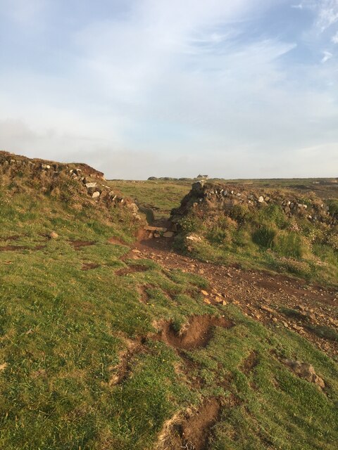
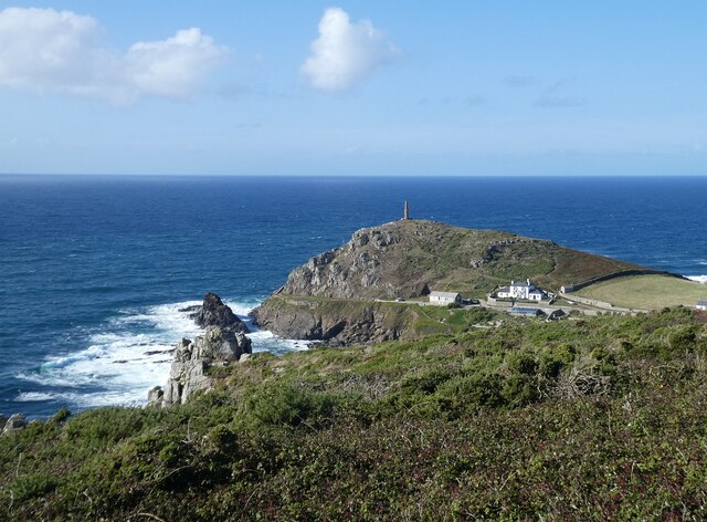
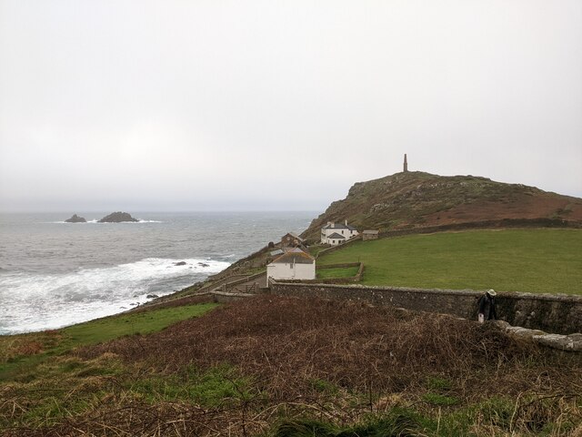
The moorland in Botallack Moor is characterized by its rolling hills, heather-covered expanses, and scattered rocky outcrops. This unique habitat provides a home to a variety of wildlife species, including birds such as skylarks and kestrels, as well as grazing animals like sheep and ponies. The moorland is often covered in a vibrant carpet of purple heather during the summer months, creating a breathtaking sight.

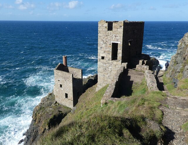
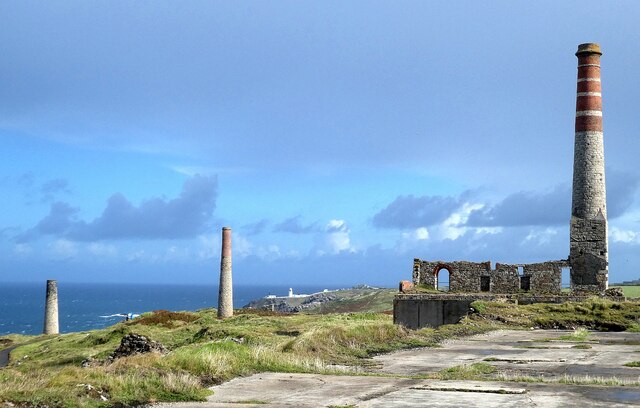
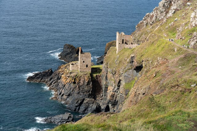
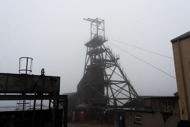
In addition to its natural beauty, Botallack Moor is also renowned for its historical significance. The area is dotted with remnants of Cornwall's mining heritage, including abandoned engine houses and chimney stacks. These structures stand as a testament to the region's rich mining past, which played a significant role in shaping its economy and culture.

Visitors to Botallack Moor can enjoy leisurely walks along the well-maintained footpaths, taking in the panoramic views of the surrounding countryside. The moorland's tranquility and untouched beauty make it an ideal destination for those seeking a peaceful retreat away from the hustle and bustle of city life.

In conclusion, Botallack Moor in Cornwall is a captivating destination that boasts a combination of breathtaking moorland scenery and historical significance. Whether exploring its vast downs or admiring the remnants of its mining heritage, visitors are sure to be captivated by the natural and cultural wonders found in this remarkable location.

If you have any feedback on the listing, please let us know in the comments section below.

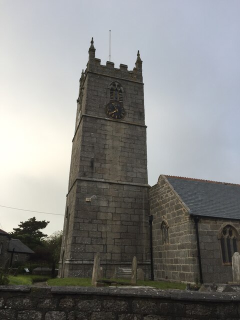
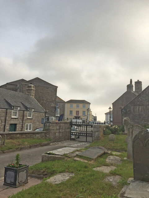
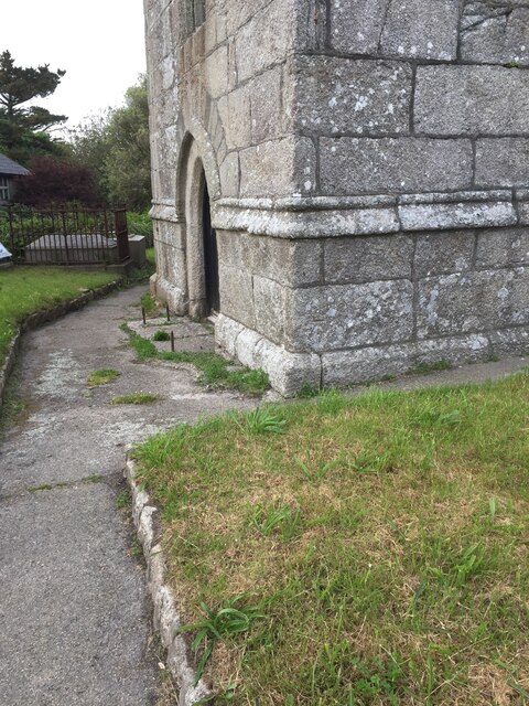
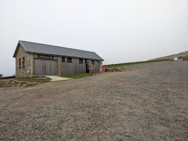
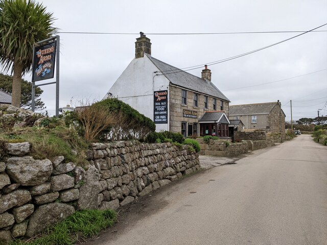
Botallack Moor Images

Images are sourced within 2km of 50.138181/-5.6866276 or Grid Reference SW3632. Thanks to Geograph Open Source API. All images are credited.

Windswept, St Just Clearly the owners of this shop have an eye for detail and design.
Windswept, St Just
Clearly the owners of this shop have an eye for detail and design.
St Just Church Tower
St Just from the churchyard of St Just church
OS Cut Mark - St Just, St Just's Church <span class="nowrap"><a title="https://www.bench-marks.org.uk/bm43294" rel="nofollow ugc noopener" href="https://www.bench-marks.org.uk/bm43294">Link</a><img style="margin-left:2px;" alt="External link" title="External link - shift click to open in new window" src="https://s1.geograph.org.uk/img/external.png" width="10" height="10"/></span>
OS Cut Mark - St Just, St Just's Church
Location of OS Cut Mark - St Just, St Just's Church <span class="nowrap"><a title="https://www.bench-marks.org.uk/bm43294" rel="nofollow ugc noopener" href="https://www.bench-marks.org.uk/bm43294">Link</a><img style="margin-left:2px;" alt="External link" title="External link - shift click to open in new window" src="https://s1.geograph.org.uk/img/external.png" width="10" height="10"/></span>
Location of OS Cut Mark - St Just, St Just's Church
Botallack Mine
Botallack Mine
Coastal views near Botallack
Section of coastal path
Botallack Head Trig Point Flush Bracket S8138
Botallack - Crowns Mines Looking down on the two ruined engine houses of Crowns Mines at Botallack, This is a UNESCO World Heritage Site.
<>More information to follow.
Botallack - Crowns Mines
Looking down on the two ruined engine houses of Crowns Mines at Botallack, This is a UNESCO World Heritage Site. <>More information to follow.
Cape Cornwall from Ballowall Barrow Looking over to England&amp;#039;s only cape - Cape Cornwall as seen from beside &lt;a href=&quot;https://www.geograph.org.uk/photo/6982138&quot;&gt;SW3531 : Ballowall Barrow&lt;/a&gt;
Cape Cornwall from Ballowall Barrow
Looking over to England's only cape - Cape Cornwall as seen from beside SW3531 : Ballowall Barrow
Chimneys of the Levant Mine There are numerous chimneys dotted about the former Levant Mine workings. Some belonged to engine houses such as those required to pump water from the mine, to operate lifts for men, ponies and ore, while others were required for the smelting process or to retrieve minerals. For example, the left-most one seen here was for the &amp;#039;calciner&amp;#039; where ores were heated to remove such useful minerals as arsenic. The most important elements to be recovered however were Tin and Copper, but this was generally extracted from the ore offsite.
Chimneys of the Levant Mine
There are numerous chimneys dotted about the former Levant Mine workings. Some belonged to engine houses such as those required to pump water from the mine, to operate lifts for men, ponies and ore, while others were required for the smelting process or to retrieve minerals. For example, the left-most one seen here was for the 'calciner' where ores were heated to remove such useful minerals as arsenic. The most important elements to be recovered however were Tin and Copper, but this was generally extracted from the ore offsite.
 Crowns Engine Houses at Botallack
Crowns Engine Houses at Botallack
Headframe and surrounding buildings at Geevor Tin Mine
The centre of St Just
Cape Cornwall seen from the National Trust car park
National Trust car park and hut at Cape Cornwall
The Queen's Arms, Botallock
Show me another place!

Botallack Moor is located at Grid Ref: SW3632 (Lat: 50.138181, Lng: -5.6866276)

Unitary Authority: Cornwall

Police Authority: Devon and Cornwall

What 3 Words

///greed.cargo.page. Near St Just, Cornwall

Related Wikis

Botallack Manor

Botallack Manor was built in the 17th century. The house is featured in the BBC television series Poldark, and is a Grade II* listed building situated...

Botallack Mine

The Botallack Mine (Cornish: Bostalek) is a former mine in Botallack in the west of Cornwall, UK. Since 2006 it has been part of the UNESCO World Heritage...

Wheal Owles

Wheal Owles was a tin mine in the parish of St Just in Cornwall, UK and the site of a disaster in 1893 when twenty miners lost their lives. Since 2006...

Botallack

Botallack (Cornish: Bostalek, meaning "Talek's dwelling") is a village in west Cornwall, England, United Kingdom. It lies along the B3306 road which connects...

Nearby Amenities

Located within 500m of 50.138181,-5.6866276
Botallack
Is In: Cornwall, England, UK
Is In Country: England
Is In Country Code: GB
Is In County: Cornwall
Name Kw: Bostalek
Place: hamlet
Source: npe
Wikidata: Q611674
Lat/Long: 50.1374888/-5.6841342
Botallack Mines
Tourism: attraction
Wikidata: Q894620
Wikipedia: en:Botallack Mine
Lat/Long: 50.1404184/-5.6891774
Bus Stop
Creswell Terrace
Naptan AtcoCode: 0800COD40219
Naptan Bearing: E
Naptan CommonName: Creswell Terrace
Naptan NaptanCode: coradapt
Naptan Street: Creswell Terrace
Naptan Verified: no
Source: naptan_import
Lat/Long: 50.1380855/-5.6805482
Truthwall
Is In: Cornwall, England, UK
Name Kw: Trewodhwal
Place: hamlet
Source: survey
Lat/Long: 50.1343198/-5.6844773
Pub
Queen's Arms
Addr City: Penzance
Addr Country: GB
Addr Place: Botallack
Addr Postcode: TR19 7QG
Fhrs Id: 409781
Wikidata: Q26613163
Lat/Long: 50.1366878/-5.6839591
Bus Stop
Queen's Arms
Bench: no
Bin: no
Bus: yes
Naptan AtcoCode: 0800COD40222
Naptan Bearing: N
Naptan CommonName: Queen's Arms
Naptan Indicator: N-bound
Naptan NaptanCode: coradamg
Naptan Verified: no
Public Transport: platform
Shelter: no
Source: naptan
Lat/Long: 50.1367206/-5.6841775
Post Box
Brand: Royal Mail
Brand Wikidata: Q638098
Collection Times: Mo-Fr 11:15; Sa 11:15
Operator: Royal Mail
Operator Wikidata: Q638098
Post Box Type: wall
Ref: TR19 8
Royal Cypher: EIIR
Royal Cypher Wikidata: Q33102113
Source: survey
Survey Date: 2015-09-29
Lat/Long: 50.1367411/-5.6841879
Parknoweth Mine
Man Made: mineshaft
Lat/Long: 50.1361064/-5.687022
Chimney
Historic: ruins
Lat/Long: 50.1404216/-5.6910477
Chimney
Historic: ruins
Lat/Long: 50.1373041/-5.6919895
Chimney
Historic: ruins
Lat/Long: 50.1414911/-5.6889767
Direction: SE
Generator Method: photovoltaic
Generator Output Electricity: small_installation
Generator Source: solar
Generator Type: solar_photovoltaic_panel
Location: roof
Power: generator
Source: bing
Lat/Long: 50.1373248/-5.6863663
Generator Method: photovoltaic
Generator Output Electricity: small_installation
Generator Source: solar
Generator Type: solar_photovoltaic_panel
Location: roof
Power: generator
Source: bing
Lat/Long: 50.1373875/-5.6853866
Direction: NE
Generator Method: photovoltaic
Generator Output Electricity: small_installation
Generator Source: solar
Generator Type: solar_photovoltaic_panel
Location: roof
Power: generator
Source: bing
Lat/Long: 50.137706/-5.6844096
Direction: SW
Generator Method: photovoltaic
Generator Output Electricity: small_installation
Generator Source: solar
Generator Type: solar_photovoltaic_panel
Location: roof
Power: generator
Source: bing
Lat/Long: 50.1376888/-5.6844652
Direction: S
Generator Method: photovoltaic
Generator Output Electricity: small_installation
Generator Source: solar
Generator Type: solar_photovoltaic_panel
Location: roof
Power: generator
Source: bing
Lat/Long: 50.1383718/-5.680511
Source: Bing
Lat/Long: 50.1387182/-5.693391
Source: Bing
Lat/Long: 50.1386494/-5.6934232
Source: Bing
Lat/Long: 50.1386872/-5.693509
Source: Bing
Lat/Long: 50.1386941/-5.6935734
Source: Bing
Lat/Long: 50.1385738/-5.6936216
Source: Bing
Lat/Long: 50.1385428/-5.6935895
Source: Bing
Lat/Long: 50.1384603/-5.6935841
Source: Bing
Lat/Long: 50.1384225/-5.6935626
Source: Bing
Lat/Long: 50.1384087/-5.6935036
Source: Bing
Lat/Long: 50.1384087/-5.6934446
Source: Bing
Lat/Long: 50.1382953/-5.693273
Source: Bing
Lat/Long: 50.1382953/-5.6933266
Source: Bing
Lat/Long: 50.1383159/-5.6933749
Source: Bing
Lat/Long: 50.1382884/-5.6934124
Source: Bing
Lat/Long: 50.1382746/-5.6934661
Source: Bing
Lat/Long: 50.1381955/-5.6934607
Source: Bing
Lat/Long: 50.1381062/-5.6934017
Source: Bing
Lat/Long: 50.1380752/-5.6934124
Source: Bing
Lat/Long: 50.1379858/-5.6934929
Source: Bing
Lat/Long: 50.1379205/-5.6935895
Barrier: stile
Foot: yes
Stile: stepover
Lat/Long: 50.1368546/-5.6863418
Barrier: stile
Stile: stepover
Lat/Long: 50.1364623/-5.6865148
Barrier: stile
Foot: yes
Stile: stepover
Lat/Long: 50.1368546/-5.6863418
Barrier: stile
Foot: yes
Stile: stepover
Lat/Long: 50.1368546/-5.6863418
Power: pole
Transformer: distribution
Lat/Long: 50.1371546/-5.686204
Power: pole
Lat/Long: 50.1368262/-5.6852599
Power: pole
Transformer: distribution
Lat/Long: 50.1361446/-5.6848106
Location Transition: yes
Power: pole
Lat/Long: 50.1351423/-5.6857333
Power: pole
Transformer: distribution
Lat/Long: 50.1344236/-5.6848857
Power: pole
Transformer: distribution
Lat/Long: 50.1382643/-5.6833421
Power: pole
Lat/Long: 50.1387302/-5.6822987
Power: pole
Lat/Long: 50.1391325/-5.6810823
Power: pole
Lat/Long: 50.1393972/-5.6800604
Man Made: mineshaft
Lat/Long: 50.1413825/-5.6896673
Historic: ruins
Lat/Long: 50.1413769/-5.6892293
The data included in this document is from www.openstreetmap.org. The data is made available under ODbL.

Have you been to Botallack Moor?

Leave your review of Botallack Moor below (or comments, questions and feedback).