Tigh na Caillich

Coastal Feature, Headland, Point in Argyllshire

Scotland

Tigh na Caillich

House on Gometra Gometra (Gòmastra) is an island in the Inner Hebrides, west of Mull. It lies immediately west of Ulva, to which it is linked by a bridge, and at low tide also by a beach (<span class="nowrap"><a title="https://en.wikipedia.org/wiki/Gometra" rel="nofollow ugc noopener" href="https://en.wikipedia.org/wiki/Gometra">Link</a><img style="margin-left:2px;" alt="External link" title="External link - shift click to open in new window" src="https://s1.geograph.org.uk/img/external.png" width="10" height="10"/></span> Wikipedia).
House on Gometra Credit: David Dixon

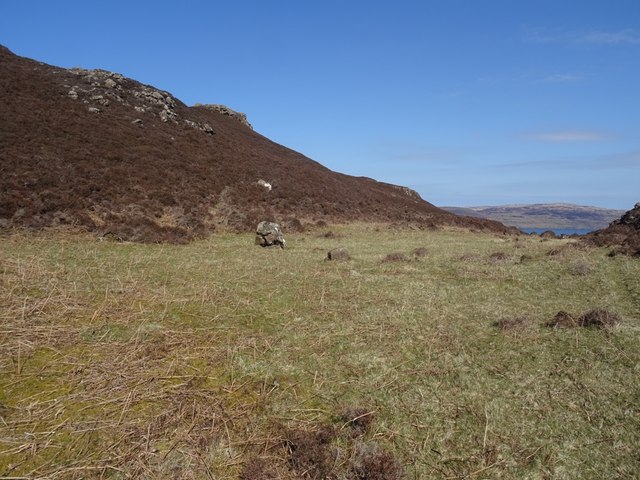
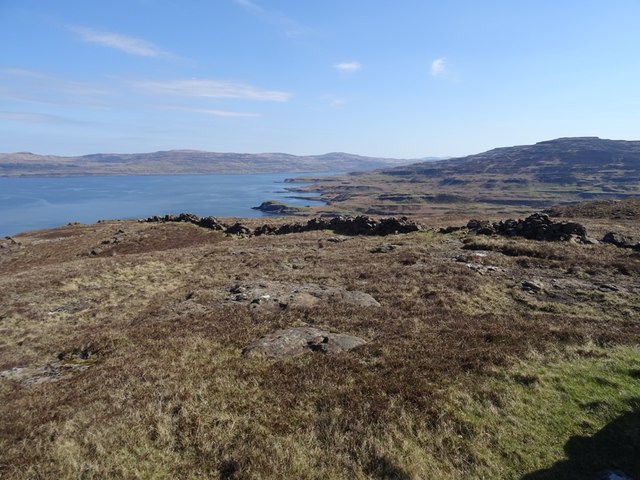
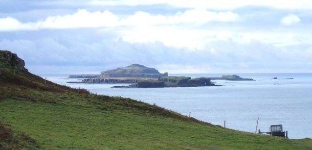
Tigh na Caillich is a prominent headland located in Argyllshire, Scotland. Situated along the rugged coastline, this coastal feature offers stunning views of the surrounding landscape and the nearby sea. The name Tigh na Caillich translates to "The Old Woman's House" in Gaelic, adding a sense of mystery and folklore to the area.

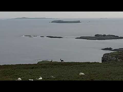
The headland is characterized by steep cliffs that drop down to the sea below, creating a dramatic and picturesque scene. Visitors can explore the rugged terrain and discover a variety of wildlife and bird species that call this area home. The headland is also a popular spot for hiking and birdwatching, attracting outdoor enthusiasts and nature lovers alike.

Tigh na Caillich is a great place to escape the hustle and bustle of everyday life and immerse oneself in the beauty of the Scottish coast. Whether taking in the panoramic views, spotting wildlife, or simply enjoying a peaceful moment by the sea, this headland offers a unique and unforgettable experience for visitors of all ages.

If you have any feedback on the listing, please let us know in the comments section below.

Tigh na Caillich Images

Images are sourced within 2km of 56.497448/-6.2928981 or Grid Reference NM3542. Thanks to Geograph Open Source API. All images are credited.

House on Gometra Gometra (Gòmastra) is an island in the Inner Hebrides, west of Mull. It lies immediately west of Ulva, to which it is linked by a bridge, and at low tide also by a beach (<span class="nowrap"><a title="https://en.wikipedia.org/wiki/Gometra" rel="nofollow ugc noopener" href="https://en.wikipedia.org/wiki/Gometra">Link</a><img style="margin-left:2px;" alt="External link" title="External link - shift click to open in new window" src="https://s1.geograph.org.uk/img/external.png" width="10" height="10"/></span> Wikipedia).
House on Gometra
Gometra (Gòmastra) is an island in the Inner Hebrides, west of Mull. It lies immediately west of Ulva, to which it is linked by a bridge, and at low tide also by a beach (LinkExternal link Wikipedia).
Burial ground, Gometra Gives its name to the township Bail' a' Chlaidh. There are still a few houses nearby.
Burial ground, Gometra
Gives its name to the township Bail' a' Chlaidh. There are still a few houses nearby.
A pass on Gometra Leaving Bail' a' Chlaidh for a low and scenic pass on the way to Gometra House.
A pass on Gometra
Leaving Bail' a' Chlaidh for a low and scenic pass on the way to Gometra House.
A pass on Gometra The road descends back to the coast on the way to Gometra House.  Even with the highest point on the island being only 155m above sea level there is some spectacular hill scenery here.
A pass on Gometra
The road descends back to the coast on the way to Gometra House. Even with the highest point on the island being only 155m above sea level there is some spectacular hill scenery here.
Pasture, Gometra A good place to start an ascent of the 155m high point of the island. Over the dyke the cropped grass gives way to deep heather, but deer paths aid progress.
Pasture, Gometra
A good place to start an ascent of the 155m high point of the island. Over the dyke the cropped grass gives way to deep heather, but deer paths aid progress.
Gometra's main road Descending beside Torr Mòr to the south coast and eventually Gometra House. The view is out to Staffa and Iona.
Gometra's main road
Descending beside Torr Mòr to the south coast and eventually Gometra House. The view is out to Staffa and Iona.
Deer, Gometra Red deer stags, still with their antlers in April.
Deer, Gometra
Red deer stags, still with their antlers in April.
Moorland, Gometra Looking towards the highest ground on the island across deep heather.
Moorland, Gometra
Looking towards the highest ground on the island across deep heather.
Former cultivated land, Gometra Amongst the heather there are often small areas of grass and bracken where land was improved for agriculture in the past.
Former cultivated land, Gometra
Amongst the heather there are often small areas of grass and bracken where land was improved for agriculture in the past.
View of the north coasts of Ulva and Gometra A view from high on Gometra along the north coast of the islands. The channel between them, Am Brù is not visible. The trap landscape of lava flows is well shown.
View of the north coasts of Ulva and Gometra
A view from high on Gometra along the north coast of the islands. The channel between them, Am Brù is not visible. The trap landscape of lava flows is well shown.
Ruin, Gometra High on the north side of the island, surrounded by land improved for agriculture and still providing grazing for sheep and deer.
Ruin, Gometra
High on the north side of the island, surrounded by land improved for agriculture and still providing grazing for sheep and deer.
Deer on Gometra Red deer stags, still with their antlers in April.
Deer on Gometra
Red deer stags, still with their antlers in April.
Basalt exposure, Gometra Resistant rock forming a stepped trap landscape near the island's summit.
Basalt exposure, Gometra
Resistant rock forming a stepped trap landscape near the island's summit.
Gometra, the summit The 155m highpoint of the island.
Gometra, the summit
The 155m highpoint of the island.
Summit, Gometra Cairn and vanessa triangulation pillar on the island's high point. The basalt drystane dyke runs straight for some distance. Coll is on the horizon.
Summit, Gometra
Cairn and vanessa triangulation pillar on the island's high point. The basalt drystane dyke runs straight for some distance. Coll is on the horizon.
Summit area, Gometra View along the coast of Ulva and Loch Tuath from beside the triangulation pillar. The heather is close cropped here due to the wind.
Summit area, Gometra
View along the coast of Ulva and Loch Tuath from beside the triangulation pillar. The heather is close cropped here due to the wind.
Perched lochan, Gometra Seen from the summit with Loch Tuath and Mull beyond.
Perched lochan, Gometra
Seen from the summit with Loch Tuath and Mull beyond.
Headland, Gometra On the north coast, seen from the summit.
Headland, Gometra
On the north coast, seen from the summit.
Show me another place!

Tigh na Caillich is located at Grid Ref: NM3542 (Lat: 56.497448, Lng: -6.2928981)

Unitary Authority: Argyll and Bute

Police Authority: Argyll and West Dunbartonshire

What 3 Words

///composts.haystack.pirate. Near Calgary, Argyll & Bute

Related Wikis

Gometra

Gometra (Scottish Gaelic: Gòmastra) is an island in the Inner Hebrides of Scotland, lying west of Mull. It lies immediately west of Ulva, to which it is...

Achleck

Achleck is a small settlement in the north-west of the Isle of Mull in Argyll and Bute, Scotland. == References ==

Cairn na Burgh Beag

Cairn na Burgh Beag is one of the Treshnish Isles in the Inner Hebrides, Scotland. Cairn na Burgh Beag is the smaller of the two "Carnburgs" (as they...

Loch Tuath

Loch Tuath (Scottish Gaelic: Loch-a-Tuath) is a sea loch in the Inner Hebrides, Scotland that separates the Isle of Mull and the island of Ulva. Loch Tuath...

Related Videos

Red Deer Hind with Fawn

This years first glimpse of Red Deer Fawn on the Isle of Gometra off the remote western side of the Isle of Mull in Scotland.

Gometra Declares

Gometra Declares The Isle of Gometra, Inner Hebrides, Scotland, declared a climate and ecological emergency, as part of 'Islands ...

Nearby Amenities

Located within 500m of 56.497448,-6.2928981
Ele: 41
Natural: peak
Lat/Long: 56.4963461/-6.3001671
The data included in this document is from www.openstreetmap.org. The data is made available under ODbL.

Have you been to Tigh na Caillich?

Leave your review of Tigh na Caillich below (or comments, questions and feedback).