An Curachan
Coastal Feature, Headland, Point in Argyllshire
Scotland
An Curachan

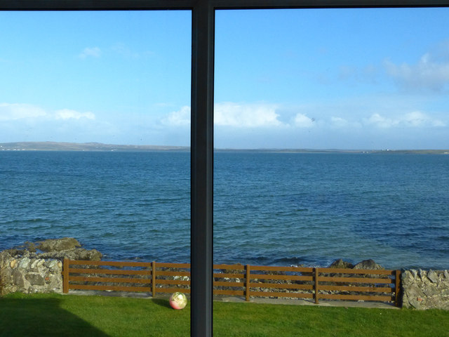
An Curachan is a coastal feature located in Argyllshire, Scotland. It is a prominent headland that juts out into the waters of the Atlantic Ocean. The headland is characterized by its rugged cliffs, which rise steeply from the sea, offering stunning panoramic views of the surrounding area.
Situated on the west coast of Scotland, An Curachan is known for its dramatic and picturesque landscape. The headland is composed of rocky outcrops and grassy slopes, and it is home to a diverse range of plant and animal species. Visitors can expect to see a variety of seabirds, such as gannets, puffins, and razorbills, as well as seals and occasionally dolphins in the waters below.
The headland is a popular destination for outdoor enthusiasts and nature lovers. It offers numerous opportunities for activities such as hiking, birdwatching, and photography. There are several walking trails that wind their way along the cliffs, offering breathtaking views and a chance to explore the unique flora and fauna of the area.
An Curachan is also steeped in history and folklore. It is believed to have been a site of ancient settlements, with archaeological remains dating back thousands of years. The headland is said to have been a lookout point for early inhabitants, providing a strategic vantage point over the ocean.
Overall, An Curachan is a captivating coastal feature in Argyllshire, offering a combination of natural beauty, wildlife, and historical significance. It is a must-visit destination for anyone seeking to experience the rugged charm of Scotland's west coast.
If you have any feedback on the listing, please let us know in the comments section below.
An Curachan Images
Images are sourced within 2km of 55.758308/-6.2987634 or Grid Reference NR3060. Thanks to Geograph Open Source API. All images are credited.


An Curachan is located at Grid Ref: NR3060 (Lat: 55.758308, Lng: -6.2987634)
Unitary Authority: Argyll and Bute
Police Authority: Argyll and West Dunbartonshire
What 3 Words
///crashing.span.childcare. Near Bowmore, Argyll & Bute
Nearby Locations
Related Wikis

Bowmore distillery
Bowmore distillery ( boh-MOR, Scottish Gaelic: Taigh-staile Bogh Mòr) produces Scotch whisky on the Isle of Islay, an island of the Inner Hebrides.The...

RAF Bowmore
Royal Air Force Bowmore or more simply RAF Bowmore is a former Royal Air Force seaplane station located in Bowmore, Argyll and Bute, Scotland. The following...
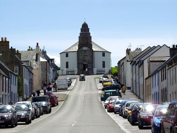
Bowmore
Bowmore (Scottish Gaelic: Bogh Mòr, 'Big Bend') is a small town on the Scottish island of Islay. It serves as administrative capital of the island, and...
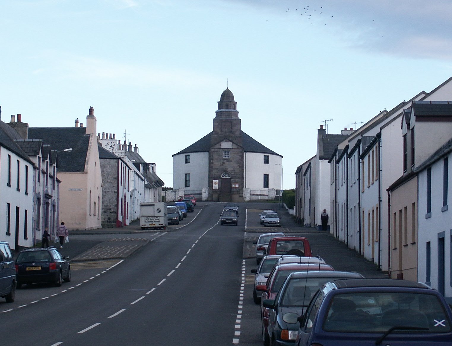
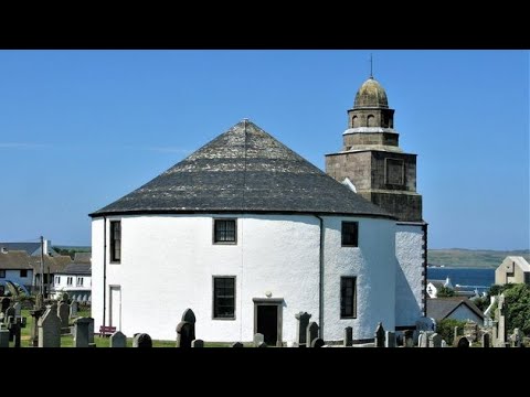
Kilarrow Parish Church
Kilarrow Church (Scottish Gaelic: Eaglais Cill an Rubha) is a Church of Scotland parish church, overlooking and serving Bowmore on the island of Islay...
Islay Hospital
Islay Hospital is a community hospital in Gortanvogie Road, Bowmore, Scotland. It is managed by NHS Highland. == History == The facility has its origins...
Bridgend Flats
Bridgend Flats is an area of mudflats and saltmarsh near the village of Bridgend on the island of Islay off the west coast of Scotland. Covering an area...

River Sorn
The River Sorn is a small river on the Scottish island of Islay. Draining Loch Finlaggan and having gathered the waters of the Allt Ruadh and the Ballygrant...
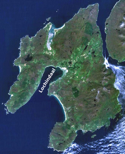
Loch Indaal
Loch Indaal (or Lochindaal) is a sea loch on Islay, the southernmost island of the Hebrides, off the west coast of Scotland. Together with Loch Gruinart...
Related Videos
Kilarow Parish Church On History Visit To Bowmore On Island Of Islay Inner Hebrides Scotland
Tour Scotland short travel video clip, with Scottish music, of Kilarow Parish Church on ancestry, genealogy, history visit to ...

Loch Indaal With Music On History Visit To Island Of Islay Inner Hebrides Scotland
Tour Scotland 4K travel video clip, with Scottish music, of Loch Indaal on ancestry, genealogy, history visit to the Island Of Islay, ...

Exploring the Isle of Islay - Bowmore and Dun Nosebridge
Continuing our exploration of the Isle of Islay in the Inner Hebrides, Scotland. We spend time in the island's 'capital', Bowmore, ...
Nearby Amenities
Located within 500m of 55.758308,-6.2987634Have you been to An Curachan?
Leave your review of An Curachan below (or comments, questions and feedback).