An Gleann

Coastal Feature, Headland, Point in Argyllshire

Scotland

An Gleann

Killinallan Point The end of the dune system and the beach, viewed at low tide.
Killinallan Point Credit: Mary and Angus Hogg

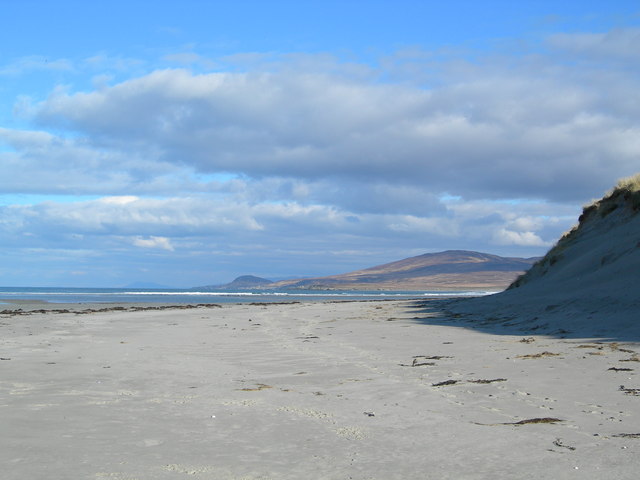
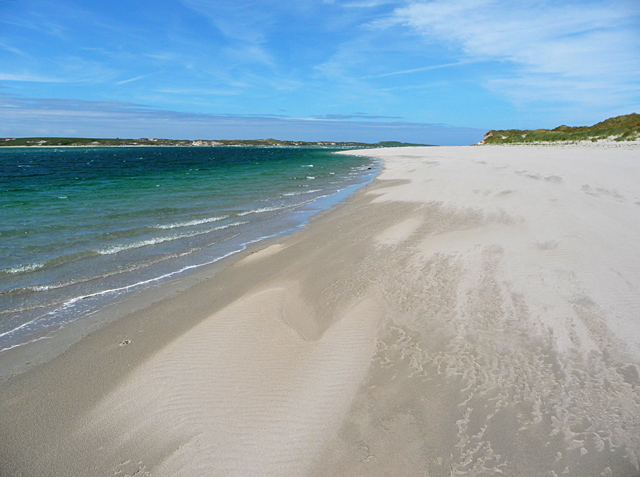
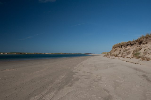
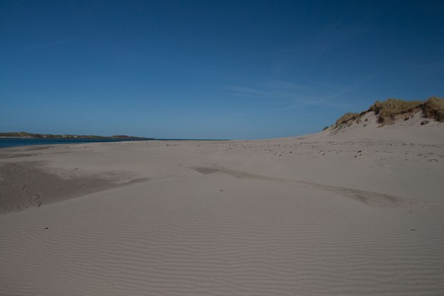
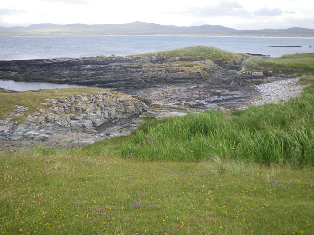
An Gleann is a picturesque coastal feature located in Argyllshire, Scotland. Situated on the western coast of the Scottish mainland, it is a headland that extends into the Atlantic Ocean, forming a prominent point that offers stunning views of the surrounding landscape.

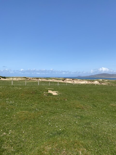
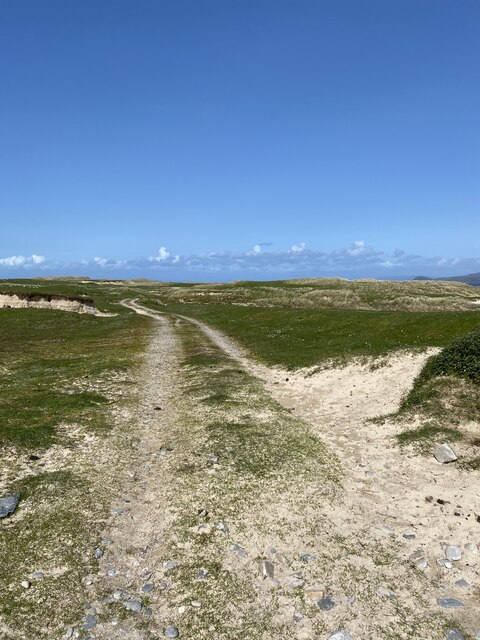
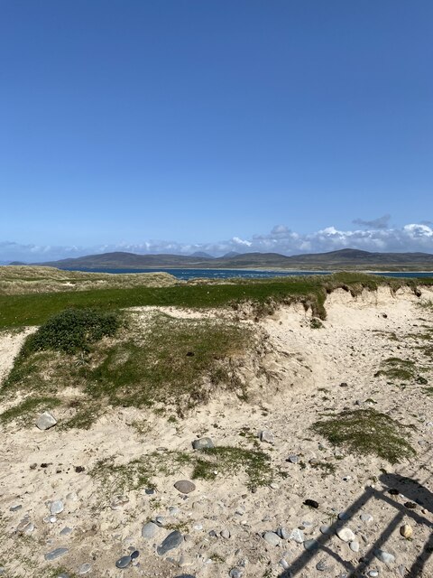
The name "An Gleann" translates to "The Glen" in English, which aptly describes the natural topography of the area. The headland is characterized by rolling hills, steep cliffs, and a rugged coastline, creating a dramatic and breathtaking scenery. The cliffs are often covered in vibrant green vegetation, adding to the beauty of the landscape.

The coastal waters surrounding An Gleann are known for their diverse marine life. The nutrient-rich currents attract a wide range of species, making it a popular spot for fishing and wildlife enthusiasts. Visitors can often spot seals, dolphins, and even whales swimming in the waters, adding to the enchantment of the area.

An Gleann is also a haven for birdwatching enthusiasts, as it is a nesting spot for various seabirds. Bird species such as puffins, guillemots, and razorbills can be observed along the cliffs and in the surrounding areas.

For those seeking outdoor activities, An Gleann offers excellent hiking opportunities. There are several well-marked trails that wind their way through the headland, providing breathtaking views at every turn. The rugged terrain and refreshing sea breeze make it an ideal destination for nature lovers and adventure seekers.

Overall, An Gleann in Argyllshire is a captivating coastal feature that showcases the natural beauty of Scotland’s western coast. With its stunning views, diverse wildlife, and recreational opportunities, it is a must-visit destination for anyone exploring the region.

If you have any feedback on the listing, please let us know in the comments section below.

An Gleann Images

Images are sourced within 2km of 55.867234/-6.3400652 or Grid Reference NR2872. Thanks to Geograph Open Source API. All images are credited.
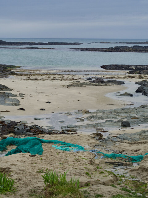
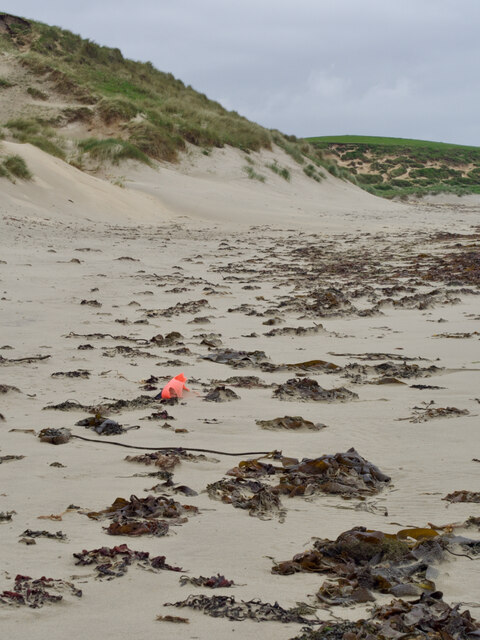
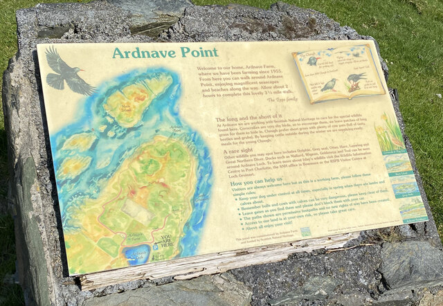
Killinallan Point The end of the dune system and the beach, viewed at low tide.
Killinallan Point
The end of the dune system and the beach, viewed at low tide.
Approaching Killinallan Point The long beach of Traigh Baile Aonghais eventually turns a corner at Killinallan Point at the entrance to Loch Gruinart.
Approaching Killinallan Point
The long beach of Traigh Baile Aonghais eventually turns a corner at Killinallan Point at the entrance to Loch Gruinart.
Killinallan Point The western side of the mouth of Loch Gruinart.
Killinallan Point
The western side of the mouth of Loch Gruinart.
Walking towards Killinallan Point, Islay This beach stretches in total for about 3 miles from the 'car park' at the Killinallan locked gate to the Gortantoid River. It is an easy and beautiful walk covering several gridsquares.
Walking towards Killinallan Point, Islay
This beach stretches in total for about 3 miles from the 'car park' at the Killinallan locked gate to the Gortantoid River. It is an easy and beautiful walk covering several gridsquares.
Corran Bàn, Killinallan Point, Islay It can be hard work walking through this dry sand! For 3 miles!
Corran Bàn, Killinallan Point, Islay
It can be hard work walking through this dry sand! For 3 miles!
Beach at the mouth of Loch Gruinart Looking towards Kilinallan Point <a href="https://www.geograph.org.uk/gridref/NR3072">NR3072</a>.
Beach at the mouth of Loch Gruinart
Looking towards Kilinallan Point NR3072.
Sands at the mouth of Loch Gruinart The Ardnave peninsula lies across the water.
Sands at the mouth of Loch Gruinart
The Ardnave peninsula lies across the water.
Eilean Nòstaig lobster farm The windswept rolling headland of Ardnave Point is a mix of machair and sand dunes and populated by inquisitive sheep.

Along the Atlantic facing coast, a strange abandoned arrangement of concrete dam walls and rusty sluice gates, too small for a boat. I read that it is an abandoned lobster farm [Google Books. (2013). Walking on Jura, Islay and Colonsay].

Further information has proved quite elusive. Canmore, the Scottish Heritage site lists "Two stone built fish traps on the shore" of unassigned age. These were definitely concrete.

A report written in 1973 notes "in recent years a concrete fishing tank has been constructed in the southwest corner of the [Ardnave peninsula], making use of a naturally advantageous position between the shore and the rocks on the lower beach. At the time of survey the tank was unused".

More questions than answers.

For references see my blog <span class="nowrap"><a title="http://www.fhithich.uk/?p=28109" rel="nofollow ugc noopener" href="http://www.fhithich.uk/?p=28109">Link</a><img style="margin-left:2px;" alt="External link" title="External link - shift click to open in new window" src="https://s1.geograph.org.uk/img/external.png" width="10" height="10"/></span>
Eilean Nòstaig lobster farm
The windswept rolling headland of Ardnave Point is a mix of machair and sand dunes and populated by inquisitive sheep. Along the Atlantic facing coast, a strange abandoned arrangement of concrete dam walls and rusty sluice gates, too small for a boat. I read that it is an abandoned lobster farm [Google Books. (2013). Walking on Jura, Islay and Colonsay]. Further information has proved quite elusive. Canmore, the Scottish Heritage site lists "Two stone built fish traps on the shore" of unassigned age. These were definitely concrete. A report written in 1973 notes "in recent years a concrete fishing tank has been constructed in the southwest corner of the [Ardnave peninsula], making use of a naturally advantageous position between the shore and the rocks on the lower beach. At the time of survey the tank was unused". More questions than answers. For references see my blog LinkExternal link
Flotsam on sands near Leac Bhuidhe
Degrading buoy, Tràigh Nòstaig
Loch Gruinart, low tide
Road to Ardnave House
Ardnave House Shows as a blue triangulation pillar on OS Maps but is in fact an Intersected Station
<span class="nowrap"><a title="https://trigpointing.uk/trig/15715" rel="nofollow ugc noopener" href="https://trigpointing.uk/trig/15715">Link</a><img style="margin-left:2px;" alt="External link" title="External link - shift click to open in new window" src="https://s1.geograph.org.uk/img/external.png" width="10" height="10"/></span>
<span class="nowrap"><a title="https://trigpointing.uk/wiki/Intersected_Station" rel="nofollow ugc noopener" href="https://trigpointing.uk/wiki/Intersected_Station">Link</a><img style="margin-left:2px;" alt="External link" title="External link - shift click to open in new window" src="https://s1.geograph.org.uk/img/external.png" width="10" height="10"/></span>
Ardnave House
Shows as a blue triangulation pillar on OS Maps but is in fact an Intersected Station LinkExternal link LinkExternal link
Ardnave Car Park
Ardnave Car Park
Ardnave Point Sign
Ardnave Point Sign
Track, Ardnave
Track, Ardnave
Views from Ardnave
Views from Ardnave
Show me another place!

An Gleann is located at Grid Ref: NR2872 (Lat: 55.867234, Lng: -6.3400652)

Unitary Authority: Argyll and Bute

Police Authority: Argyll and West Dunbartonshire

What 3 Words

///respond.beep.boss. Near Bridgend, Argyll & Bute

Related Wikis

Loch Gruinart

Loch Gruinart (Scottish Gaelic: Loch Gruinneard from the Old Norse, meaning "shallow fjord") is a sea loch on the northern coast of isle of Islay in Scotland...

Ardnave Point

Ardnave Point (Scottish Gaelic, Àird an Naoimh) is a coastal promontory on the northwest of Islay, a Scottish island. This landform has a rocky northern...

Nave Island

Nave Island lies to the north of Islay in the Inner Hebrides near the mouth of Loch Gruinart. It is uninhabited. == Geography == The island is all but...

Battle of Traigh Ghruinneart

The Battle of Traigh Ghruinneart or in Scottish Gaelic Blàr Tràigh Ghruineart or sometimes called the Battle of Gruinart Strand was a Scottish clan battle...

Nearby Amenities

Located within 500m of 55.867234,-6.3400652
Source: PGS
Lat/Long: 55.8673563/-6.3379846
Barrier: cattle_grid
Lat/Long: 55.8667356/-6.3427563
Sgeir Liath
Description: Translates into English as "Grey rock"
Name Gd: Sgeir Liath
Natural: bare_rock
Lat/Long: 55.8695857/-6.3341182
Port na Feannaige
Description: Translates into English as "Port of the royston"
Name Gd: Port na Feannaige
Natural: bay
Lat/Long: 55.8662161/-6.3374022
Tobar Nèill Neònaich
Description: Translates into English as "Eccentic Neill's Well"
Name Gd: Tobar Nèill Neònaich
Natural: spring
Lat/Long: 55.8652696/-6.3385659
Ceann an Àrd
Description: Translates into English as "Head of the height"
Ele: 30
Name Gd: Ceann an Àrd
Natural: hill
Lat/Long: 55.8641448/-6.3434665
Power: pole
Lat/Long: 55.8665107/-6.3412966
Power: pole
Lat/Long: 55.8708972/-6.3399078
Power: pole
Lat/Long: 55.8716892/-6.3396607
Power: pole
Lat/Long: 55.8633702/-6.342288
Power: pole
Lat/Long: 55.8640009/-6.3420889
Power: pole
Lat/Long: 55.8648504/-6.3418208
Power: pole
Lat/Long: 55.8656798/-6.3415589
Power: pole
Lat/Long: 55.8674223/-6.341008
Power: pole
Lat/Long: 55.8681254/-6.3407854
Power: pole
Lat/Long: 55.8687985/-6.3405723
Power: pole
Lat/Long: 55.8696283/-6.3403096
Power: pole
Lat/Long: 55.8702811/-6.3401029
The data included in this document is from www.openstreetmap.org. The data is made available under ODbL.

Have you been to An Gleann?

Leave your review of An Gleann below (or comments, questions and feedback).