Rubhaichean na h-Airigh Buidhe

Coastal Feature, Headland, Point in Ross-shire

Scotland

Rubhaichean na h-Airigh Buidhe

Port Griogaspuil Always marked on OS maps right back to the very first in 1858, but very little to see other than the ruins of old quays and the low walls of three buildings. Rumoured to be the site of a mill, but not much of a stream to turn a mill wheel
Port Griogaspuil Credit: Richard Barrett

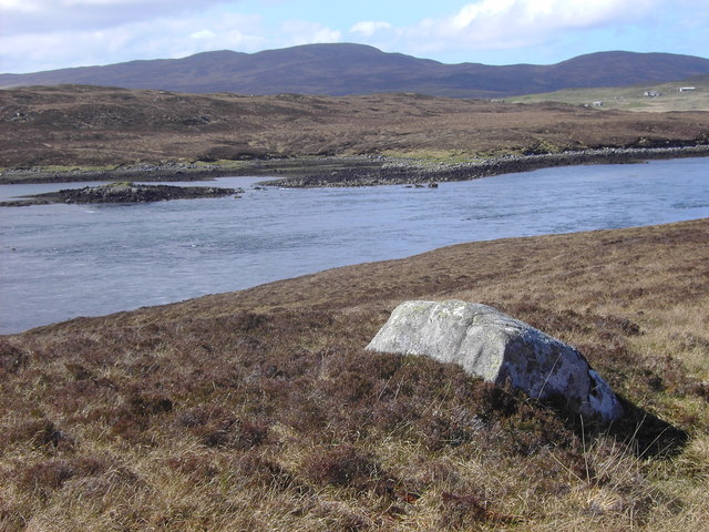
Rubhaichean na h-Airigh Buidhe is a headland located in Ross-shire, Scotland. This coastal feature is known for its stunning views of the surrounding landscape and the nearby sea. The headland is characterized by rocky cliffs and grassy slopes that lead down to the water's edge.

The name Rubhaichean na h-Airigh Buidhe translates to "point of the yellow shielings" in English, reflecting the historical presence of small summer dwellings in the area. These shielings were used by farmers to graze livestock during the warmer months.

The headland is a popular spot for outdoor enthusiasts, offering opportunities for hiking, birdwatching, and photography. Visitors can enjoy panoramic views of the coastline and the open sea, as well as the chance to spot a variety of seabirds and marine wildlife.

Rubhaichean na h-Airigh Buidhe is a peaceful and scenic location, perfect for those looking to escape the hustle and bustle of city life and immerse themselves in the natural beauty of the Scottish coast.

If you have any feedback on the listing, please let us know in the comments section below.

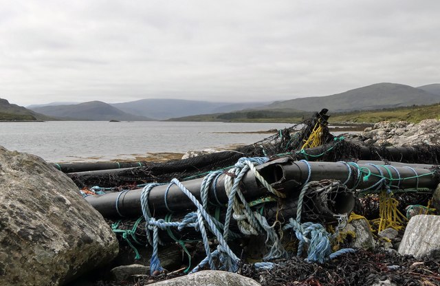
Rubhaichean na h-Airigh Buidhe Images

Images are sourced within 2km of 58.037241/-6.6798898 or Grid Reference NB2314. Thanks to Geograph Open Source API. All images are credited.

Port Griogaspuil Always marked on OS maps right back to the very first in 1858, but very little to see other than the ruins of old quays and the low walls of three buildings. Rumoured to be the site of a mill, but not much of a stream to turn a mill wheel
Port Griogaspuil
Always marked on OS maps right back to the very first in 1858, but very little to see other than the ruins of old quays and the low walls of three buildings. Rumoured to be the site of a mill, but not much of a stream to turn a mill wheel
Ãird an Troim Looking over Loch an Rathaid.
Ãird an Troim
Looking over Loch an Rathaid.
Debris on the shore of Loch Seaforth/Loch Shiphoirt, Isle of Lewis I assume the debris has drifted from a fish farm.
Debris on the shore of Loch Seaforth/Loch Shiphoirt, Isle of Lewis
I assume the debris has drifted from a fish farm.
View across moorland from Corra Chnoc, Isle of Lewis Looking towards Cearnabhal, the top of which is in the cloud.
View across moorland from Corra Chnoc, Isle of Lewis
Looking towards Cearnabhal, the top of which is in the cloud.
Loch a' Chorra Chnoic, Isle of Lewis According to the OS Name Book of 1848-1852, Loch a' Chorra Chnoic means Steep Hill Loch.
Loch a' Chorra Chnoic, Isle of Lewis
According to the OS Name Book of 1848-1852, Loch a' Chorra Chnoic means Steep Hill Loch.
Ruined farmstead by Loch Seaforth/Loch Shiphoirt, Isle of Lewis The farmstead is marked as a ruin on the 1st Edition OS map surveyed during 1850-53.
Ruined farmstead by Loch Seaforth/Loch Shiphoirt, Isle of Lewis
The farmstead is marked as a ruin on the 1st Edition OS map surveyed during 1850-53.
Salt marsh by Loch Seaforth/Loch Shiphoirt, Isle of Lewis The Aline Community Woodland can be seen on the right and in the centre of the horizon is the unnamed hill on Eilean Shìophoirt.
Salt marsh by Loch Seaforth/Loch Shiphoirt, Isle of Lewis
The Aline Community Woodland can be seen on the right and in the centre of the horizon is the unnamed hill on Eilean Shìophoirt.
Dorus Beag, Loch Seaforth/Loch Shiphoirt, Isle of Lewis Dorus Beag is the channel between the shore and a rock called Sgeir Liath which was under water at the time the photo was taken.  Dorus Beag means Little Door.
Dorus Beag, Loch Seaforth/Loch Shiphoirt, Isle of Lewis
Dorus Beag is the channel between the shore and a rock called Sgeir Liath which was under water at the time the photo was taken. Dorus Beag means Little Door.
Shieling mound, Rubha Àirigh an t-Sruth, Loch Seaforth/Loch Shiphoirt, Isle of Lewis According to the OS Name Book of 1848-1852, Rubha Àirigh an t-Sruth means The Streams Shieling's point.
Shieling mound, Rubha Àirigh an t-Sruth, Loch Seaforth/Loch Shiphoirt, Isle of Lewis
According to the OS Name Book of 1848-1852, Rubha Àirigh an t-Sruth means The Streams Shieling's point.
Building remains by Loch Seaforth/Loch Shiphoirt, Isle of Lewis The 1st Edition OS map, surveyed in 1850-53, shows two buildings, already unroofed at that time.
Building remains by Loch Seaforth/Loch Shiphoirt, Isle of Lewis
The 1st Edition OS map, surveyed in 1850-53, shows two buildings, already unroofed at that time.
Loch Seaforth/Loch Shiphoirt, Isle of Lewis Looking towards Mullach Breac Mhalasgair.
Loch Seaforth/Loch Shiphoirt, Isle of Lewis
Looking towards Mullach Breac Mhalasgair.
Tob Sgeir nan Radan, Loch Seaforth/Loch Shiphoirt, Isle of Lewis The OS Name Book of 1848-52 describes Tob Sgeir nan Radan as a small bay or harbour. The name means Rat's Rock Bay.
Tob Sgeir nan Radan, Loch Seaforth/Loch Shiphoirt, Isle of Lewis
The OS Name Book of 1848-52 describes Tob Sgeir nan Radan as a small bay or harbour. The name means Rat's Rock Bay.
Stone circle (and nosy sheep) by Loch Seaforth/Loch Shiphoirt, Isle of Lewis The stone circle is one of two about 20 metres apart and is described at <span class="nowrap"><a title="https://canmore.org.uk/site/282987/lewis-rubha-leathann" rel="nofollow ugc noopener" href="https://canmore.org.uk/site/282987/lewis-rubha-leathann">Link</a><img style="margin-left:2px;" alt="External link" title="External link - shift click to open in new window" src="https://s1.geograph.org.uk/img/external.png" width="10" height="10"/></span>.
Stone circle (and nosy sheep) by Loch Seaforth/Loch Shiphoirt, Isle of Lewis
The stone circle is one of two about 20 metres apart and is described at LinkExternal link.
Ruined farmhouse, Tota nan Scalag by Loch Seaforth/Loch Shìophoirt, Isle of Lewis The farmhouse was already in ruins at the time of the compilation of the OS Name Book in 1848-52.
Ruined farmhouse, Tota nan Scalag by Loch Seaforth/Loch Shìophoirt, Isle of Lewis
The farmhouse was already in ruins at the time of the compilation of the OS Name Book in 1848-52.
Loch an Rathaid With clouds reflected in the still water.
Loch an Rathaid
With clouds reflected in the still water.
Looking across Loch Seaforth
An inlet on the shore of Loch Seaforth
Ruined blackhouses on the shore of Loch Seaforth
Show me another place!

Rubhaichean na h-Airigh Buidhe is located at Grid Ref: NB2314 (Lat: 58.037241, Lng: -6.6798898)

Unitary Authority: Na h-Eileanan an Iar

Police Authority: Highlands and Islands

What 3 Words

///trouble.magazines.ambition. Near Leurbost, Na h-Eileanan Siar

Related Wikis

Airidh a' Bhruaich

Airidh a' Bhruaich (Arivruaich - anglicised) is a scattered crofting township in the South Lochs district of the Isle of Lewis in the Outer Hebrides of...

Seaforth Island

Seaforth Island (Scottish Gaelic: Eilean Shìphoirt/Shìophoirt or Mulag) is an uninhabited island in the Outer Hebrides of Scotland. Unlike many other...

Ardvourlie Castle

Ardvourlie Castle is a 19th-century country house on Harris, one of the Western Isles off the north-west coast of Scotland. The house was built beside...

Balallan

Balallan (Scottish Gaelic: Baile Ailein, Bail' Ailein), meaning "Allan's Town", is a crofting township on the Isle of Lewis, in the Outer Hebrides, Scotland...

Nearby Amenities

Located within 500m of 58.037241,-6.6798898
Created By: dmgroom_coastlines
Lat/Long: 58.03597/-6.6849
Cithis Bheag
Natural: peak
Source: OS7
Lat/Long: 58.0328857/-6.6800934
The data included in this document is from www.openstreetmap.org. The data is made available under ODbL.

Have you been to Rubhaichean na h-Airigh Buidhe?

Leave your review of Rubhaichean na h-Airigh Buidhe below (or comments, questions and feedback).