An Dubh-àird

Coastal Feature, Headland, Point in Inverness-shire

Scotland

An Dubh-àird

Is Loch Suardal a dried-up lake? A lacustrine plain, perhaps?
Is Loch Suardal a dried-up lake? A lacustrine plain, perhaps? Credit: Mick Garratt

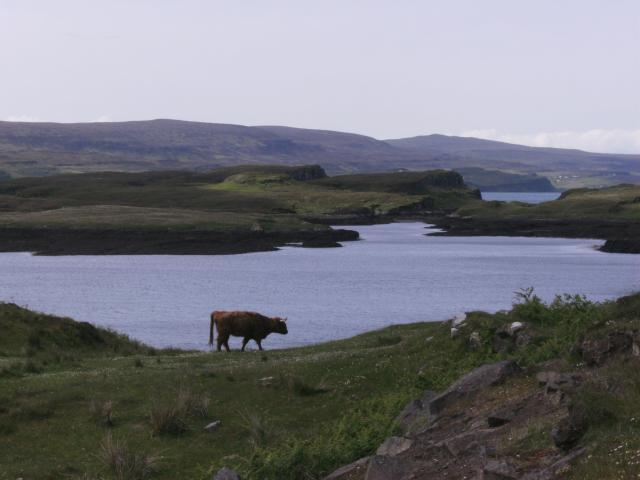
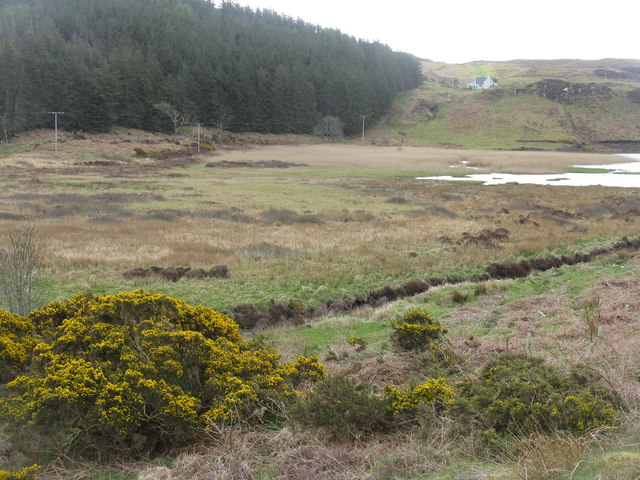
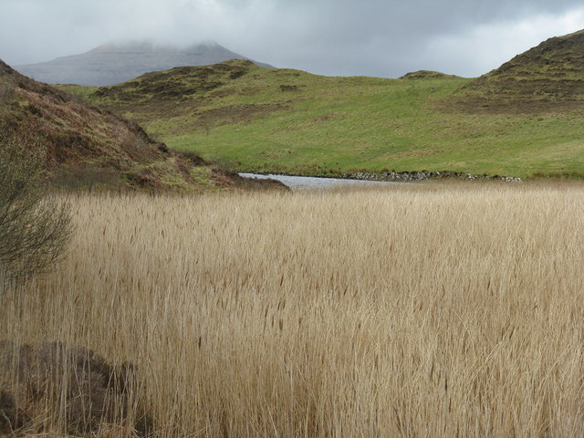
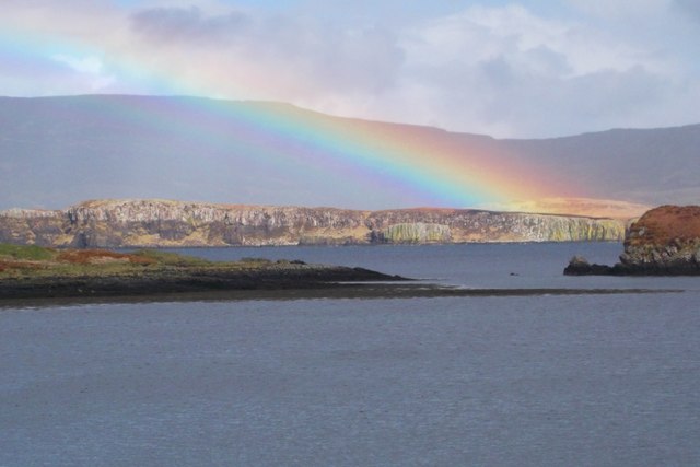
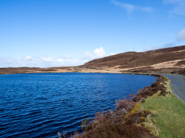
An Dubh-àird is a prominent headland located in Inverness-shire, Scotland. It is situated along the rugged coastline of the North Sea, offering stunning views of the surrounding landscape. The headland is characterized by steep cliffs that rise dramatically from the sea, creating a striking and picturesque scene.

An Dubh-àird is a popular spot for outdoor enthusiasts, offering opportunities for hiking, birdwatching, and photography. The headland is home to a variety of seabirds, including gannets, puffins, and guillemots, making it a haven for birdwatchers.

The coastal feature is also known for its rich maritime history, with evidence of ancient settlements and Viking activity in the area. Visitors can explore the remains of old structures and artifacts that provide insight into the region's past.

Overall, An Dubh-àird is a must-visit destination for nature lovers and history buffs alike. Its rugged beauty and historical significance make it a truly special place to explore along the Scottish coastline.

If you have any feedback on the listing, please let us know in the comments section below.

An Dubh-àird Images

Images are sourced within 2km of 57.462634/-6.6116742 or Grid Reference NG2350. Thanks to Geograph Open Source API. All images are credited.

Is Loch Suardal a dried-up lake? A lacustrine plain, perhaps?
Oh great, yet another stunning masterpiece of Loch Corlarach. Can't contain my excitement!
Highland Cattle at Loch Dunvegan Taken from the Claigan road North of Dunvegan Castle. View over blooming meadows to Fiadhairt peninsula with the open Loch beyond. Across Loch Dunvegan lie the hamlets Uig, Borreraig and Galtrigill with Ben Skriaig and Biod an Athair rising behind them.
Highland Cattle at Loch Dunvegan
Taken from the Claigan road North of Dunvegan Castle. View over blooming meadows to Fiadhairt peninsula with the open Loch beyond. Across Loch Dunvegan lie the hamlets Uig, Borreraig and Galtrigill with Ben Skriaig and Biod an Athair rising behind them.
MV Hebridean Princess off Colbost The luxury cruise vessel (formerly CalMac's "Columba") glides up Loch Dunvegan early on an October morning, bringing her passengers to visit Dunvegan Castle.
MV Hebridean Princess off Colbost
The luxury cruise vessel (formerly CalMac's "Columba") glides up Loch Dunvegan early on an October morning, bringing her passengers to visit Dunvegan Castle.
Dam across Loch Suardal Constructed of stone and earth infill, just north of Dunvegan Castle/Caisteal Dhun Bhegan.
Dam across Loch Suardal
Constructed of stone and earth infill, just north of Dunvegan Castle/Caisteal Dhun Bhegan.
Loch Suardal, near Dunvegan Viewed from the dam, which carries the road up the glen.
Loch Suardal, near Dunvegan
Viewed from the dam, which carries the road up the glen.
Reeds in Loch Suardal Looking south at the part of the loch below the dam, and what is presumably the lower dam, marked on the map at the normal tide line, can be seen at the narrow point.
Reeds in Loch Suardal
Looking south at the part of the loch below the dam, and what is presumably the lower dam, marked on the map at the normal tide line, can be seen at the narrow point.
Looking north to Coralach From the head of Loch Suardal, north of Dunvegan.
Looking north to Coralach
From the head of Loch Suardal, north of Dunvegan.
Loch Suardal A wet drained area feeding into the loch. The plantation beyond appears nameless, but is on the slope of Creag a' Mhill.
Loch Suardal
A wet drained area feeding into the loch. The plantation beyond appears nameless, but is on the slope of Creag a' Mhill.
Loch Suardal Looking north from the eastern end of the dam to extensive reed beds and conifer plantations in the next square north.
Loch Suardal
Looking north from the eastern end of the dam to extensive reed beds and conifer plantations in the next square north.
Reeds by Loch Suardal A large patch abounding with warblers and other bird song, on the lower side of the dam. Macleod's Table North/Healabhal Mhòr is the peak in cloud in the distance.
Reeds by Loch Suardal
A large patch abounding with warblers and other bird song, on the lower side of the dam. Macleod's Table North/Healabhal Mhòr is the peak in cloud in the distance.
Rainbow over Fiadhairt A low afternoon rainbow is seen over Fiadhairt across Loch Dunvegan from Colbost.  The islands in the foreground are the Eilean Glas and Eilean Dubh Beag.
Rainbow over Fiadhairt
A low afternoon rainbow is seen over Fiadhairt across Loch Dunvegan from Colbost. The islands in the foreground are the Eilean Glas and Eilean Dubh Beag.
Sea Cloud II Viewed from Colbost, the windjammer Sea Cloud II lies at anchor off the Fiadhairt peninsula in Loch Dunvegan.  She is a 3-masted barque of 3,849 tons built in Castropol in northern Spain in 2000 and registered in Valetta, Malta.  For more details see the following:

Marine Traffic <span class="nowrap"><a title="http://www.marinetraffic.com/en/ais/details/ships/248953000" rel="nofollow ugc noopener" href="http://www.marinetraffic.com/en/ais/details/ships/248953000">Link</a><img style="margin-left:2px;" alt="External link" title="External link - shift click to open in new window" src="https://s1.geograph.org.uk/img/external.png" width="10" height="10"/></span>
Wikipedia <span class="nowrap"><a title="http://en.wikipedia.org/wiki/Sea_Cloud_II" rel="nofollow ugc noopener" href="http://en.wikipedia.org/wiki/Sea_Cloud_II">Link</a><img style="margin-left:2px;" alt="External link" title="External link - shift click to open in new window" src="https://s1.geograph.org.uk/img/external.png" width="10" height="10"/></span>
and the ship's own site <span class="nowrap"><a title="http://www.seacloud.com/en/the-yachts/sea-cloud-2/" rel="nofollow ugc noopener" href="http://www.seacloud.com/en/the-yachts/sea-cloud-2/">Link</a><img style="margin-left:2px;" alt="External link" title="External link - shift click to open in new window" src="https://s1.geograph.org.uk/img/external.png" width="10" height="10"/></span>
Sea Cloud II
Viewed from Colbost, the windjammer Sea Cloud II lies at anchor off the Fiadhairt peninsula in Loch Dunvegan. She is a 3-masted barque of 3,849 tons built in Castropol in northern Spain in 2000 and registered in Valetta, Malta. For more details see the following: Marine Traffic LinkExternal link Wikipedia LinkExternal link and the ship's own site LinkExternal link
Rushes at south end of Loch Suardal Loch Suardal lies to the north of a minor road which crosses a dam separating it from another loch; it's seen from that road at the eastern side of the dam.
Rushes at south end of Loch Suardal
Loch Suardal lies to the north of a minor road which crosses a dam separating it from another loch; it's seen from that road at the eastern side of the dam.
Loch Corlarach Loch Corlarach lies beside the minor road extending northwards from Dunvegan.
Loch Corlarach
Loch Corlarach lies beside the minor road extending northwards from Dunvegan.
Saga Pearl II at anchor in Loch Dunvegan The ship, which carries around 450 passengers, stopped for shore visits on Skye. It was en-route to St Kilda on a National Trust for Scotland cruise.
Saga Pearl II at anchor in Loch Dunvegan
The ship, which carries around 450 passengers, stopped for shore visits on Skye. It was en-route to St Kilda on a National Trust for Scotland cruise.
Loch Suardal Loch Suardal lies to the north of Dunvegan and is seen here from a minor road out of that village heading northwards.
Loch Suardal
Loch Suardal lies to the north of Dunvegan and is seen here from a minor road out of that village heading northwards.
Loch Corlarach Loch Corlarach lies beside a minor road connecting the small settlement at Claigan with the village of Dunvegan. Macleod's Tables are the distant mountains.
Loch Corlarach
Loch Corlarach lies beside a minor road connecting the small settlement at Claigan with the village of Dunvegan. Macleod's Tables are the distant mountains.
Show me another place!

An Dubh-àird is located at Grid Ref: NG2350 (Lat: 57.462634, Lng: -6.6116742)

Unitary Authority: Highland

Police Authority: Highlands and Islands

What 3 Words

///streetcar.tumblers.florists. Near Dunvegan, Highland

Related Wikis

Dun Fiadhairt

Dun Fiadhairt is an Iron Age broch located on the north coast of the island of Skye, in Scotland (grid reference NG23115042). == Location == Dun Fiadhairt...

Dunvegan Castle

Dunvegan Castle (Caisteal Dhùn Bheagain) is located 1 mile (1.6 km) to the north of Dunvegan on the Isle of Skye, off the west coast of Scotland. It is...

Eilean Mòr, Loch Dunvegan

Eilean Mòr is an uninhabited island in Loch Dunvegan in north west Skye, Scotland. At low water the island is connected to Eilean Dubh. == Footnotes ==

Claigan

Claigan (Scottish Gaelic: An Claigeann) is a small coastal settlement on the north east shore of the sea loch, Loch Dunvegan, on the Waternish peninsula...

Nearby Amenities

Located within 500m of 57.462634,-6.6116742
Barrier: cattle_grid
Source: survey
Lat/Long: 57.4620432/-6.6034677
Fiadhairt
Place: locality
Lat/Long: 57.4589636/-6.6164245
An Dubh-àird
Place: locality
Lat/Long: 57.4612057/-6.6094316
Ele: 45
Natural: peak
Lat/Long: 57.46149/-6.6112774
The data included in this document is from www.openstreetmap.org. The data is made available under ODbL.

Have you been to An Dubh-àird?

Leave your review of An Dubh-àird below (or comments, questions and feedback).