Oban Dùin

Sea, Estuary, Creek in Inverness-shire

Scotland

Oban Dùin

Is Loch Suardal a dried-up lake? A lacustrine plain, perhaps?
Is Loch Suardal a dried-up lake? A lacustrine plain, perhaps? Credit: Mick Garratt

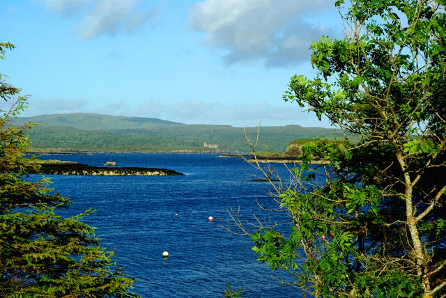
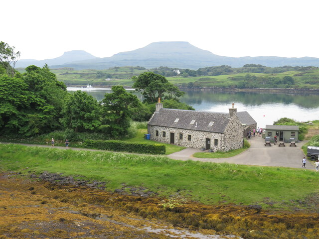
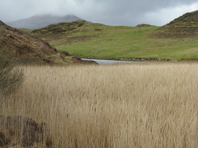
Oban Dùin is a small coastal village located in Inverness-shire, Scotland. Situated on the shores of the North Atlantic Ocean, Oban Dùin is known for its stunning sea views and picturesque surroundings. The village is nestled along a rugged coastline, with rocky cliffs and sandy beaches lining the shore.

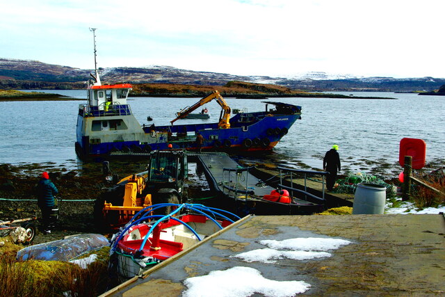
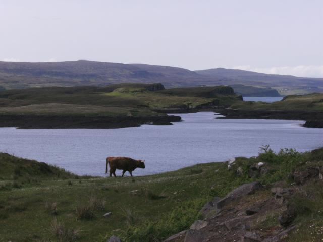
The village is also located near an estuary, where the river meets the sea, creating a unique and diverse ecosystem. This estuary provides a habitat for a variety of marine life, including fish, birds, and other wildlife. Visitors to Oban Dùin can enjoy exploring the estuary and observing the diverse flora and fauna that call this area home.

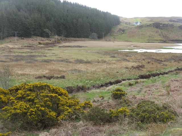
In addition to the sea and estuary, Oban Dùin is also home to a tranquil creek that winds its way through the village. The creek provides a peaceful setting for residents and visitors to relax and enjoy the natural beauty of the area.

Overall, Oban Dùin is a charming coastal village with a rich maritime heritage and stunning natural scenery. Visitors to this picturesque village can enjoy exploring the sea, estuary, and creek, as well as experiencing the unique culture and history of this coastal community.

If you have any feedback on the listing, please let us know in the comments section below.

Oban Dùin Images

Images are sourced within 2km of 57.458022/-6.6184855 or Grid Reference NG2350. Thanks to Geograph Open Source API. All images are credited.

Is Loch Suardal a dried-up lake? A lacustrine plain, perhaps?
Oh great, yet another stunning masterpiece of Loch Corlarach. Can't contain my excitement!
Loch Dunvegan A view across the sea loch from Colbost on a June evening. Dunvegan Castle in <a href="https://www.geograph.org.uk/gridref/NG2449">NG2449</a> is prominent on the eastern shore.
Loch Dunvegan
A view across the sea loch from Colbost on a June evening. Dunvegan Castle in NG2449 is prominent on the eastern shore.
Looking along the coast towards Dunvegan Castle, Skye, 1988
Dunvegan Castle/Caisteal Dhùn Bheagain <span class="nowrap"><a title="https://canmore.org.uk/site/10835/skye-dunvegan-castle" rel="nofollow ugc noopener" href="https://canmore.org.uk/site/10835/skye-dunvegan-castle">Link</a><img style="margin-left:2px;" alt="External link" title="External link - shift click to open in new window" src="https://s1.geograph.org.uk/img/external.png" width="10" height="10"/></span>
Dunvegan Castle/Caisteal Dhùn Bheagain
Landing craft Toplander in Loch Dunvegan Seen here off Colbost where she was delivering a pontoon, Toplander is a 22-metre multi-role vessel built in 2019 by Meercat Boats of Hythe near Southampton for civil engineering firm Topbond, and leased to BK Marine of Tingwall, Shetland.

RINA <span class="nowrap"><a title="https://www.rina.org.uk/MRV22.html" rel="nofollow ugc noopener" href="https://www.rina.org.uk/MRV22.html">Link</a><img style="margin-left:2px;" alt="External link" title="External link - shift click to open in new window" src="https://s1.geograph.org.uk/img/external.png" width="10" height="10"/></span>
Landing craft Toplander in Loch Dunvegan
Seen here off Colbost where she was delivering a pontoon, Toplander is a 22-metre multi-role vessel built in 2019 by Meercat Boats of Hythe near Southampton for civil engineering firm Topbond, and leased to BK Marine of Tingwall, Shetland. RINA LinkExternal link
Laying a pontoon at Colbost Jetty The landing craft Toplander <a title="www.geograph.org.uk/photo/7429356" href="https://www.geograph.org.uk/photo/7429356">Link</a> has brought the structure across the loch from Dunvegan. It will provide a facility for fish farm support craft.
Laying a pontoon at Colbost Jetty
The landing craft Toplander Link has brought the structure across the loch from Dunvegan. It will provide a facility for fish farm support craft.
Loch from Dunvegan Castle The castle provides opportunities for trips to see seals.
Loch from Dunvegan Castle
The castle provides opportunities for trips to see seals.
Eilean Traigh, Carraig Shleamhuinn, and the haunting ruins of a crofting township For details of the crofting township see ‘Skye, Colbost | Canmore’. 2023. Canmore.org.uk <<span class="nowrap"><a title="https://canmore.org.uk/site/119436/skye-colbost" rel="nofollow ugc noopener" href="https://canmore.org.uk/site/119436/skye-colbost">Link</a><img style="margin-left:2px;" alt="External link" title="External link - shift click to open in new window" src="https://s1.geograph.org.uk/img/external.png" width="10" height="10"/></span> > [accessed 13 July 2023]

‌
Eilean Traigh, Carraig Shleamhuinn, and the haunting ruins of a crofting township
For details of the crofting township see ‘Skye, Colbost | Canmore’. 2023. Canmore.org.uk <LinkExternal link > [accessed 13 July 2023] ‌
Highland Cattle at Loch Dunvegan Taken from the Claigan road North of Dunvegan Castle. View over blooming meadows to Fiadhairt peninsula with the open Loch beyond. Across Loch Dunvegan lie the hamlets Uig, Borreraig and Galtrigill with Ben Skriaig and Biod an Athair rising behind them.
Highland Cattle at Loch Dunvegan
Taken from the Claigan road North of Dunvegan Castle. View over blooming meadows to Fiadhairt peninsula with the open Loch beyond. Across Loch Dunvegan lie the hamlets Uig, Borreraig and Galtrigill with Ben Skriaig and Biod an Athair rising behind them.
MV Hebridean Princess off Colbost The luxury cruise vessel (formerly CalMac&amp;#039;s &amp;quot;Columba&amp;quot;) glides up Loch Dunvegan early on an October morning, bringing her passengers to visit Dunvegan Castle.
MV Hebridean Princess off Colbost
The luxury cruise vessel (formerly CalMac's "Columba") glides up Loch Dunvegan early on an October morning, bringing her passengers to visit Dunvegan Castle.
Dam across Loch Suardal Constructed of stone and earth infill, just north of Dunvegan Castle/Caisteal Dhun Bhegan.
Dam across Loch Suardal
Constructed of stone and earth infill, just north of Dunvegan Castle/Caisteal Dhun Bhegan.
Loch Suardal, near Dunvegan Viewed from the dam, which carries the road up the glen.
Loch Suardal, near Dunvegan
Viewed from the dam, which carries the road up the glen.
Reeds in Loch Suardal Looking south at the part of the loch below the dam, and what is presumably the lower dam, marked on the map at the normal tide line, can be seen at the narrow point.
Reeds in Loch Suardal
Looking south at the part of the loch below the dam, and what is presumably the lower dam, marked on the map at the normal tide line, can be seen at the narrow point.
Looking north to Coralach From the head of Loch Suardal, north of Dunvegan.
Looking north to Coralach
From the head of Loch Suardal, north of Dunvegan.
Loch Suardal A wet drained area feeding into the loch. The plantation beyond appears nameless, but is on the slope of Creag a&amp;#039; Mhill.
Loch Suardal
A wet drained area feeding into the loch. The plantation beyond appears nameless, but is on the slope of Creag a' Mhill.
Loch Suardal Looking north from the eastern end of the dam to extensive reed beds and conifer plantations in the next square north.
Loch Suardal
Looking north from the eastern end of the dam to extensive reed beds and conifer plantations in the next square north.
Reeds by Loch Suardal A large patch abounding with warblers and other bird song, on the lower side of the dam. Macleod&amp;#039;s Table North/Healabhal Mhòr is the peak in cloud in the distance.
Reeds by Loch Suardal
A large patch abounding with warblers and other bird song, on the lower side of the dam. Macleod's Table North/Healabhal Mhòr is the peak in cloud in the distance.
Show me another place!

Oban Dùin is located at Grid Ref: NG2350 (Lat: 57.458022, Lng: -6.6184855)

Unitary Authority: Highland

Police Authority: Highlands and Islands

What 3 Words

///puddings.inched.audio. Near Dunvegan, Highland

Related Wikis

Dun Fiadhairt

Dun Fiadhairt is an Iron Age broch located on the north coast of the island of Skye, in Scotland (grid reference NG23115042). == Location == Dun Fiadhairt...

Eilean Mòr, Loch Dunvegan

Eilean Mòr is an uninhabited island in Loch Dunvegan in north west Skye, Scotland. At low water the island is connected to Eilean Dubh. == Footnotes ==
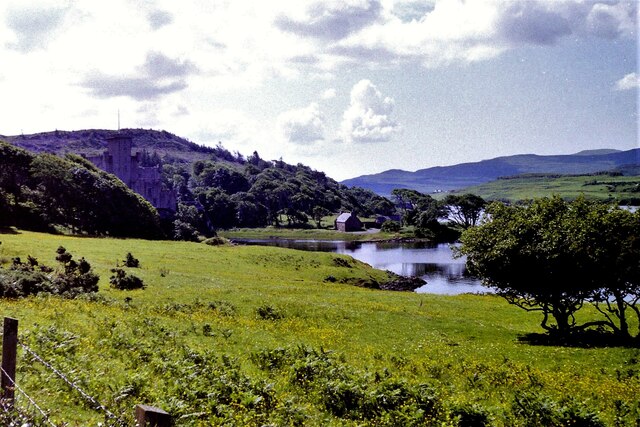
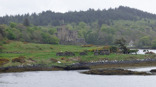
Dunvegan Castle

Dunvegan Castle (Caisteal Dhùn Bheagain) is located 1 mile (1.6 km) to the north of Dunvegan on the Isle of Skye, off the west coast of Scotland. It is...

The Three Chimneys

The Three Chimneys is a restaurant in Colbost, Isle of Skye, Scotland. While in operation beforehand, the restaurant came to prominence after being taken...

Nearby Amenities

Located within 500m of 57.458022,-6.6184855
Source: PGS
Lat/Long: 57.4577934/-6.6104801
Source: PGS
Lat/Long: 57.4578353/-6.6102465
Source: PGS
Lat/Long: 57.4576335/-6.6102819
Dun Fiadhairt Broch
Historic: archaeological_site
Wikidata: Q18150940
Wikipedia: en:Dun Fiadhairt
Lat/Long: 57.4595048/-6.6181071
Ele: 38
Natural: peak
Lat/Long: 57.4602589/-6.623015
Fiadhairt
Place: locality
Lat/Long: 57.4589636/-6.6164245
The data included in this document is from www.openstreetmap.org. The data is made available under ODbL.

Have you been to Oban Dùin?

Leave your review of Oban Dùin below (or comments, questions and feedback).