Dùn Channa

Coastal Feature, Headland, Point in Argyllshire

Scotland

Dùn Channa

Rocks and grass in the west of Canna
Rocks and grass in the west of Canna Credit: Alpin Stewart

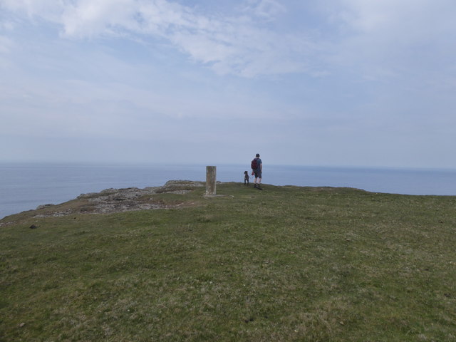
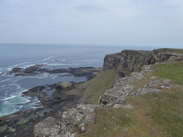
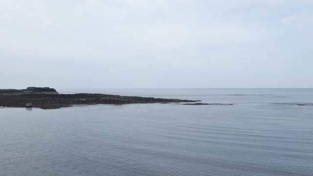
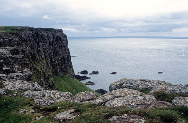
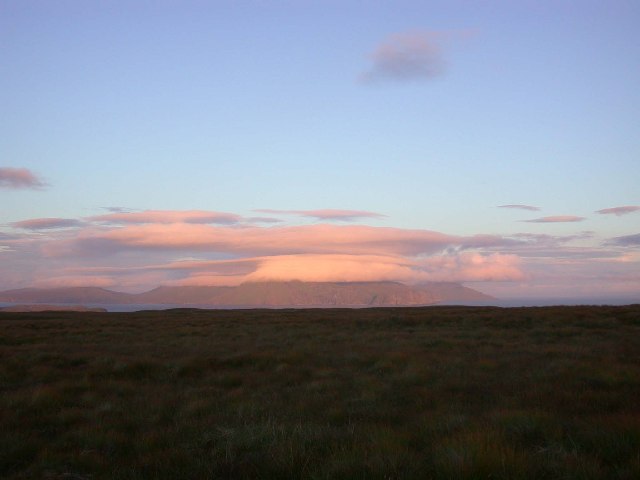
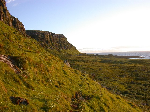
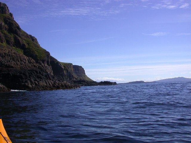
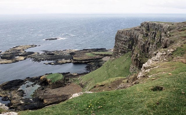
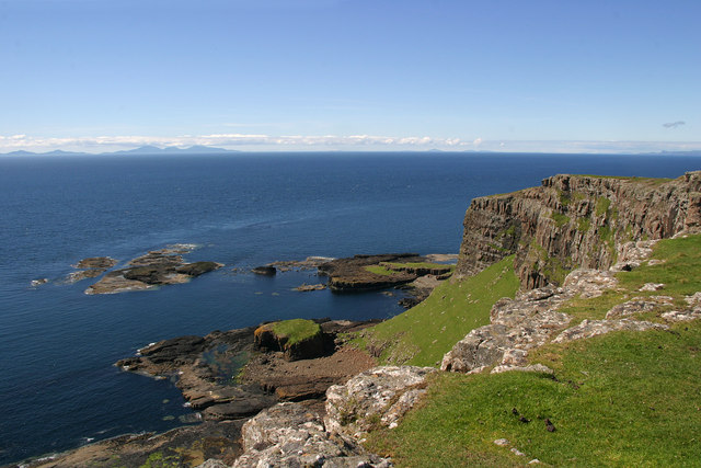
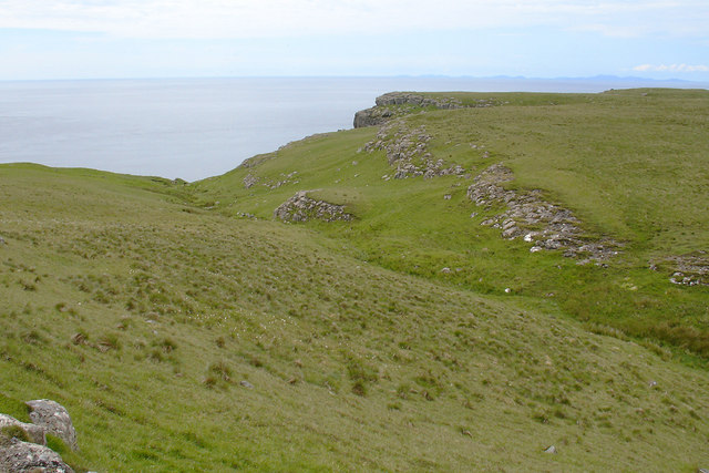
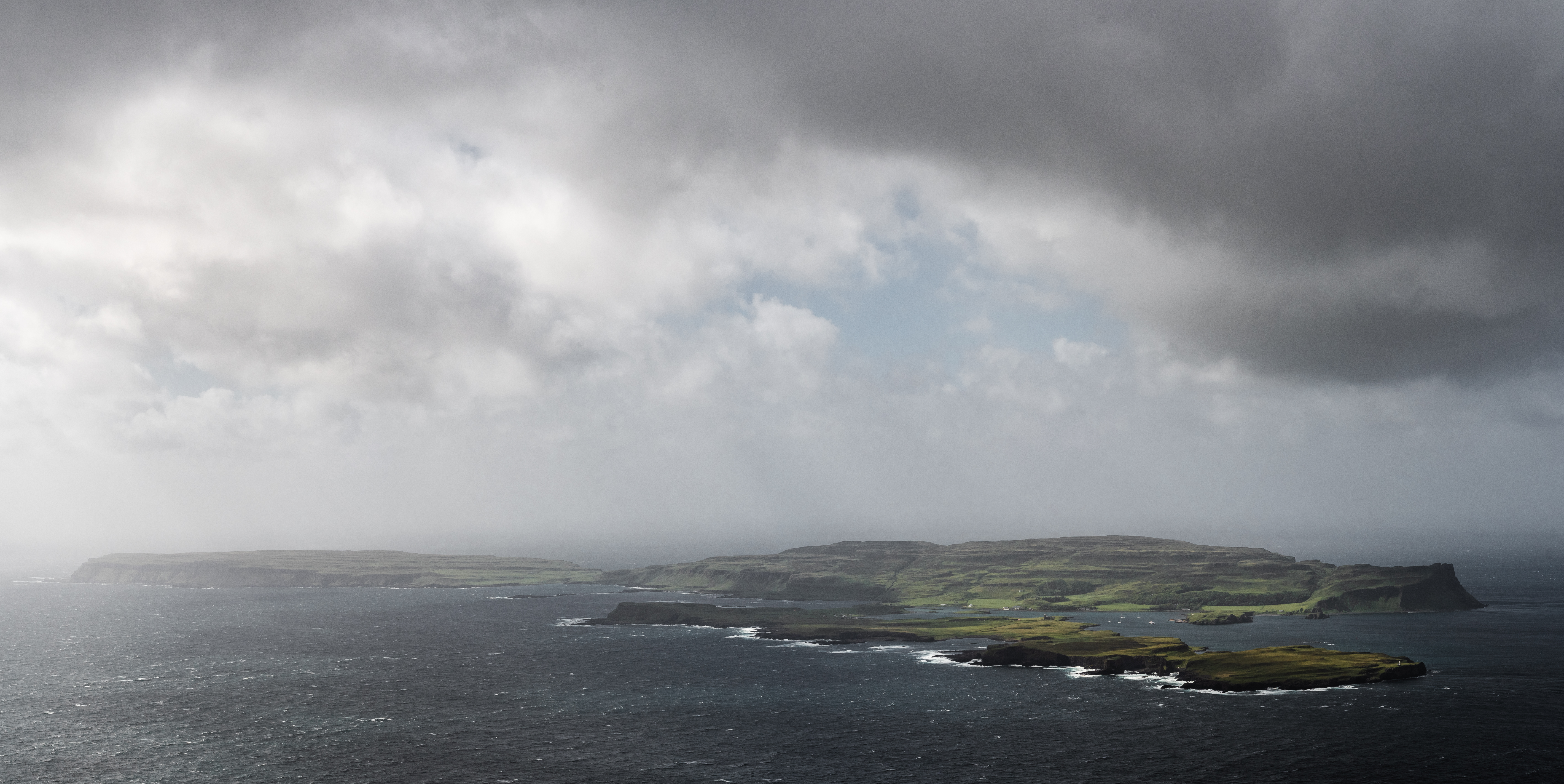
Dùn Channa is a prominent headland located in Argyllshire, Scotland. Situated along the rugged and picturesque coastline, this coastal feature offers breathtaking views of the surrounding area. With its distinctive shape and towering cliffs, Dùn Channa stands as a striking landmark in the region.

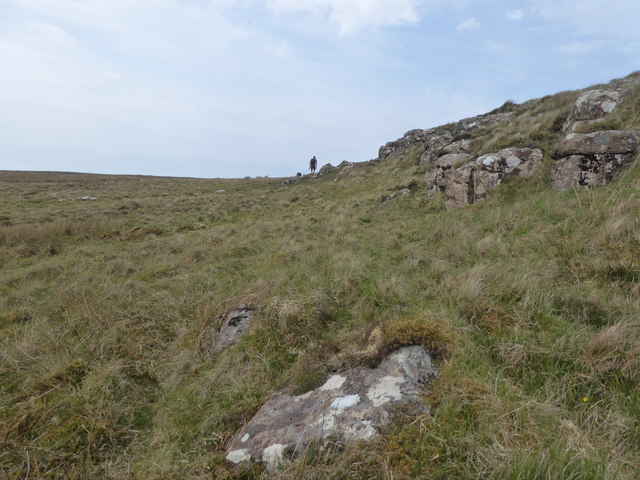
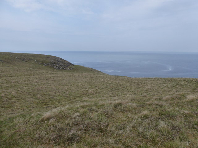
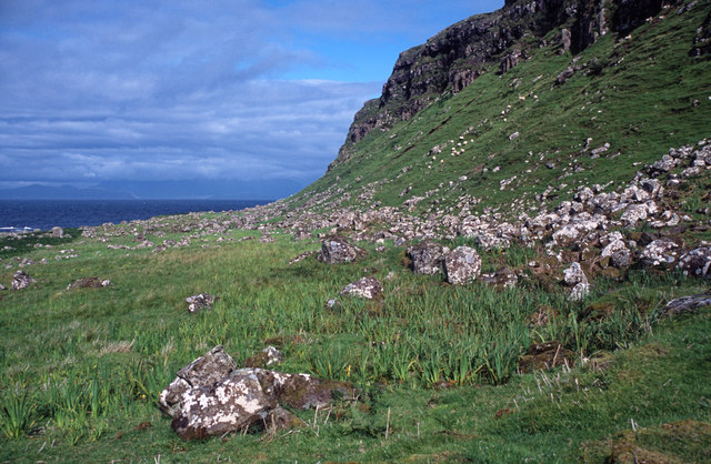
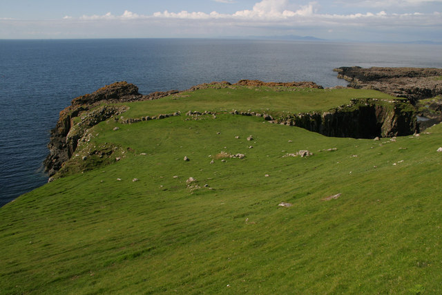
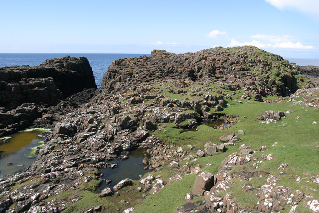
The headland is characterized by its rocky terrain, composed of ancient sedimentary rocks such as sandstone and limestone. This geological composition contributes to its rugged appearance and provides a habitat for various plant and animal species. The higher elevation of the headland offers panoramic vistas of the surrounding sea, nearby islands, and the rolling hills of Argyllshire.

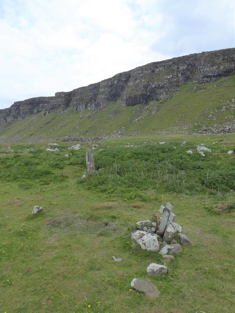
Dùn Channa is also home to an ancient fort, which gives the headland its name. The fort, believed to date back to the Iron Age, consists of earthworks and stone walls that once protected its inhabitants. This archaeological site adds historical significance to the area, attracting visitors interested in exploring Scotland's rich past.

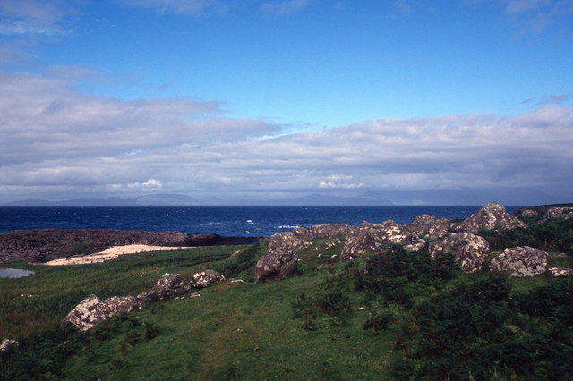
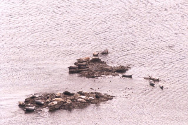
In addition to its natural and historical attractions, Dùn Channa is a popular destination for outdoor enthusiasts. The headland offers opportunities for hiking and birdwatching, with an abundance of coastal and marine wildlife to be observed. The surrounding waters are known for their diverse marine life, including seals, dolphins, and a variety of seabirds.

Overall, Dùn Channa in Argyllshire is a captivating coastal feature that combines stunning natural beauty, historical significance, and recreational opportunities. Its unique geology, ancient fort, and picturesque views make it a must-visit destination for anyone exploring the west coast of Scotland.

If you have any feedback on the listing, please let us know in the comments section below.

Dùn Channa Images

Images are sourced within 2km of 57.049217/-6.6079868 or Grid Reference NG2004. Thanks to Geograph Open Source API. All images are credited.

Rocks and grass in the west of Canna
Trig point at the west end of Canna
Looking to Garrisdale Point, Isle of Canna
Grassland at Garrisdale, Isle of Canna
Rocks by Sgeir nan Sgarbh, Isle of Canna
Grave and standing stone, Congearaidh
The cliffs of Garrisdale Point, Isle of Canna The pillar of the OS Trig Station can be seen beyond the headland.
The cliffs of Garrisdale Point, Isle of Canna
The pillar of the OS Trig Station can be seen beyond the headland.
Close to the beach below Conagearaidh A scramble down the cliff leads to some very fine grass enjoyed by the farm animals of Canna.
Close to the beach below Conagearaidh
A scramble down the cliff leads to some very fine grass enjoyed by the farm animals of Canna.
Under the Conagearaidh cliffs, Isle of Canna An unexpected find on the north coast of Canna.  Better concentration on map reading should have identified the area as worthy of exploration.  It does mean losing considerable height to visit when walking the perimeter cliffs of Canna.
Under the Conagearaidh cliffs, Isle of Canna
An unexpected find on the north coast of Canna. Better concentration on map reading should have identified the area as worthy of exploration. It does mean losing considerable height to visit when walking the perimeter cliffs of Canna.
Druim na Tire, Isle of Canna View East to Rum from Druim na Tire on Canna.
Druim na Tire, Isle of Canna
View East to Rum from Druim na Tire on Canna.
North Coast of Canna View West from the remote North West corner of Canna
North Coast of Canna
View West from the remote North West corner of Canna
South West Corner of Canna. South West Corner of Canna, View toward the East.
South West Corner of Canna.
South West Corner of Canna, View toward the East.
Garrisdale Point and Dun Channa Coastline to the SE of Garrisdale Point viewed from the Trig Point.  The historic fort of Dun Canna is visible as a round grassy-topped fortification on the gravel beach
Garrisdale Point and Dun Channa
Coastline to the SE of Garrisdale Point viewed from the Trig Point. The historic fort of Dun Canna is visible as a round grassy-topped fortification on the gravel beach
Garrisdale Point, Isle of Canna A pity you can't hear the haunting song of the seals basking on the rocks below.  The grassy knoll on the shore is Dùn Channa.
Garrisdale Point, Isle of Canna
A pity you can't hear the haunting song of the seals basking on the rocks below. The grassy knoll on the shore is Dùn Channa.
Seals on Eileanan Bhrè-sgorr Very little of these islands remains above sea level at high tide.
Seals on Eileanan Bhrè-sgorr
Very little of these islands remains above sea level at high tide.
The fort near Garrisdale The fort is on Canna's northern shore just below the cliffs and appears to have been a defensive position.  It is a small peninsula with the sea to the west, north and east.  The only overland access to the south is blocked by a six foot thick wall.  Remains of the wall are still visible.
The fort near Garrisdale
The fort is on Canna's northern shore just below the cliffs and appears to have been a defensive position. It is a small peninsula with the sea to the west, north and east. The only overland access to the south is blocked by a six foot thick wall. Remains of the wall are still visible.
Allt Bhrè-sgorr The western side of Canna is a grassy plateau called Sliabh Meadhonach.  Most walkers don't venture inland preferring to stay close to the spectacular clifftops.  Allt Bhrè-sgorr is a small burn about one kilometre east of the trig point at Sron Ruail.  Its waters run south.
Allt Bhrè-sgorr
The western side of Canna is a grassy plateau called Sliabh Meadhonach. Most walkers don't venture inland preferring to stay close to the spectacular clifftops. Allt Bhrè-sgorr is a small burn about one kilometre east of the trig point at Sron Ruail. Its waters run south.
Sgeir nan Sgarbh Sgeir nan Sgarbh is inaccessible at high tide so timing the walk was essential to get this geograph.
Sgeir nan Sgarbh
Sgeir nan Sgarbh is inaccessible at high tide so timing the walk was essential to get this geograph.
Show me another place!

Dùn Channa is located at Grid Ref: NG2004 (Lat: 57.049217, Lng: -6.6079868)

Unitary Authority: Highland

Police Authority: Highlands and Islands

What 3 Words

///suckle.reseller.crows. Near Carbost, Highland

Related Wikis

Canna, Scotland

Canna (; Scottish Gaelic: Canaigh, Eilean Chanaigh) is the westernmost of the Small Isles archipelago, in the Scottish Inner Hebrides. It is linked to...

A' Chill

A' Chill was a village on Canna, in the Scottish Small Isles. The name means "the cell", referring to a Culdee church, and is often anglicised as "Kil...

St Edward's Church, Sanday

St Edward's Church, Sanday, is a deconsecrated, and now disused church on the small isle of Sanday, Inner Hebrides, Scotland. The church was a gift to...

St Columba's Church, Canna

St Columba's Church is a Category B listed building on the isle of Canna, in the Small Isles, Highland, Scotland. == History == Prior to the building of...

Nearby Amenities

Located within 500m of 57.049217,-6.6079868
Source: PGS
Lat/Long: 57.04956/-6.61389
Source: PGS
Lat/Long: 57.0497/-6.61435
Source: PGS
Lat/Long: 57.05021/-6.61432
Source: PGS
Lat/Long: 57.05045/-6.61336
Source: PGS
Lat/Long: 57.04968/-6.61317
Source: PGS
Lat/Long: 57.04942/-6.61296
Source: PGS
Lat/Long: 57.04552/-6.60334
Source: PGS
Lat/Long: 57.04553/-6.60381
Source: PGS
Lat/Long: 57.04566/-6.60404
Source: PGS
Lat/Long: 57.04618/-6.60424
Source: PGS
Lat/Long: 57.04606/-6.60472
Source: PGS
Lat/Long: 57.04607/-6.60519
Source: PGS
Lat/Long: 57.0462/-6.60541
Source: PGS
Lat/Long: 57.04633/-6.60564
Source: PGS
Lat/Long: 57.04647/-6.60587
Source: PGS
Lat/Long: 57.04659/-6.60609
Source: PGS
Lat/Long: 57.04688/-6.60748
Source: PGS
Lat/Long: 57.04689/-6.60795
Source: PGS
Lat/Long: 57.04676/-6.6082
Source: PGS
Lat/Long: 57.04651/-6.60821
Source: PGS
Lat/Long: 57.04625/-6.60799
Source: PGS
Lat/Long: 57.04639/-6.60892
Source: PGS
Lat/Long: 57.04653/-6.60915
Source: PGS
Lat/Long: 57.04678/-6.60914
Source: PGS
Lat/Long: 57.04728/-6.60863
Source: PGS
Lat/Long: 57.04754/-6.60862
Source: PGS
Lat/Long: 57.0478/-6.6086
Source: PGS
Lat/Long: 57.0483/-6.6081
Source: PGS
Lat/Long: 57.04855/-6.60807
Source: PGS
Lat/Long: 57.04907/-6.60828
Source: PGS
Lat/Long: 57.04895/-6.60876
Source: PGS
Lat/Long: 57.04896/-6.60923
Source: PGS
Lat/Long: 57.0496/-6.60942
Source: PGS
Lat/Long: 57.04986/-6.60941
Source: PGS
Lat/Long: 57.05012/-6.60962
Source: PGS
Lat/Long: 57.05011/-6.60869
Source: PGS
Lat/Long: 57.05087/-6.60864
Source: PGS
Lat/Long: 57.05102/-6.60957
Source: PGS
Lat/Long: 57.05103/-6.61051
Source: PGS
Lat/Long: 57.05104/-6.61098
Source: PGS
Lat/Long: 57.05117/-6.6112
Source: PGS
Lat/Long: 57.0517/-6.61164
Source: PGS
Lat/Long: 57.05196/-6.61187
Source: PGS
Lat/Long: 57.05207/-6.61138
Source: PGS
Lat/Long: 57.05207/-6.61091
Source: PGS
Lat/Long: 57.05205/-6.60998
Source: PGS
Lat/Long: 57.05216/-6.60902
Source: PGS
Lat/Long: 57.05293/-6.60921
Source: PGS
Lat/Long: 57.05319/-6.60943
Source: PGS
Lat/Long: 57.0533/-6.60896
Source: PGS
Lat/Long: 57.05367/-6.60752
Sròn Ruail
Corbett: no
Ele: 129
Graham: no
Munro: no
Natural: peak
Lat/Long: 57.0469999/-6.6039201
Sron Ruail
Place: locality
Source: OS_OpenData_StreetView
Lat/Long: 57.0476788/-6.6038612
Garrisdale Point
Place: locality
Source: OS_OpenData_StreetView
Wikidata: Q24643650
Lat/Long: 57.0518011/-6.6121583
Heritage: yes
Historic: archaeological_site
Wikidata: Q56662556
Lat/Long: 57.0484309/-6.6021556
The data included in this document is from www.openstreetmap.org. The data is made available under ODbL.

Have you been to Dùn Channa?

Leave your review of Dùn Channa below (or comments, questions and feedback).