An Crois-sgeir
Coastal Feature, Headland, Point in Argyllshire
Scotland
An Crois-sgeir

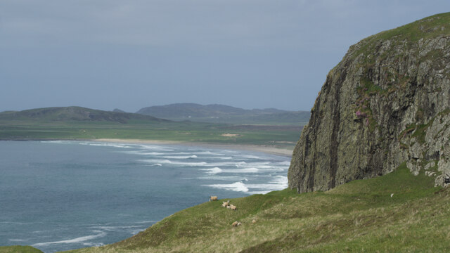
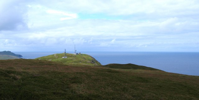
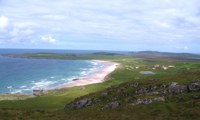
An Crois-sgeir, also known as The Cruach, is a prominent headland located in Argyllshire, Scotland. Situated on the rugged west coast of the country, it is a significant coastal feature that juts out into the sea, forming a distinctive and imposing point.
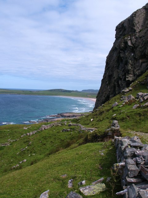
The headland is characterized by its steep cliffs, which rise dramatically from the crashing waves below. These sheer rock faces are composed of ancient volcanic rock, giving the area a striking and unique appearance. The cliffs provide nesting sites for various seabirds, including gulls, fulmars, and puffins, making it a popular spot for birdwatchers and nature enthusiasts.
An Crois-sgeir offers breathtaking panoramic views of the surrounding landscape, with sweeping vistas of the vast expanse of the North Atlantic Ocean. On clear days, it is possible to see the distant islands of Mull and Islay, adding to the allure of the area.
The headland is also of historical significance, with remnants of ancient settlements and forts scattered throughout the area. These archaeological sites provide insight into the rich history of the region and attract visitors interested in the area's past.
An Crois-sgeir is a popular destination for hikers and outdoor enthusiasts, thanks to its rugged beauty and challenging terrain. Several walking trails wind their way along the headland, offering visitors the opportunity to explore the area and experience its natural wonders up close.
Overall, An Crois-sgeir is a captivating coastal feature that showcases Scotland's stunning natural beauty and rich history. Its majestic cliffs, breathtaking views, and historical significance make it a must-visit destination for those exploring Argyllshire's coastline.
If you have any feedback on the listing, please let us know in the comments section below.
An Crois-sgeir Images
Images are sourced within 2km of 55.764559/-6.4661862 or Grid Reference NR1961. Thanks to Geograph Open Source API. All images are credited.


![Dune slack pond Natural pond in a dune slack behind Machir Bay beach. Old coastal cliffs in the background [raised beach].](https://s0.geograph.org.uk/geophotos/02/53/28/2532840_a7bf34fd.jpg)

An Crois-sgeir is located at Grid Ref: NR1961 (Lat: 55.764559, Lng: -6.4661862)
Unitary Authority: Argyll and Bute
Police Authority: Argyll and West Dunbartonshire
What 3 Words
///skater.outboard.aspect. Near Port Charlotte, Argyll & Bute
Nearby Locations
Related Wikis

RAF Kilchiaran
RAF Kilchiaran was a Royal Air Force radar station situated on the Isle of Islay in Scotland. It was originally active from 1940-1945. In 1954 the base...

Kilchoman
Kilchoman ( kil-(K)HOM-ən; Scottish Gaelic: Cill Chomain [kʲʰiːʎ ˈxɔmɛɲ]) is a small settlement and large parish on the Scottish island of Islay, within...

Rinns of Islay
The Rinns of Islay (Scottish Gaelic: Na Roinn Ìleach; alternative English spelling Rhinns of Islay) is an area on the west of the island of Islay in the...

Kilchoman distillery
Kilchoman distillery (pronounced Kil-ho-man) is a distillery that produces single malt Scotch whisky on Islay, an island of the Inner Hebrides. Kilchoman...

HMS Graph
HMS Graph (pennant number P715) was a German Type VIIC U-boat that the British Royal Navy captured during World War II. Commissioned as U-570 in Nazi Germany...

Loch Gorm Castle
Loch Gorm Castle is a ruined castle located on Eilean Mòr (big island) on Loch Gorm, Islay, Scotland. It was once a stronghold of Clan Macdonald. The castle...

A847 road
The A847 road is one of the two principal roads of Islay in the Inner Hebrides off the west coast of mainland Scotland. It connects Bridgend, at a junction...

Port Charlotte distillery
Port Charlotte distillery (also known as Rhins distillery and Lochindaal distillery) was a Scotch whisky distillery on the island of Islay, off the west...
Have you been to An Crois-sgeir?
Leave your review of An Crois-sgeir below (or comments, questions and feedback).