An Dùn

Coastal Feature, Headland, Point in Argyllshire

Scotland

An Dùn

Cnoc Mor Trig Point Flush Bracket S9081
Cnoc Mor Trig Point Flush Bracket S9081 Credit: thejackrustles

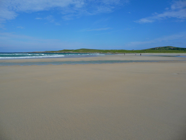
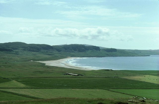
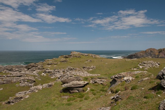
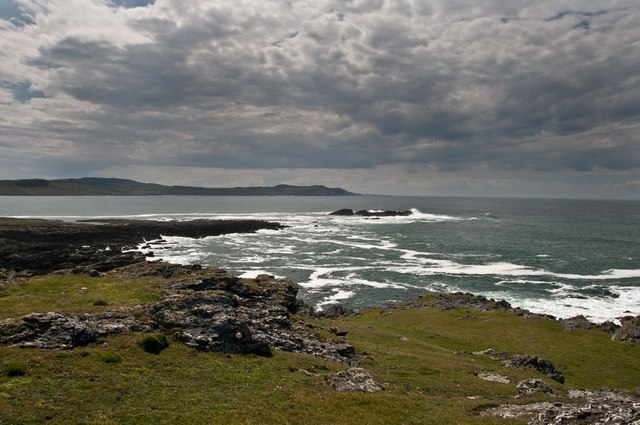
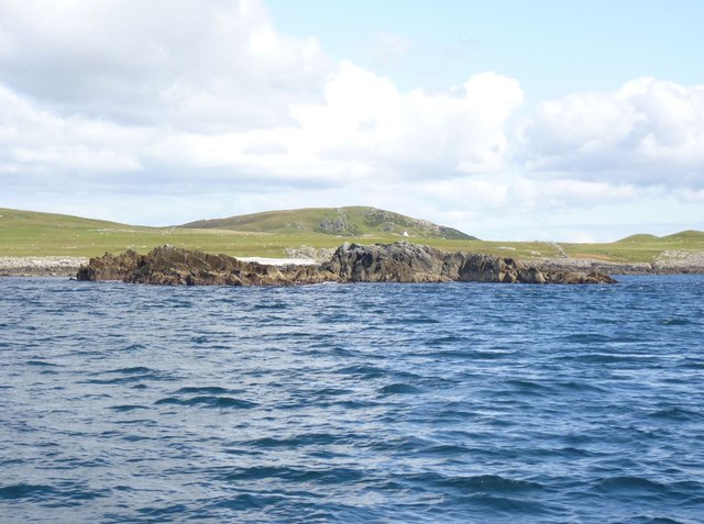
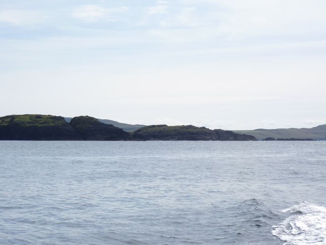
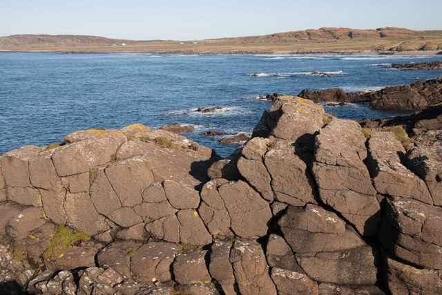
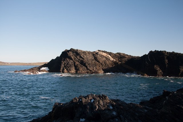
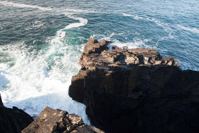
An Dùn is a prominent headland located in Argyllshire, Scotland. Situated on the west coast of the country, this coastal feature is known for its stunning natural beauty and rich historical significance.

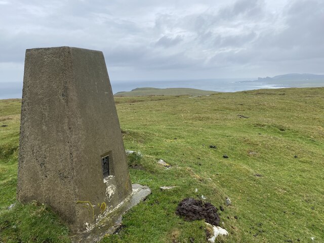
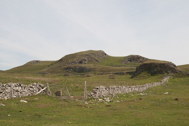
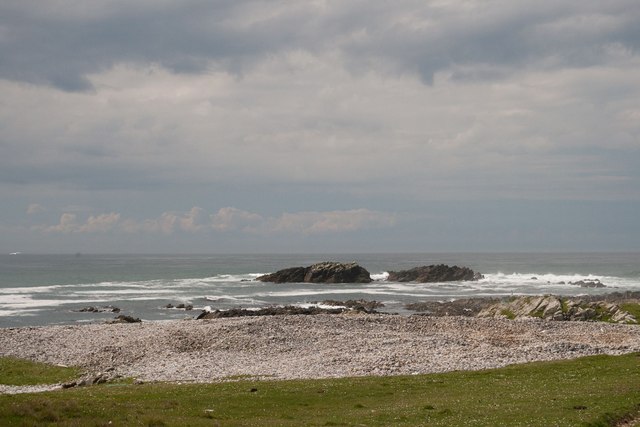
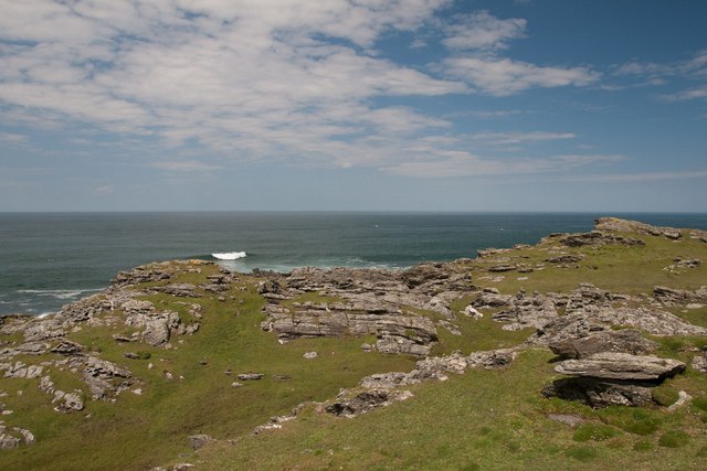
Rising majestically from the surrounding landscape, An Dùn stands at an impressive height, offering breathtaking panoramic views of the surrounding area. Its rugged cliffs, which are primarily composed of ancient sandstone, add to its dramatic appeal. The headland is characterized by its distinct shape, jutting out into the sea and forming a natural point that serves as a prominent landmark along the coast.

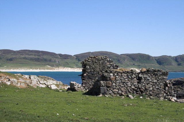
An Dùn is not only a picturesque natural feature but also holds historical importance. As its name suggests, it is home to an ancient fort or dun, which dates back to the Iron Age. The fort is believed to have been a defensive structure, strategically positioned to provide protection and oversee the surrounding landscape. The ruins of the fort can still be seen today, serving as a reminder of the area's ancient past.

The headland is also known for its diverse wildlife, with various seabirds nesting in the cliffs and surrounding areas. Visitors to An Dùn can often spot species such as puffins, gannets, and guillemots, making it a popular spot for birdwatching enthusiasts.

For those seeking outdoor activities, An Dùn offers opportunities for hiking, walking trails, and exploring the nearby coastline. Its natural beauty, historical significance, and abundant wildlife make it a must-visit destination for nature lovers and history enthusiasts alike.

If you have any feedback on the listing, please let us know in the comments section below.

An Dùn Images

Images are sourced within 2km of 55.792584/-6.4857803 or Grid Reference NR1864. Thanks to Geograph Open Source API. All images are credited.

Cnoc Mor Trig Point Flush Bracket S9081
Ruin west of Machir Bay, Islay This is now an historic photo as the ruin has been converted into a 'Chough House' for Choughs to nest in.
Ruin west of Machir Bay, Islay
This is now an historic photo as the ruin has been converted into a 'Chough House' for Choughs to nest in.
Tràigh Mhachir Looking towards the north end of the beach on Machir Bay.
Tràigh Mhachir
Looking towards the north end of the beach on Machir Bay.
Wartime lookout building, Carn Mòr, Islay
Crags near Saligo, Islay
View from Cnoc Mòr Over pasture and farm buildings with Tràigh Mhachir in the distance.
View from Cnoc Mòr
Over pasture and farm buildings with Tràigh Mhachir in the distance.
Eilean an Tannais Sgeir, near Coul Point, Islay Tannais may be a corruption of Tannasg (spectre), which is an interesting translation. But maybe there's a more plausible explanation!
Eilean an Tannais Sgeir, near Coul Point, Islay
Tannais may be a corruption of Tannasg (spectre), which is an interesting translation. But maybe there's a more plausible explanation!
Coul Point, Islay
Coul Point, Islay
Coul Point, Islay
Coul Point, Islay
Coul Point, Islay Looking towards An Dòirlinn and Eilean an Tannais-sgeir (possibly Spectre Rock)
Coul Point, Islay
Looking towards An Dòirlinn and Eilean an Tannais-sgeir (possibly Spectre Rock)
Eilean an Tannais-sgeir, Islay Taken from a boat on a boat trip round Islay.
Eilean an Tannais-sgeir, Islay
Taken from a boat on a boat trip round Islay.
Reidh a' Bhuirg, near Coul Point, Islay 'Level ground of the fortress'. The fort is situated in the next gridsquare, NR 1964.
Reidh a' Bhuirg, near Coul Point, Islay
'Level ground of the fortress'. The fort is situated in the next gridsquare, NR 1964.
Coull Farm Farm behind Machir Bay.
Coull Farm
Farm behind Machir Bay.
Coulererach A glimpse of the roof of Coulererach, near the north-west coast of Islay.
Coulererach
A glimpse of the roof of Coulererach, near the north-west coast of Islay.
Basalt Columns at Campa, Islay I think these are similar to the basalt pillars on Staffa, but I'm not a geologist!
Basalt Columns at Campa, Islay
I think these are similar to the basalt pillars on Staffa, but I'm not a geologist!
Rocks at Campa, Islay From an outcrop when trying to access NR1966. Note the beautiful quartz vein through the rock. For a closer view of the quartzite vein, see <a href="https://www.geograph.org.uk/photo/4233763">NR2065 : Quartz vein, Campa, Islay</a>
Rocks at Campa, Islay
From an outcrop when trying to access NR1966. Note the beautiful quartz vein through the rock. For a closer view of the quartzite vein, see NR2065 : Quartz vein, Campa, Islay
Campa, Islay The closest I felt I could safely venture to photograph this gridsquare! It will have to remain a supplemental!
Campa, Islay
The closest I felt I could safely venture to photograph this gridsquare! It will have to remain a supplemental!
A burn not marked on the map I took the photo feeling sure this definite burn would be marked on the map - only to discover it wasn't!
A burn not marked on the map
I took the photo feeling sure this definite burn would be marked on the map - only to discover it wasn't!
Show me another place!

An Dùn is located at Grid Ref: NR1864 (Lat: 55.792584, Lng: -6.4857803)

Unitary Authority: Argyll and Bute

Police Authority: Argyll and West Dunbartonshire

What 3 Words

///lads.marmalade.mothering. Near Port Charlotte, Argyll & Bute

Related Wikis

HMS Graph

HMS Graph (pennant number P715) was a German Type VIIC U-boat that the British Royal Navy captured during World War II. Commissioned as U-570 in Nazi Germany...

Kilchoman

Kilchoman ( kil-(K)HOM-ən; Scottish Gaelic: Cill Chomain [kʲʰiːʎ ˈxɔmɛɲ]) is a small settlement and large parish on the Scottish island of Islay, within...

Kilchoman distillery

Kilchoman distillery (pronounced Kil-ho-man) is a distillery that produces single malt Scotch whisky on Islay, an island of the Inner Hebrides. Kilchoman...

RAF Kilchiaran

RAF Kilchiaran was a Royal Air Force radar station situated on the Isle of Islay in Scotland. It was originally active from 1940-1945. In 1954 the base...

Nearby Amenities

Located within 500m of 55.792584,-6.4857803
Place: islet
Lat/Long: 55.7910654/-6.4867493
The data included in this document is from www.openstreetmap.org. The data is made available under ODbL.

Have you been to An Dùn?

Leave your review of An Dùn below (or comments, questions and feedback).