Rubha Phlocrapoil

Coastal Feature, Headland, Point in Inverness-shire

Scotland

Rubha Phlocrapoil

Loch Phlocrapoil This is one of the larger lochs on the route of the Golden Road.
Loch Phlocrapoil Credit: Anne Burgess

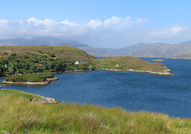
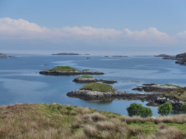
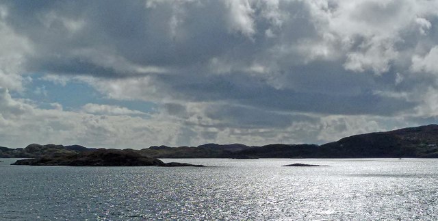
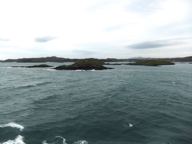
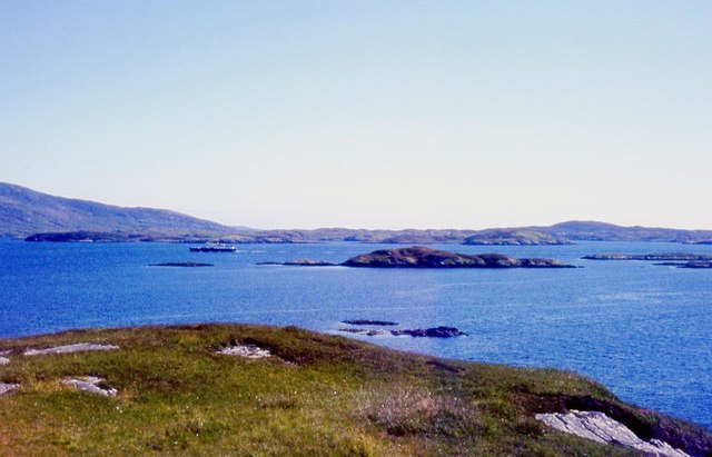
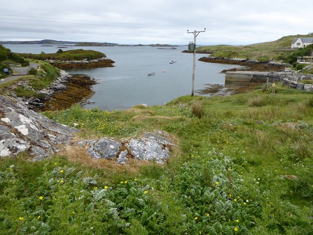
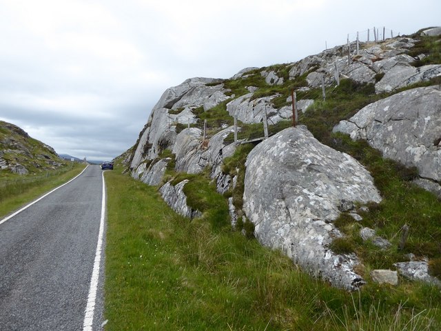
Rubha Phlocrapoil is a prominent coastal feature located in Inverness-shire, Scotland. It is a rugged headland that extends into the North Atlantic Ocean, forming a distinctive point along the coastline. The headland is characterized by its steep cliffs, rocky terrain, and stunning panoramic views of the surrounding seascape.

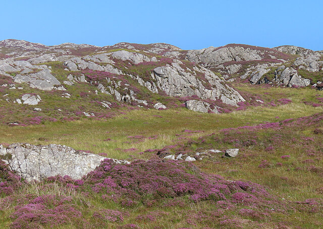
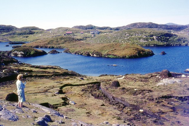
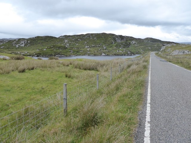
Situated on the western coast of Scotland, Rubha Phlocrapoil is known for its wild and untamed beauty. The area is rich in flora and fauna, with numerous seabirds nesting on the cliffs and dolphins often spotted in the waters below. The headland is also home to various plant species, including heather and mosses, which thrive in the coastal environment.

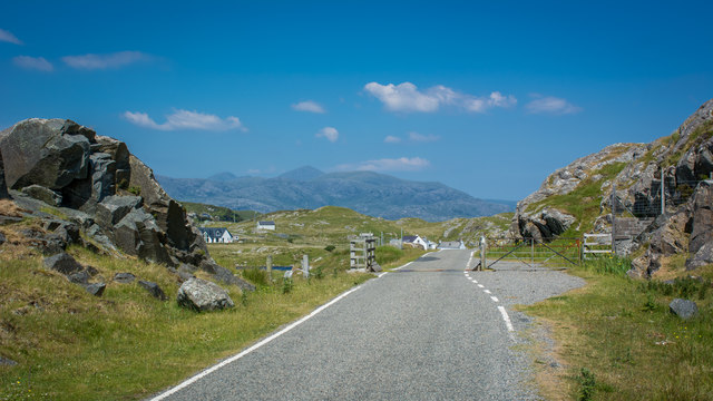
Access to Rubha Phlocrapoil is relatively challenging due to its remote location. Visitors can reach the headland by following a narrow footpath that winds its way along the coastline. The walk offers a unique opportunity to experience the ruggedness of the Scottish landscape and enjoy the tranquility of the surrounding nature.

The panoramic views from Rubha Phlocrapoil are truly breathtaking. On a clear day, visitors can see miles of coastline stretching out before them, with the distant mountains of the Highlands providing a stunning backdrop. The headland is particularly popular among photographers and nature enthusiasts, who come to capture the beauty of the Scottish coast.

Overall, Rubha Phlocrapoil is a remarkable coastal feature that showcases the natural beauty and ruggedness of Inverness-shire. Its dramatic cliffs, diverse wildlife, and stunning views make it a must-visit destination for those seeking an authentic Scottish coastal experience.

If you have any feedback on the listing, please let us know in the comments section below.

Rubha Phlocrapoil Images

Images are sourced within 2km of 57.844466/-6.7449719 or Grid Reference NG1893. Thanks to Geograph Open Source API. All images are credited.

Loch Phlocrapoil This is one of the larger lochs on the route of the Golden Road.
Loch Phlocrapoil
This is one of the larger lochs on the route of the Golden Road.
Lewisian Gneiss This is classic Lewisian Gneiss, in irregular outcrops smoothed by the glaciers of the last (and no doubt previous) Ice Ages.
Lewisian Gneiss
This is classic Lewisian Gneiss, in irregular outcrops smoothed by the glaciers of the last (and no doubt previous) Ice Ages.
Drinishader A bay on the west side of islet-studded Loch Tairbeart, the largest of the sea-lochs on the east side of Harris.
Drinishader
A bay on the west side of islet-studded Loch Tairbeart, the largest of the sea-lochs on the east side of Harris.
In the driving seat of the Hattersley Mk1 at Drinisiadar Built in Keighley, West Yorkshire and one time Luddite bait the loom was designed by George Hattersley and from 1919 to the present has proved a godsend to the people of Harris.
In the driving seat of the Hattersley Mk1 at Drinisiadar
Built in Keighley, West Yorkshire and one time Luddite bait the loom was designed by George Hattersley and from 1919 to the present has proved a godsend to the people of Harris.
All trades their gear, tackle, and trim.. The loom and some of the products at the exhibition at Drinisiadar.
All trades their gear, tackle, and trim..
The loom and some of the products at the exhibition at Drinisiadar.
Original Harris Tweed Introduced to Harris in 1919 the Hattersley cottage loom which was manufactured by George Hattersley of Keighley, West Yorkshire and proved a godsend for the people of Harris.
Original Harris Tweed
Introduced to Harris in 1919 the Hattersley cottage loom which was manufactured by George Hattersley of Keighley, West Yorkshire and proved a godsend for the people of Harris.
Nostalgia's not what it used to be! If ever a poem ran in parallel with Yeats' Lake Isle of Innisfree then this is the one.
Nostalgia's not what it used to be!
If ever a poem ran in parallel with Yeats' Lake Isle of Innisfree then this is the one.
The Spinning Wheels of Harris Before you weave, first spin the wool.
The Spinning Wheels of Harris
Before you weave, first spin the wool.
Islands and skerries off Drinishader Not quite a painted ship on a painted ocean, but close;  there is a fishing boat dead-centre in this image.
Islands and skerries off Drinishader
Not quite a painted ship on a painted ocean, but close; there is a fishing boat dead-centre in this image.
Gloraig Dhubh, Loch an Tairbeairt, Harris The northern (right hand) tip of Gloraig Dhubh, the larger skerry, and the whole of the smaller skerry lie within the grid square.
Gloraig Dhubh, Loch an Tairbeairt, Harris
The northern (right hand) tip of Gloraig Dhubh, the larger skerry, and the whole of the smaller skerry lie within the grid square.
Dun Corr Mor
Dun Corr Mor
Rubha na Mòine The ferry heading in to Tarbert past the Gloraigs.
Rubha na Mòine
The ferry heading in to Tarbert past the Gloraigs.
Loch Plocrapol at Scadabay
Cattle grid on the Golden Road
Abandoned Kirk at Scadabay
The harbour at Drinisiadair
Minor road approaching Plocrapool
Ice-sculpted rock next to minor road at Scadabay
Show me another place!

Rubha Phlocrapoil is located at Grid Ref: NG1893 (Lat: 57.844466, Lng: -6.7449719)

Unitary Authority: Na h-Eileanan an Iar

Police Authority: Highlands and Islands

What 3 Words

///salary.reckons.bliss. Near Tarbert, Na h-Eileanan Siar

Related Wikis

East Loch Tarbert

East Loch Tarbert (Scottish Gaelic: Loch an Tairbeairt) is a sea loch that lies to the east of Harris in the Outer Hebrides of Scotland. The loch contains...

Sgeotasaigh

Scotasay (Scottish Gaelic: Sgeotasaigh) is small island in the Outer Hebrides of Scotland. It lies 1 kilometre (0.6 miles) off the east coast of Harris...

Scalpay, Outer Hebrides

Scalpay (; Scottish Gaelic: Sgalpaigh or Sgalpaigh na Hearadh; i.e. "Scalpay of Harris" to distinguish it from Scalpay off Skye) is an island in the Outer...

Stockinish Island

Stockinish Island (Scottish Gaelic: Eilean Stocainis) is an uninhabited island off Harris, in the Outer Hebrides. == Geography and geology == Stockinish...

Nearby Amenities

Located within 500m of 57.844466,-6.7449719
Loch an Ear
Natural: bay
Lat/Long: 57.8482003/-6.7467291
Rubha Phlocrapoil
Natural: cape
Lat/Long: 57.8445111/-6.7449447
The data included in this document is from www.openstreetmap.org. The data is made available under ODbL.

Have you been to Rubha Phlocrapoil?

Leave your review of Rubha Phlocrapoil below (or comments, questions and feedback).