Am Famhair

Coastal Feature, Headland, Point in Inverness-shire

Scotland

Am Famhair

Ruin above Galtrigill This is clearly the same ruined croft or blackhouse as shown in <a href="https://www.geograph.org.uk/photo/3955062">NG1754 : Ruined croft above Galtrigill</a>.
Ruin above Galtrigill Credit: Ian Taylor

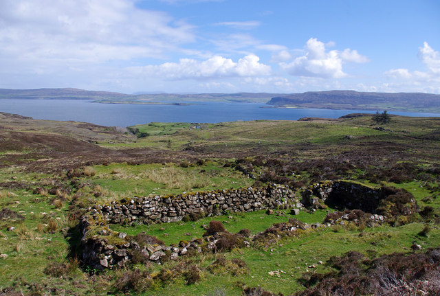
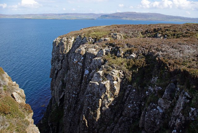
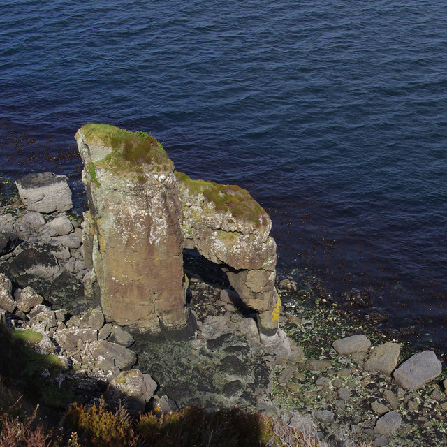
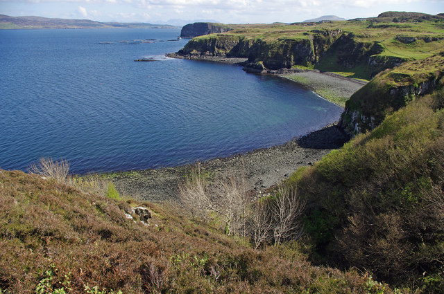
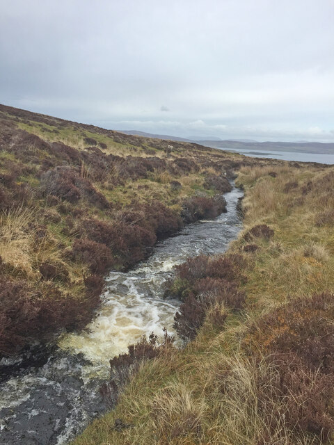
Am Famhair is a prominent coastal feature located in Inverness-shire, Scotland. Situated on the western coast, it is a headland that extends into the North Atlantic Ocean, forming a distinct point. The name "Am Famhair" is derived from Scottish Gaelic, meaning "the giant," which reflects its imposing and majestic presence.

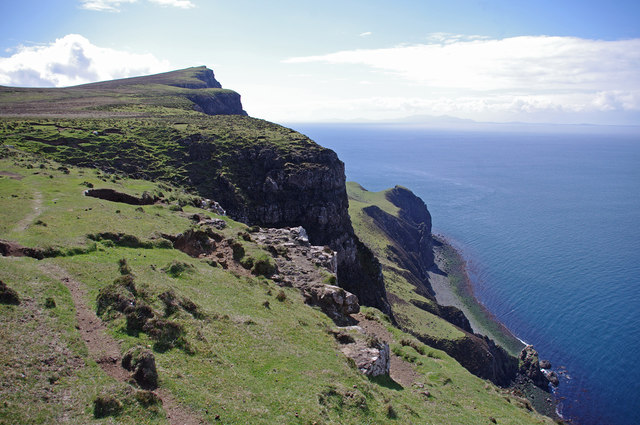
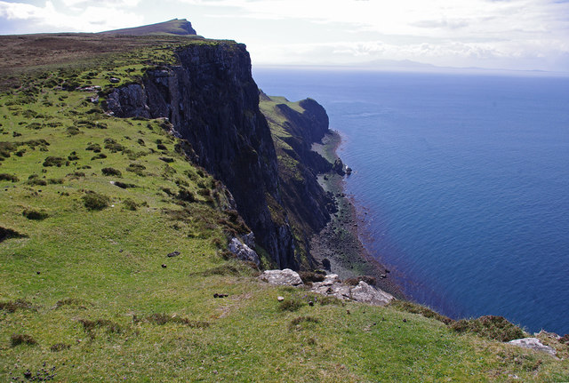
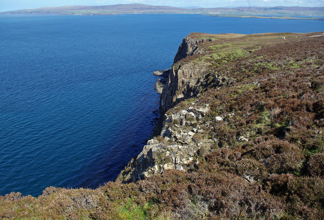
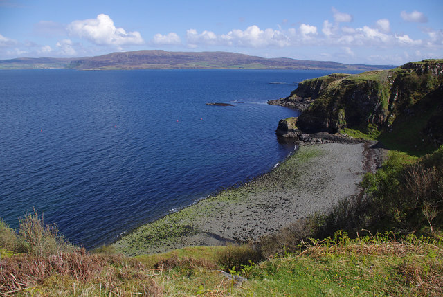
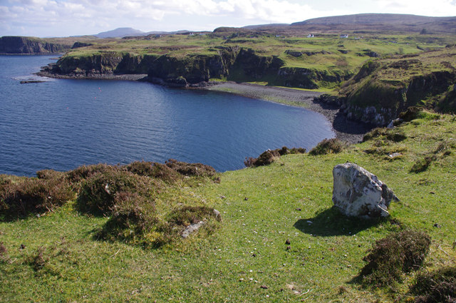
This headland is characterized by dramatic cliffs that rise sheer from the sea, providing a breathtaking panoramic view of the surrounding landscape. The rugged terrain is composed of ancient rock formations, with layers of sedimentary rock dating back millions of years. The coastal erosion has shaped the cliffs into fascinating formations, with distinctive layers and patterns visible to the naked eye.

Am Famhair is a popular destination for nature enthusiasts and hikers, offering a diverse range of flora and fauna. The headland is home to various seabird species, such as puffins and gannets, which nest in the cliffs during the breeding season. Visitors can observe these magnificent creatures in their natural habitat and enjoy the stunning coastal scenery.

The point also boasts a rich marine ecosystem, with an abundance of marine life in the surrounding waters. Seal colonies can often be spotted basking on the rocks, while dolphins and porpoises occasionally make appearances, delighting both locals and tourists alike.

Overall, Am Famhair in Inverness-shire is a remarkable coastal feature, offering a captivating blend of rugged cliffs, diverse wildlife, and awe-inspiring views. Its natural beauty and unique geological formations make it a must-visit destination for anyone seeking an unforgettable coastal experience in Scotland.

If you have any feedback on the listing, please let us know in the comments section below.

Am Famhair Images

Images are sourced within 2km of 57.505082/-6.7059586 or Grid Reference NG1855. Thanks to Geograph Open Source API. All images are credited.

Ruin above Galtrigill This is clearly the same ruined croft or blackhouse as shown in <a href="https://www.geograph.org.uk/photo/3955062">NG1754 : Ruined croft above Galtrigill</a>.
Ruin above Galtrigill
This is clearly the same ruined croft or blackhouse as shown in NG1754 : Ruined croft above Galtrigill.
Cliffs north of Biod an Athair The grassy shelf below is Scorgruim.
The Outer Hebrides are on the horizon.
Cliffs north of Biod an Athair
The grassy shelf below is Scorgruim. The Outer Hebrides are on the horizon.
Cliffs north of Biod an Athair The grassy shelf below is Scorgruim.
The Outer Hebrides are on the horizon.
Cliffs north of Biod an Athair
The grassy shelf below is Scorgruim. The Outer Hebrides are on the horizon.
Dunvegan Head Looking across Loch Dunvegan to Waternish.
Dunvegan Head
Looking across Loch Dunvegan to Waternish.
Ravine south of Dunvegan Head Looking across Loch Dunvegan to Waternish.
Ravine south of Dunvegan Head
Looking across Loch Dunvegan to Waternish.
Am Famhair h for a natural arch
Am Famhair
h for a natural arch
Ruined crofthouse at Galtrigill <a href="https://www.geograph.org.uk/photo/3360898">NG1854 : Ruin at Galtrigill</a> viewed from a different angle.
Ruined crofthouse at Galtrigill
NG1854 : Ruin at Galtrigill viewed from a different angle.
Bay below Galtrigill
View to Loch Dunvegan on the way to Dunvegan Head Trig Point
Shieling on the way to Dunvegan Head Trig Point A shieling (Scottish Gaelic: àirigh), also spelt sheiling, shealing and sheeling, is a hut, or collection of huts, once common in wild or lonely places in the hills and mountains of Scotland and northern England.

<span class="nowrap"><a title="https://en.wikipedia.org/wiki/Shieling" rel="nofollow ugc noopener" href="https://en.wikipedia.org/wiki/Shieling">Link</a><img style="margin-left:2px;" alt="External link" title="External link - shift click to open in new window" src="https://s1.geograph.org.uk/img/external.png" width="10" height="10"/></span>
Shieling on the way to Dunvegan Head Trig Point
A shieling (Scottish Gaelic: àirigh), also spelt sheiling, shealing and sheeling, is a hut, or collection of huts, once common in wild or lonely places in the hills and mountains of Scotland and northern England. LinkExternal link
View to Loch Dunvegan on the way to Dunvegan Head Trig Point
Galtrigill Burn on the way to Dunvegan Head Trig Point
View towards Dunvegan Head Trig Point Still some distance to go across pathless rough, tough moorland
View towards Dunvegan Head Trig Point
Still some distance to go across pathless rough, tough moorland
Galtrigill Burn on the way back from Dunvegan Head Trig Point
Waterfall near Galtrigill I was on the wrong side of the burn at this point and wondered if I would manage to cross it or have to back track
Waterfall near Galtrigill
I was on the wrong side of the burn at this point and wondered if I would manage to cross it or have to back track
Galtrigill Burn Looking rather uninviting as I was about to cross it
Galtrigill Burn
Looking rather uninviting as I was about to cross it
Show me another place!

Am Famhair is located at Grid Ref: NG1855 (Lat: 57.505082, Lng: -6.7059586)

Unitary Authority: Highland

Police Authority: Highlands and Islands

What 3 Words

///adults.health.pens. Near Glendale, Highland

Nearby Locations

Am Famhair

Related Wikis

Galtrigill

Galtrigill (Scottish Gaelic: Galtraigil) is a largely abandoned crofting township on the far north end of the east side of the Duirinish peninsula on the...

Loch Dunvegan

Loch Dunvegan (Scottish Gaelic: Loch Dhùn Bheagain), is a sea loch on the west coast of the island of Skye in the Inner Hebrides of Scotland. Dunvegan...

Borreraig

Borreraig (Scottish Gaelic: Boraraig) is a crofting settlement in Duirinish, north-west of Dunvegan on the Isle of Skye. The ancient and famous MacCrimmon...

Uig, Duirinish

Uig is a hamlet 14 miles (23 km) south west of Uig in Snizort, on the eastern shore of Loch Dunvegan, in the civil parish of Duirinish, on the Isle of...

Related Videos

Fhuair Mi Pog at the MacCrimmon Cairn at Borreraig

During a holiday to Skye, I visited the MacCrimmon Cairn at Borreraig and played a slow air version of the piobaireachd 'I Got A ...

Have you been to Am Famhair?

Leave your review of Am Famhair below (or comments, questions and feedback).