Geodha Bogha-sgeir
Coastal Feature, Headland, Point in Argyllshire
Scotland
Geodha Bogha-sgeir

Geodha Bogha-sgeir is a prominent coastal feature located in Argyllshire, Scotland. It is specifically classified as a headland or point due to its unique geographical formation. The name "Geodha Bogha-sgeir" originates from Gaelic and translates to "cove with the bow-shaped rock".
Situated along the rugged coastline, Geodha Bogha-sgeir is characterized by its towering cliffs and rocky outcrops. The headland extends into the sea, forming a distinctive bow-shaped rock formation that is visible from various viewpoints. These striking cliffs not only add to the scenic beauty of the area but also serve as a natural barrier against the powerful waves of the Atlantic Ocean.
The location of Geodha Bogha-sgeir makes it a popular destination for nature enthusiasts and photographers. The rugged landscape, combined with the crashing waves and dramatic rock formations, creates a picturesque setting that is often captured in photographs and paintings.
The area surrounding Geodha Bogha-sgeir is rich in biodiversity. The coastal waters are home to a variety of marine life, including seals, dolphins, and various species of seabirds. The cliffs provide nesting sites for seabird colonies, contributing to the ecological importance of the headland.
Access to Geodha Bogha-sgeir is possible via a designated walking trail that offers stunning views of the surrounding coastline. Visitors are advised to exercise caution due to the uneven terrain and potentially slippery surfaces.
In conclusion, Geodha Bogha-sgeir is a captivating coastal feature in Argyllshire, Scotland. Its distinctive bow-shaped rock, towering cliffs, and diverse wildlife make it a must-visit destination for nature lovers and those seeking awe-inspiring natural beauty.
If you have any feedback on the listing, please let us know in the comments section below.
Geodha Bogha-sgeir Images
Images are sourced within 2km of 55.675227/-6.5060452 or Grid Reference NR1651. Thanks to Geograph Open Source API. All images are credited.


Geodha Bogha-sgeir is located at Grid Ref: NR1651 (Lat: 55.675227, Lng: -6.5060452)
Unitary Authority: Argyll and Bute
Police Authority: Argyll and West Dunbartonshire
What 3 Words
///comic.ballpoint.removal. Near Portnahaven, Argyll & Bute
Nearby Locations
Related Wikis

Orsay, Inner Hebrides
Orsay (Scottish Gaelic: Orasaigh) is a small island in the Inner Hebrides of Scotland. It lies a short distance off the west coast of the island of Islay...

Portnahaven
Portnahaven (Scottish Gaelic: Port na h-Abhainne, meaning river port) is a village on Islay in the Inner Hebrides, Scotland. The village is within the...

Eilean Mhic Coinnich
Eilean Mhic Coinnich, also known as Mackenzie Island (although recorded on the Land Register as McKenseys Island), is an uninhabited island of 17.3 hectares...

Islay LIMPET
Islay LIMPET was the world's first commercial wave power device and was connected to the United Kingdom's National Grid. == History == Islay LIMPET (Land...

Rhinns complex
The Rhinns complex is a deformed Palaeoproterozoic igneous complex that is considered to form the basement to the Colonsay Group of metasedimentary rocks...

Easter Ellister
Easter Ellister (Aolastradh) is a settlement on the Rinns of Islay on Islay in the Inner Hebrides of Scotland. It lies just off the A847 road between Portnahaven...

Nerabus
Nerabus (otherwise Nereabolls) is a hamlet in the west of the isle of Islay in Scotland. The vicinity is noted for its scenic qualities and diverse birdlife...

Rinns of Islay
The Rinns of Islay (Scottish Gaelic: Na Roinn Ìleach; alternative English spelling Rhinns of Islay) is an area on the west of the island of Islay in the...
Related Videos


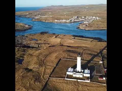
Portnahaven Sunset
Islay festival week 2019.

MAIRI’S WEDDING Live On BAGPIPES | Portnahaven Islay
PipingBairn performs a live solo bagpipe cover of Mairi's Wedding also known as the Lewis Bridal Song (composed by John ...
Orsay House Islay
Orsay Lighthouse to Portnahaven Islay. Orsay House B&B. Orsayhouse.co.uk.
Nearby Amenities
Located within 500m of 55.675227,-6.5060452Have you been to Geodha Bogha-sgeir?
Leave your review of Geodha Bogha-sgeir below (or comments, questions and feedback).