Bun Othan

Settlement in Argyllshire

Scotland

Bun Othan

Memorial to Lieutenant David Lowe Macintyre David Lowe Macintyre VC, CB (18 June 1895 – 31 July 1967) was a Scottish recipient of the Victoria Cross.
Memorial to Lieutenant David Lowe Macintyre Credit: Andrew Abbott

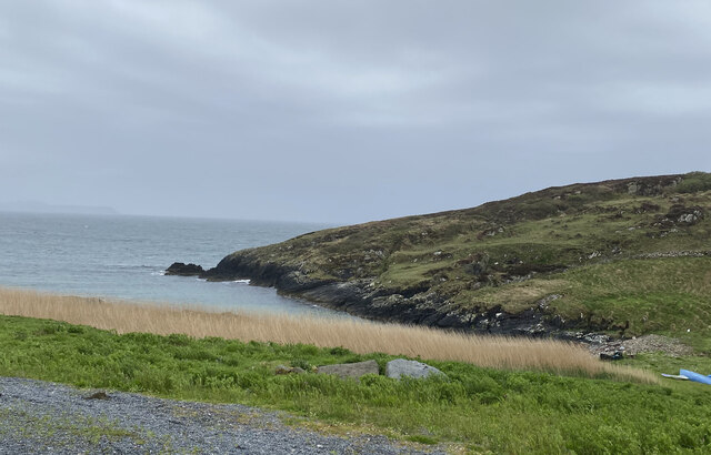
Bun Othan is a small coastal village located on the west coast of Scotland, in the region of Argyllshire. Situated on the picturesque shores of Loch Othan, the village offers breathtaking views of the surrounding natural beauty. With a population of around 200 residents, Bun Othan is known for its peaceful and close-knit community.

The village is characterized by its charming traditional houses, many of which date back several centuries. The local architecture showcases a mix of Scottish and Gaelic influences, providing a glimpse into the area's rich cultural heritage. Visitors can explore the narrow winding streets, lined with quaint cottages and lush gardens.

Nature enthusiasts will delight in the abundance of outdoor activities available in Bun Othan. The nearby Loch Othan is a haven for fishing enthusiasts, with its teeming waters offering opportunities to catch trout and salmon. The surrounding hills and forests provide ample opportunities for hiking and birdwatching, with a variety of native bird species residing in the area.

Despite its small size, Bun Othan boasts several amenities to cater to both residents and visitors. The village is home to a local pub, where visitors can enjoy a pint of traditional Scottish ale and sample local cuisine. Additionally, there are a few small shops and a post office, providing basic necessities for the community.

Overall, Bun Othan offers a tranquil and idyllic retreat for those seeking a peaceful getaway in the heart of Scotland's stunning natural landscape.

If you have any feedback on the listing, please let us know in the comments section below.

Bun Othan Images

Images are sourced within 2km of 55.676322/-6.5053595 or Grid Reference NR1651. Thanks to Geograph Open Source API. All images are credited.

Memorial to Lieutenant David Lowe Macintyre David Lowe Macintyre VC, CB (18 June 1895 – 31 July 1967) was a Scottish recipient of the Victoria Cross.
Memorial to Lieutenant David Lowe Macintyre
David Lowe Macintyre VC, CB (18 June 1895 – 31 July 1967) was a Scottish recipient of the Victoria Cross.
Rocks at An Dubh-laoig
Rubbish tip
Rubbish tip
Boat under repair
Boat under repair
Main Street, Port Wemyss/Bun Othan
Caolas na Cor-sgeire
Coast at Claddach
Coast at Claddach
Main Street, Port Wemyss/Bun Othan
Village Hall
Village Hall
Coastal views from holiday cottage
Portnahaven
Portnahaven
Views out to sea Portnahaven
Portnahaven, Parish Church
OS Cut Mark - Portnahaven, Parish Church <span class="nowrap"><a title="https://www.bench-marks.org.uk/bm58120" rel="nofollow ugc noopener" href="https://www.bench-marks.org.uk/bm58120">Link</a><img style="margin-left:2px;" alt="External link" title="External link - shift click to open in new window" src="https://s1.geograph.org.uk/img/external.png" width="10" height="10"/></span>
OS Cut Mark - Portnahaven, Parish Church
View to Orsay from Port Wemyss
Port Ellister
Port Ellister
Location of Cnoc Undail OS Pipe <span class="nowrap"><a title="http://trigpointing.uk/trig/9482" rel="nofollow ugc noopener" href="http://trigpointing.uk/trig/9482">Link</a><img style="margin-left:2px;" alt="External link" title="External link - shift click to open in new window" src="https://s1.geograph.org.uk/img/external.png" width="10" height="10"/></span>
Location of Cnoc Undail OS Pipe
Former Portnahaven Coast Guard Lookout
Show me another place!

Bun Othan is located at Grid Ref: NR1651 (Lat: 55.676322, Lng: -6.5053595)

Unitary Authority: Argyll and Bute

Police Authority: Argyll and West Dunbartonshire

Also known as: Port Wemyss

What 3 Words

///lecturers.mistaken.loud. Near Portnahaven, Argyll & Bute

Related Wikis

Orsay, Inner Hebrides

Orsay (Scottish Gaelic: Orasaigh) is a small island in the Inner Hebrides of Scotland. It lies a short distance off the west coast of the island of Islay...

Portnahaven

Portnahaven (Scottish Gaelic: Port na h-Abhainne, meaning river port) is a village on Islay in the Inner Hebrides, Scotland. The village is within the...

Eilean Mhic Coinnich

Eilean Mhic Coinnich, also known as Mackenzie Island (although recorded on the Land Register as McKenseys Island), is an uninhabited island of 17.3 hectares...

Islay LIMPET

Islay LIMPET was the world's first commercial wave power device and was connected to the United Kingdom's National Grid. == History == Islay LIMPET (Land...

Nearby Amenities

Located within 500m of 55.676322,-6.5053595
Created By: dmgroom_coastlines
Source: PGS
Lat/Long: 55.67642/-6.51233
Port Wemyss
Name En: Port Wemyss
Name Gd: Bun Othain
Place: village
Wikidata: Q1747432
Lat/Long: 55.6766674/-6.5051379
Pub
An Tigh Seinnse
Addr Country: GB
Addr Postcode: PA47 7SJ
Addr Street: Queen Street
Fhrs Id: 33472
Opening Hours: Mo-Su 12:00-23:00
Opening Hours Kitchen: Fr-Tu 12:00-18:00; We-Th 12:00-16:00
Tourism: guest_house
Wheelchair: no
Lat/Long: 55.6801455/-6.509529
Bus Stop
Naptan AtcoCode: 60709357
Naptan NaptanCode: 54723234
Shelter: yes
Lat/Long: 55.6762188/-6.5054353
Post Box
Post Box Type: lamp
Ref: PA47 26
Royal Cypher: scottish_crown
Lat/Long: 55.6803442/-6.5062882
Bus Stop
Lat/Long: 55.6800095/-6.5094011
Post Box
Post Box Type: wall
Ref: PA47 10
Royal Cypher: scottish_crown
Lat/Long: 55.676299/-6.5054353
Telephone
Booth: K6
Covered: booth
Phone: +44 1496 860245
Lat/Long: 55.6762763/-6.5054353
Post Office
Portnahaven Post Office
Addr Housenumber: 23
Addr Postcode: PA47 7SH
Addr Street: Shore Street
Note: an outreach facility
Opening Hours: Mo 10:00-12:00
Lat/Long: 55.6805075/-6.5063326
Building: yes
Lat/Long: 55.6776966/-6.5013709
Hugh MacKay's Grave
Cemetery: grave
Heritage: yes
Wikidata: Q1634457
Lat/Long: 55.6757106/-6.5124048
Bench
Lat/Long: 55.6753385/-6.5042293
Leisure: picnic_table
Lat/Long: 55.6750271/-6.505369
Power: pole
Lat/Long: 55.68/-6.5013001
Power: pole
Lat/Long: 55.6798029/-6.5047686
Power: pole
Lat/Long: 55.6799331/-6.502596
Power: pole
Lat/Long: 55.679671/-6.5054325
Power: pole
Lat/Long: 55.678804/-6.5069206
Power: pole
Lat/Long: 55.6792306/-6.504601
Power: pole
Lat/Long: 55.6786352/-6.5044514
Power: pole
Lat/Long: 55.6778843/-6.5042637
Power: pole
Lat/Long: 55.6774189/-6.5040983
Power: pole
Lat/Long: 55.6774413/-6.5054085
Power: pole
Lat/Long: 55.6777709/-6.5075208
Material: wood
Power: pole
Lat/Long: 55.6777832/-6.5081622
Material: wood
Power: pole
Lat/Long: 55.6783729/-6.5078761
Power: pole
Lat/Long: 55.6779703/-6.5077975
Street Lamp
Lat/Long: 55.6800204/-6.5094048
Street Lamp
Lat/Long: 55.6801334/-6.5091755
Street Lamp
Lat/Long: 55.6802506/-6.5059474
Street Lamp
Lat/Long: 55.6804551/-6.5060634
Street Lamp
Lat/Long: 55.6806207/-6.5062599
Street Lamp
Lat/Long: 55.6807005/-6.5060131
Street Lamp
Lat/Long: 55.6805387/-6.5046727
Street Lamp
Lat/Long: 55.6804858/-6.504206
Street Lamp
Lat/Long: 55.6804245/-6.5037628
Power: pole
Lat/Long: 55.6805251/-6.5026216
Street Lamp
Lat/Long: 55.6803988/-6.5032531
Street Lamp
Lat/Long: 55.6804472/-6.5027898
Power: pole
Lat/Long: 55.679859/-6.5038121
Power: pole
Lat/Long: 55.6776209/-6.5065596
Power: pole
Lat/Long: 55.6771019/-6.5064856
Power: pole
Lat/Long: 55.6798004/-6.5010359
Power: pole
Lat/Long: 55.6789114/-6.5073653
Power: pole
Lat/Long: 55.6762673/-6.5037743
Power: pole
Lat/Long: 55.676702/-6.504224
Power: pole
Lat/Long: 55.6769632/-6.5046178
Telephone
Booth: K6
Covered: booth
Phone: +44 1496 860225
Lat/Long: 55.6805938/-6.5052138
The data included in this document is from www.openstreetmap.org. The data is made available under ODbL.

Have you been to Bun Othan?

Leave your review of Bun Othan below (or comments, questions and feedback).