Maol Dubh

Coastal Feature, Headland, Point in Inverness-shire

Scotland

Maol Dubh

View south over Leac a' Li Looking from a window of a house in Leac a' Li. 
A few sheep graze the poor vegetation between the exposed bedrock. 
The water is Loch Stocanais.
View south over Leac a' Li Credit: Richard Dorrell

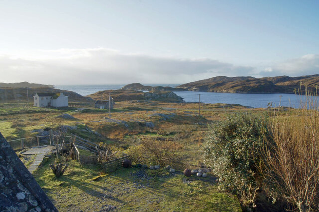
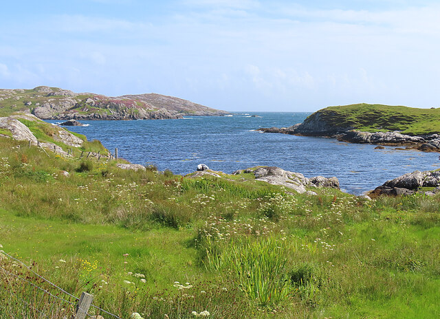
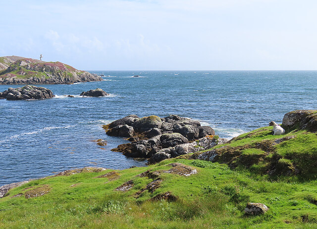
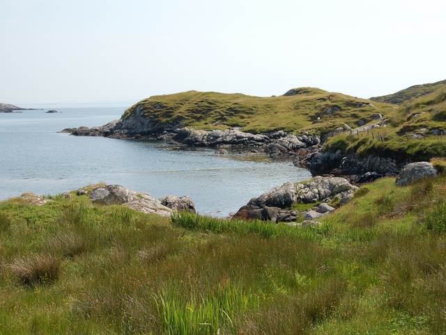
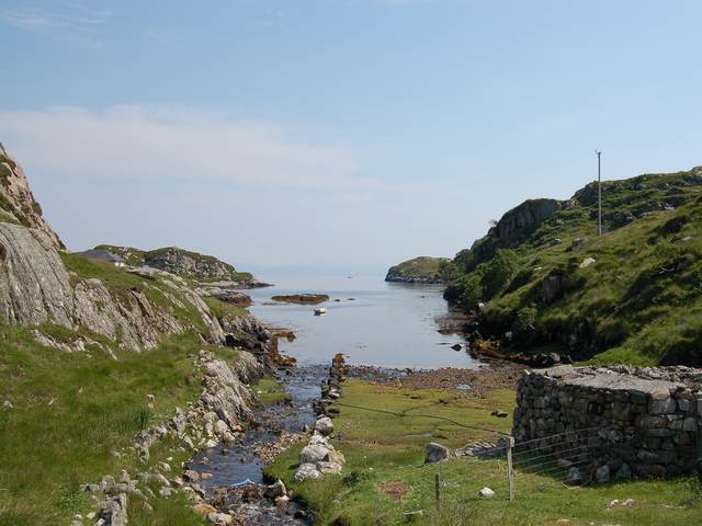
Maol Dubh is a prominent coastal feature located in Inverness-shire, Scotland. It is a headland that juts out into the North Atlantic Ocean, forming a distinct point along the coastline. Situated on the western coast of the Scottish Highlands, Maol Dubh offers breathtaking views of the surrounding sea and rugged landscape.

The headland is characterized by its steep cliffs, which rise dramatically from the rocky shoreline. These cliffs provide a nesting habitat for an array of seabirds, including puffins, guillemots, and razorbills. The area is recognized as an important site for birdwatching and wildlife enthusiasts.

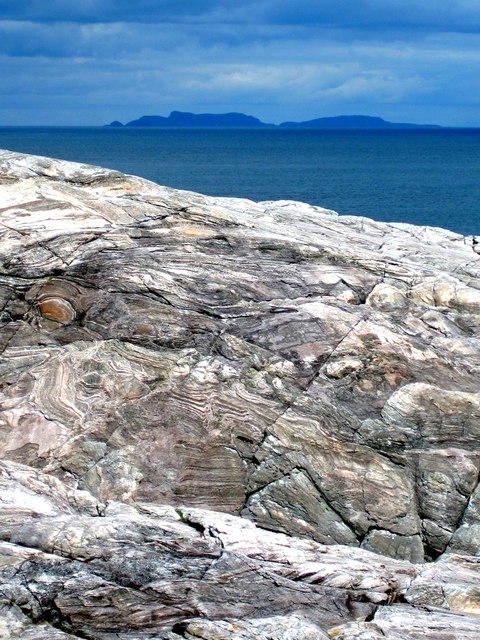
The geology of Maol Dubh is fascinating, with exposed rocks displaying layers of sedimentary and volcanic formations. The headland is primarily composed of basalt, a volcanic rock that formed millions of years ago during ancient volcanic activity. This geological diversity adds to the unique charm of the area.

Maol Dubh is a popular destination for outdoor activities such as hiking and photography. The headland offers several walking trails that provide access to its stunning viewpoints. Visitors can enjoy panoramic vistas of the ocean, neighboring islands, and the distant Scottish Highlands.

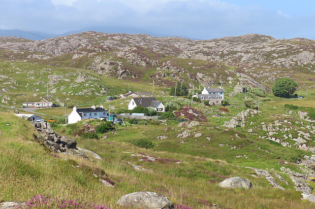
Access to Maol Dubh is relatively easy, with a well-maintained road leading to a parking area near the headland. From there, visitors can follow marked paths to explore the area. It is advisable to come prepared with appropriate footwear and clothing, as the weather conditions can be changeable and the terrain can be rough in some areas.

Overall, Maol Dubh is a captivating coastal feature that showcases the natural beauty and geological wonders of Inverness-shire. Its dramatic cliffs, diverse wildlife, and breathtaking views make it a must-visit destination for nature lovers and adventurers alike.

If you have any feedback on the listing, please let us know in the comments section below.
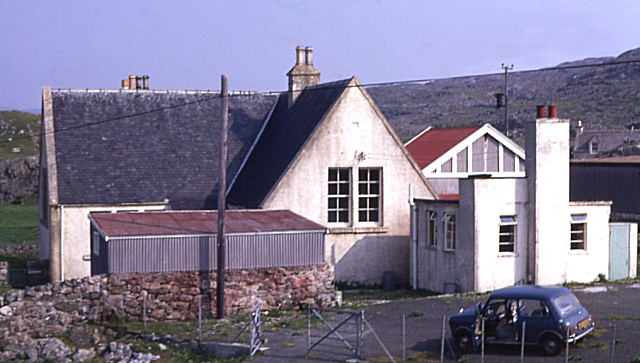
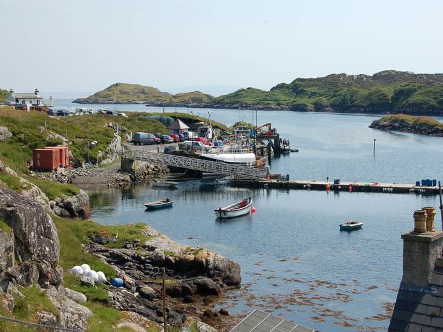
Maol Dubh Images

Images are sourced within 2km of 57.811714/-6.8033923 or Grid Reference NG1490. Thanks to Geograph Open Source API. All images are credited.
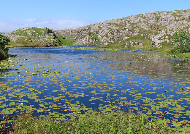
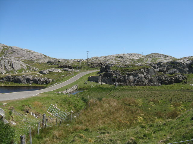
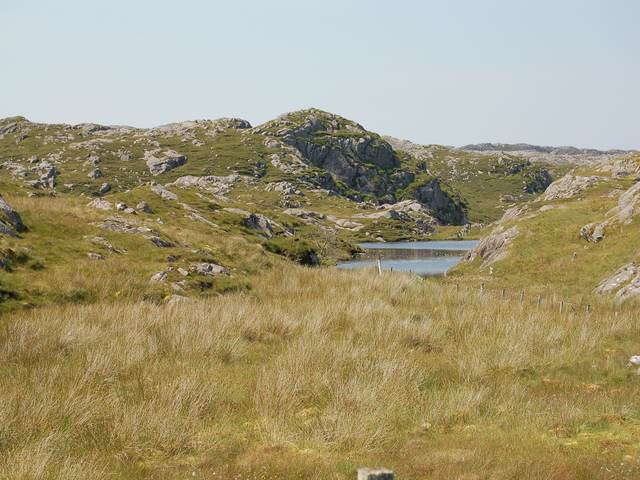
View south over Leac a' Li Looking from a window of a house in Leac a' Li. 
A few sheep graze the poor vegetation between the exposed bedrock. 
The water is Loch Stocanais.
View south over Leac a' Li
Looking from a window of a house in Leac a' Li. A few sheep graze the poor vegetation between the exposed bedrock. The water is Loch Stocanais.
Kirk at Stocanais The sign on the wall says that this is the Stockinish meeting house of the North Harris Free Presbyterian Church.
Kirk at Stocanais
The sign on the wall says that this is the Stockinish meeting house of the North Harris Free Presbyterian Church.
White Water-lily (Nymphaea alba) I always associate water-lilies with the lochans of eastern Harris, and was glad to find some still in flower in August, as I have only ever been to na h-Eileanan an Iar in spring and early summer before.
White Water-lily (Nymphaea alba)
I always associate water-lilies with the lochans of eastern Harris, and was glad to find some still in flower in August, as I have only ever been to na h-Eileanan an Iar in spring and early summer before.
Loch a' Chaolais This lochan is well covered with the floating leaves of the White Water-lily (Nymphaea alba).
Loch a' Chaolais
This lochan is well covered with the floating leaves of the White Water-lily (Nymphaea alba).
Loch Chliuthair This inlet opens in to Loch Cluer, another of the eastern Harris sea-lochs.
Loch Chliuthair
This inlet opens in to Loch Cluer, another of the eastern Harris sea-lochs.
Loch Cluer Loch Chliuthair in Gaelic takes its name from the village of Cliuthar, anglicised as Cluer.
Loch Cluer
Loch Chliuthair in Gaelic takes its name from the village of Cliuthar, anglicised as Cluer.
Collam A handful of houses beside Loch Ghreosabhaigh.
Collam
A handful of houses beside Loch Ghreosabhaigh.
Lewisian Gneiss with the Shiant Isles behind Magnificent swirls of Lewisian Gneiss just south of Mol Ban in South Harris.
Lewisian Gneiss with the Shiant Isles behind
Magnificent swirls of Lewisian Gneiss just south of Mol Ban in South Harris.
Road at Caolas Stocinis/Kyles Stockinish Looking over a short causeway across the end of Loch a' Chaolais.
Road at Caolas Stocinis/Kyles Stockinish
Looking over a short causeway across the end of Loch a' Chaolais.
Loch a' Chaolais A small loch in the rocky landscape, with pond weed [Potomageton sp.].
Loch a' Chaolais
A small loch in the rocky landscape, with pond weed [Potomageton sp.].
The church at Stockinish
Kyles Road End at Stockinish Opposite the church, a bus stop and some ground preparation in progress.
Kyles Road End at Stockinish
Opposite the church, a bus stop and some ground preparation in progress.
Stockinish Harbour This busy harbour on South Harris's east coast is owned by the local authority.  A large number of fishing vessels are based here, and the area is popular with visiting yachts.
Stockinish Harbour
This busy harbour on South Harris's east coast is owned by the local authority. A large number of fishing vessels are based here, and the area is popular with visiting yachts.
Stockinish Youth Hostel In the 1960s and 1970s the school at Stockinish doubled as a temporary youth hostel. Like most of these, it is long since closed down.
Stockinish Youth Hostel
In the 1960s and 1970s the school at Stockinish doubled as a temporary youth hostel. Like most of these, it is long since closed down.
The harbour at Stocinis The busy harbour in Loch Stocinis is very sheltered by Eilean Stocinis, seen in the background.
The harbour at Stocinis
The busy harbour in Loch Stocinis is very sheltered by Eilean Stocinis, seen in the background.
The head of Loch Cliuthair
Loch na Buaile A small loch in a marshy hollow near Cliuthar.
Loch na Buaile
A small loch in a marshy hollow near Cliuthar.
The head of Loch Chollaim The burn entering the sea here has been canalised to the left side of the head of the loch to provide some flat dry ground for sheep fanks, the edge of which can be seen on the right.
The head of Loch Chollaim
The burn entering the sea here has been canalised to the left side of the head of the loch to provide some flat dry ground for sheep fanks, the edge of which can be seen on the right.
Show me another place!

Maol Dubh is located at Grid Ref: NG1490 (Lat: 57.811714, Lng: -6.8033923)

Unitary Authority: Na h-Eileanan an Iar

Police Authority: Highlands and Islands

What 3 Words

///covenants.dote.supplier. Near Tarbert, Na h-Eileanan Siar

Related Wikis

Stockinish Island

Stockinish Island (Scottish Gaelic: Eilean Stocainis) is an uninhabited island off Harris, in the Outer Hebrides. == Geography and geology == Stockinish...

East Loch Tarbert

East Loch Tarbert (Scottish Gaelic: Loch an Tairbeairt) is a sea loch that lies to the east of Harris in the Outer Hebrides of Scotland. The loch contains...

Sgeotasaigh

Scotasay (Scottish Gaelic: Sgeotasaigh) is small island in the Outer Hebrides of Scotland. It lies 1 kilometre (0.6 miles) off the east coast of Harris...

Borsham

Borsham (Scottish Gaelic: Boirseam) is a village in the 'Bays' area of Harris in the Outer Hebrides, Scotland. Borsham is within the parish of Harris....

Nearby Amenities

Located within 500m of 57.811714,-6.8033923
Passing Place
Lat/Long: 57.8157568/-6.806473
Passing Place
Lat/Long: 57.8124808/-6.7997551
Barrier: cattle_grid
Lat/Long: 57.8130105/-6.7995781
Turning Circle
Lat/Long: 57.8139922/-6.8010039
Barrier: cattle_grid
Lat/Long: 57.8157532/-6.80321
Passing Place
Lat/Long: 57.8116633/-6.7997916
Post Box
Ref: HS3 112
Source: survey
Lat/Long: 57.8159205/-6.8047232
Loch Chliuthair
Natural: bay
Lat/Long: 57.8092142/-6.80825
Material: wood
Power: pole
Lat/Long: 57.8151061/-6.8038791
Material: wood
Power: pole
Lat/Long: 57.8151746/-6.8035466
Material: wood
Power: pole
Lat/Long: 57.8158676/-6.8054777
Material: wood
Power: pole
Lat/Long: 57.8133519/-6.8000586
Material: wood
Power: pole
Lat/Long: 57.8138033/-6.8010309
Material: wood
Power: pole
Lat/Long: 57.8141227/-6.8017567
Material: wood
Power: pole
Lat/Long: 57.812928/-6.7991303
Material: wood
Power: pole
Lat/Long: 57.814635/-6.8028696
Material: wood
Power: pole
Lat/Long: 57.8114453/-6.799283
Material: wood
Power: pole
Lat/Long: 57.8116761/-6.7993756
Material: wood
Power: pole
Lat/Long: 57.8123282/-6.7992459
Material: wood
Power: pole
Lat/Long: 57.8153091/-6.8046247
Power: pole
Lat/Long: 57.8145647/-6.7976555
Power: pole
Lat/Long: 57.8142314/-6.7983156
Power: pole
Lat/Long: 57.8139171/-6.7989432
The data included in this document is from www.openstreetmap.org. The data is made available under ODbL.

Have you been to Maol Dubh?

Leave your review of Maol Dubh below (or comments, questions and feedback).