Loch na h-Airidh

Lake, Pool, Pond, Freshwater Marsh in Inverness-shire

Scotland

Loch na h-Airidh

View south over Leac a' Li Looking from a window of a house in Leac a' Li. 
A few sheep graze the poor vegetation between the exposed bedrock. 
The water is Loch Stocanais.
View south over Leac a' Li Credit: Richard Dorrell

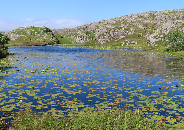
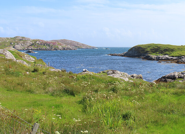
Loch na h-Airidh is a picturesque freshwater loch located in Inverness-shire, Scotland. Nestled amidst the stunning Scottish Highlands, this pristine body of water is known for its natural beauty and tranquil atmosphere.

Covering an area of approximately 5 hectares, Loch na h-Airidh is surrounded by lush greenery and rolling hills, creating a breathtaking backdrop for visitors. The loch is situated at an elevation of 200 meters above sea level, offering stunning panoramic views of the surrounding landscape.

The water in Loch na h-Airidh is crystal clear and reflects the surrounding scenery, creating a mesmerizing sight. The depth of the loch varies, with some parts reaching a maximum of 10 meters. It is fed by several small streams and springs that flow into the loch, ensuring a constant supply of fresh water.

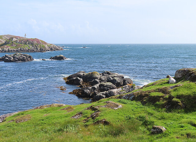
The shores of the loch are home to a diverse range of flora and fauna. The area surrounding Loch na h-Airidh is a haven for birdwatchers, as it attracts a variety of bird species, including ducks, swans, and herons. The lush vegetation around the loch provides an ideal habitat for small mammals and insects, adding to the biodiversity of the area.

Loch na h-Airidh is a popular destination for outdoor enthusiasts. Visitors can enjoy various activities such as fishing, boating, and picnicking on its shores. The calm and serene environment makes it a perfect spot for relaxation and rejuvenation.

Overall, Loch na h-Airidh is a hidden gem in Inverness-shire, offering a peaceful retreat amidst the stunning Scottish Highlands.

If you have any feedback on the listing, please let us know in the comments section below.

Loch na h-Airidh Images

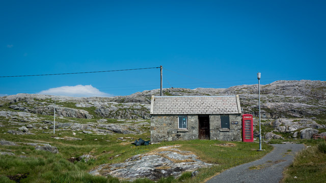
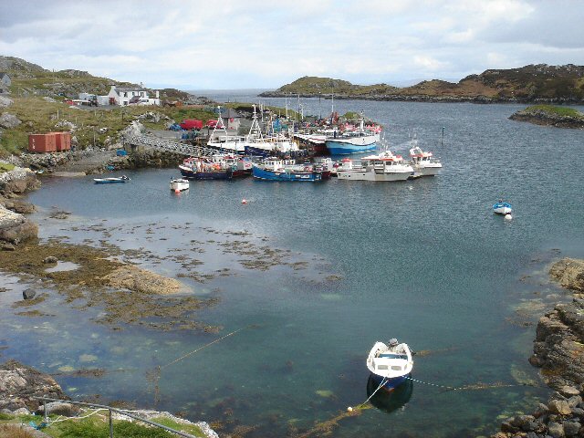
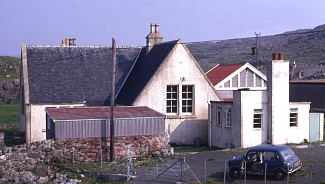
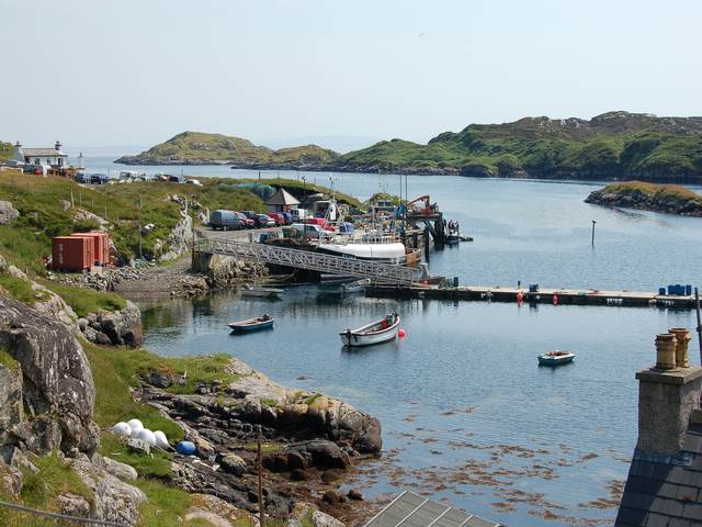
Images are sourced within 2km of 57.816757/-6.8046713 or Grid Reference NG1490. Thanks to Geograph Open Source API. All images are credited.
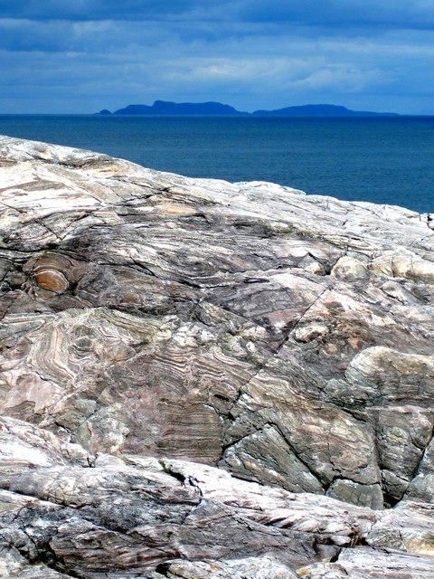
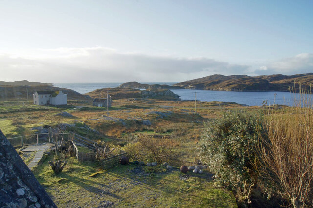
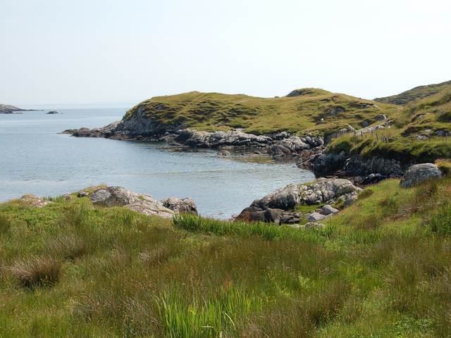
View south over Leac a' Li Looking from a window of a house in Leac a' Li. 
A few sheep graze the poor vegetation between the exposed bedrock. 
The water is Loch Stocanais.
View south over Leac a' Li
Looking from a window of a house in Leac a' Li. A few sheep graze the poor vegetation between the exposed bedrock. The water is Loch Stocanais.
Kirk at Stocanais The sign on the wall says that this is the Stockinish meeting house of the North Harris Free Presbyterian Church.
Kirk at Stocanais
The sign on the wall says that this is the Stockinish meeting house of the North Harris Free Presbyterian Church.
White Water-lily (Nymphaea alba) I always associate water-lilies with the lochans of eastern Harris, and was glad to find some still in flower in August, as I have only ever been to na h-Eileanan an Iar in spring and early summer before.
White Water-lily (Nymphaea alba)
I always associate water-lilies with the lochans of eastern Harris, and was glad to find some still in flower in August, as I have only ever been to na h-Eileanan an Iar in spring and early summer before.
Loch a' Chaolais This lochan is well covered with the floating leaves of the White Water-lily (Nymphaea alba).
Loch a' Chaolais
This lochan is well covered with the floating leaves of the White Water-lily (Nymphaea alba).
Loch Chliuthair This inlet opens in to Loch Cluer, another of the eastern Harris sea-lochs.
Loch Chliuthair
This inlet opens in to Loch Cluer, another of the eastern Harris sea-lochs.
Loch Cluer Loch Chliuthair in Gaelic takes its name from the village of Cliuthar, anglicised as Cluer.
Loch Cluer
Loch Chliuthair in Gaelic takes its name from the village of Cliuthar, anglicised as Cluer.
Collam A handful of houses beside Loch Ghreosabhaigh.
Collam
A handful of houses beside Loch Ghreosabhaigh.
Fish Farm In the outer part of Loch Ghreosabhagh. I take it that the poles and nets are to discourage birds form taking the fish.
Fish Farm
In the outer part of Loch Ghreosabhagh. I take it that the poles and nets are to discourage birds form taking the fish.
Lewisian Gneiss with the Shiant Isles behind Magnificent swirls of Lewisian Gneiss just south of Mol Ban in South Harris.
Lewisian Gneiss with the Shiant Isles behind
Magnificent swirls of Lewisian Gneiss just south of Mol Ban in South Harris.
Road at Caolas Stocinis/Kyles Stockinish Looking over a short causeway across the end of Loch a' Chaolais.
Road at Caolas Stocinis/Kyles Stockinish
Looking over a short causeway across the end of Loch a' Chaolais.
Loch a' Chaolais A small loch in the rocky landscape, with pond weed [Potomageton sp.].
Loch a' Chaolais
A small loch in the rocky landscape, with pond weed [Potomageton sp.].
The church at Stockinish
Kyles Road End at Stockinish Opposite the church, a bus stop and some ground preparation in progress.
Kyles Road End at Stockinish
Opposite the church, a bus stop and some ground preparation in progress.
Old Post Office and Telephone Box
Stockinish Harbour This busy harbour on South Harris's east coast is owned by the local authority.  A large number of fishing vessels are based here, and the area is popular with visiting yachts.
Stockinish Harbour
This busy harbour on South Harris's east coast is owned by the local authority. A large number of fishing vessels are based here, and the area is popular with visiting yachts.
Stockinish Youth Hostel In the 1960s and 1970s the school at Stockinish doubled as a temporary youth hostel. Like most of these, it is long since closed down.
Stockinish Youth Hostel
In the 1960s and 1970s the school at Stockinish doubled as a temporary youth hostel. Like most of these, it is long since closed down.
The harbour at Stocinis The busy harbour in Loch Stocinis is very sheltered by Eilean Stocinis, seen in the background.
The harbour at Stocinis
The busy harbour in Loch Stocinis is very sheltered by Eilean Stocinis, seen in the background.
The head of Loch Cliuthair
Show me another place!

Loch na h-Airidh is located at Grid Ref: NG1490 (Lat: 57.816757, Lng: -6.8046713)

Unitary Authority: Na h-Eileanan an Iar

Police Authority: Highlands and Islands

What 3 Words

///vented.radically.screaming. Near Tarbert, Na h-Eileanan Siar

Related Wikis

Stockinish Island

Stockinish Island (Scottish Gaelic: Eilean Stocainis) is an uninhabited island off Harris, in the Outer Hebrides. == Geography and geology == Stockinish...

East Loch Tarbert

East Loch Tarbert (Scottish Gaelic: Loch an Tairbeairt) is a sea loch that lies to the east of Harris in the Outer Hebrides of Scotland. The loch contains...

Sgeotasaigh

Scotasay (Scottish Gaelic: Sgeotasaigh) is small island in the Outer Hebrides of Scotland. It lies 1 kilometre (0.6 miles) off the east coast of Harris...

Borsham

Borsham (Scottish Gaelic: Boirseam) is a village in the 'Bays' area of Harris in the Outer Hebrides, Scotland. Borsham is within the parish of Harris....

Nearby Amenities

Located within 500m of 57.816757,-6.8046713
Cluer
Naptan AtcoCode: 6010731614
Naptan Bearing: E
Naptan BusStopType: CUS
Naptan CommonName: Cluer
Naptan Indicator: Village
Naptan Landmark: Opposite house No 9
Naptan NaptanCode: 94723635
Naptan Street: Unclassified road
Naptan Verified: no
Source: naptan_import
Lat/Long: 57.8158857/-6.8085477
Passing Place
Lat/Long: 57.8202862/-6.8002172
Passing Place
Lat/Long: 57.8194795/-6.8012931
Passing Place
Lat/Long: 57.8190603/-6.8012316
Passing Place
Lat/Long: 57.8182934/-6.8013132
Passing Place
Lat/Long: 57.8174106/-6.802284
Passing Place
Lat/Long: 57.8166067/-6.8034615
Passing Place
Lat/Long: 57.8157568/-6.806473
Barrier: cattle_grid
Lat/Long: 57.8164639/-6.810861
Turning Circle
Lat/Long: 57.8139922/-6.8010039
Barrier: cattle_grid
Lat/Long: 57.8157532/-6.80321
Post Box
Ref: HS3 112
Source: survey
Lat/Long: 57.8159205/-6.8047232
Cliuthar
Name En: Cluer
Name Gd: Cliuthar
Place: hamlet
Lat/Long: 57.8163997/-6.8076746
Material: wood
Power: pole
Lat/Long: 57.8162912/-6.8122801
Material: wood
Power: pole
Lat/Long: 57.8166284/-6.8117664
Material: wood
Power: pole
Lat/Long: 57.8167827/-6.8107311
Turning Circle
Lat/Long: 57.8195687/-6.7989544
Barrier: cattle_grid
Lat/Long: 57.8200152/-6.7996916
Material: wood
Power: pole
Lat/Long: 57.8176106/-6.8023367
Material: wood
Power: pole
Lat/Long: 57.8182274/-6.8014485
Material: wood
Power: pole
Lat/Long: 57.8191869/-6.8018799
Material: wood
Power: pole
Lat/Long: 57.8203208/-6.800698
Material: wood
Power: pole
Lat/Long: 57.8169619/-6.803273
Material: wood
Power: pole
Lat/Long: 57.8151061/-6.8038791
Material: wood
Power: pole
Lat/Long: 57.8151746/-6.8035466
Material: wood
Power: pole
Lat/Long: 57.8158676/-6.8054777
Material: wood
Power: pole
Lat/Long: 57.8163004/-6.8073205
Material: wood
Power: pole
Lat/Long: 57.8163004/-6.8063602
Material: wood
Power: pole
Lat/Long: 57.8162847/-6.809316
Material: wood
Power: pole
Lat/Long: 57.8162804/-6.8087044
Material: wood
Power: pole
Lat/Long: 57.8165198/-6.8102429
Material: wood
Power: pole
Lat/Long: 57.8133519/-6.8000586
Material: wood
Power: pole
Lat/Long: 57.8138033/-6.8010309
Material: wood
Power: pole
Lat/Long: 57.8141227/-6.8017567
Material: wood
Power: pole
Lat/Long: 57.814635/-6.8028696
Material: wood
Power: pole
Lat/Long: 57.8153091/-6.8046247
Power: pole
Lat/Long: 57.8198079/-6.8012238
Power: pole
Lat/Long: 57.8168795/-6.8129279
Power: pole
Lat/Long: 57.8168485/-6.8122145
Power: pole
Lat/Long: 57.8168246/-6.8114927
Power: pole
Lat/Long: 57.816212/-6.8115493
Power: pole
Lat/Long: 57.8161434/-6.8109109
Power: pole
Lat/Long: 57.8163022/-6.8050327
Power: pole
Lat/Long: 57.8145647/-6.7976555
Power: pole
Lat/Long: 57.8156905/-6.7969608
Power: pole
Lat/Long: 57.8161734/-6.7978405
Power: pole
Lat/Long: 57.8166348/-6.7986774
Power: pole
Lat/Long: 57.8172234/-6.7997181
Power: pole
Lat/Long: 57.8178063/-6.8007507
Power: pole
Lat/Long: 57.8148058/-6.7971917
Power: pole
Lat/Long: 57.8142314/-6.7983156
Power: pole
Lat/Long: 57.8139171/-6.7989432
The data included in this document is from www.openstreetmap.org. The data is made available under ODbL.

Have you been to Loch na h-Airidh?

Leave your review of Loch na h-Airidh below (or comments, questions and feedback).