Làmh-sgeir Mhòr

Coastal Feature, Headland, Point in Argyllshire

Scotland

Làmh-sgeir Mhòr

Houses, Gott Bay View from  Gott Bay, just above the mapped rocks.
Houses, Gott Bay Credit: Richard Webb

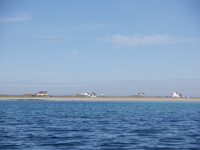
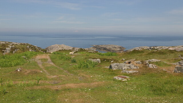
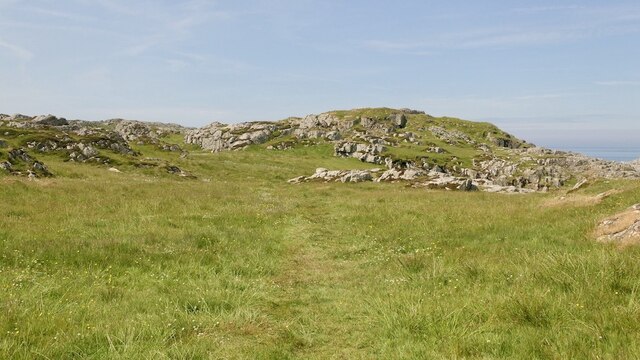
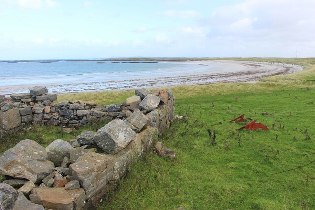
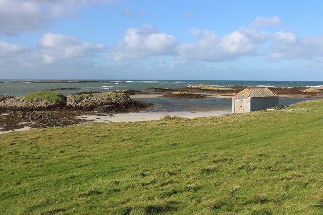
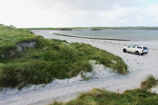
Làmh-sgeir Mhòr is a prominent coastal feature located in Argyllshire, Scotland. It is a headland or point that juts out into the Atlantic Ocean, offering stunning views of the surrounding landscape. With its rugged cliffs and rocky terrain, Làmh-sgeir Mhòr showcases the raw beauty of the Scottish coastline.

The headland is characterized by its unique geological formations, which have been shaped by centuries of erosion from the powerful waves crashing against the rocks. The exposed cliffs display layers of sedimentary rock, providing a glimpse into the region's geological history.

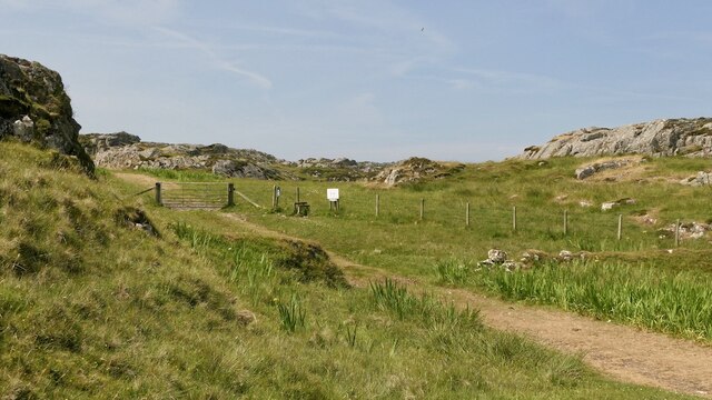
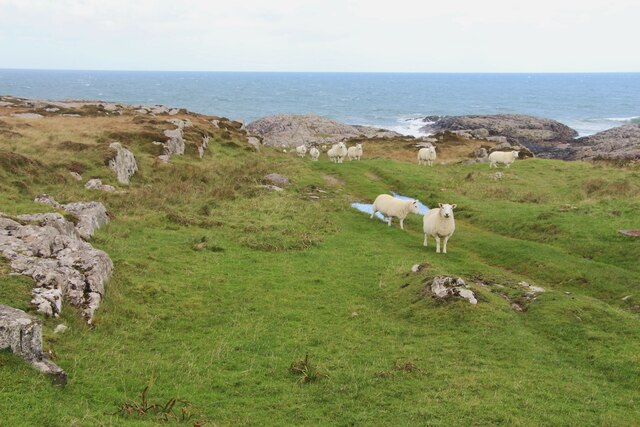
Làmh-sgeir Mhòr is also known for its diverse wildlife. The surrounding waters are home to a rich marine ecosystem, attracting various species of fish, seals, and seabirds. Birdwatchers can often spot species such as puffins, guillemots, and razorbills nesting on the cliffs. It is a popular spot for bird enthusiasts to observe these majestic creatures in their natural habitat.

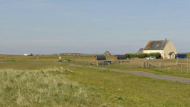
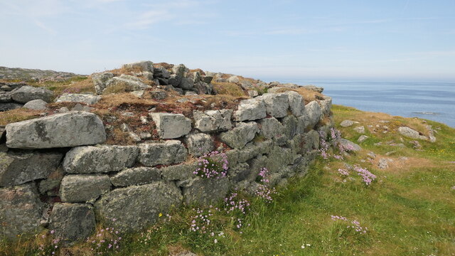
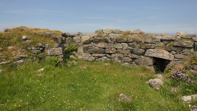
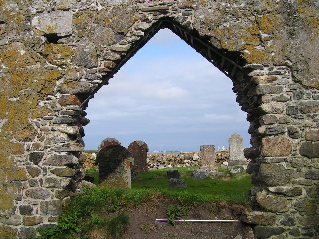
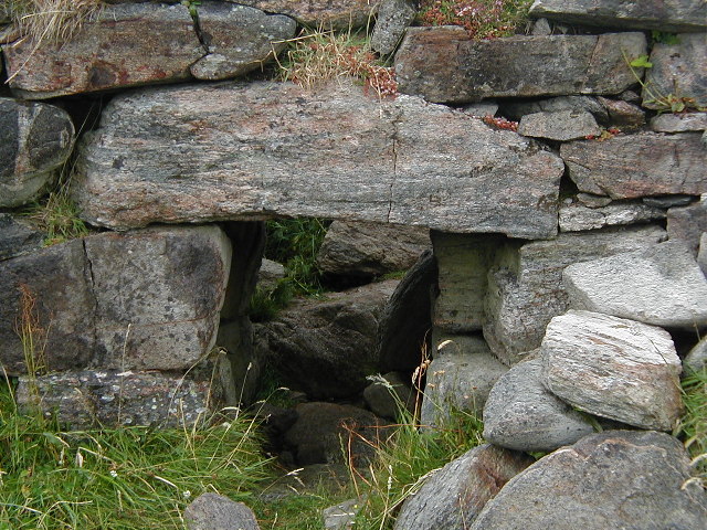
In addition to its natural beauty, Làmh-sgeir Mhòr holds historical significance. The headland is believed to have been inhabited by early settlers, with archaeological evidence suggesting human activity in the area dating back thousands of years. The site provides a glimpse into the ancient history of the region and its early inhabitants.

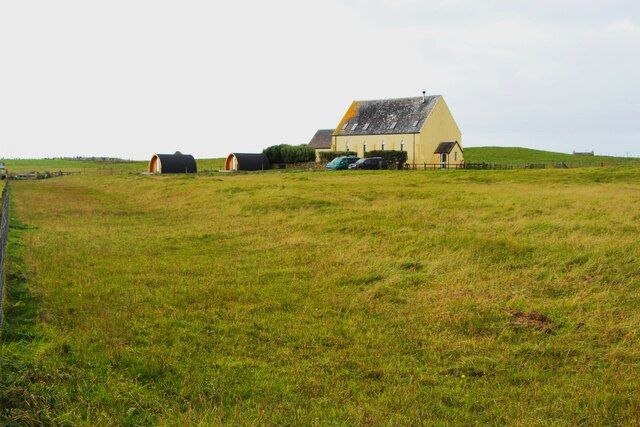
Overall, Làmh-sgeir Mhòr is a picturesque coastal feature that showcases the rugged beauty of Argyllshire's coastline. With its stunning cliffs, diverse wildlife, and rich history, it is a must-visit destination for nature lovers and those seeking a deeper connection with Scotland's natural and cultural heritage.

If you have any feedback on the listing, please let us know in the comments section below.

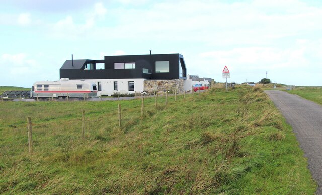
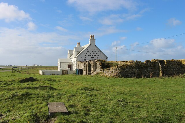
Làmh-sgeir Mhòr Images

Images are sourced within 2km of 56.541838/-6.80327 or Grid Reference NM0449. Thanks to Geograph Open Source API. All images are credited.

Houses, Gott Bay View from  Gott Bay, just above the mapped rocks.
Houses, Gott Bay
View from Gott Bay, just above the mapped rocks.
Kirkapol, Tiree
Kirkapol, Tiree
Track, Vaul
Track, Vaul
Track beneath Dùn Mòr A pleasant short walk to a fine broch.
Track beneath Dùn Mòr
A pleasant short walk to a fine broch.
Dùn Mòr A broch on the north coast of Tiree.
Dùn Mòr
A broch on the north coast of Tiree.
Dùn Mòr Surviving wall of a broch.  Dùn Mòr has been excavated in the recent past and very recognisable broch features can be seen.
Dùn Mòr
Surviving wall of a broch. Dùn Mòr has been excavated in the recent past and very recognisable broch features can be seen.
Dùn Mòr Very recognisable as a broch with some internal staircase surviving. The ruin is also covered in flowers.
Dùn Mòr
Very recognisable as a broch with some internal staircase surviving. The ruin is also covered in flowers.
A grassy track by An Cnap
A modern house at Vaul
Vaul Bay, Tiree
Vaul Bay, Tiree
Silversands, a 'white house' by Tràigh Mhòr The old 'black house' sits alongside.
Silversands, a 'white house' by Tràigh Mhòr
The old 'black house' sits alongside.
Store by the shore at Salum Bay
Salum Bay
Salum Bay
Colourful house, Kirkapol
Chapel ruins, Tiree Ruins of chapel, Kirkapol, Tiree
Chapel ruins, Tiree
Ruins of chapel, Kirkapol, Tiree
Broch, near Vaul, Tiree Entrance to the Broch, Dun Mor, near Vaul, Tiree
Broch, near Vaul, Tiree
Entrance to the Broch, Dun Mor, near Vaul, Tiree
Vaul Bay
Vaul Bay
Old Plough at Vaul Bay
Show me another place!

Làmh-sgeir Mhòr is located at Grid Ref: NM0449 (Lat: 56.541838, Lng: -6.80327)

Unitary Authority: Argyll and Bute

Police Authority: Argyll and West Dunbartonshire

What 3 Words

///reactions.grinning.backyards. Near Scarinish, Argyll & Bute

Related Wikis

Dun Mor Vaul

Dun Mor Vaul (or simply Dun Mor; Scottish Gaelic: Dùn Mòr) is an iron-age broch located on the north coast of the island of Tiree, in Scotland. ��2�...

Tiree

Tiree (; Scottish Gaelic: Tiriodh, pronounced [ˈtʲʰiɾʲəɣ]) is the most westerly island in the Inner Hebrides of Scotland. The low-lying island, southwest...

Scarinish

Scarinish (Scottish Gaelic: Sgairinis [ˈs̪kaɾʲɪnɪʃ]) is the main village on the island of Tiree, in the Inner Hebrides of Scotland. It is located on the...

Gunna, Scotland

Gunna (Gaelic: Gunnaigh) is an island in the Inner Hebrides of Scotland. == Geography and geology == Gunna lies between Coll and Tiree, closer to Coll...

Nearby Amenities

Located within 500m of 56.541838,-6.80327
Created By: dmgroom_coastlines
Source: PGS
Lat/Long: 56.5426/-6.81117
Created By: dmgroom_coastlines
Source: PGS
Lat/Long: 56.54311/-6.81092
Created By: dmgroom_coastlines
Source: PGS
Lat/Long: 56.54323/-6.81044
Created By: dmgroom_coastlines
Source: PGS
Lat/Long: 56.54347/-6.8095
Created By: dmgroom_coastlines
Source: PGS
Lat/Long: 56.54346/-6.80903
Created By: dmgroom_coastlines
Source: PGS
Lat/Long: 56.54344/-6.80764
Created By: dmgroom_coastlines
Source: PGS
Lat/Long: 56.54356/-6.80717
Created By: dmgroom_coastlines
Source: PGS
Lat/Long: 56.54305/-6.80743
Created By: dmgroom_coastlines
Source: PGS
Lat/Long: 56.54254/-6.80769
Created By: dmgroom_coastlines
Source: PGS
Lat/Long: 56.54265/-6.80722
Created By: dmgroom_coastlines
Source: PGS
Lat/Long: 56.54277/-6.80629
Created By: dmgroom_coastlines
Source: PGS
Lat/Long: 56.54226/-6.80609
Created By: dmgroom_coastlines
Source: PGS
Lat/Long: 56.54199/-6.80564
Created By: dmgroom_coastlines
Source: PGS
Lat/Long: 56.54148/-6.80521
Created By: dmgroom_coastlines
Source: PGS
Lat/Long: 56.54096/-6.805
Created By: dmgroom_coastlines
Source: PGS
Lat/Long: 56.54082/-6.80455
Source: PGS
Lat/Long: 56.5406887/-6.8044494
Source: PGS
Lat/Long: 56.5403799/-6.8040606
Source: PGS
Lat/Long: 56.5399675/-6.8035656
Source: PGS
Lat/Long: 56.5396959/-6.8030497
Source: PGS
Lat/Long: 56.5394111/-6.8026909
Created By: dmgroom_coastlines
Source: PGS
Lat/Long: 56.53912/-6.80233
Source: PGS
Lat/Long: 56.5388439/-6.8020041
Source: PGS
Lat/Long: 56.5387052/-6.8019825
Source: PGS
Lat/Long: 56.5383452/-6.8009982
Barrier: cattle_grid
Lat/Long: 56.5379228/-6.8055905
Barrier: cattle_grid
Lat/Long: 56.5393064/-6.8065074
Power: pole
Lat/Long: 56.5377141/-6.8038946
Power: pole
Lat/Long: 56.5384188/-6.8050256
Power: pole
Lat/Long: 56.5388381/-6.8056622
Power: pole
Lat/Long: 56.5392521/-6.8063166
Power: pole
Lat/Long: 56.5394769/-6.8067324
Power: pole
Lat/Long: 56.5396396/-6.8072527
Power: pole
Lat/Long: 56.5400465/-6.8100809
Power: pole
Lat/Long: 56.5400616/-6.8092573
Power: pole
Lat/Long: 56.5400768/-6.8083599
Power: pole
Lat/Long: 56.5399755/-6.8077855
Power: pole
Lat/Long: 56.5378658/-6.8063749
Power: pole
Lat/Long: 56.5381126/-6.8057668
The data included in this document is from www.openstreetmap.org. The data is made available under ODbL.

Have you been to Làmh-sgeir Mhòr?

Leave your review of Làmh-sgeir Mhòr below (or comments, questions and feedback).