Rubh' a' Gharbh-phuirt

Coastal Feature, Headland, Point in Argyllshire

Scotland

Rubh' a' Gharbh-phuirt

Tiree - Buchanan Monument This monument to Alexander Buchanan sits on a little mound at Cnoc Eibrig near the settlement of Baugh, west of Scarinish and is clearly visible from the B8065 which passes it.
For more information including the inscription, see <a href="https://www.geograph.org.uk/photo/6909988">NM0243 : Tiree - Buchanan Monument - Detail with inscription</a>
Tiree - Buchanan Monument Credit: Rob Farrow

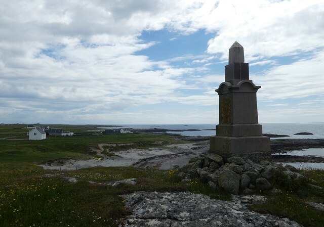
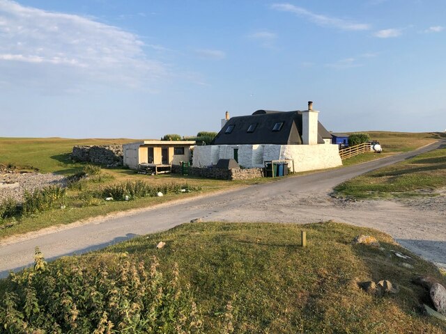
Rubh' a' Gharbh-phuirt is a headland located in Argyllshire, Scotland. Situated on the west coast of the country, this coastal feature is known for its stunning natural beauty and rugged charm. The name "Rubh' a' Gharbh-phuirt" translates to "Point of the Rough Port" in English.

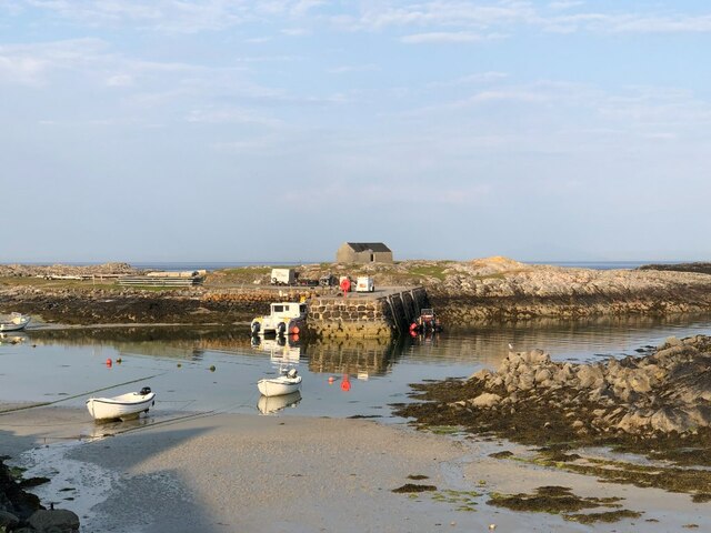
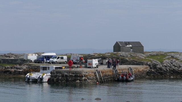
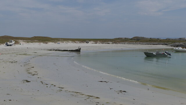
The headland juts out into the Atlantic Ocean, offering breathtaking panoramic views of the surrounding area. It is characterized by its rocky cliffs, which are sculpted by the constant battering of the waves and wind. The headland is also home to a diverse range of flora and fauna, making it a popular spot for nature enthusiasts and birdwatchers.

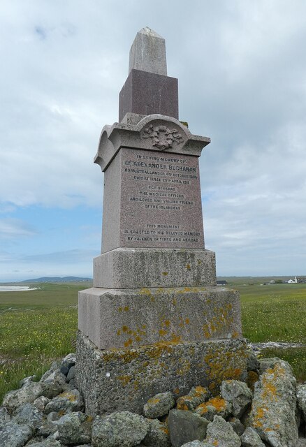
At the tip of Rubh' a' Gharbh-phuirt, there is a lighthouse that has been guiding ships safely along the coast since its construction in the 19th century. The lighthouse adds to the picturesque scenery and serves as a reminder of the area's maritime history.

Access to Rubh' a' Gharbh-phuirt is relatively easy, with a well-maintained path leading from a nearby parking area. Visitors can enjoy a leisurely stroll along the headland, taking in the breathtaking views and immersing themselves in the tranquil ambiance.

Overall, Rubh' a' Gharbh-phuirt is a captivating coastal feature that showcases the raw beauty of Scotland's west coast. Its rugged cliffs, diverse wildlife, and historic lighthouse make it a must-visit destination for nature lovers and those seeking a peaceful retreat.

If you have any feedback on the listing, please let us know in the comments section below.

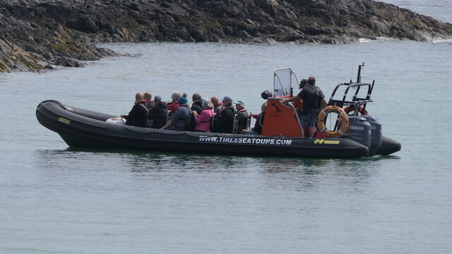
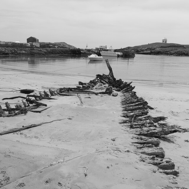
Rubh' a' Gharbh-phuirt Images

Images are sourced within 2km of 56.487814/-6.8188174 or Grid Reference NM0343. Thanks to Geograph Open Source API. All images are credited.

Tiree - Buchanan Monument This monument to Alexander Buchanan sits on a little mound at Cnoc Eibrig near the settlement of Baugh, west of Scarinish and is clearly visible from the B8065 which passes it.
For more information including the inscription, see <a href="https://www.geograph.org.uk/photo/6909988">NM0243 : Tiree - Buchanan Monument - Detail with inscription</a>
Tiree - Buchanan Monument
This monument to Alexander Buchanan sits on a little mound at Cnoc Eibrig near the settlement of Baugh, west of Scarinish and is clearly visible from the B8065 which passes it. For more information including the inscription, see NM0243 : Tiree - Buchanan Monument - Detail with inscription
Tiree - Buchanan Monument - Detail with inscription This monument, seen in context here <a href="https://www.geograph.org.uk/photo/6909971">NM0243 : Tiree - Buchanan Monument</a> has the following inscription (all in capitals).

In Loving Memory of
Dr Alexander Buchanan
Born at Callander 4th October 1835
Died at Tiree 29th April 1911
For 51 years
The Medical Officer
And loved and valued friend
of the Islanders
This Monument
is erected to his beloved memory
by friends in Tiree and abroad.
Tiree - Buchanan Monument - Detail with inscription
This monument, seen in context here NM0243 : Tiree - Buchanan Monument has the following inscription (all in capitals). In Loving Memory of Dr Alexander Buchanan Born at Callander 4th October 1835 Died at Tiree 29th April 1911 For 51 years The Medical Officer And loved and valued friend of the Islanders This Monument is erected to his beloved memory by friends in Tiree and abroad.
Tiree - Scarinish - Harbour A view out to sea across the little harbour at Scarinish (not to be confused with the more commercial jetty where the ferry docks).
The little white beacon seen on the right can be seen in detail here <a href="https://www.geograph.org.uk/photo/6915633">NM0444 : Tiree - Scarinish - Harbour beacon</a>
Tiree - Scarinish - Harbour
A view out to sea across the little harbour at Scarinish (not to be confused with the more commercial jetty where the ferry docks). The little white beacon seen on the right can be seen in detail here NM0444 : Tiree - Scarinish - Harbour beacon
Tiree - Scarinish - Stone and whitewash houses There are several houses in and around Scarinish that have this unusual and attractive appearance with widely spaced stones set into a white background.
Tiree - Scarinish - Stone and whitewash houses
There are several houses in and around Scarinish that have this unusual and attractive appearance with widely spaced stones set into a white background.
Tiree - Scarinish - Harbour beacon This beacon is situated on Rubh' an Fhaing on the western side of the entrance to Scarinish Harbour on Tiree. This image is viewed from seaward entering the harbour.
It can be seen from landward here <a href="https://www.geograph.org.uk/photo/6915238">NM0444 : Tiree - Scarinish - Harbour</a>
Tiree - Scarinish - Harbour beacon
This beacon is situated on Rubh' an Fhaing on the western side of the entrance to Scarinish Harbour on Tiree. This image is viewed from seaward entering the harbour. It can be seen from landward here NM0444 : Tiree - Scarinish - Harbour
Tiree - Scarinish - Houses on the Common In the centre of Scarinish there is a triangular green area grazed by sheep. Along the western side of this 'common' are a row of houses, two of which are seen here. The one nearest the camera is typical of the Tiree blackhouse with a black pitch roof. There are also thatched blackhouses on Tiree, but this tarred variety is far more common.
Note the thickness of the massive walls and the few apertures in the lower storey. (I believe originally that these dwellings would not have had rooms in the upper storey as this would have just been the roof.)
Tiree - Scarinish - Houses on the Common
In the centre of Scarinish there is a triangular green area grazed by sheep. Along the western side of this 'common' are a row of houses, two of which are seen here. The one nearest the camera is typical of the Tiree blackhouse with a black pitch roof. There are also thatched blackhouses on Tiree, but this tarred variety is far more common. Note the thickness of the massive walls and the few apertures in the lower storey. (I believe originally that these dwellings would not have had rooms in the upper storey as this would have just been the roof.)
Tiree - Scarinish - pitch-roofed blackhouse A different view of the house seen nearest the camera in <a href="https://www.geograph.org.uk/photo/6916250">NM0444 : Tiree - Scarinish - Houses on the Common</a> - see that image for more details.
Tiree - Scarinish - pitch-roofed blackhouse
A different view of the house seen nearest the camera in NM0444 : Tiree - Scarinish - Houses on the Common - see that image for more details.
Tiree - Scarinish - Houses on the B8065 through the village Looking across the sheep-grazed common in the centre of Scarinish at houses on the far side of the B8065 which weaves its way through the village, which is the principal settlement on the isle of Tiree.
Tiree - Scarinish - Houses on the B8065 through the village
Looking across the sheep-grazed common in the centre of Scarinish at houses on the far side of the B8065 which weaves its way through the village, which is the principal settlement on the isle of Tiree.
Tiree - Scarinish - Thatched blackhouse The majority of blackhouses on Tiree have roofs that are pitch-covered, but a few like this one have thatch instead (which elsewhere in the Hebrides is more common than pitch).
The one seen here is the penultimate house in a row that borders a triangular common in the middle of Scarinish.
Tiree - Scarinish - Thatched blackhouse
The majority of blackhouses on Tiree have roofs that are pitch-covered, but a few like this one have thatch instead (which elsewhere in the Hebrides is more common than pitch). The one seen here is the penultimate house in a row that borders a triangular common in the middle of Scarinish.
Tiree - Scarinish - Wreck of the Mary Stuart Just the bare bones of this old wooden boat project from the sands at the northern end of Scarinish Harbour. The 'Mary Stuart' was laid up at Scarinish Harbour c. 1938, and "allowed to go to pieces" (Canmore website: <span class="nowrap"><a title="https://canmore.org.uk/site/102548/mary-stuart-scarinish-harbour-tiree-passage-of-tiree" rel="nofollow ugc noopener" href="https://canmore.org.uk/site/102548/mary-stuart-scarinish-harbour-tiree-passage-of-tiree">Link</a><img style="margin-left:2px;" alt="External link" title="External link - shift click to open in new window" src="https://s1.geograph.org.uk/img/external.png" width="10" height="10"/></span> )
Note: Some references are to 'Stewart' rather than 'Stuart'.
Tiree - Scarinish - Wreck of the Mary Stuart
Just the bare bones of this old wooden boat project from the sands at the northern end of Scarinish Harbour. The 'Mary Stuart' was laid up at Scarinish Harbour c. 1938, and "allowed to go to pieces" (Canmore website: LinkExternal link ) Note: Some references are to 'Stewart' rather than 'Stuart'.
Coffee shop, Scarinish
Harbour, Scarinish Near low water (neap).
Harbour, Scarinish
Near low water (neap).
Cottage, Scarinish
Cottage, Scarinish
Scarinish harbour A tour group is about to depart for the Treshnish islands.
Scarinish harbour
A tour group is about to depart for the Treshnish islands.
Scarinish Hotel
Scarinish Hotel
Beach, Scarinish harbour
Boat tour departing from Scarinish About to head for Lunga.
Boat tour departing from Scarinish
About to head for Lunga.
Mary Stuart wreck, Scarinish A wreck in Scarinish harbour.
Mary Stuart wreck, Scarinish
A wreck in Scarinish harbour.
Show me another place!

Rubh' a' Gharbh-phuirt is located at Grid Ref: NM0343 (Lat: 56.487814, Lng: -6.8188174)

Unitary Authority: Argyll and Bute

Police Authority: Argyll and West Dunbartonshire

What 3 Words

///staples.indirect.hamsters. Near Scarinish, Argyll & Bute

Related Wikis

Scarinish

Scarinish (Scottish Gaelic: Sgairinis [ˈs̪kaɾʲɪnɪʃ]) is the main village on the island of Tiree, in the Inner Hebrides of Scotland. It is located on the...

Tiree

Tiree (; Scottish Gaelic: Tiriodh, pronounced [ˈtʲʰiɾʲəɣ]) is the most westerly island in the Inner Hebrides of Scotland. The low-lying island, southwest...

Tiree Airport

Tiree Airport (Scottish Gaelic: Port-adhair Thiriodh) (IATA: TRE, ICAO: EGPU) is located 2.5 nautical miles (4.6 km; 2.9 mi) north northeast of Balemartine...

Tiree Music Festival

Tiree Music Festival is a Scottish folk music festival held annually on the Island of Tiree in the Inner Hebrides. The festival was founded in 2010 by...

Mannal

Mannal is a coastal hamlet on the west side of Hynish Bay, on the island of Tiree, Scotland. The township of Mannal lies on the southwest corner of Tiree...

Dun Mor Vaul

Dun Mor Vaul (or simply Dun Mor; Scottish Gaelic: Dùn Mòr) is an iron-age broch located on the north coast of the island of Tiree, in Scotland. ��2�...

Nearby Amenities

Located within 500m of 56.487814,-6.8188174
Power: pole
Lat/Long: 56.4919234/-6.8173207
Power: pole
Lat/Long: 56.4919048/-6.8166555
Power: pole
Lat/Long: 56.491885/-6.8159967
Power: pole
Lat/Long: 56.4918616/-6.8153379
The data included in this document is from www.openstreetmap.org. The data is made available under ODbL.

Have you been to Rubh' a' Gharbh-phuirt?

Leave your review of Rubh' a' Gharbh-phuirt below (or comments, questions and feedback).