Cleit na Cloiche Bioraich

Coastal Feature, Headland, Point in Ross-shire

Scotland

Cleit na Cloiche Bioraich

Across Braigh Mor to Loch Reasort entrance guarded by Taran Mor Across Braigh Mor to Loch Reasort entrance guarded by Taran Mor
Across Braigh Mor to Loch Reasort entrance guarded by Taran Mor Credit: Simon Bonney

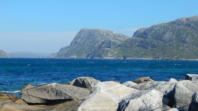
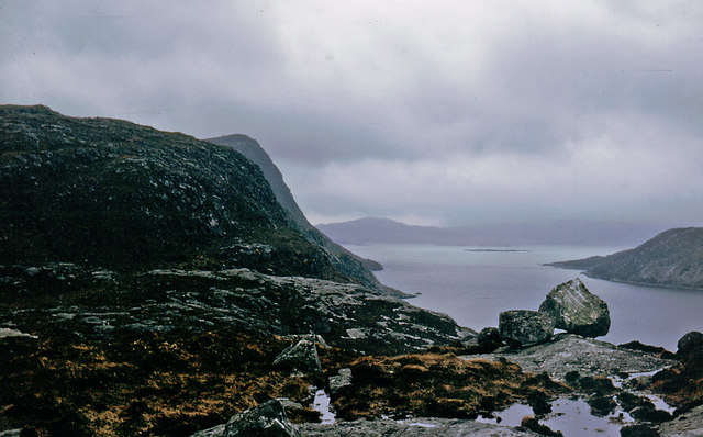
Cleit na Cloiche Bioraich is a prominent coastal feature located in Ross-shire, Scotland. It is a headland that stretches out into the North Sea, forming a distinct point that offers breathtaking views of the surrounding landscape.

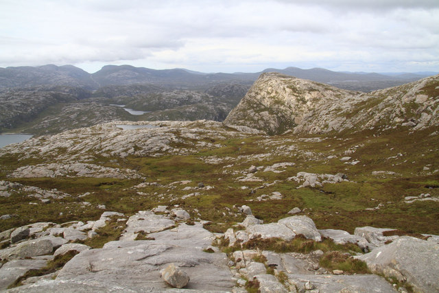
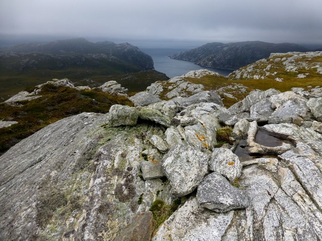
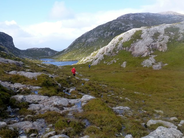
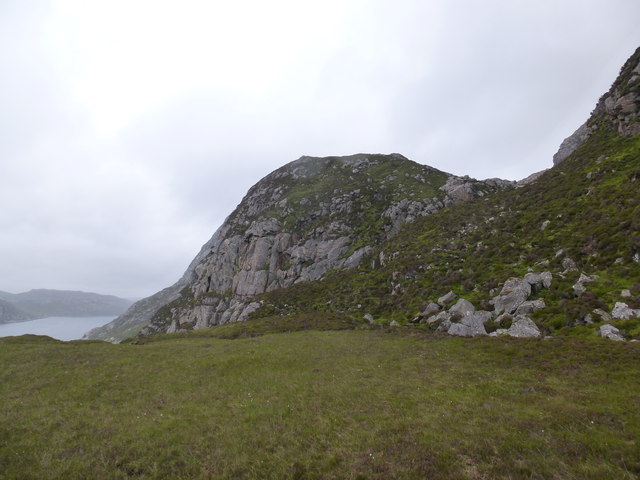
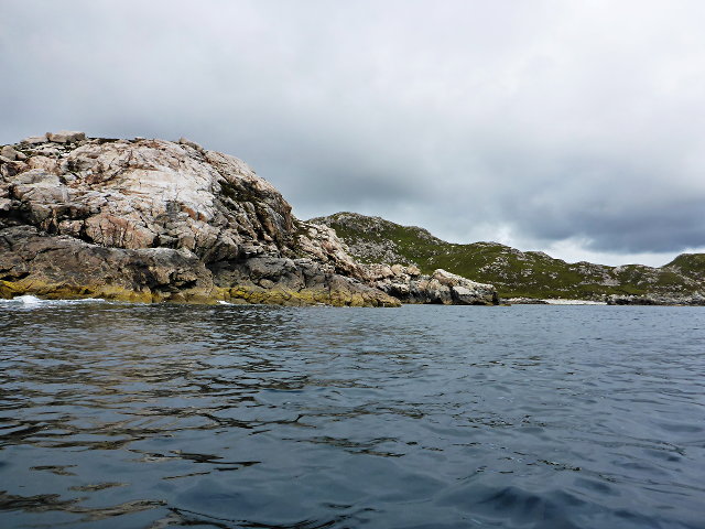
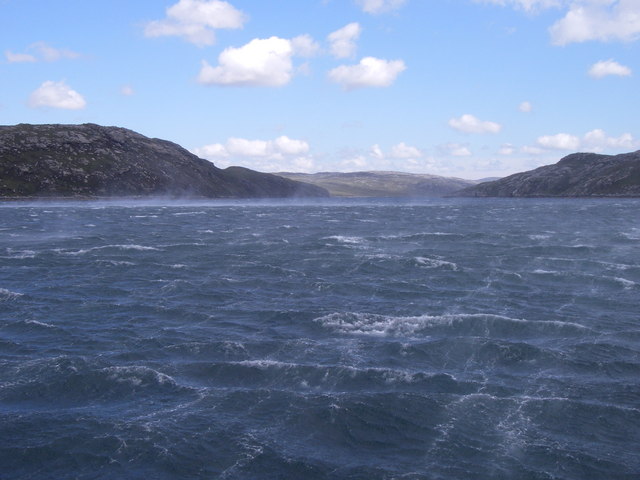
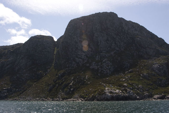
The headland is characterized by its rugged cliffs, which rise steeply from the sea, creating a dramatic and picturesque vista. These cliffs are composed of various rock formations, including sandstone and granite, which have been shaped by centuries of erosion caused by the relentless waves crashing against them.

Cleit na Cloiche Bioraich is a popular destination for nature enthusiasts and hikers due to its stunning natural beauty. Its elevated position provides a vantage point for spotting a diverse array of wildlife, including seabirds, such as gannets and puffins, that nest along the cliffs. The surrounding coastal waters are also home to seals and dolphins, occasionally spotted by lucky visitors.

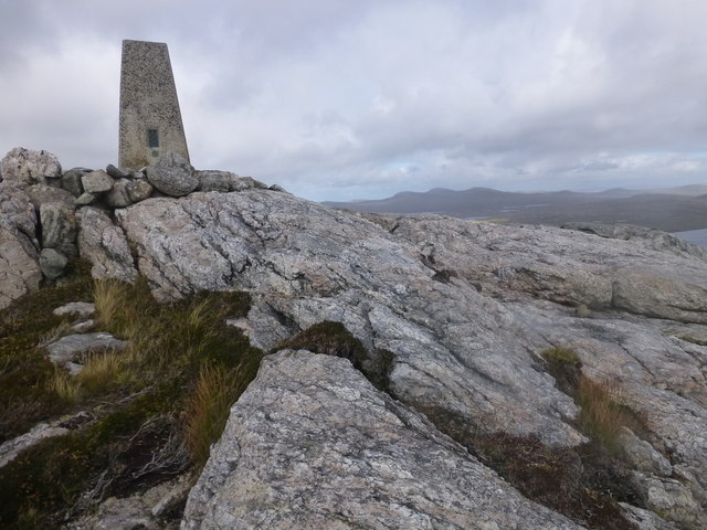
The headland is accessible via walking trails that wind through the rugged terrain, offering visitors an opportunity to explore its unique geology and immerse themselves in the untamed beauty of the Scottish coast. These trails are relatively challenging, requiring a moderate level of fitness and sturdy footwear.

In addition to its natural attractions, Cleit na Cloiche Bioraich holds historical significance. Ruins of ancient settlements and burial sites have been discovered in the vicinity, providing glimpses into the area's rich past.

Overall, Cleit na Cloiche Bioraich is a captivating coastal feature, offering a combination of breathtaking views, diverse wildlife, and a glimpse into Scotland's history.

If you have any feedback on the listing, please let us know in the comments section below.

Cleit na Cloiche Bioraich Images

Images are sourced within 2km of 58.036176/-7.0351742 or Grid Reference NB0216. Thanks to Geograph Open Source API. All images are credited.

Across Braigh Mor to Loch Reasort entrance guarded by Taran Mor Across Braigh Mor to Loch Reasort entrance guarded by Taran Mor
Across Braigh Mor to Loch Reasort entrance guarded by Taran Mor
Erratic Boulder above Loch nan Uidhean An erratic boulder between Loch nan Uidhean and Loch na Creage 
Lionta in the Aird Mhor.
Erratic Boulder above Loch nan Uidhean
An erratic boulder between Loch nan Uidhean and Loch na Creage Lionta in the Aird Mhor.
Across Gleann Dubh from An Sith On the LAMM 2018, descending to the coast through the gap on the horizon
Across Gleann Dubh from An Sith
On the LAMM 2018, descending to the coast through the gap on the horizon
Unnamed Lochan From Lag Mor The peak in the right middle distance is Tarran Mor, with Loch nan Uidheam immediately behind the subject.
Unnamed Lochan From Lag Mor
The peak in the right middle distance is Tarran Mor, with Loch nan Uidheam immediately behind the subject.
Taran Mòr Taran Mòr, 303 metres, with its rarely visited remote trig point.  This hill is a subMarilyn and HuMP with a prominence of 146 metres.
This was the chosen location for Martin Richardson's 2000th HuMP with Alan Holmes, George Morl, Iain Brown, Jim Bloomer, Michael Earnshaw and Douglas Law on a mixed weather day but what a wonderful summit to be on. A total HuMP count for the seven walkers was 14,145 HuMPs ie an average of over 2,000. Leosaval, Ceartaval, Sgianait and finally Taran Mòr, just under 22 KM and 1588 metres of ascent for 3 subMarilyns and a subHuMP
Taran Mòr
Taran Mòr, 303 metres, with its rarely visited remote trig point. This hill is a subMarilyn and HuMP with a prominence of 146 metres. This was the chosen location for Martin Richardson's 2000th HuMP with Alan Holmes, George Morl, Iain Brown, Jim Bloomer, Michael Earnshaw and Douglas Law on a mixed weather day but what a wonderful summit to be on. A total HuMP count for the seven walkers was 14,145 HuMPs ie an average of over 2,000. Leosaval, Ceartaval, Sgianait and finally Taran Mòr, just under 22 KM and 1588 metres of ascent for 3 subMarilyns and a subHuMP
Sneathabhal Mor Third HuMP around the north of Loch Resort via an Alan Holmes RIB trip. Just a brilliant trip.
Name: Sneathabhal Mor
Hill number: 4949
Height: 175m / 574ft
Area: 24A: Lewis and Nearby Islands
Class: Hu,1
Grid ref: NB043177 (est)
Drop: 114m
Col: 61m  NB054178
Sneathabhal Mor
Third HuMP around the north of Loch Resort via an Alan Holmes RIB trip. Just a brilliant trip. Name: Sneathabhal Mor Hill number: 4949 Height: 175m / 574ft Area: 24A: Lewis and Nearby Islands Class: Hu,1 Grid ref: NB043177 (est) Drop: 114m Col: 61m NB054178
Meall nan Sidhean [Meall nan Sithean] Last of four HuMPs around the north of Loch Resort on an Alan Holmes RIB trip. What a brilliant day. The summit is one of 3 tops in a line with the middle rocky top being lower than the tops on either side.
Name: Meall nan Sidhean [Meall nan Sithean]
Hill number: 4948
Height: 177m / 581ft
Area: 24A: Lewis and Nearby Islands
Class: Hu,1
Grid ref: NB024175 (est)
Drop: 122m
Col: 55m  NB039176
Meall nan Sidhean [Meall nan Sithean]
Last of four HuMPs around the north of Loch Resort on an Alan Holmes RIB trip. What a brilliant day. The summit is one of 3 tops in a line with the middle rocky top being lower than the tops on either side. Name: Meall nan Sidhean [Meall nan Sithean] Hill number: 4948 Height: 177m / 581ft Area: 24A: Lewis and Nearby Islands Class: Hu,1 Grid ref: NB024175 (est) Drop: 122m Col: 55m NB039176
View Across To Coirnis View across to Coirnis, 77 metres and a P30 hill. This is close to the spot that the RIB tender boat collected us after climbing Meall nan Sidhean.
View Across To Coirnis
View across to Coirnis, 77 metres and a P30 hill. This is close to the spot that the RIB tender boat collected us after climbing Meall nan Sidhean.
Heading For Taran Mòr Heading For Taran Mòr with a view towards Lochan na Sgàil.
Heading For Taran Mòr
Heading For Taran Mòr with a view towards Lochan na Sgàil.
South coast of Loch Reasort from Grobadh na h-Uinneag Looking east along south side of Loch Reasort. Sheep/deer track leads up around the south of the buttress in centre of photo to upper stretch of Allt na Sgail burn.
South coast of Loch Reasort from Grobadh na h-Uinneag
Looking east along south side of Loch Reasort. Sheep/deer track leads up around the south of the buttress in centre of photo to upper stretch of Allt na Sgail burn.
Loch Reasort from north shore Looking down Loch Reasort from the north shore after a 13 mile cycle/walk from Uig
Loch Reasort from north shore
Looking down Loch Reasort from the north shore after a 13 mile cycle/walk from Uig
Boulder on North Shore of Loch Reasort Reached this point after a 13 mile cycle/walk from Uig. While sitting here the bay was circled by a golden eagle.
Boulder on North Shore of Loch Reasort
Reached this point after a 13 mile cycle/walk from Uig. While sitting here the bay was circled by a golden eagle.
A deep cleft
A deep cleft
Rubha Càrnach
Rubha Càrnach
Entering Loch Reasort into the teeth of a Gale. Mouth of Loch Reasort, view Eastwards.
Entering Loch Reasort into the teeth of a Gale.
Mouth of Loch Reasort, view Eastwards.
South side of Loch Resort Very rough terrain.  We had hoped to walk to Taran Mor, the symmetrical hill in the distance, but gave up at Taran Beag.  We had started from Kinlochresort.
South side of Loch Resort
Very rough terrain. We had hoped to walk to Taran Mor, the symmetrical hill in the distance, but gave up at Taran Beag. We had started from Kinlochresort.
Mol Tealasbhaigh Even in this remote inlet on the Atlantic Western Seaboard of Harris there is much evidence of plastic litter
Mol Tealasbhaigh
Even in this remote inlet on the Atlantic Western Seaboard of Harris there is much evidence of plastic litter
Taran Mòr Taken from a boat at the mouth of Loch Reasort, this rock overlooks the natural harbour. To the left a thin green vertical line can be seen where a small stream trickles off the island into the sea.
Taran Mòr
Taken from a boat at the mouth of Loch Reasort, this rock overlooks the natural harbour. To the left a thin green vertical line can be seen where a small stream trickles off the island into the sea.
Show me another place!

Cleit na Cloiche Bioraich is located at Grid Ref: NB0216 (Lat: 58.036176, Lng: -7.0351742)

Unitary Authority: Na h-Eileanan an Iar

Police Authority: Highlands and Islands

What 3 Words

///flattered.lakes.dignity. Near Tarbert, Na h-Eileanan Siar

Related Wikis

Scarp, Scotland

Scarp (Scottish Gaelic: An Sgarp) is an uninhabited island in the Outer Hebrides of Scotland, west of Hushinish on Harris. Once inhabited, the island was...

Tiorga Mor

Tiorga Mor (679 m) is a mountain in Harris, in the Outer Hebrides of Scotland. The most westerly peak of the high mountains of Harris, it is a very rugged...

Hushinish

Huisinish or Hushinish (Scottish Gaelic Hùisinis) is a remote place on the west coast of Harris in the Outer Hebrides of Scotland. It lies at the end of...

Uladail

Uladail is a location near Amhuinnsuidhe, on Harris in the Outer Hebrides, Scotland. Sron Ulladail is a sheer cliff which at 370 metres (1,210 ft) is one...

Chliostair Hydro-Electric Scheme

Chliostair Hydro-Electric Scheme is a small scheme promoted by the North of Scotland Hydro-Electric Board on Harris, Outer Hebrides. It consists of a single...

Eilean Mhealasta

Eilean Mhealasta (Mealista Island) is an uninhabited island off the west coast of Lewis in the Outer Hebrides of Scotland. It takes its name from Mealista...

Amhuinnsuidhe

Amhuinnsuidhe (Scottish Gaelic: Abhainn Suidhe) is a settlement on Harris, in the Outer Hebrides, Scotland. The settlement is also within the parish of...

Oireabhal

Oireabhal (662 m) is a mountain in Harris, in the Outer Hebrides of Scotland. The peak is the highest point on a complex ridge that runs from north to...

Nearby Amenities

Located within 500m of 58.036176,-7.0351742
Created By: dmgroom_coastlines
Lat/Long: 58.0358/-7.03276
Tob a` Ghearraidh
Natural: bay
Lat/Long: 58.0359453/-7.0435894
The data included in this document is from www.openstreetmap.org. The data is made available under ODbL.

Have you been to Cleit na Cloiche Bioraich?

Leave your review of Cleit na Cloiche Bioraich below (or comments, questions and feedback).