Rubha nan Iasgairean

Coastal Feature, Headland, Point in Argyllshire

Scotland

Rubha nan Iasgairean

Tiree - Scarinish - Stone and whitewash houses There are several houses in and around Scarinish that have this unusual and attractive appearance with widely spaced stones set into a white background.
Tiree - Scarinish - Stone and whitewash houses Credit: Rob Farrow

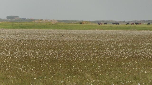
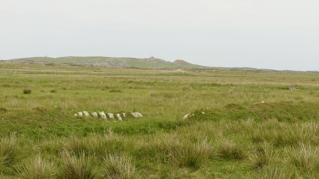
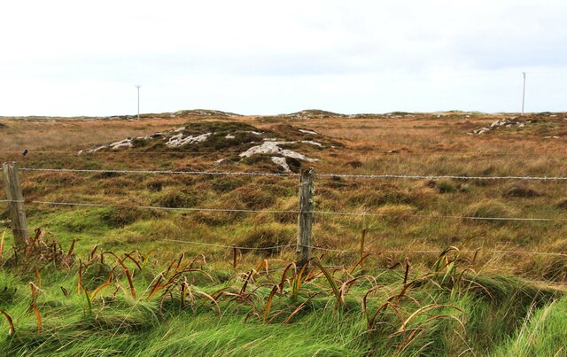
Rubha nan Iasgairean, located in Argyllshire, Scotland, is a prominent coastal feature that boasts a picturesque headland jutting out into the Atlantic Ocean. With its Gaelic name translating to "Point of the Fishermen," it is a place of great natural beauty and historical significance.

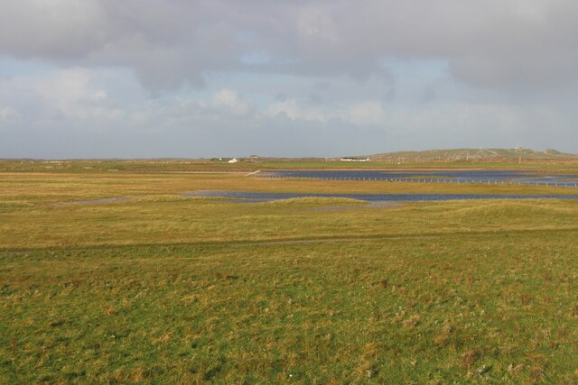
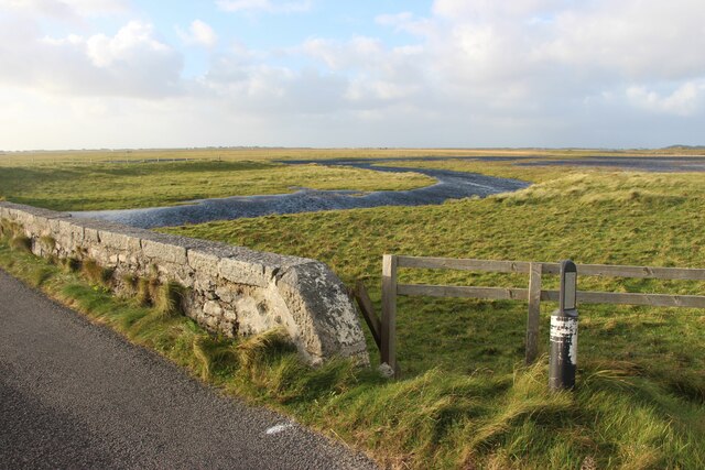
The headland of Rubha nan Iasgairean offers stunning panoramic views of the surrounding landscape. With its rugged cliffs and rocky terrain, it provides a dramatic backdrop against the crashing waves of the ocean. The headland is also home to a diverse range of flora and fauna, making it a popular spot for nature enthusiasts and birdwatchers.

Historically, Rubha nan Iasgairean has been a place of significance for local communities. It served as a vital fishing location for generations, with its name reflecting its importance to the local fishing industry. The headland has also witnessed various cultural and historical events, contributing to its rich heritage.

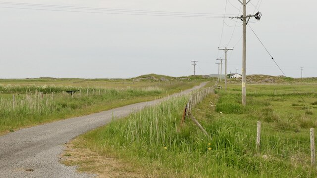
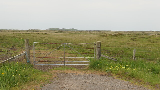
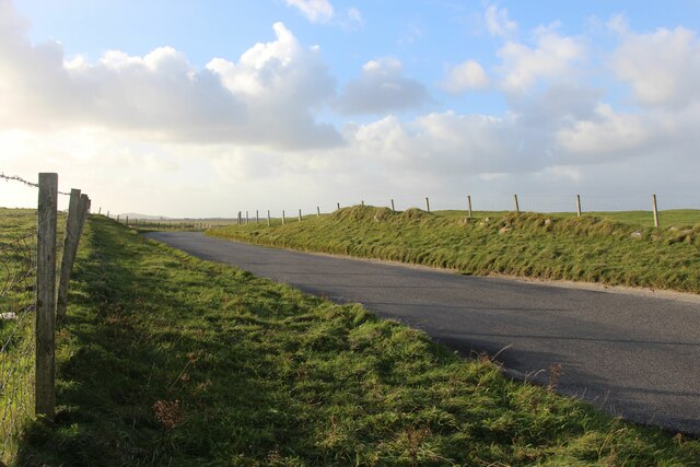
Access to Rubha nan Iasgairean is relatively easy, as it is well connected by roads and walking trails. Visitors can explore the headland by following the coastal path that offers breathtaking views of the surrounding area. Additionally, there are designated picnic areas and benches where visitors can relax and soak in the tranquil atmosphere.

Overall, Rubha nan Iasgairean is a captivating coastal feature in Argyllshire, offering both natural beauty and historical significance. Whether it is for its scenic vistas, diverse wildlife, or its cultural heritage, this headland is a must-visit destination for anyone exploring the stunning coastline of Scotland.

If you have any feedback on the listing, please let us know in the comments section below.

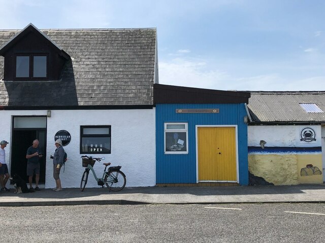
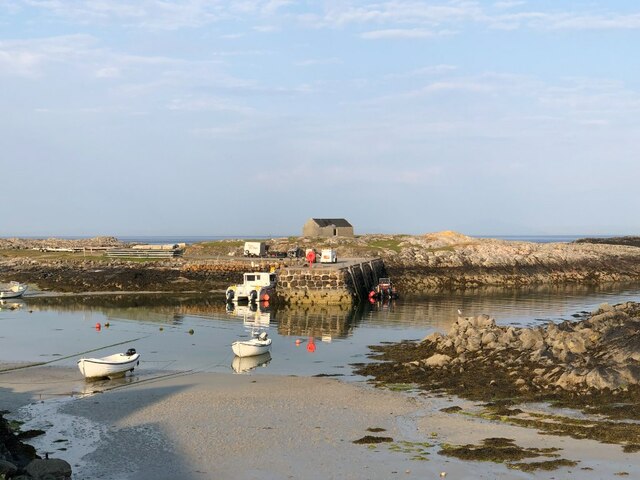
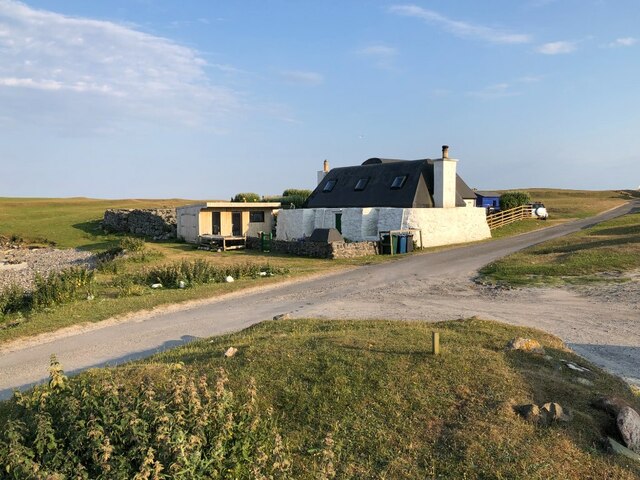
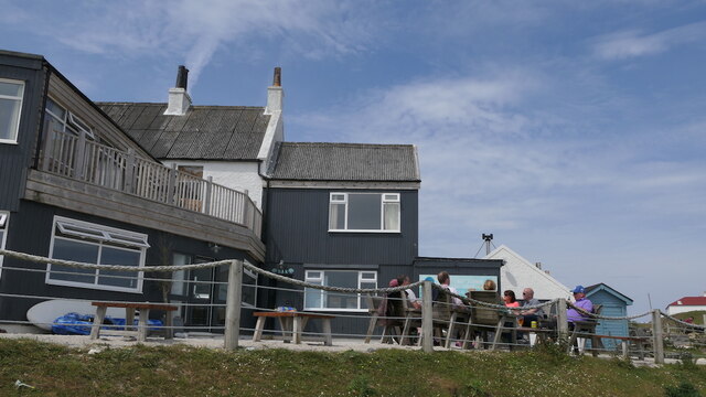
Rubha nan Iasgairean Images

Images are sourced within 2km of 56.490589/-6.8311879 or Grid Reference NM0243. Thanks to Geograph Open Source API. All images are credited.

Tiree - Scarinish - Stone and whitewash houses There are several houses in and around Scarinish that have this unusual and attractive appearance with widely spaced stones set into a white background.
Tiree - Scarinish - Stone and whitewash houses
There are several houses in and around Scarinish that have this unusual and attractive appearance with widely spaced stones set into a white background.
Tiree - Scarinish - Harbour beacon This beacon is situated on Rubh' an Fhaing on the western side of the entrance to Scarinish Harbour on Tiree. This image is viewed from seaward entering the harbour.
It can be seen from landward here <a href="https://www.geograph.org.uk/photo/6915238">NM0444 : Tiree - Scarinish - Harbour</a>
Tiree - Scarinish - Harbour beacon
This beacon is situated on Rubh' an Fhaing on the western side of the entrance to Scarinish Harbour on Tiree. This image is viewed from seaward entering the harbour. It can be seen from landward here NM0444 : Tiree - Scarinish - Harbour
Tiree - Scarinish - Houses on the Common In the centre of Scarinish there is a triangular green area grazed by sheep. Along the western side of this 'common' are a row of houses, two of which are seen here. The one nearest the camera is typical of the Tiree blackhouse with a black pitch roof. There are also thatched blackhouses on Tiree, but this tarred variety is far more common.
Note the thickness of the massive walls and the few apertures in the lower storey. (I believe originally that these dwellings would not have had rooms in the upper storey as this would have just been the roof.)
Tiree - Scarinish - Houses on the Common
In the centre of Scarinish there is a triangular green area grazed by sheep. Along the western side of this 'common' are a row of houses, two of which are seen here. The one nearest the camera is typical of the Tiree blackhouse with a black pitch roof. There are also thatched blackhouses on Tiree, but this tarred variety is far more common. Note the thickness of the massive walls and the few apertures in the lower storey. (I believe originally that these dwellings would not have had rooms in the upper storey as this would have just been the roof.)
Tiree - Scarinish - pitch-roofed blackhouse A different view of the house seen nearest the camera in <a href="https://www.geograph.org.uk/photo/6916250">NM0444 : Tiree - Scarinish - Houses on the Common</a> - see that image for more details.
Tiree - Scarinish - pitch-roofed blackhouse
A different view of the house seen nearest the camera in NM0444 : Tiree - Scarinish - Houses on the Common - see that image for more details.
Tiree - Scarinish - Houses on the B8065 through the village Looking across the sheep-grazed common in the centre of Scarinish at houses on the far side of the B8065 which weaves its way through the village, which is the principal settlement on the isle of Tiree.
Tiree - Scarinish - Houses on the B8065 through the village
Looking across the sheep-grazed common in the centre of Scarinish at houses on the far side of the B8065 which weaves its way through the village, which is the principal settlement on the isle of Tiree.
Tiree - Scarinish - Thatched blackhouse The majority of blackhouses on Tiree have roofs that are pitch-covered, but a few like this one have thatch instead (which elsewhere in the Hebrides is more common than pitch).
The one seen here is the penultimate house in a row that borders a triangular common in the middle of Scarinish.
Tiree - Scarinish - Thatched blackhouse
The majority of blackhouses on Tiree have roofs that are pitch-covered, but a few like this one have thatch instead (which elsewhere in the Hebrides is more common than pitch). The one seen here is the penultimate house in a row that borders a triangular common in the middle of Scarinish.
Coffee shop, Scarinish
Harbour, Scarinish Near low water (neap).
Harbour, Scarinish
Near low water (neap).
Cottage, Scarinish
Cottage, Scarinish
Scarinish Hotel
Scarinish Hotel
Machair, Tiree Full of waders and their chicks.  A vast flat area behind Tràigh Bhàgh.
Machair, Tiree
Full of waders and their chicks. A vast flat area behind Tràigh Bhàgh.
Rough grazing, Tiree
Road to Ardachaidh A dead end road into the interior of Tiree.
Road to Ardachaidh
A dead end road into the interior of Tiree.
Road end Beyond, rough grazing and cattle.
Road end
Beyond, rough grazing and cattle.
Rock outcrops on moor behind Scarinish
An Fhaodhail, a tidal inlet
B8065 road at Baugh
B8065 road at Baugh
Show me another place!

Rubha nan Iasgairean is located at Grid Ref: NM0243 (Lat: 56.490589, Lng: -6.8311879)

Unitary Authority: Argyll and Bute

Police Authority: Argyll and West Dunbartonshire

What 3 Words

///scoop.changing.relax. Near Scarinish, Argyll & Bute

Related Wikis

Scarinish

Scarinish (Scottish Gaelic: Sgairinis [ˈs̪kaɾʲɪnɪʃ]) is the main village on the island of Tiree, in the Inner Hebrides of Scotland. It is located on the...

Tiree Airport

Tiree Airport (Scottish Gaelic: Port-adhair Thiriodh) (IATA: TRE, ICAO: EGPU) is located 2.5 nautical miles (4.6 km; 2.9 mi) north northeast of Balemartine...

Tiree

Tiree (; Scottish Gaelic: Tiriodh, pronounced [ˈtʲʰiɾʲəɣ]) is the most westerly island in the Inner Hebrides of Scotland. The low-lying island, southwest...

Tiree Music Festival

Tiree Music Festival is a Scottish folk music festival held annually on the Island of Tiree in the Inner Hebrides. The festival was founded in 2010 by...

Mannal

Mannal is a coastal hamlet on the west side of Hynish Bay, on the island of Tiree, Scotland. The township of Mannal lies on the southwest corner of Tiree...

Dun Mor Vaul

Dun Mor Vaul (or simply Dun Mor; Scottish Gaelic: Dùn Mòr) is an iron-age broch located on the north coast of the island of Tiree, in Scotland. ��2�...

Nearby Amenities

Located within 500m of 56.490589,-6.8311879
Telephone
Booth: K6
Covered: booth
Phone: +44 1879 220333
Lat/Long: 56.4916948/-6.8348241
Post Box
Collection Times: Mo-Sa 08:45
Operator: Royal Mail
Post Box Type: lamp
Ref: PA77 103
Royal Cypher: scottish_crown
Lat/Long: 56.491721/-6.834919
Passing Place
Lat/Long: 56.4917482/-6.8313426
Power: pole
Lat/Long: 56.492952/-6.8311056
Power: pole
Lat/Long: 56.4936266/-6.8261601
Baugh
Name Gd: Am Bàgh
Place: hamlet
Lat/Long: 56.4918987/-6.8345284
Power: pole
Lat/Long: 56.4916238/-6.8359941
Power: pole
Lat/Long: 56.491414/-6.8352402
Power: pole
Transformer: distribution
Lat/Long: 56.4914898/-6.8345518
Power: pole
Lat/Long: 56.4918955/-6.8345962
Power: pole
Lat/Long: 56.4926578/-6.8346659
Power: pole
Lat/Long: 56.4933911/-6.8346595
Power: pole
Lat/Long: 56.493548/-6.8346417
Power: pole
Lat/Long: 56.4933633/-6.8335461
Power: pole
Lat/Long: 56.4937385/-6.8356735
Power: pole
Lat/Long: 56.4931621/-6.832352
Power: pole
Lat/Long: 56.4931428/-6.8298428
Power: pole
Lat/Long: 56.4934689/-6.82736
Power: pole
Lat/Long: 56.4933229/-6.828472
Power: pole
Lat/Long: 56.492694/-6.8298069
Power: pole
Lat/Long: 56.4922533/-6.8297668
Power: pole
Lat/Long: 56.4917276/-6.8295366
Power: pole
Lat/Long: 56.4917124/-6.8289496
Port a' Mhuilinn
Natural: bay
Lat/Long: 56.4910967/-6.8323432
Passing Place
Lat/Long: 56.4917844/-6.8329497
Passing Place
Lat/Long: 56.4919614/-6.8289872
The data included in this document is from www.openstreetmap.org. The data is made available under ODbL.

Have you been to Rubha nan Iasgairean?

Leave your review of Rubha nan Iasgairean below (or comments, questions and feedback).