Lurg an Tamna

Coastal Feature, Headland, Point in Ross-shire

Scotland

Lurg an Tamna

Wild camp at the head of Tamana Siar
Wild camp at the head of Tamana Siar Credit: Peter Edwards

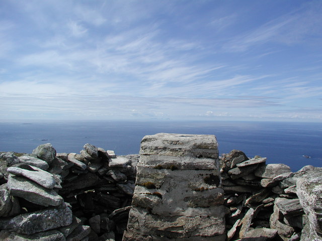
Lurg an Tamna is a prominent coastal feature located in Ross-shire, Scotland. It is a headland or point that juts out into the North Sea, offering stunning views of the surrounding landscape. The name Lurg an Tamna is derived from the Gaelic language, where "Lurg" means a ridge or hill, and "Tamna" refers to a hillock or small hill.

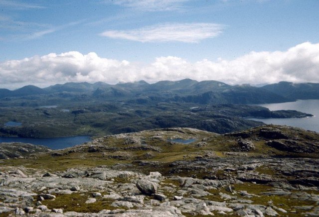
This headland is known for its rugged and rocky terrain, with cliffs that rise steeply from the sea below. The geology of Lurg an Tamna is predominantly composed of sandstone, which has been shaped over centuries by the erosive forces of wind and waves. The result is a distinctive landscape characterized by dramatic cliffs and rocky outcrops.

Lurg an Tamna is also home to a diverse range of wildlife, both on land and in the surrounding waters. Seabirds such as gulls, kittiwakes, and puffins can often be seen nesting on the cliffs, while seals and dolphins can be spotted swimming in the nearby waters. The headland and its surrounding area also provide habitat for various plant species, including heather, gorse, and grasses.

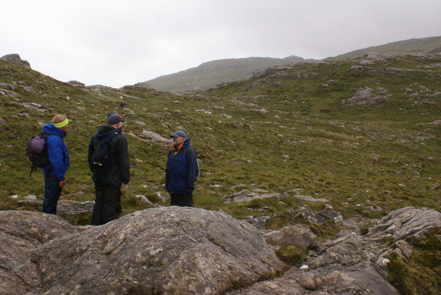
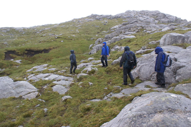
The location of Lurg an Tamna makes it a popular destination for outdoor enthusiasts and nature lovers. Visitors can enjoy coastal walks along the headland, taking in the breathtaking views of the North Sea and the surrounding coastline. The area is also ideal for birdwatching, photography, and exploring the diverse flora and fauna that can be found in this unique coastal environment.

Overall, Lurg an Tamna is a remarkable coastal feature in Ross-shire, offering a combination of stunning natural beauty and rich biodiversity.

If you have any feedback on the listing, please let us know in the comments section below.

Lurg an Tamna Images

Images are sourced within 2km of 58.070012/-7.062854 or Grid Reference NB0120. Thanks to Geograph Open Source API. All images are credited.

Wild camp at the head of Tamana Siar
Moorland opposite Eilean Mhealasta
Mullach na h-Airde Bige Second HuMP around the northern edge of Loch Resort on an Alan Holmes RIB trip. What a brilliant day.
Name: Mullach na h-Airde Bige
Hill number: 4947
Height: 182m / 597ft
Area: 24A: Lewis and Nearby Islands
Class: Hu,1
Grid ref: NB026188 (est)
Drop: 128m
Col: 54m  NB044194
Mullach na h-Airde Bige
Second HuMP around the northern edge of Loch Resort on an Alan Holmes RIB trip. What a brilliant day. Name: Mullach na h-Airde Bige Hill number: 4947 Height: 182m / 597ft Area: 24A: Lewis and Nearby Islands Class: Hu,1 Grid ref: NB026188 (est) Drop: 128m Col: 54m NB044194
Rubha Loisgte An abruptly truncated spur of rock meets the sea.
Rubha Loisgte
An abruptly truncated spur of rock meets the sea.
Rubha Geodha nan Sgarbh The entrance to Loch Tealasvay is well concealed close to the right of the picture.
Rubha Geodha nan Sgarbh
The entrance to Loch Tealasvay is well concealed close to the right of the picture.
Summit of Gromabhal On horizon 92km away is St Kilda
Summit of Gromabhal
On horizon 92km away is St Kilda
View over the summit plateau of Griomabhal From the worn-down gneiss platform of Griomaval (which was how it was spelt on the OS map when we climbed it in 1974), the hills of South Harris are laid out in all their splendour (when you can see them).
View over the summit plateau of Griomabhal
From the worn-down gneiss platform of Griomaval (which was how it was spelt on the OS map when we climbed it in 1974), the hills of South Harris are laid out in all their splendour (when you can see them).
View to Scarp from the Island of Liongam
View of the Lewis mainland to Mealasta Island from the Island of Liongam
View from the Island of Liongam to the North Harris Hills
Looking South over the lochan to Scarp and beyond from the Island of Liongam
Looking East to the Lewis mainland from the Island of Liongam
The Rocky South East Shore of the Island of Liongam with a view of the North Harris Hills
A Craggy Cove on the East Coast of the Island of Liongam
A View looking South over the Island of Liongam to Scarp, the North Harris Hills and Taransay beyond
Loch Tamnabhaigh Aird Bheag to left of image and Tamana Sear to right
Loch Tamnabhaigh
Aird Bheag to left of image and Tamana Sear to right
Sgaladal on the east ridge of Griomabhal
Sgaladal
on the east ridge of Griomabhal
Griomabhal East Ridge Summit on the skyline
Griomabhal East Ridge
Summit on the skyline
Show me another place!

Lurg an Tamna is located at Grid Ref: NB0120 (Lat: 58.070012, Lng: -7.062854)

Unitary Authority: Na h-Eileanan an Iar

Police Authority: Highlands and Islands

What 3 Words

///suspended.swift.universes. Near Tarbert, Na h-Eileanan Siar

Related Wikis

Eilean Mhealasta

Eilean Mhealasta (Mealista Island) is an uninhabited island off the west coast of Lewis in the Outer Hebrides of Scotland. It takes its name from Mealista...

Mealista

Mealista (Scottish Gaelic: Mealasta) was a township in the west of the Isle of Lewis. It is currently largely uninhabited due to the Highland Clearances...

Game pieces of the Lewis chessmen hoard

Game pieces of the Lewis chessmen hoard include the ninety-three game pieces of the Lewis chessmen hoard found on the Isle of Lewis in the Outer Hebrides...

Scarp, Scotland

Scarp (Scottish Gaelic: An Sgarp) is an uninhabited island in the Outer Hebrides of Scotland, west of Hushinish on Harris. Once inhabited, the island was...

Nearby Amenities

Located within 500m of 58.070012,-7.062854
Created By: dmgroom_coastlines
Lat/Long: 58.06968/-7.05458
Created By: dmgroom_coastlines
Lat/Long: 58.06956/-7.05483
Created By: dmgroom_coastlines
Lat/Long: 58.06943/-7.05507
Mol Arsbaig
Natural: bay
Lat/Long: 58.067986/-7.0604908
The data included in this document is from www.openstreetmap.org. The data is made available under ODbL.

Have you been to Lurg an Tamna?

Leave your review of Lurg an Tamna below (or comments, questions and feedback).