Big Jolly Rock
Coastal Feature, Headland, Point in Cornwall
England
Big Jolly Rock

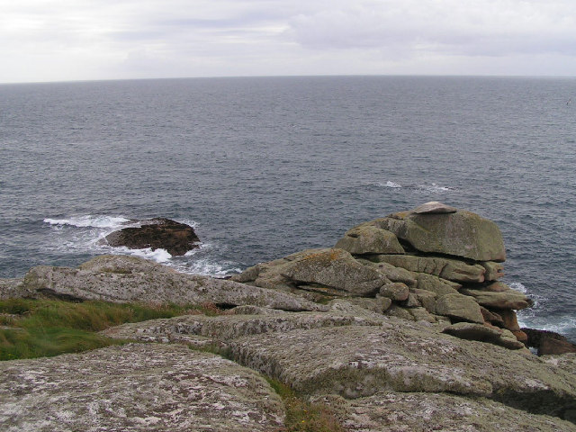
Big Jolly Rock is a prominent coastal feature located in Cornwall, England. Situated on the southwestern tip of the county, it is a well-known headland that juts out into the Atlantic Ocean. The rock formation is characterized by its imposing size, rugged appearance, and distinctive shape, resembling a large, jagged tooth rising from the sea.
Standing at an impressive height of 50 meters, Big Jolly Rock offers breathtaking panoramic views of the surrounding coastline, making it a popular destination for tourists and nature enthusiasts. The headland provides an ideal vantage point to witness the powerful crashing waves and dramatic cliffs that characterize the Cornish coastline.
With its strategic location, Big Jolly Rock has served as a navigational landmark for centuries, guiding ships and sailors along the treacherous coast. Its presence has also earned it a place in local folklore and legends, adding to its mystique and allure.
The area surrounding Big Jolly Rock is home to a diverse range of marine wildlife, making it a haven for birdwatchers and nature photographers. Seals, seabirds, and even the occasional dolphin can be spotted in the waters surrounding the headland.
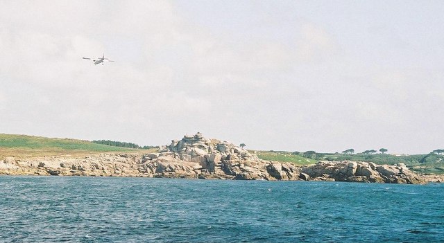
Access to Big Jolly Rock is relatively easy, with a well-maintained coastal path leading visitors to the site. However, caution is advised due to the steep and uneven terrain. The headland is also equipped with safety measures, including railings and warning signs, to ensure the well-being of visitors.
In summary, Big Jolly Rock is a captivating coastal feature in Cornwall, offering stunning views, rich biodiversity, and a touch of mythical charm to those fortunate enough to visit.
If you have any feedback on the listing, please let us know in the comments section below.
Big Jolly Rock Images
Images are sourced within 2km of 49.903629/-6.302345 or Grid Reference SV9109. Thanks to Geograph Open Source API. All images are credited.


Big Jolly Rock is located at Grid Ref: SV9109 (Lat: 49.903629, Lng: -6.302345)
Division: Isles of Scilly
Unitary Authority: Isles of Scilly
Police Authority: Devon and Cornwall
What 3 Words
///entrust.riverside.snoozing. Near St Mary's, Isles of Scilly
Nearby Locations
Related Wikis

Peninnis Lighthouse
Peninnis Lighthouse is situated on Peninnis Head, St Mary's, Isles of Scilly. == History == The light was built to replace the lighthouse in the centre...

Minnehaha (cargo ship)
The Minnehaha was a barque built in 1857 and wrecked on 18 January 1874 in the Isles of Scilly. == Wreck == On 18 January 1874, while travelling from...
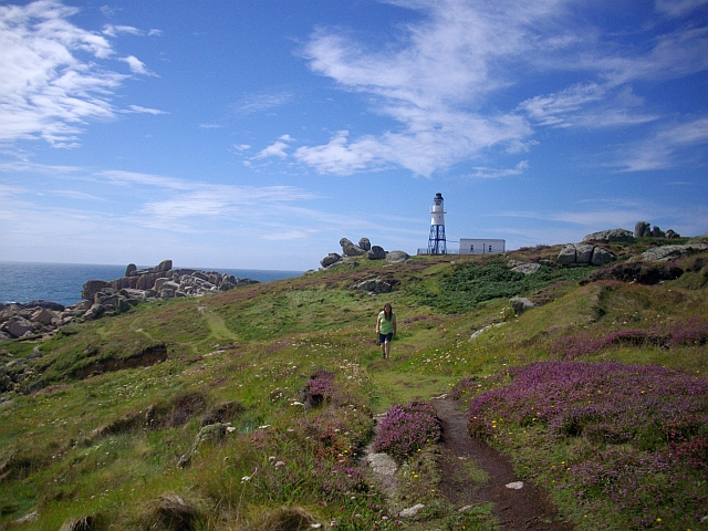
Peninnis Head
Peninnis Head (Cornish: Penn Enys, meaning Island Head) is the southernmost point of St Mary's, Isles of Scilly. The headland is within the Isles of Scilly...

St Mary's Old Church, St Mary's
St Mary's Old Church, St Mary's is a parish church in the Church of England located in Old Town on St Mary's, Isles of Scilly, Cornwall, United Kingdom...
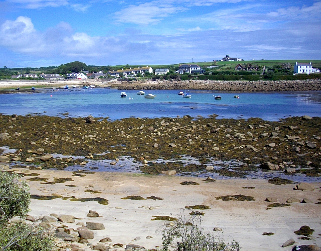
Old Town, Isles of Scilly
Old Town (Cornish: Treveglos "church town") is a village on St Mary's in the Isles of Scilly located southeast of Hugh Town. It is thought to be the oldest...
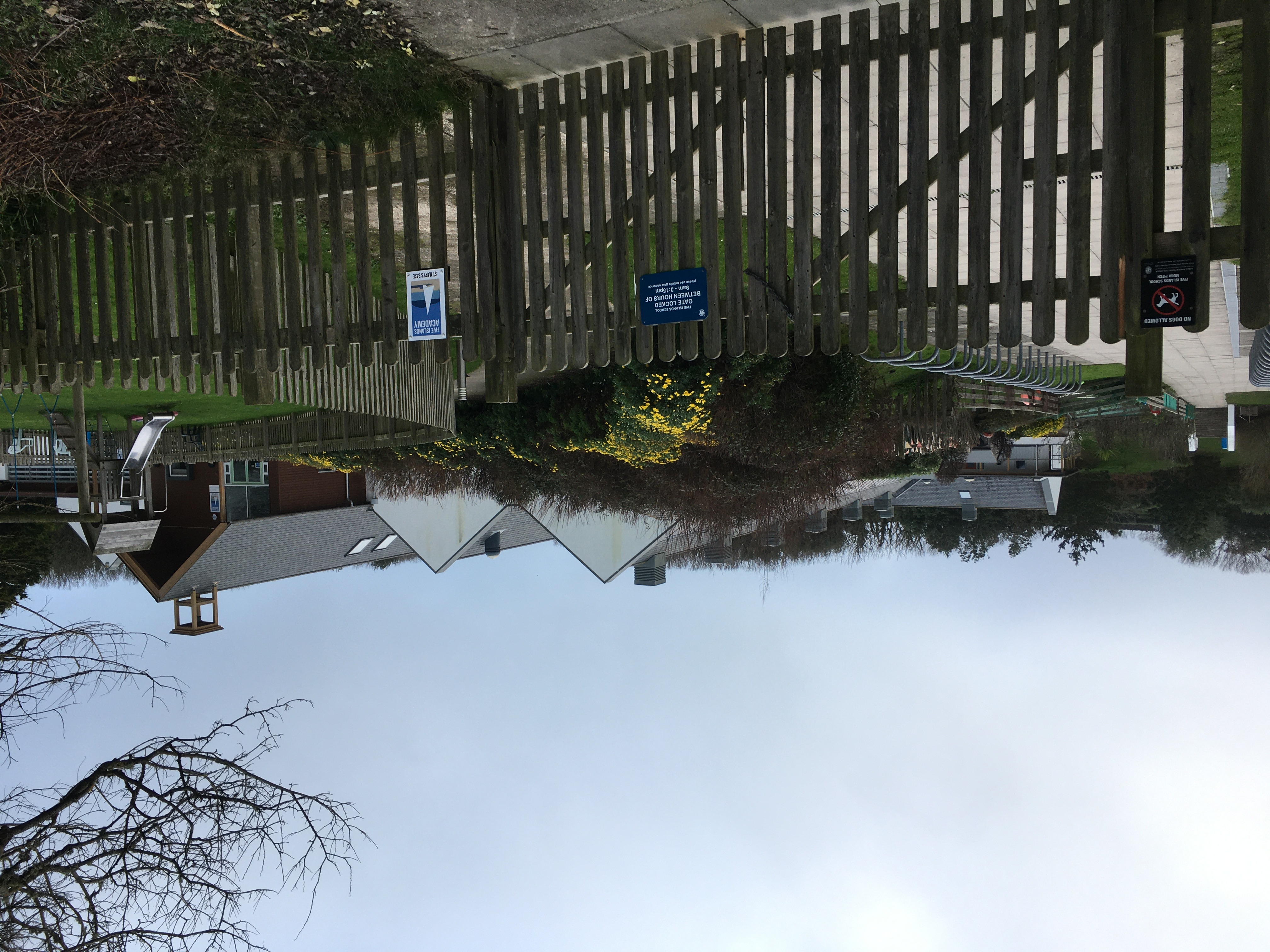
Five Islands Academy
Five Islands Academy, formerly Five Islands School, is the first federated school in the United Kingdom, providing primary and secondary education for...

Buzza Tower
Buzza Tower is a Grade II listed structure on St Mary's, Isles of Scilly now used as a camera obscura. The tower was built in 1821 as a windmill. It was...

St Mary's Airport, Isles of Scilly
St Mary's Airport or Isles of Scilly Airport (IATA: ISC, ICAO: EGHE) is an airport located 1 nautical mile (1.9 km; 1.2 mi) east of Hugh Town on St Mary...
Nearby Amenities
Located within 500m of 49.903629,-6.302345Have you been to Big Jolly Rock?
Leave your review of Big Jolly Rock below (or comments, questions and feedback).