Bayhead

Settlement in Inverness-shire

Scotland

Bayhead

The Manse of the Free Presbyterian Church, Bayhead, North Uist The church is on the left and the Manse to the right.
The Manse of the Free Presbyterian Church, Bayhead, North Uist Credit: Julian Paren

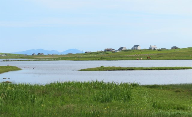
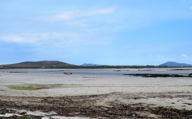
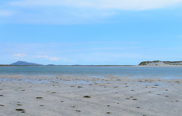
Bayhead is a small village located in the region of Inverness-shire, Scotland. Situated on the northwest coast of the country, it lies on the shores of the beautiful Loch Ewe, offering breathtaking views of the surrounding landscape. The village is nestled amidst rolling hills and verdant countryside, providing a tranquil and picturesque setting.

With a population of around 200 residents, Bayhead is a close-knit community that exudes a warm and welcoming atmosphere. The village is known for its strong ties to the fishing industry, which has been a significant part of its history and economy for generations. Local fishermen can often be seen returning to the harbor with their catches of herring or mackerel, adding to the authentic charm of the area.

Bayhead is also renowned for its rich maritime heritage, particularly during World War II. The village played a crucial role as a naval base and was involved in the Arctic Convoys, which delivered supplies to the Soviet Union. Today, visitors can explore the fascinating history of Bayhead at the local heritage center, which showcases artifacts and stories from this era.

Nature enthusiasts will find plenty to admire in Bayhead. The region is a haven for wildlife, with various species of birds, seals, and even occasional sightings of dolphins. Outdoor activities such as hiking, fishing, and wildlife spotting are popular among both residents and tourists.

Overall, Bayhead is a tranquil and historically significant village that offers visitors a chance to experience the natural beauty and maritime heritage of the Scottish Highlands.

If you have any feedback on the listing, please let us know in the comments section below.
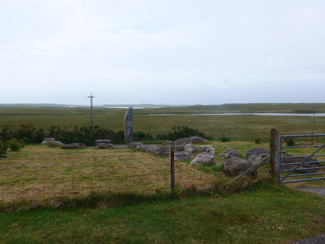
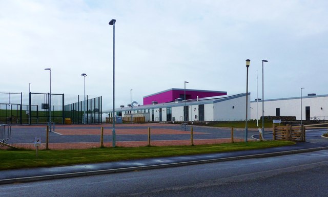
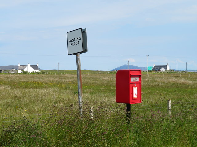
Bayhead Images

Images are sourced within 2km of 57.583907/-7.4571277 or Grid Reference NF7468. Thanks to Geograph Open Source API. All images are credited.

The Manse of the Free Presbyterian Church, Bayhead, North Uist The church is on the left and the Manse to the right.
The Manse of the Free Presbyterian Church, Bayhead, North Uist
The church is on the left and the Manse to the right.
Track to Balemore from Lagan Arnal A track that leads to the sea.
Track to Balemore from Lagan Arnal
A track that leads to the sea.
Memorial to the Paiblesgarry Land Raiders A monolith by the A865 in North Uist <a href="https://www.geograph.org.uk/photo/5024863">NF7369 : Paiblesgarry Land Raid Memorial plaque</a>.
Memorial to the Paiblesgarry Land Raiders
A monolith by the A865 in North Uist NF7369 : Paiblesgarry Land Raid Memorial plaque.
Paiblesgarry Land Raid Memorial plaque MAR CHUIMHNEACHAN [In Remembrance of]
IN MEMORY OF THE MEN WHO TOOK PART IN THE
PAIBLESGARRY LAND RAID ON BALRANALD ESTATE IN
1921
The memorial is a monolith by the A865 in North Uist <a href="https://www.geograph.org.uk/photo/5024854">NF7369 : Memorial to the Paiblesgarry Land Raiders</a>.
Paiblesgarry Land Raid Memorial plaque
MAR CHUIMHNEACHAN [In Remembrance of] IN MEMORY OF THE MEN WHO TOOK PART IN THE PAIBLESGARRY LAND RAID ON BALRANALD ESTATE IN 1921 The memorial is a monolith by the A865 in North Uist NF7369 : Memorial to the Paiblesgarry Land Raiders.
Houses at Druim Dubh On the A865, looking north from the Paiblesgarry Memorial.
Houses at Druim Dubh
On the A865, looking north from the Paiblesgarry Memorial.
Memorial to the Paiblesgarry Land Raiders In memory of the men who took part in the Paiblesgarry Land Raid on Balranald Estate in 1921. For a view of the plaque, see <a href="https://www.geograph.org.uk/photo/443940">NF7369 : Closeup of Paiblesgarry Memorial.</a>
Memorial to the Paiblesgarry Land Raiders
In memory of the men who took part in the Paiblesgarry Land Raid on Balranald Estate in 1921. For a view of the plaque, see NF7369 : Closeup of Paiblesgarry Memorial.
North Uist School This is a fine new school, but there has been controversy and pain associated with its build.  There was previously a small secondary school here, which closed in 2012, with all pupils being transferred to Sgoil Lionacleit in Benbecula.  

This new school is a primary school and is now the sole primary school in North Uist, with all the previous smaller schools closed and pupils bussed daily from their homes.
North Uist School
This is a fine new school, but there has been controversy and pain associated with its build. There was previously a small secondary school here, which closed in 2012, with all pupils being transferred to Sgoil Lionacleit in Benbecula. This new school is a primary school and is now the sole primary school in North Uist, with all the previous smaller schools closed and pupils bussed daily from their homes.
Old Milestone by the A865, northwest of Bayhead, North Uist parish Granite slab by the A865, in parish of North Uist (North Uist District), Northwest of Bayhead, on brow near new woodfaced house and opposite white house.

Surveyed

Milestone Society National ID: WI_NUCW05
Old Milestone by the A865, northwest of Bayhead, North Uist parish
Granite slab by the A865, in parish of North Uist (North Uist District), Northwest of Bayhead, on brow near new woodfaced house and opposite white house. Surveyed Milestone Society National ID: WI_NUCW05
Old Milestone by the A865, Bayhead, North Uist Granite slab by the A865, in parish of North Uist (North Uist District), Bayhead, in passing place East of 'SLOW' on road.

Surveyed

Milestone Society National ID: WI_NUCW04
Old Milestone by the A865, Bayhead, North Uist
Granite slab by the A865, in parish of North Uist (North Uist District), Bayhead, in passing place East of 'SLOW' on road. Surveyed Milestone Society National ID: WI_NUCW04
Loch Sanndaraigh The map shows a causeway across this shallow loch and the feature is visible to the left side of the photo.
Loch Sanndaraigh
The map shows a causeway across this shallow loch and the feature is visible to the left side of the photo.
Paiblesgearraidh post box Since Chris Downer was here, the post box appears to have been replaced with a shiny new one.
Paiblesgearraidh post box
Since Chris Downer was here, the post box appears to have been replaced with a shiny new one.
Paibeil phone box Still standing against the Hebridean gales, but at a slightly drunken angle. [leaning into the prevailing wind]
Paibeil phone box
Still standing against the Hebridean gales, but at a slightly drunken angle. [leaning into the prevailing wind]
Miles of sand - Caolas Phaibell Looking out across the tidal flats between 'mainland' North Uist and the island of Kirkibost, which is off picture to the right.
Miles of sand - Caolas Phaibell
Looking out across the tidal flats between 'mainland' North Uist and the island of Kirkibost, which is off picture to the right.
Sand and sea channels Oitir Mhor Large areas of sand between 'mainland' North Uist and the sandy island of Kirkibost, the dunes on that island being visible to the right.
Sand and sea channels Oitir Mhor
Large areas of sand between 'mainland' North Uist and the sandy island of Kirkibost, the dunes on that island being visible to the right.
Shoreline at Sgeir a' Chotain As one heads south westwards along this beach, so white sand tends to give way to pebble and seaweed. The northern end of Kirkibost Island is to the left, whilst to the south the view is towards the big hills of South Uist, the low island of Benbecula hardly showing at all.
Shoreline at Sgeir a' Chotain
As one heads south westwards along this beach, so white sand tends to give way to pebble and seaweed. The northern end of Kirkibost Island is to the left, whilst to the south the view is towards the big hills of South Uist, the low island of Benbecula hardly showing at all.
Vehicle graveyard One of many little out of the way corners on the Uists where old and unwanted vehicles come to die. Is there no scrap yard on the Western isles?
Vehicle graveyard
One of many little out of the way corners on the Uists where old and unwanted vehicles come to die. Is there no scrap yard on the Western isles?
Shoreline at Ruadh Bhruthach One probably wouldn't fancy a paddle on this side of the headland thanks to weed and rocks, but turn a corner to Lagan Arnal and there is a fine weed free beach.
Shoreline at Ruadh Bhruthach
One probably wouldn't fancy a paddle on this side of the headland thanks to weed and rocks, but turn a corner to Lagan Arnal and there is a fine weed free beach.
Paiblesgarry Land Raid memorial
Show me another place!

Bayhead is located at Grid Ref: NF7468 (Lat: 57.583907, Lng: -7.4571277)

Unitary Authority: Na h-Eileanan an Iar

Police Authority: Highlands and Islands

Also known as: Ceann a Bhaigh

What 3 Words

///artichoke.blazed.traps. Near Balivanich, Na h-Eileanan Siar

Related Wikis

Ardheisker

Ardheisker (Scottish Gaelic: Àird Heillsgeir) is a settlement on North Uist, in the Outer Hebrides, Scotland. Ardheisker is within the parish of North...

Kirkibost

Kirkibost (Scottish Gaelic: Eilean Chirceaboist) is a low-lying island west of North Uist in the Outer Hebrides of Scotland. == Geography == Kirkibost...

RRH Benbecula

Remote Radar Head Benbecula or RRH Benbecula, is an air defence radar station operated by the Royal Air Force. It is located at Cleitreabhal a'Deas, 17...

Balranald Nature Reserve

The Balranald Nature Reserve is an RSPB reserve on the north west coast of North Uist, Outer Hebrides, Scotland. The reserve is open all year round and...

Nearby Amenities

Located within 500m of 57.583907,-7.4571277
Place Of Worship
Lat/Long: 57.5883643/-7.4566914
Paibeil
Name En: Paible
Name Gd: Paibeil
Place: village
Source Name: OS OpenData StreetView
Lat/Long: 57.5832692/-7.4578286
Power: pole
Lat/Long: 57.5883057/-7.4554494
Power: pole
Lat/Long: 57.5872836/-7.4536633
Power: pole
Lat/Long: 57.5867574/-7.4545377
Power: pole
Lat/Long: 57.5862542/-7.4554067
Power: pole
Lat/Long: 57.5857438/-7.4562731
Power: pole
Lat/Long: 57.5852305/-7.4571448
Power: pole
Lat/Long: 57.5847244/-7.4579978
Power: pole
Lat/Long: 57.5842255/-7.4588266
Power: pole
Lat/Long: 57.5839652/-7.459245
Power: pole
Lat/Long: 57.5841924/-7.4596822
Power: pole
Lat/Long: 57.5834634/-7.4600389
Power: pole
Lat/Long: 57.5829717/-7.4608436
Power: pole
Lat/Long: 57.5824569/-7.4616563
Power: pole
Lat/Long: 57.5819565/-7.4624475
Power: pole
Lat/Long: 57.5814604/-7.4632603
Power: pole
Lat/Long: 57.5847172/-7.4605861
Power: pole
Lat/Long: 57.5883012/-7.456413
Power: pole
Lat/Long: 57.5879265/-7.4568138
The data included in this document is from www.openstreetmap.org. The data is made available under ODbL.

Have you been to Bayhead?

Leave your review of Bayhead below (or comments, questions and feedback).