White Island Ledge

Coastal Feature, Headland, Point in Cornwall

England

White Island Ledge

Sunset over Samson, Scilly Seen from Star Castle, Hugh Town, St Mary's, Scilly
Sunset over Samson, Scilly Credit: Martin Tester

White Island Ledge is a prominent coastal feature located in Cornwall, England. Situated on the southern coast of the county, it is primarily known for its impressive headland and point jutting out into the Atlantic Ocean. This rugged and picturesque landscape attracts both locals and tourists alike.

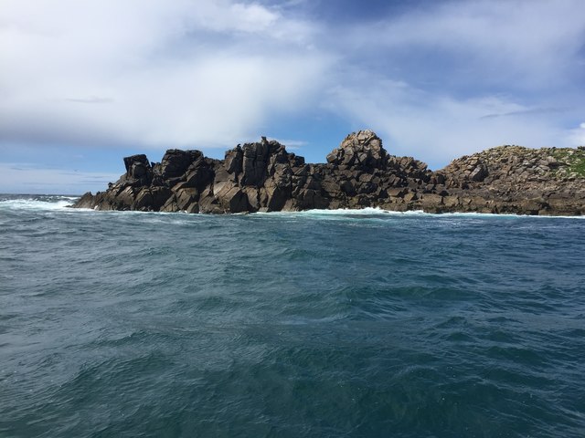
The headland of White Island Ledge is characterized by its towering cliffs, which reach heights of up to 100 feet. These cliffs are formed from a combination of sedimentary rocks, including sandstone and shale, which have been shaped and eroded by the relentless force of the crashing waves. The exposed nature of the headland means that it is particularly vulnerable to the elements, with strong winds and powerful tides constantly shaping its appearance.

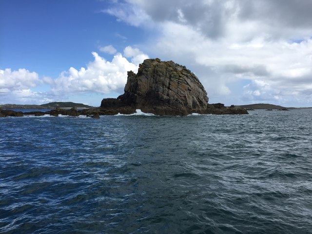
At the tip of the headland, the point of White Island Ledge provides breathtaking panoramic views of the surrounding coastline. From this vantage point, visitors can admire the rugged cliffs, the expansive ocean, and the nearby sandy beaches. The point is also home to a diverse array of marine life, making it a popular spot for birdwatching and seal spotting.

Access to White Island Ledge is relatively easy, with a well-maintained footpath leading visitors to the headland. The area is also equipped with safety measures, including warning signs and barriers, to ensure the well-being of visitors. However, caution is still advised as the cliffs can be unstable and the strong currents pose a risk to swimmers.

Overall, White Island Ledge is a captivating coastal feature that showcases the natural beauty and geological diversity of Cornwall. Its dramatic cliffs, stunning views, and abundant wildlife make it a must-visit destination for nature enthusiasts and those seeking a unique coastal experience.

If you have any feedback on the listing, please let us know in the comments section below.

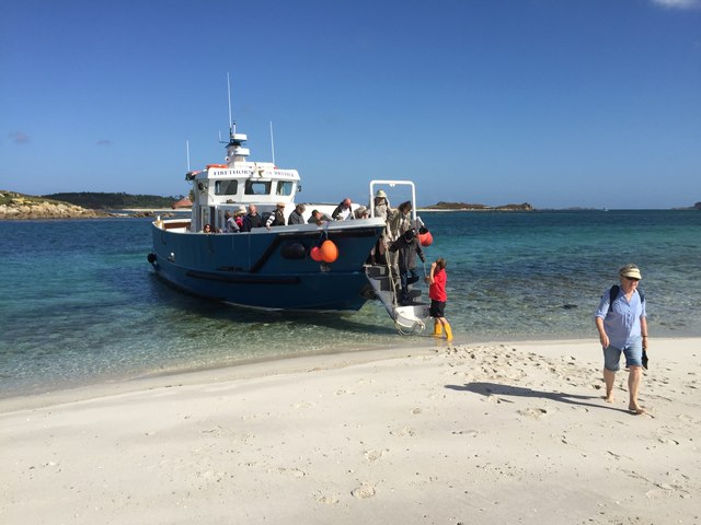
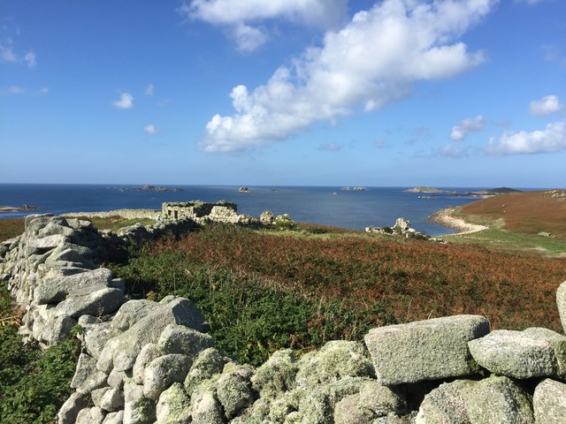
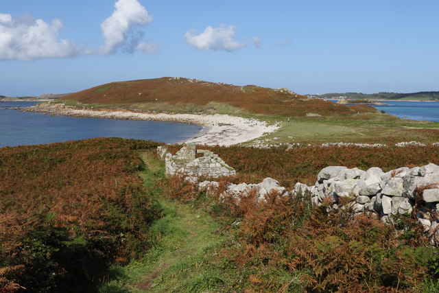
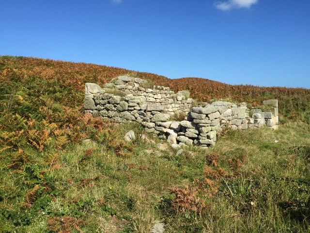
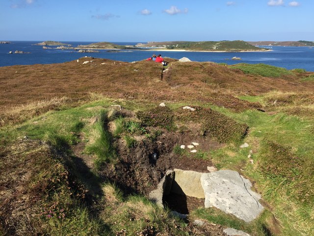
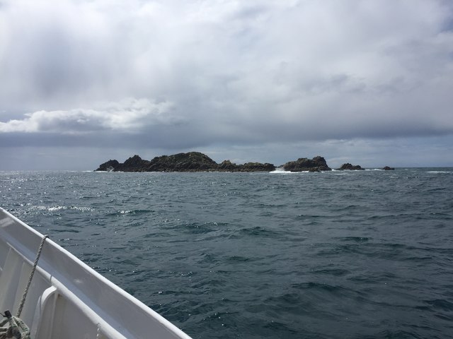
White Island Ledge Images

Images are sourced within 2km of 49.932082/-6.359333 or Grid Reference SV8712. Thanks to Geograph Open Source API. All images are credited.

Sunset over Samson, Scilly Seen from Star Castle, Hugh Town, St Mary's, Scilly
Sunset over Samson, Scilly
Seen from Star Castle, Hugh Town, St Mary's, Scilly
Heathy Hill, Bryher A view from Gweak Hill. The peninsula across the centre of the image encloses a bay including Stinking Porth and Great Porth, and contains one of many prehistoric field systems on the Isles of Scilly <span class="nowrap"><a title="https://historicengland.org.uk/listing/the-list/list-entry/1015005?section=official-list-entry" rel="nofollow ugc noopener" href="https://historicengland.org.uk/listing/the-list/list-entry/1015005?section=official-list-entry">Link</a><img style="margin-left:2px;" alt="External link" title="External link - shift click to open in new window" src="https://s1.geograph.org.uk/img/external.png" width="10" height="10"/></span> . Nearer at hand, Merrick Island is on the right, and Point of Bars is on the left.
Heathy Hill, Bryher
A view from Gweak Hill. The peninsula across the centre of the image encloses a bay including Stinking Porth and Great Porth, and contains one of many prehistoric field systems on the Isles of Scilly LinkExternal link . Nearer at hand, Merrick Island is on the right, and Point of Bars is on the left.
Great Porth, Bryher A view from Heathy Hill across the mouth of the bay seen in <a href="https://www.geograph.org.uk/photo/7765522">SV8714 : School House and Carn Leigh, Great Porth, Bryher</a>, with the School House in the centre beyond the Point of Bars, and Great Pool just visible beyond. Right of centre is the Hell Bay Hotel, with a group of houses behind the beach. On the left is a glimpse of Shipman Head at the north end of the island.
Great Porth, Bryher
A view from Heathy Hill across the mouth of the bay seen in SV8714 : School House and Carn Leigh, Great Porth, Bryher, with the School House in the centre beyond the Point of Bars, and Great Pool just visible beyond. Right of centre is the Hell Bay Hotel, with a group of houses behind the beach. On the left is a glimpse of Shipman Head at the north end of the island.
Alighting on Samson Firethorn dropping off visitors to Samson.
Alighting on Samson
Firethorn dropping off visitors to Samson.
Stonewall on Samson At the uninhabited settlement on Samson
Stonewall on Samson
At the uninhabited settlement on Samson
Remnants on Samson Remnants of housing and stone walls on Samson
Remnants on Samson
Remnants of housing and stone walls on Samson
Abandoned dwelling An abandoned dwelling on Samson
Abandoned dwelling
An abandoned dwelling on Samson
Cairns on North Hill Burial chambers on North Hill, Samson
Cairns on North Hill
Burial chambers on North Hill, Samson
Mincarlo Island From Firethorn of Tresco Boat Services
Mincarlo Island
From Firethorn of Tresco Boat Services
Southern end of Mincarlo From Firethorn of Tresco Boat Services
Southern end of Mincarlo
From Firethorn of Tresco Boat Services
Castle Bryher rock From Firethorn of Tresco Boat Services
Castle Bryher rock
From Firethorn of Tresco Boat Services
Tresco & Bryher low tide event A few times a year the tide is low enough for the sands to be exposed enough to walk between the two Islands of Breyer & Tresco.
Tresco & Bryher low tide event
A few times a year the tide is low enough for the sands to be exposed enough to walk between the two Islands of Breyer & Tresco.
Show me another place!

White Island Ledge is located at Grid Ref: SV8712 (Lat: 49.932082, Lng: -6.359333)

Division: Isles of Scilly

Unitary Authority: Isles of Scilly

Police Authority: Devon and Cornwall

What 3 Words

///hype.investor.incursion. Near Bryher, Isles of Scilly

Related Wikis

Samson, Isles of Scilly

Samson (Cornish: (Enys) Sampson) is the largest uninhabited island of the Isles of Scilly, off the southwestern tip of the Cornish peninsula of Great Britain...

HMS Colossus (1787)

HMS Colossus was a 74-gun third-rate ship of the line of the Royal Navy. She was launched at Gravesend on 4 April 1787 and lost on 10 December 1798. During...

Oliver's Battery, Tresco

Oliver's Battery is a ruined artillery battery on the island of Tresco in the Isles of Scilly off of Cornwall, England. It was built by the Parliamentarian...

All Saints' Church, Bryher

All Saints' Church is a Grade II listed parish church in the Church of England located in Bryher, Isles of Scilly. == History == Bryher is the most westerly...

Nearby Amenities

Located within 500m of 49.932082,-6.359333
West Porth
Natural: bay
Source: OS Open Names
Lat/Long: 49.9339921/-6.3555842
The data included in this document is from www.openstreetmap.org. The data is made available under ODbL.

Have you been to White Island Ledge?

Leave your review of White Island Ledge below (or comments, questions and feedback).